Cape Disappointment Ilwaco Chinook Seaview Long Beach
Ocean Park Oysterville Willapa Bay Naselle Chinook Indians
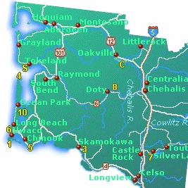
My Driving Tours of Willapa Bay Maps
Blog Reports Seasons and Months Four Days in Grayland
Native Americans
History 1700-1880
History 1880-1950
Bibliography
Shellfish Oysters Clams Fishing Food Cranberries Yurt Camping
Information Weather Maps Walking Beachcombing
Timber Industry Washington Oregon
Cloud Hands Blog
Green Way Research
Four Days in Grayland
Alphabetical Index to the Long Beach
Peninsula
A Traveler's Hypertext Notebook and Guide by Mike Garofalo
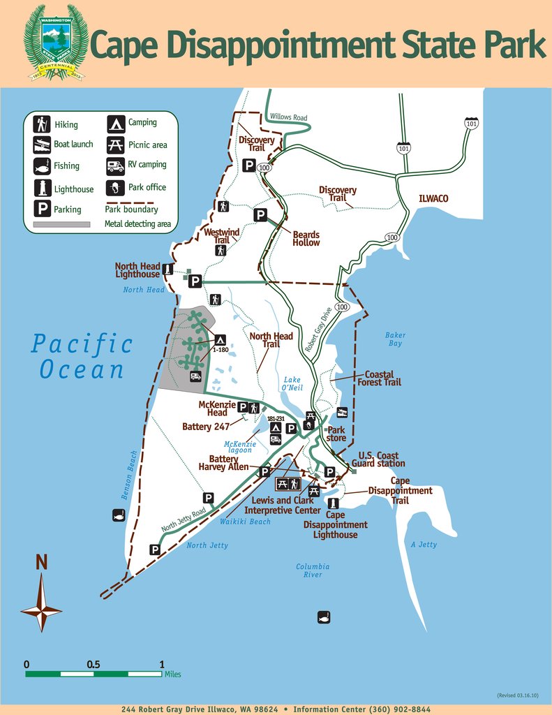
Cape Disappointment State Park CR Camping, Yurts, Fishing, Trails Images
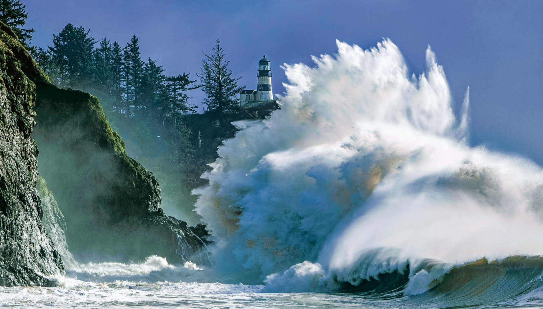
Cape Disappointment Lighthouse In operation since 1856.
Cape Disappointment Weather
Lewis and Clark Interpretative Center History Wikipedia
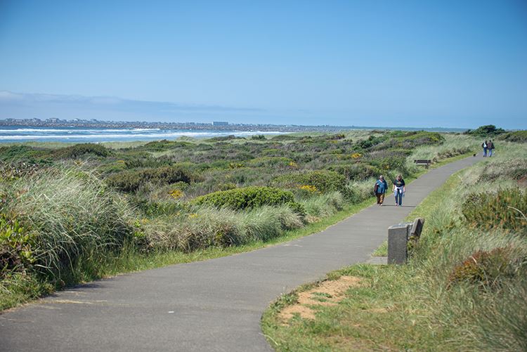
Discovery Bicycling and Walking Trail
Fort Canby State Park is the old name for Cape Disappointment State Park
Travel Adventure and Ghost Tales and History
"Cape Disappointment State Park (formerly Fort Canby State Park) is a public recreation area on Cape Disappointment, located southwest of Ilwaco, Washington, on the bottom end of Long Beach Peninsula, the northern headlands where the Columbia River meets the Pacific Ocean. The state park's 2,023 acres (819 ha) encompass a diverse landscape of old-growth forest, freshwater lakes, freshwater and saltwater marshes, and oceanside tidelands. Park sites include Fort Canby, the Lewis and Clark Interpretive Center, North Head Lighthouse, and Cape Disappointment Lighthouse.[2] Cape Disappointment is one of several state parks and sites in Washington and Oregon that are included in Lewis and Clark National Historical Park.[3]"
Chinook - Wikipedia Population 450. Images
Chinook: Travel Port Port-Estuary
Chinook: Baker's Bay Gray's Bay
Chinook Food Columbia River Road House Old Fishtrap Seafood and Spirits
Chinook Dock Boat Launch
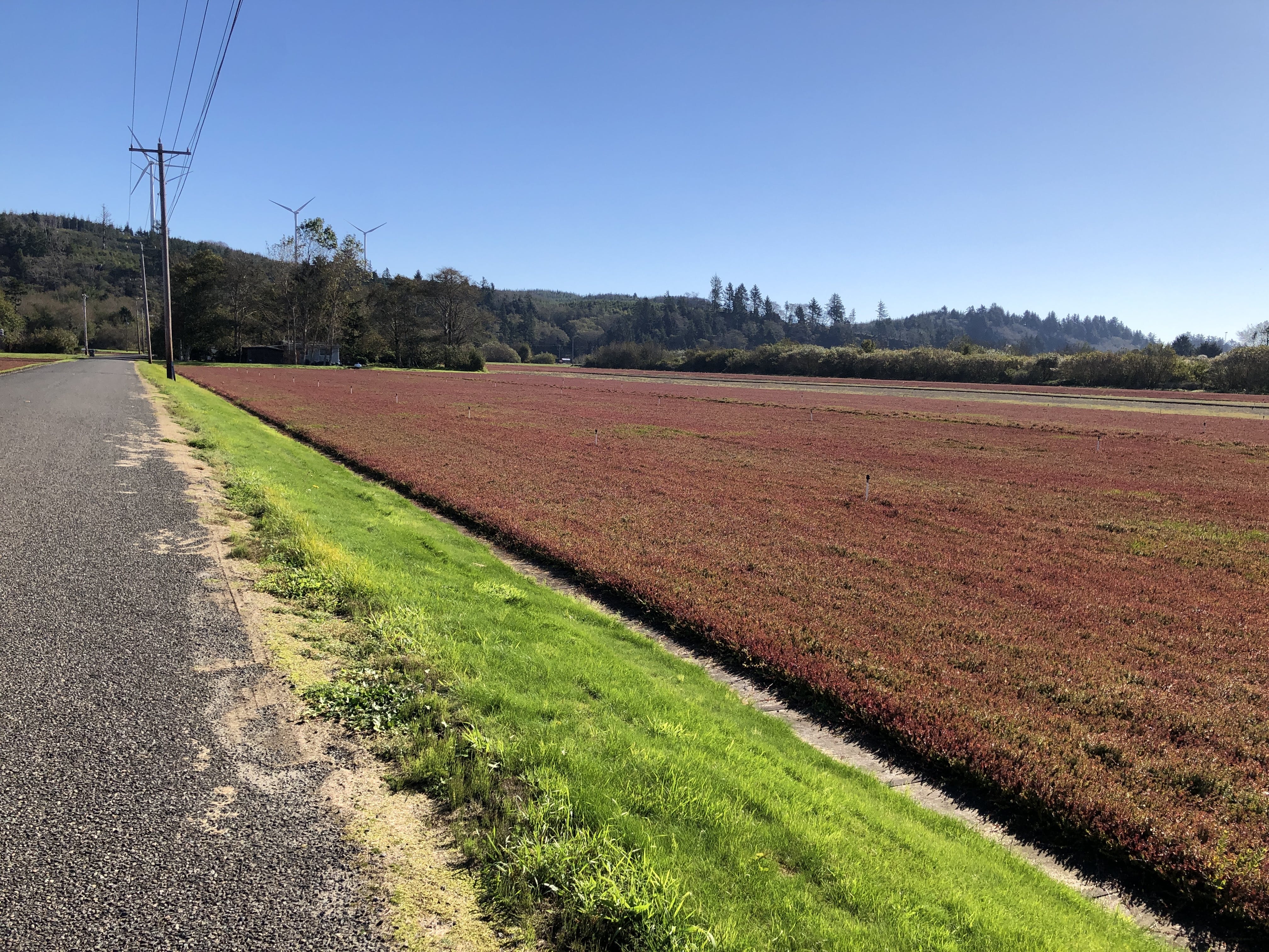
Cranberries, Wild Berries, Berry Harvesting
Wild Berries of Washington and Oregon. By T. Abe Loyd and Fiona Hammersley Chambers. Lone Pine, 2014, 256 pages.
Both the Long Beach Peninsula and Grayland have many acres in lowland bog
farms that are growing and harvesting cranberries. There are alos many
cranberry farms south of Bandon, Oregon.
There are Cranberry Museums in both Long Beach and Grayland. Currently, there is a clean and tidy Ocean Spray bottling plant by the bridge over the Johns River between Aberdeen and Westport.
The Native Peoples in Southwestern Washington have been harvesting wild berries for over 2,000 years. There were ceremonies for the Berry Harvest in July. Groups would travel to prairie and boggy areas where berries were plentiful, and camp nearby while harvesting. Some areas were periodically burnt by Native Peoples to produce better crops of berries in the years ahead.
Grayland Cranberries: Cranberry Road Winery
Cranberry Museum Furlow Pickers 1933
Driving Tour in Grayland Cranberry Coastal Bogs
Washington's Cranberry Coast. By Sydney Stevens for the Pacific
Coast Cranberry Research Foundation. Arcadia, 2014, 128 pages.
Images of America Series.
History of the cranberry farmers in Grayland and Long Beach.
Wild Berries of the Northwest. By J. Duane Sept. Calypso, 2015, 96 pages.
Foraging Washington: Finding, Identifying, and Preparing Edible Wild Foods. By Christopher Nyerges. Falcon, 2017, 272 pages.
Elderberries: The Beginner's Guide to Foraging, Preserving and Using Elderberries for Health Remedies, Recipes, Drinks. By Alicia Bayer. 2017, 162 pages.
CW = Chinook Language (Wa Wa) Using George C. Shaw and George Gibbs.
Berry In CW: o'lil-lie or o'lal-lie Berry: Wikipedia
Blackberries In CW: klik'-a-muks or klale o'lil-lie Botany: Rubus fructosis Blackberry: Wikipedia
Blueberry In CW: klale o'lil-lie Blueberry: Wikipedia Botany:
Cranberry In CW: so'-le-mie or siwah isalk Cranberry: Wikipedia Botany:
Cranberry Museum - Long Beach
Huckleberry Huckleberry: Wikipedia Botany:
"From coastal Central California through Oregon to southern Washington and British Columbia, the red huckleberry (Vaccinium parvifolium) is found in the maritime-influenced plant community. Huckleberries were traditionally collected by Native American and First Nations people along the Pacific coast, interior British Columbia, Idaho, and Montana for use as food or traditional medicine.[2][6][7] The berries are small and round, 5�10 millimetres (0.20�0.39 in) in diameter, and look like large dark blueberries. In taste, they may be tart, with a flavor similar to that of a blueberry, especially in blue- and purple-colored varieties, and some have noticeably larger, bitter seeds. The fruit is versatile in various foods or beverages, including jam, pudding, candy, pie, ice cream, muffins, pancakes, salad dressings, juice, tea, soup, and syrup.[2][7] Traditional medical applications included treating pain, heart ailments, and infections.[7] In the wild, huckleberries are consumed by bears, birds, coyotes, and deer."
"Rubus berries, such as blackberry, raspberry, black raspberry, dewberry, loganberry, and thimbleberry all produce dye colors. These were once used by Native Americans."
Olallieberry 1935 Cultivar in Oregon
Red Chokeberry Botany: Aronia arbutifolia 'Brilliantissima'
Rubus is a large and diverse genus of flowering plants in the rose family, Rosaceae, subfamily Rosoideae, with over 1,350 species. Raspberries, blackberries, and dewberries are common, widely distributed members of the genus. Wikipedia
Bramble: A bramble is any rough, tangled, prickly shrub, usually in the genus Rubus, which grows blackberries, raspberries, or dewberries. "Bramble" is also used to describe other prickly shrubs such as roses. Wikipedia
Sallal Berries In CW: sallal olallie Botany: Sallal Berries: Wikipedia
Salmon Berry
Botany: Salmon
Berry: Wikipedia
"Rubus spectabilis, the salmonberry, is a species of bramble in
the rose family Rosaceae,
native to the west coast of North
America from west central Alaska to California,
inland as far as Idaho."
Pick (verb) In CW: iskum or tikegh or pick
Ripe (verb) In CW: piah
"Folklore in the United Kingdom and Ireland tells that blackberries should
not be picked after Old
Michaelmas Day (11 October) as the devil (or
a P�ca)
has made them unfit to eat by stepping, spitting or fouling on them.[47] There
is some value in this legend as autumn's wetter and cooler weather often
allows the fruit to become infected by various molds such
as Botryotinia which
give the fruit an unpleasant look and may be toxic."
See Also: Beachcombing
Berries, Cranberries Birds and Waterfowl Clam DiggingFishing Food and Seafood Foraging Mushrooms Oysters Rock Hounding
Ilwaco Population 1,200. City and marina on north shore of the Columbia River nearest to the Pacific. On shallow Baker's Bay.
Work on the north jetty at the mouth of the Columbia River Bar began in 1915. Work on the south jetty at the Columbia in Oregon began in 1885.
Illwaco NOKSKA'ITMITHLS (Chinook Name) On the Columbia River at Cape Disappointment and Baker's Bay
Chinook River
Chinookan Peoples of the Lower Columbia. Edited by Robert T. Boyd, Kenneth M. Amers, and Tony A. Johnson. University of Washington, 2015, 464 pages.
Ilwaco Images Boardwalk Wildlife
American Indian Place Names in Washington
Ilwaco Cape Disappointment State Park CR Camping, Yurts, Fishing, Trails
Discovery Bicycling and Walking Trail
Ilwaco Fishing Charter Boats Images
"Ilwaco: this town was named for the son-in-law of Chinook Chief Comcomly, Elowahka Jim which then became Ilwaco. ... The name �Mukilteo� means �good camping ground.� Nahcotta: this community is named for Chinook chief Nahcati who was friendly with the American settlers when the town was established in 1888."
Ilwaco: Jetty Fishing Pier Fishing Dock Fishing
Ilwaco: Port of Ilwaco
Ilwaco Ocean Beach Hospital
Ilwaco Museum: Columbia Pacific Heritage Museum and gift shop.
Ilwaco: Baker's Bay
Ilwaco - Chinook Indian People
Ilwaco Railway and Navigation Company
Ilwaco Shopping
Ilwaco: Images of Port and Docks
Ilwaco Things to Do in Ilwaco
Ilwaco Long Beach Peninsula
Ledbetter Point State Park
Willapa Bay National Wildlife Refuge WB The Long Island, Ledbetter Point, Lewis and Porter Point Units of the WBNWR.
Long Beach Population 1,390. WB. Long Beach 29 mile Peninsula with wide sandy beaches facing the Pacific.
Long Beach WB Images Travel Lodging, shops, restaurants, rentals. Long Beach's 8 mile Discovery Bicycling Trail.
Long Beach Peninsula Visitors Bureau and Information Videos on Facebook
Long Beach Peninsula. By Nancy L. Hobbs and Donella J. Lucero. Arcadia, 2005, 130 pages. History, photographs.
Long Beach Travel Opportunities
Long Beach: Cranberry Museum and Gift Shop
Shopping on the Long Beach Peninsula
Friends of the Willapa Bay National Wildlife Refuge
Discovery Bicycling and Walking Trail
Food: Benson's By the Beach Breakfast Lunch Dinner Crab Pot
Visitor Information Tourist Information
Long Beach - Chinook Indian People
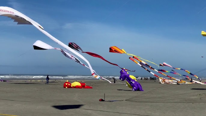
The wide, flat, sandy beaches of Southwestern Washington are excellent locations for flying kites. From Copalis to Ocean Shores, from Westport to Grayland, from Ocean Beach to Long Beach ... miles and miles of wide flat beaches for flying kites. A very popular Spring and Summer sport along coastal Washington.
There are retail stores and gift shops that sell kites in Ocean Shores, in Westport, and in Long Beach. I thought Ocean Shores Kites had a wide inventory of kites. There is Wind World in Long Beach. I have purchased kites from The Kite Company in Newport, Oregon; and from Into the Wind in Boulder, Colorado.
Long Beach is famous for its World Kite Museum. They host many events. They host the Washington State International Kite Festival every third week in August. They have many exhibits and video tours. Online collections of photographs.
Long Beach Peninsula. By Nancy L. Hobbs and Donella J. Lucero. Arcadia, 2005, 130 pages. History, photographs.
Long Beach Peninsula Visitors Bureau and Information in Seaview Videos on Facebook
Naselle: Naselle River Images Store Gas Inland from the Columbia River. The Naselle River flows into the south end of Willapa Bay
Naselle is about six miles east of the junction of US101 and WA4. Junction of US101 and WA4. Johnston's Landing. Along the wide Naselle River valley, and near the bridge over the Naselle River. The Naselle River flows into the south end of Willapa Bay. Parking near the bridge. 62 miles east of Exit 39/I5.
Fort Columbia Historical State Park South of Naselle
Megler-Astoria Bridge South of Naselle
"Naselle: this settlement is named for the Na-sil band of Chinook Indians."
Chinook Village
Discovery Bicycling and Walking Trail
"Ocean Park was once a station on the Ilwaco Railway and Navigation Company, a narrow gauge railroad that ran along the Long Beach Peninsula from 1889 to 1930.[4] One of the oldest buildings in Pacific County is the Taylor Hotel building, built in 1887, currently in use as Adelaide's Cafe and Yarnshop named after Adelaide Taylor, the wife of the original hotel owner. The oldest building in Ocean Park is the Lamberson Cabin, built in 1883 by Buell Lamberson. The cabin has been kept in private family ownership through the generations for the use of Lamberson descendants."
Ocean Park Wikipedia Population 1,600
Ledbetter Point State Park
Willapa Bay National Wildlife Refuge WB The Long Island, Ledbetter Point, Lewis and Porter Point Units of the WBNWR.
Ilwaco - Chinook Indian People
Seaview Information South of Long Beach.
42 Cafe and Bistro Depot Restaurant
Long Beach Peninsula Visitors Bureau and Information in Seaview
Seaview - Wikipedia
Discovery Bicycling and Walking Trail
Weather
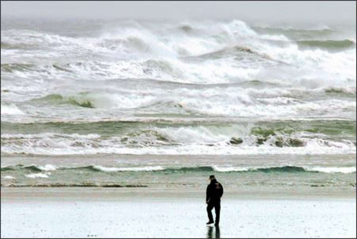
The temperature of the water in the lower Columbia River at the Columbia Bar is from 45 to 50 degrees F in the winter.
The Columbia River channel begins at the Columbia River bar and continues five miles upriver at a depth of 55 feet and a width of 2,640 feet. After which, it maintains a depth of 43 feet and a width of 600 feet for 100 miles to the Portland Harbor.
Weather - Westport Annual details. Maps and charts.
Average annual water temperature on the coast in Westport is 52�F, by the seasons: in winter 49�F, in spring 50�F, in summer 57�F, in autumn 54�F. Minimum water temperature (46�F) in Westport it happens in March, maximum (59�F) in August.
General Notes
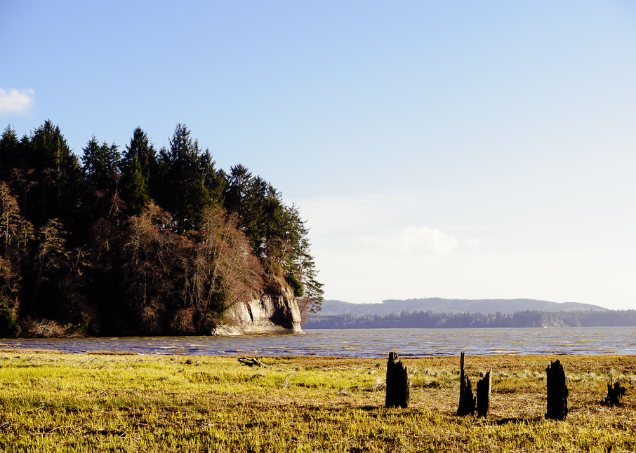
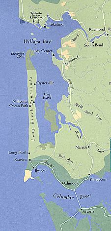
Willapa Bay Images WB
Willapa Bay is in Pacific County with a total County Population of 20,920.
Willapa Bay: Willapa Hills
Willapa Bay: Detailed Map
Willapa Bay
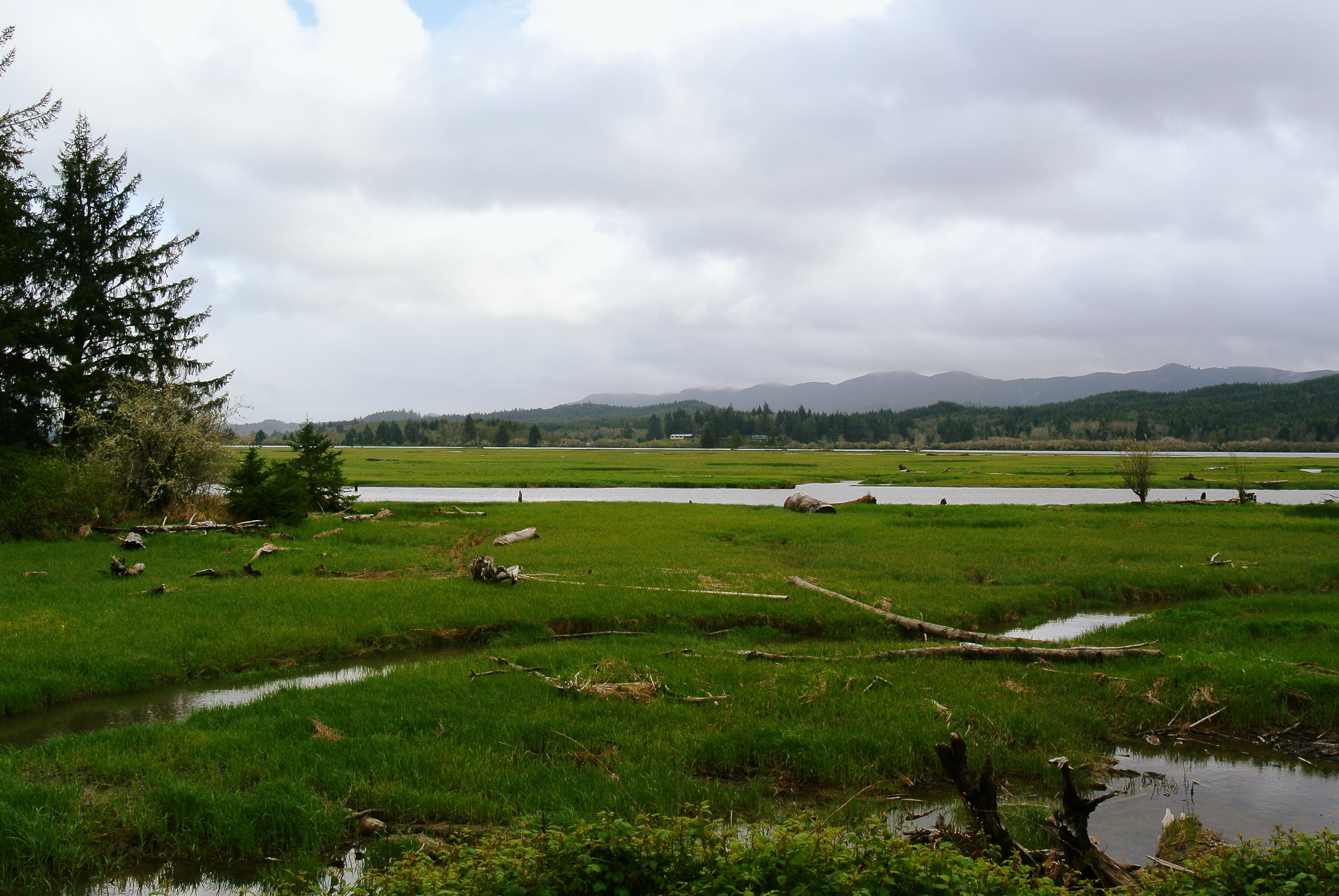
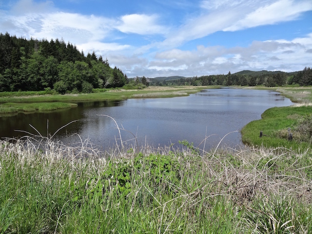
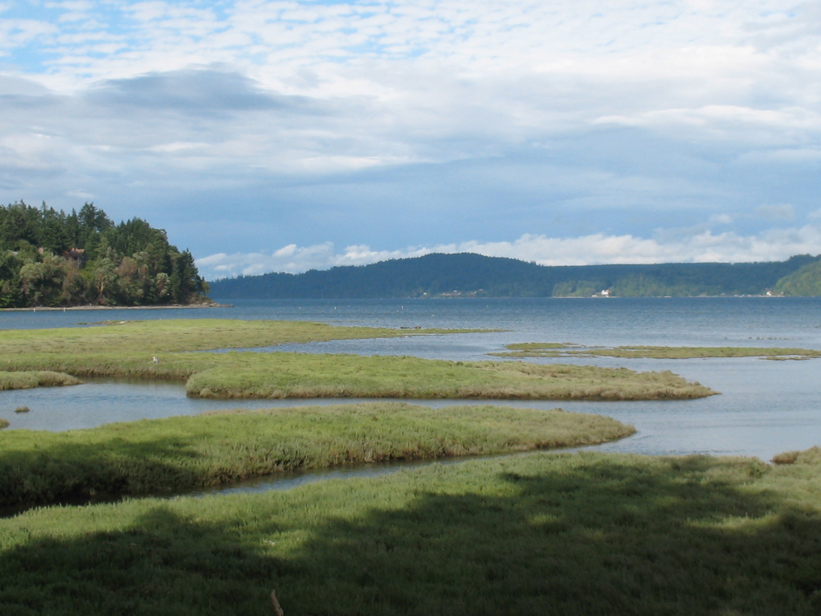
Estuaries
There are many estuaries
at the mouths of the various rivers that flow into
Willapa Bay, and the Bay itself is an estuary.
"Willapa Bay is a major estuary on the Pacific Coast and at mean high tide encompasses approximately 70,400 acres (28,500 hectares). An estuary is defined as the area near the mouth of a river, or rivers, in the case of Willapa Bay, where oceanic tidal waters and freshwater currents collide and mix. Biologically, estuaries are among the most productive environments on earth and provide important habitat for a large variety of organisms. This high productivity is due basically to physical and biological processes unique to estuaries. Dissolved organic nutrients from detrital (dead plants and animals, and excrement) material enter the estuary from inflowing rivers. Saltwater pushed along the estuary bottom by the incoming tide brings in other nutrients of marine origin. Currents and tides circulate fresh and salt water, distributing and, to a certain extent, trapping dissolved and suspended matter. Deposition of these substances fertilizes the estuary and plant life flourishes. This plant life includes grasses, rushes, sedges of estuarine marshes, benthic algae (diatoms), epi-benthic algae, and eelgrass on intertidal sediments. Some plants are fed upon directly by fish and wildlife but most die and enter the food chain in the form of detritus or partly decomposed plant material. This detritus, suspended in the water and deposited on the bottom, is a high-quality food for consumers because of its high nutritional value. A number of studies have shown that many species of fish and invertebrates feed wholly or partially on detritus. Therefore, detritus feeders are the critical link between plant production and the production of higher consumers. Consequently, the ultimate ecological value of primary production in marshes occurs when detritus of marsh plant origin enters the food web of the estuary." Willapa Estuary
"An estuary is a partially enclosed coastal body
of brackish
water with one or more rivers or streams flowing into it, and with a
free connection to the open sea. Estuaries form a transition zone between
river environments and maritime environments and are an example of an ecotone.
Estuaries are subject both to marine influences such as tides,
waves, and the influx of saline water and to riverine influences such as
flows of freshwater and sediment. The mixing of seawater and freshwater
provides high levels of nutrients both in the water column and in sediment,
making estuaries among the most productive natural habitats in the world."
"Estuaries are a happy land, rich in the continent itself, stirred by the
forces of nature like the soup of a French chef; the home of myriad forms of
life from bacteria and protozoans to grasses and mammals; the nursery,
resting place, and refuge of countless things." - Stanely A.
Cain
Willapa Bay Climate 90 inches of rain each year in South Bend on Willapa Bay.
South Bend Climate 90 inches of rain each year. 30% of the oysters consumed in the USA come from Willapa Bay. Westport Climate
Northwest Washington Coast Ecoregion
Trees in the Willapa Forest: Coastal Temperate Rainforests, Late-successional coastal lowland forest
Logging in the Willapa Hills
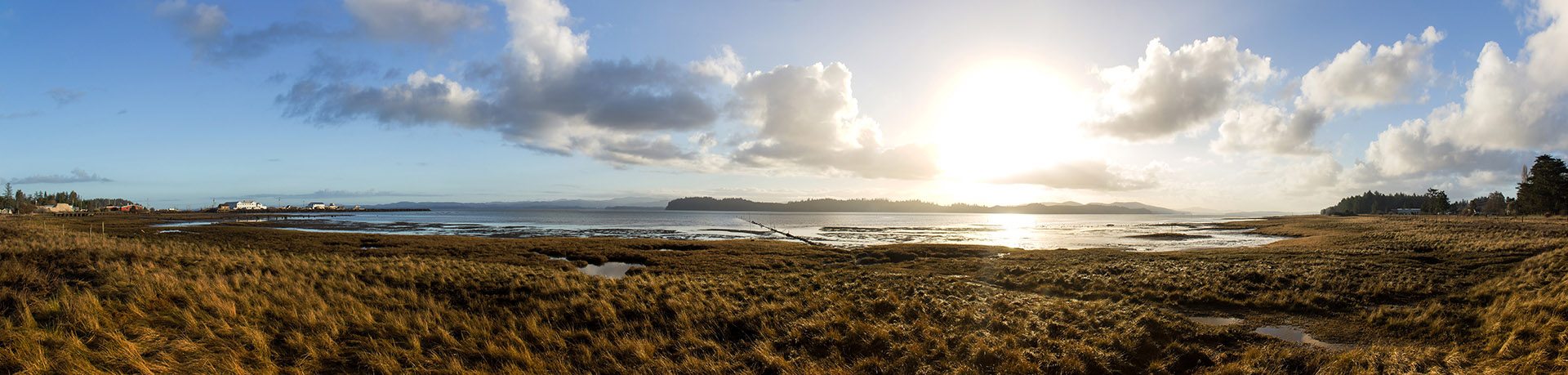
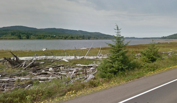
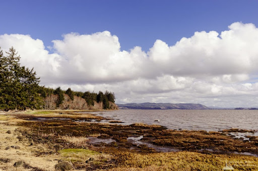
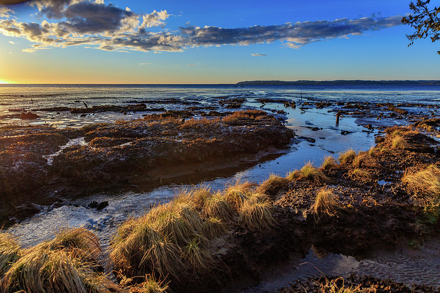
"Willapa Bay is a bay located on the southwest Pacific coast of Washington. The Long Beach Peninsula separates Willapa Bay from the greater expanse of the Pacific Ocean. With over 260 square miles (670 km2) of water surface. Willapa Bay is the second-largest estuary on the United States Pacific coast. Early settlers called the bay Shoalwater Bay and this name is found on old maps and charts of the region. Willapa Bay is fairly shallow: more than half of its surface area lies in the intertidal zone, and half of the volume of water inside it enters and leaves with every tide. The bay is an estuary formed when the Long Beach Peninsula, a long sand spit from the Columbia River to the south, partially enclosed the estuaries of several smaller rivers. It is a ria, which formed after the rise in sea level at the end of the last ice age flooded several small river valleys." - Wikipedia
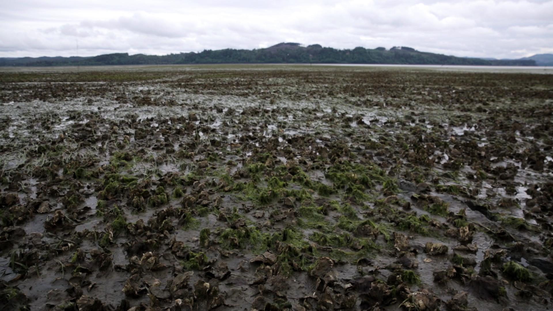
Shellfish in Willapa Bay
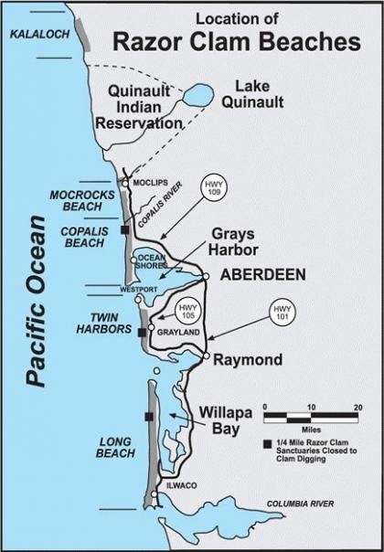
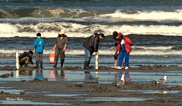
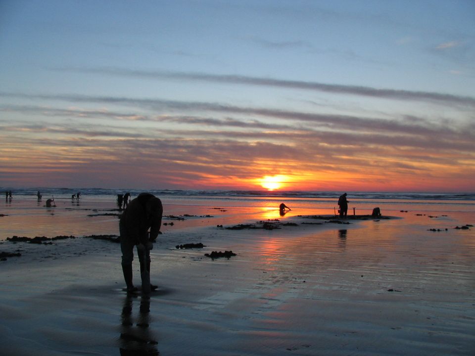
Clam Digging Razor Clams Washington State Fish and Wildlife
Clam Digging Razor Clam Rules and Best Beaches for Digging
Clam Digging Seasonal Schedule [Sept-Dec 2021]
Clam Digging Tides Grays Harbor
Clam Digging and Crabbing in Washington. By John A. Johnson. Adventure North Publishing, 1997, 125 pages. VSCL.
Clam Digging and Crabbing in Oregon. By John A. Johnson.
Clams - Eating Tinned Clams - Conservas My favorite is canned in Galicia, Spain, from Ram�n Pe�a, Razor Clams in Brine, $18.99, 4/6 pieces.
Clamming in the Pacific Northwest. By Ken Axt. Frank Amato, 2016, 88 pages. VSCL.
Clam Digging Grayland and Twin Harbors This stretch of beach is referred to in books as the 'Twin Harbors' Beaches.
Preparing and Cooking Razor Clams
The Secret Life of Clams: The Mysteries and Magic of Our Favorite Shellfish. By Anthony D. Dredericks. Skyhorse, 2014, 286 pages. FVRL
Clam Digging Tools: Waist waders with attached boots. Waterproof
top as needed [mine is
Riverruns]. Waterproof and warm gloves, hat, and warm clothing.
Clam shovels (9"x18" and 11'x31") and one cylindrical plastic clam digging tool.
Headlamps for night clamming. Mesh basket for holding razor clams.
Snacks in your pocket. Friends to have fun with at the seashore.
If you work at shellfishing and have some luck then you will need: A clam
opening knife and cutting pad. Pot in camp big enough to clean and
cook clams, oysters, or crabs. Surf fishing for redtail surf perch is supposed to be very good using clam baits on the high tide
immediately after the razor clammers have dug at low tide.
Oyster History on Willapa Bay, Schooner Trade, Boom Years, Fishery to
Farm. The Sou'wester Fall, 2005. By the Pacific County
Historical Society, South Bend.
Willapa Bay and the Oysters. By Nancy Lloyd. Oysterville Hand Print, 1999, 61 pages.
Oysters: A Celebration in the Raw. By Jeremy Sewall and Marion Lear Swaybill. Abbeyville Press, 2016, 216 pages.
The Essential Oyster: A Salty Appreciation of Taste and Temptation. By Rowan Jacobsen. Booomsbury, 2016, 304 pages.
Ekone Oyster Company and Taylor Shellfish Farms Tinned Shellfish Products. I have eaten their smoked oysters, albacore tuna, mussels, and octopus, ordered from Caputo's. "Ekone is a Chinook Jargon word meaning �Good Spirit.� Ekone evokes the ethos of Taylor Shellfish Farms. Fifth generation oyster farmers from Willapa Bay in the southwest corner of Washington, the Taylor family harvest impeccable oysters � shucked and in shell, and to our delight, tinned smoked oysters and mussels. Here, where the cold waters of the Pacific meet the waterways flowing from Willapa Hills, is the cleanest, most productive coastal ecosystem in the continental United States; producing, in our opinion, the best tinned oysters around.
"Located on the shores of Willapa Bay in Washington state, Ekone Oyster Company and Taylor Shellfish Farms are small independent, family run oyster businesses. We specialize in smoked oysters, offering a variety of flavors, as well as shucked and in shell oyster products. Originally home to the Chinook Tribe, Willapa Bay is a large estuary in the southwest corner of Washington. It is considered the cleanest and most productive coastal ecosystem remaining in the continental United States. It is here, where the cold waters of the Pacific Ocean meet the rivers and streams flowing out of the Willapa Hills, that we grow the Pacific oyster for processing in our cannery. In order to produce the finest tasting oyster, we have to be responsible stewards of the environment where the oysters grow. Water quality is vital to growing healthy shellfish. We strive for good management practices, both in our cannery and on the bay, ensuring our commitment to our family, the local community, and for the future. All of our oysters are sustainably farmed, harvested and processed in strict accordance with local, state and federal health guidelines. For over thirty-five years, the family at Ekone and five generations of Taylors have been producing quality, local and sustainable products. From our signature smoked oyster line, to live, in-shell, shucked oysters and the newest Ekone Seafoods items, we strive to bring you the best product we can, truly in the Chinook �Good Spirit.� Cannery in South Bend.
When camping at Grayland Beach, I tend to cook and eat fish or shellfish. Westport has three seafood markets. Tokeland has Nelson's Crab Specialty Market. Goose Point near Bay Center. Ekone Taylor Oysters. All the small towns in the area have food markets with foods to compliment seafood dishes and campground cooking.
The Magic of Tinned Fish: Elevate Your Cooking with Canned Anchovies,
Sardines, Mackerel, Crab and Other Amazing Seafood. By Chris McDade.
Artisan, 2021, 208 pages. VSCL. Recipes, history, resources,
online ordering. VSCL.
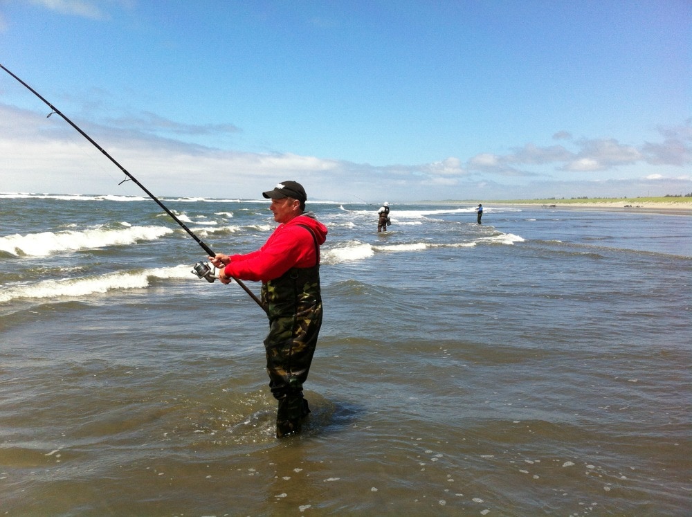
Fishing, Surfcasting, Jetty
Fishing, Pier Fishing
Fishing Washington State Fishing Regulations NS SS
Fishing: The Complete Guide to Surfcasting: Tackle, Technique, Species, Locations and More. By Joe Cermele. Burford, 2011, 288 pages. VSCL.
Grayland Beach and Twin Harbors Beach Surf Fishing
Surf Fishing Grayland Images
Fishing from the North Jetty in Ocean Shores Ilwaco Jetty and Docks Cape Disappointment Jetty South Jetty in Westport
Fishing in freshwater rivers, streams and lakes in Washington
Fishing Biography: Casting Into the Light, 2019. A fisherwomen's lifetime of fishing adventures and friendships and surfcasting around Martha's Vineyard MA. TRL
How to Catch Redtail Surf Perch UTube 2 oz round weight, Gulp Sandworm Nereis Camo dried, # 2 hook, 2 hook rig
Light Tackle Surf Perch Fishing. J. D. Richey. 2014, 52 pages. VSCL.
11 Best Beaches for Surf Perch Fishing in Washington and Oregon
Redtail Surf Perch - Wikipedia
Washington River Maps and Fishing Guide. Excellent resource for river trips and fishing.
Westport: Fishing from the South Jetty in Westport.
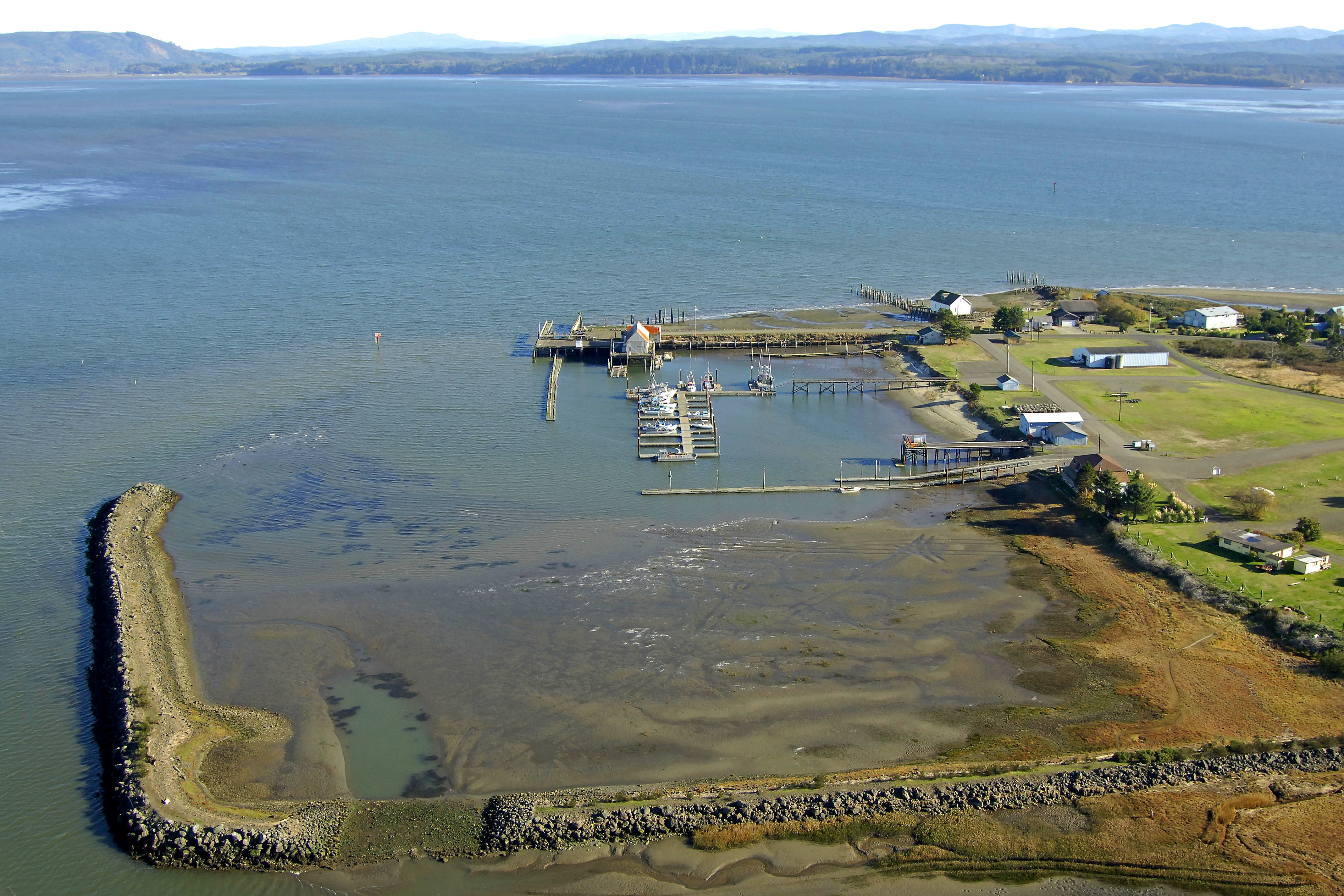
Tokeland Population 200 Willapa Bay Images Small marina, jetty, boat ramps, RV parks. Shoalwater Casino. Restaurant. Historic hotel.
Westport: Fishing and crabbing from the Docks, Boardwalks, and Pier at Westport.
Fishing My surfcasting rod is an 11 foot Fiblink Surf Spinning Fishing Rod, 4 piece. Reel: KastKing Sharky Baitfeeder III Spinning Reel. Line: Kast King Braided line, 30 lib, 327 yards, Moss Green. Tackle box with surf fishing and jetty fishing gear. I have a valid current Washington fishing license and shell fishing license.
Surf fishing for redtail surf perch is supposed to be very good using clam baits on the high tide immediately after the razor clammers have dug at low tide.
Casting into the Light: Tales of a Fishing Life. By Janet Messineo, 2019. Surf fishing in Marthas Vineyard, MA.
Food, Cooking, Eating, Campsite Cooking, Food Markets, Seafood Markets
When camping at Grayland Beach, I tend to cook and eat fish or shellfish.
Westport has three
seafood markets. Tokeland has
Nelson's Crab Specialty Market.
Goose Point near Bay Center.
Ekone Taylor Oysters. All the small towns in the area have food
markets with foods to compliment seafood dishes and campground cooking.
The Magic of Tinned Fish: Elevate Your Cooking with Canned Anchovies,
Sardines, Mackerel, Crab and Other Amazing Seafood. By Chris McDade.
Artisan, 2021, 208 pages. VSCL. Recipes, history, resources,
online ordering. VSCL.
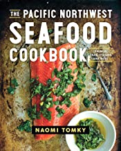
The Pacific Northwest Seafood Cookbook: Salmon, Crab, Oysters and More. By Naomi Tomsky. Countryman Press, 2019, 256 pages. VSCL.
Flannel John's Razor Clam and Oyster Cookbook: Tastes from Willapa Bay and the Long Beach Peninsula. By Tim Murphy, 2016, 52 pages.
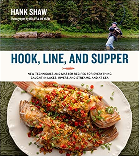
Hook, Line and Supper. By Hank Shaw. H & H, 2021, 336 pages.
The Tinned Fish Cookbook. By Bart van Olphen. Experiment, 2020, 144 pages.
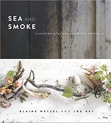
Sea and Smoke: Flavors from the Untamed Pacific Northwest. By Blaine Wetzel and Joe Ray. Running Press, 2015, 272 pages.
Oysters Clams Redtail Surf Perch
Shell Fish Canned: I enjoy eating tin canned shellfish (Conservas: Mussels, Oysters, Crab, Clams, Sardines, Salmon, Mackerel, etc.) from canners such as Jose Gourmet from Lisbon, Portugal; Ramon Pena from Galicia, Spain; Ekone Oysters from Willapa Bay, Washington; Nelson's Crab, Willapa Bay; Bela sardines from Portugal; etc.

Native Americans in
Southwestern Washington
Willapa Bay, Grays Harbor, Chehalis, Longview,
Columbia River
"The Willapa or Willoopah, also known as Kwalhioqua / Kwalhiokwa, were a Northern Athapaskan-speaking people in southwestern Washington, United States. Their territory was the valley of the Willapa River and the prairie between the headwaters of the Chehalis and Cowlitz Rivers. Together with the Clatskanie people (also: Tlatskanai / Klatskanai, according to tradition originally part of the "Suwal/Swaal" subgroup) in the upper Nehalem River Valley and along the headwaters of the Klaskanine and Clatskanie River in northwestern Oregon they spoke dialects of the now extinct Kwalhioqua-Clatskanie (Kwalhioqua�Tlatskanai) language, the Willapa dialect was the most divergent. The Kwalhioqua lived north of the lower Columbia River, the Clatskanie (Tlatskanai) to the south, separated by the territory of the Lower Chinook-speaking Shoalwater Bay Chinook (or Willapa Chinook) or Clatsop and the Kathlamet (Cathlamet), who spoke another Chinookan variant. The Kwalhioqua-Clatskanie people were dispersed among Coast Salish peoples in the 19th century and their language was extinct before the 1930s." - Wikipedia, 2021
Native American tribes have lived in the Grays Harbor region for over 8,000 years. They were expert fishermen and canoe travelers. Such tribes in the Olympic Peninsula and Chelais River Valley and Grays Harbor included: Chelais, Chinook, Copalis, Hoh, Makah, Klallam, Muckleshoot, Niqqually, Quinault, Shoalwater Bay. Here is a list of some of the books I have read about Native American People and Cultures of the Northwest. Read more History of Native Americans in this area.
The Quinault Indian Nation is a federally recognized tribe of Quinault, Queets, Quileute, Hoh, Chehalis, Chinook, and Cowlitz people. They are a Southwestern Coast Salish people of the Pacific Northwest Coast.
Native American Cultures in Southwestern Washington
Bridge of the Gods, Mountains of Fire: A Return to the Columbia Gorge. Text and photos by Chuck Williams. Elephant Mountain Arts, Hood River, Oregon and Friends of the Earth. 1993, 191 pages. Excellent coverage of the Native Peoples of the Columbia River from John Day Dam to Astoria. Nine-tenths of the Native population along the river died from communicable diseases from 1800-1840. History of European settlement from 1830 to 1900 is chronicled. An excellent collection of photographs. FVRL = Fort Vancouver Regional Library System.
Cedar: Tree of Life to the Northwest Coast Indians. By Hilary Stewart. University of Washington, 1984, index, 192 pages. Detailed illustrations and a few photographs. TRL.
Legends of the Cowlitz Indian Tribe. By Roy I. Wilson. Cowlitz Indian Tribe, 1998, 401 pages. VSCL.
Native Americans of the Pacific Coast: Peoples of the Sea Wind. By Vinson Brown. Happy Camp, 1985, 272 pages. FVRL.
Peoples of the Northwest Coast: Their Archaeology and Prehistory. By Kenneth M. Ames. Thames and Hudson, 1999, 288 pages. FVRL.
Stone, Bone, Antler and Shell: Artifacts of the Northwest Coast. By Hilary Stewart. University of Washington, 1996, 140 pages. FVRL.
Native American Languages in Southwestern Washington
Dictionary of the Chinook Jargon, Or, Trade Language of Oregon. By George Gibbs, 1863. Cramoisy Press, New York. DCJ Gibbs 1863. Free public domain Kindle E-book. Sagwan Press, 2015, 88 pages. VSCL.
Chinuk Wawa: Kakwa nsayka ulman-tilixam laska munk-kemteks nsayka / As Our Elders Teach Us to Speak It. By the Chinuk Wawa Dictionary Project. 400 pages, 2012. Confederated Tribes of the Grand Ronde, Oregon. FVRL.
Making Wawa: The Genesis of Chinook Jargon. By George Lang. UBC Press, 2018, 216 pages.
The Chinook Jargon and How to Use It: A Complete and Exhaustive Lexicon of the Trade Language. By George Coombs Shaw. Franklin Classics, 2018, 88 pages. VSCL.
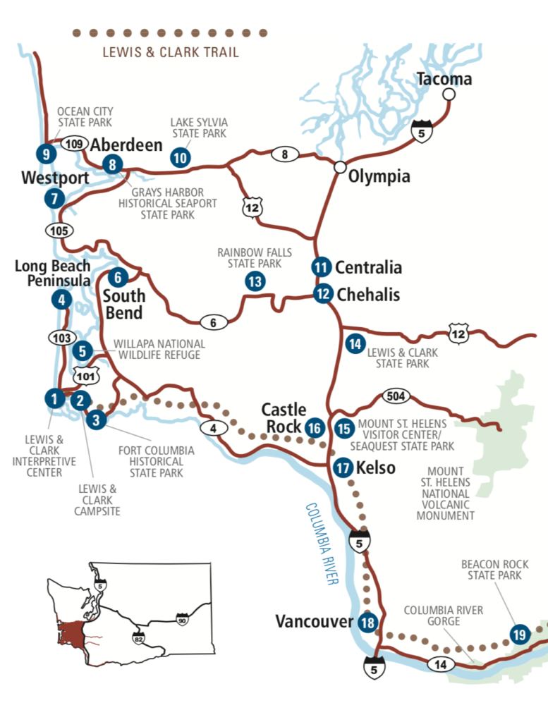
Driving Tour #1: Kelso-Longview to
Westport
Touring on
WA Road 4, US101, and WA Road 105
This is very scenic drive that will take you along the north side of the Columbia
River, through the Willapa Hills, winding along fertile river valleys,
weaving along the east and north sides of the dramatic wide Willapa Bay,
passing over numerous beautiful river estuaries, looking around in the small
coastal towns, and finally cruising by the
wide straight beaches of Westport.
This travel route is my favorite driving adventure in Southwestern Coastal Washington.
Washington State Route 4 is also know as the Ocean Beach Highway, Lewis and Clark Trail Scenic Byway, and Washington State Scenic Highway.
From Longview to US101 near Naselle via WA4 it is 62 (100 km) miles. From Naselle to Raymond it is 36 miles (57 km), and from Raymond to Westport on WA105 it is 33 miles (53 km); for a total driving distance of 131 miles (210 km). The distance from my home in Vancouver to Longview is 41 (65 km) miles via US Interstate 5. Thus, from Vancouver to Westport via this route it is 172 miles (276 km).
These are all well maintained State and Federal highways. They are wide, nicely paved, generally flat, with ample turnout options, and small communities and towns (Cathlamet, Skamokawa, Rosburg, South Bend, Raymond and Westport) for supplies and services along the roads.
I don't find the traffic on these roads bothersome, it is mostly very light. I drive around 40-50 miles per hour, and pull off the road to let all faster vehicles pass. You will share the road with with logging trucks, trucks with trailers, service vehicles, SUV's and RV rigs on these roads. For the entire distance of 131 miles (210 km) be always alert to side traffic entering the road from lanes, streets, gravel roads, and pull-outs. Finally, the driver must concentrate on driving and not sightseeing, looking at the scenery, and staring at beauty. Switch drivers frequently. Stop at scenic pull-outs to stand and rest. Be SAFE while driving. Never drive after using alcohol or cannabis.
Begin this delightful driving trip at U. S. Interstate 5 (Exit 39
Interchange) and
Washington Road 4 (WA4). Maps
Pictures of
Exit 39 Area
Google Map At Exit 39 is the Three Rivers Mall, many fast food
restaurants, motels, big box stores, shopping.
Follow WA Road 4, WA4, heading west for the next 62 miles.
Kelso Population 11,925 CR Junction of WA4 and Interstate 5, Exit 39. Along the Cowlitz River.
Longview
Population 37,520
Images CR
By the Cowlitz River (the boundary between Kelso and Longview) and the Columbia River.
Museum
Sacajawea Park
and Japanese Gardens.
The first 7 miles on WA4 from Exit 39 to the Junction with WA432 is through the many businesses, stores, services, restaurants, and homes along WA4 through Kelso and Longview. Shoppers can stock up on everything here. Two big bridges go over the Cowlitz River; and the big Longview/Ranier (1930) bridge crosses over the Columbia River.
Junction of WA4 and WA432. This ends the city environment, and from here on driving west on WA4 is through rural and forest areas first along the Columbia River. You will pass sloughs and lilly ponds.
Stella
Abernathy Creek and Fish Technology Center
After Mill Creek Street the road follows on the road dyke right along the Columbia
River. This is about 15 miles west of Exit39/I5.
Everything to your right, to the north, all those cliffs, hills and dense forests are the
Willapa Hills.
County Line Park WA4 road is at times right along the Columbia River in this area. Limited parking, restroom.
There are many spots to pull off and fish from the dyke in the Columbia River at high tide time. There are many fish hatcheries off of WA4 and US101.
Look for the small green WA4 mile marker signs
on the left side of the road as you are driving
west on WA4.
GREEN MILE MARKER = GMM The numbers will decrease as you drive
west on WA4.
Cathlamet Population 532 CR Images On WA4 Marina, ramp, stores You begin to drive inland from here on. Nearby ferry across the Columbia. GMM 36.
Julia Butler Hansen National Wildlife Refuge Images Large refuge for deer. Viewing Station. Beautiful low areas inland. GMM 34.
Columbian White-Tailed Deer National Wildlife Refuge Viewing Station.
Skamokawa
On WA4.
Images CR Kayaking B&B Campground at Vista Park,
yurts, boat ramp, playgrounds, yurts. Museum.
The road WA4 turns inland from Skamokawa most of the way to Naselle.
You will be driving through the forests of the Willapa
Hills.
Evidence of logging is everywhere. GMM 27.
33 miles east of Exit 39/I5.
Gray's River Images CR Crosses WA4 near Rosburg
Gray's River Valley GMM 19-13.
Gray's River Covered Bridge Some beautiful small river valleys in these areas along WA4.
Deep River Images Boat Launch GMM 11.
Rosburg Population 416 CR Store 47 miles east of Exit 39.
Junction of WA4 and WA401. Head south on WA401 if you want to get to the Ilwaco/Astoria Bridge. GMM 8.
Naselle: Naselle River Images Store Gas CR Naselle is about six miles east of the junction of US101 and WA4. GMM 7-4.
Naselle River Images WB GMM 1.
Junction of US101 and WA4. Johnston's Landing. Along the
wide Naselle River valley, and near the bridge over the Naselle River.
The Naselle River flows into the south end of Willapa Bay. Parking
near the bridge. 62 miles east of Exit 39/I5.
Turn right onto US101 and drive north. As soon as you start driving north on 101 there is a green mile marker on the right side of the road that is numbered GMM 29. The GMM numbers will increase as you drive north on US101 to Raymond.
Nemah River
Images US101 As you drive north on US101 you
will cross the South Fork of the Nemah river, its Middle Fork, and its
North Fork.
The forest of the Willapa Hills along the road is quite dense at times.
Evidence of logging and reforestation.
US101 is wide, straight, relatively flat and a very good road from here
to South Bend. GMM 29-37.
Nemah River Natural Area Preserve
Willapa Bay: Bear River WB US101 Boat ramp Here begins your views of Willapa Bay.
Willapa Bay: Palix River WB
Willapa Bay: Palix River Natural Area Preserve Boat Ramp
Bay Center
Village Population 300
Images Willapa Bay Cafe, No stores.
Bush Pioneer County Park In Bay Center Village WB Camping USk101 Also a KOA campground in Bay Center.
Willapa Bay: Niawiakum River US101
Willapa Bay: Niawiakum River Natural Area Preserve Preserve
Willapa Bay:
Bone River
Images WB
Willapa Bay: Bone River Natural Area Preserve GMM 45.
Willapa Bay Overlooking Ridges GMM 45-49. Dramatic views from roadside turnouts.
Bruceport County Park Images Camping US101 Overlooking the Pacific, trails, rugged small campsites.
Stuart Slough There are many sloughs in this area. Wide open views. Some huge flat cattle farms in the area.
Willapa River Valley and Willapa Bay Ports GMM 50-54. US 101.
South Bend Population 1,637 WB Images Pacific County Along the Willapa River US101
South Bend: County HQ Courthouse WB
South Bend: Pacific County Historical Society and Museum
South Bend Timberland Library In an old rundown Carnegie library building.
South Bend Climate 90 inches of rain each year 30% of the oysters consumed in the USA come from Willapa Bay.
South Bend: Goose Point Oysters, small marina, South Bend is famous for its Oysters
South Bend Travel Bay Sights Williams Campground Helen Davis Memorial Park Boat ramp
South Bend: Willapa Hills State Park Trail 56 miles
South Bend: Bruceport County Park Images Camping US101 Overlooking the Pacific, trails. South of South Bend.
Many fish canneries are in or near South Bend and Raymond. There are numerous commercial and public docks in the area.
Raymond Population 2,975
Pacific County WB Junction of US101, WA 6, and WA 105.
The largest town on
the east side of Willapa Bay and largest city in Pacific County.
Raymond is 35 miles north of Naselle, 56 miles west of Centralia, and 25
miles south of Aberdeen.
Raymond Images WB
Raymond: Carriage Museum Willapa Seaport Museum Harbor/Docks Sightseeing Paddling
Raymond: Willapa River Images WB There is a north and south fork of the Willapa River in Raymond.
Raymond:
Steamboats of Willapa Bay There is a huge Weyerhaeuser
lumber mill in Raymond.
Many fish canneries are in or near South Bend and
Raymond. There are numerous commercial and public docks in the
area.
Raymond: Willapa Paddle Adventures Paddling canoes or kayaks on the many Willapa Bay rivers is very popular.
Raymond: Willapa Hills State Park Trail 56 miles east to Centralia. River biking trail from Raymond to South Bend.
Numerous rusted metal sculptures along the roadway in Raymond.
As you leave Raymond you will turn left onto WA 105 and drive west to Tokeland.
Look for the small green WA4 mile marker signs
on the left side of the road as you are driving
west on WA 015. GREEN MILE MARKER = GMM
The numbering on WA105 begins with GMM 1 in Raymond, and the GMM increases
as you are heading west and north on WA 105.
Willapa River Docks GMM 1.
Willapa River Valley and Airport GMM 2-5. Lovely flat valley, cattle grazing, forested hillsides.
Views of Willapa Bay: Dramatic scenes looking south from the roadway dyke into this huge Willapa Bay. GMM 10-15,.
Smith Creek State Wildlife Recreation Area WB Boat ramp
Willapa Bay: North River WB Paddling Near Smith Creek
Willapa Bay:
Cedar
River WB
Images
Approximately 2 miles east of Tokeland on WA105. GMM
10.
"The river's lowermost course runs through part of the North Willapa Bay
Wildlife Area Unit, part of the Johns River Wildlife Area. The mouth
of the Cedar River merges with Willapa Bay in a tidally-influenced estuary.
There is a 275 acre protected unit called the Cedar River Estuary, managed
by Forterra. This area is a tidal ecosystem with salt marshes, tidelands,
and coniferous forests. It also includes Oyster Island, Bone Creek, and
Norris Slough."
North Willapa Bay Wildlife Area

Tokeland Population 200 Willapa Bay North Images Small harbor. Old Hotel Restaurant. WA105
Tokeland: Nelson Crab: Specialty Market; Offering local canned tuna, salmon, and dungness crab, etc. Wines, gifts.
Willapa Bay National Wildlife Refuge WB Images
Dexter By the Sea WA105 WB
Shoalwater Indian Reservation Casino Images GMM 17
"In the days before European settlement the shores of Shoalwater Bay were a mix of a bountiful natural environment and many native villages. The north end of the bay around the present day reservation was populated predominantly by Lower Chehalis speaking peoples. The Southern end of the bay, near present day Bay Center and southward was inhabited by Willapa Chinook peoples. The original territory of the Shoalwater Bay peoples was a vast network of waterways along the coast. For the Lower Chehalis Shoalwater�s village of �Naaphs Chaahts� (today�s reservation) was the southern tip of the territory. From there it extended northward to �ts-a-lis� the lower Chehalis word for Westport, meaning �place of sand�. Early explorers pronounced the word �Chehalis� and gave this name to the river and the people living up river who later became the Chehalis tribe. From Westport the territory went east up the Chehalis river to present day Satsop, Washington." Source
North Cove Parking Area, Northcove Beach Access GMM 20
Smith Anderson Road leads to many beautiful cranberry bogs. GMM 21.
Seashore Conservation Area State Park near North Cove or Tokeland WA105
Old Highway 105
Beach Driving Access = A paved and/or gravel road leading to the drivable beach area.
Warrenten Cannery Road Beach Driving Access Very long sand dunes and beach, dry sand road, sketchy access and warnings.
Midway Beach Road Beach Driving Access GMM23
Grayland Community GMM25
Grayland Beach State Park It is 10 miles from Grayland SP to the Westport Marina.
Cranberry Beach Road Beach Driving Access Restrooms, picnic area GMM 25
Grayland Beach Oba State Park Walking Beach Access GMM26
Bonge Ave Beach Driving Access GMM30
Twin Harbors State Park Walking Beach Access
Junction of WA105 and WA105 Spur Road into the Westport Marina (3 miles). GMM 31
Schafer Island Beach Approach Walking Beach Access
Cohasset Area Housing in the unincorporated area
West Ocean Ave Beach Access Picnic area, trails, bikepath to Westport, Westport Lighthouse GMM 32.
Westhaven State Park Images Jetty, picnic, parking, restrooms, surfing, trails for walking/biking. GMM 34
Point Chelais and the South Jetty
Westport Marina GMM 34.
Maps of Willapa Bay and Grays Harbor

.jpg)
Information, Bibliography, Sources, Readings about Willapa Bay
Coast Country: A History of Southwest Washington. By Lucile McDonald.
Long Beach, Midway Printery, 1989. Index, 183 pages. TRLS = Timberland
Regional Library System, WA [I pick up my reserved books and videos as
the Westport Branch of the TRLS.].
The Historical and Regional Geography of the Willapa Bay Area, Washington. By Jean Hazeltine. South Bend, 1956, 308 pages. FVRL
Shoalwater Willapa., By Douglas Allen. Snoose Peak Publishing, South Bend, WA, 2004. Index, notes, sources, 286 pages. TRLS.
Telling Our Stories: Voices of Grays Harbor. By students of the Evergreen State College, Grays Harbor Campus. Gorham Printing, Centralia, WA, 2012. 155 pages. TRLS.
A Tidewater Place: Portrait of the Willapa Ecosystem. By The Willapa Alliance, Long Beach, WA, 1993. Color photographs and text, 50 pages. TRLS.
Willapa Bay: The Longstreet Highroad Guide to the Northwest Coast has good coverage on Willapa Bay.
Willapa Bay Blog Reports and Photographs by Michael P. Garofalo.
The Northwest Coast: Or, Three Years' Residence in Washington Territory. By James Gilchrist Swan. Adesite Press, 2017, 448 pages.
Information, Books, Guides, Reference Books, Field Guides, Handbooks
Grayland Beach, Willapa Bay, Grays Harbor, Olympic Peninsula, and the Pacific Northwest
Useful Books for Your Vehicle While Traveling:
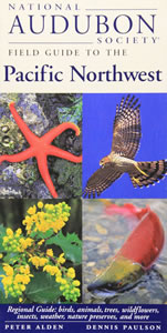
National Audubon Society Field Guide to the Pacific Northwest. By Peter Alden and Dennis Paulson. Knopf, 1998, 488 pages. Regional Guide (Washington and Oregon): birds, animals, trees, wildflowers, insects, weather, nature preservers, etc. This is a handy, small, and sturdy field guide for enthusiasts of natural history studies. Over 1,500 small colored photographs, some maps and drawings. I carry in my car along with camera, binoculars, magnifying glass, tools, and walking backpack (with 10 essentials) and recreational supplies. VSCL.
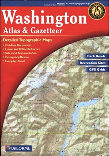
Washington: DeLorme Atlas and Gazetter. Detailed topographic maps, back roads, recreation sites, GPS Grids. Yarmouth, Maine, DeLorme Publications, 2016, 12th Edition. Indexes, 104 pages. ISBN: 0-89933329X. VSCL. An oversized map book. I keep this map in my Ford Escape. An essential tool for travelers. Very convenient to use. Since I drive on paved roads, this book provides sufficient detail for my needs. Handy for home study.
Also, use more detailed maps, as needed, such as good County maps, topographic maps, walking and hiking guides, fishing guides, birding guides, local tourist maps, etc. And, Google NAV and Google Maps on your cellphone can really provide detailed information and directions.
Useful Books for Your Picnic Table by the Sea
The Flora and Fauna of the Pacific Northwest. By Collin Varner. University of Washington Press, 2018, 462 pages. Over 1,000 outstanding large photographs of 800 species of the most frequently observed plants and animals of the region. What you are likely to see in Washington and Oregon from the seashore to 60 miles inland. This book is oversized and heavy - like a large photography book on your coffee table at home. VSCL.
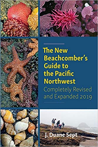
The New Beachcomber's Guide to the Pacific Northwest. By J. Duane Sept. Harbor Publishing, 2019, 416 pages. Covering the Pacific Northwest most common shoreline-dwelling flora and fauna. Focused on the kinds of inter-tidal marine life you might find on the shorelines of Washington and Oregon. Hundreds of colored photographs and good descriptions. Handy book for your backpack when heading out to walk the shore an hour before low tide ends; and the glossy paper stock would probably hold up in field conditions. VSCL.
Bring any book you like to enjoy at your sunny picnic table or comfy camp chair.
Nature Studies in Grayland Beach, Willapa
Bay, Grays Harbor, the Olympic Peninsula, and
the Pacific Northwest
Useful Books for Your Campsite or Home Study
A Birder's Guide to Coastal Waqshington. By Bob Morse. Featuring Ocean Shores, Long Beach Peninsula, Forks, Westport, Tokeland, and 160 Birding Hot Spots. R. W. Morse Co., 2001, Index, 249 pages, spiral bound text. VSCL. Detailed coverage of birding locations and how to get there.
Beachcombing SEE Beachcombing
A Coast of Scenic Wonders: Coastal Geology and Ecology of the OUter Coast of Oregon and Washington and the Strait of Juan de Fuca. By Miles O. Hayes, Jacqueline Michel, and Joseph Holmes. Pandion Books, 2020, 229 pages.
The Flora and Fauna of the Pacific Northwest. By Collin Varner. University of Washington, 2018, 462 pages. VSCL. Outstanding photographs, larger size.
Grayland Beach Nature Studies. By Michael P. Garofalo. 2021-
More Northwest Coastal Field Guides
National Audubon Society Field Guide to the Pacific Northwest. By Peter Alden and Dennis Paulson. Knopf, 1998, 488 pages. This is a handy and sturdy field guide for enthusiasts of natural history studies. I carry in my car along with binoculars, magnifying glass, and supplies in my backpack. VSCL.
Natural History of the Pacific Northwest Mountains. By Daniel Mathews. Timber Press Field Guide, 2017, Index, 583 pages. VSCL.
A Naturalist's Guide to the Hidden World of Pacific Northwest Dunes. By George Poinar Jr. Oregon State University, 2016, 288 pages. VSCL. PND 2016
The New Beachcomber's Guide to the Pacific Northwest. By J. Duane Sept. Harbor Publishing, 2019, 416 pages. VSCL. BG 2016
The Northwest Coast: A Natural History. By Stewart T. Schultz. Timber Press, 1990, index, 389 pages. VSCL.
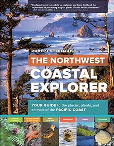
The Northwest Coastal Explorer. By Robert Steelquist. Timer Press, 2016, 282 pages. Overview of key features with pictures and text. VSCL.
Plants of the Pacific Northwest. By Jim Pojar and Andy MacKinnon. Partners, 2004, 528 pages.
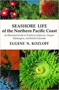
Seashore Life of the Northern Pacific Coast: An Illustrated Guide to Northern California, Oregon, Washington, and British Columbia. By Eugene N. Kozloff. University of Washington, 1983, 378 pages. A technical scientific presentation. VSCL.
Seashore of the Pacific Northwest. By Ian Sheldon. Lone Pine, 1998, 192 pages. VSCL.
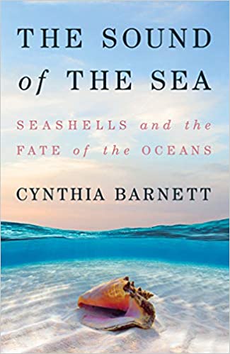
The Sound of the Sea: Seashells and the Fate of the Oceans. By Cynthia Barnett. W.W. Norton, 2021, 432 pages. VSCL.
Wildlife of the Pacific Northwest. Tracking and Identifying Mammals, Birds, Reptiles, Amphibians, and Invertebrates. By David Moskowitz. Timber Press, 2010, 364 pages. VSCL.
Books in my personal home library (VSCL) about Washington State.
Automobile Traveling in Grays Harbor, Willapa Bay, the Olympic
Peninsula, and the Pacific Northwest
Useful Books for Home Study and Your Automobile Library
History, Events, Accommodations, Highlights, Sightseeing, Cities, Parks
Washington: DeLorme Atlas and Gazetter. Detailed topographic maps,
back roads, recreation sites, GPS Grids. Yarmouth, Maine, DeLorme
Publications, 2016, 12th Edition. Indexes, 104 pages. ISBN:
0-89933329X. VSCL. An oversized map book. I keep this map in
my
Ford Escape. An essential tool for travelers. Very convenient
to use. Detailed!
The Last Wilderness: A History of the Olympic Peninsula. By Murray Morgan. University of Washington, 2019, 262 pages. VSCL.
The Longstreet Highroad Guide to the Northwest Coast. By Allan and Elizabeth May. Atlanta, Georgia, Longstreet Press, 2000. Index, 370 pages. VSCL. For both home and filed use.
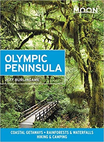
Moon Olympic Peninsula: Coastal Getaways, Rainforests, Waterfalls, Hiking and Camping Travel Guide. By Jeff Burlingame. Moon Travel, 2021, 256 pages. Covers the coastal towns and travel highlights from Forks south to Grays Harbor, Willapa Bay, and Illwaco. For home and field use. VSCL.
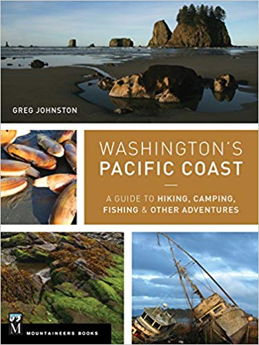
Washington's Pacific Coast: A Guide to Hiking, Camping, Fishing & Other Adventures
By Greg Johnston. Seattle, Washington, Mountaineers Books, 2015.
Index, 318 pages. ISBN: 9781594859397. VSCL.
By the Shore: Explore the Pacific Northwest Like a Local. By Nancy Blakey. Sasquatch Books, 2018, 256 pages. VSCL.
Pacific Northwest, Fodor's Travel. 22nd Edition, 2020.
The Pacific Northwest: An Interpretive History. By Carlos Arnaldo Schwantes. Revised and enlarged edition, 1996. Lincoln, Nebraska, University of Nebraska Press, 1989, 1996. Index, bibliography, 568 pages. ISBN: 978-0803292284. Professor Schwantes, Ph.D., is a field historian and author. VSCL.
Books in my personal home library (VSCL) about Washington State.
Washington River Maps and Fishing Guide. Edited By Doug Rose. Frank Amato Publications, 2013. 87 pages. ISBN: 978-1571885135. VSCL. Excellent resource for river trips and fishing.
Washington Road & Recreation Atlas
Beachcombing, Kite Flying, Fishing, Clamming, Crabbing, Walking,
Camping and other Seashore Activities in
this Region
Grays Habor, Willapa Bay, Olympic Peninsula, Pacific Northwest
Beachcombing Fishing Digging Razor Clams Oysters Kites Walking
The Essential Guide to Beachcombing and the Strandline. By Steve
Trewhella and Julie Hatcher. Princeton University Press, 2015, 304
pages.
The New Beachcomber's Guide to the Pacific Northwest. By J. Duane Sept. Harbor Publishing, 2019, 416 pages. VSCL.
By the Shore: Explore the Pacific Northwest Like a Local. By Nancy Blakey. Sasquatch Books, 2018, 256 pages. VSCL. Roughly arranged by the four seasons. Good on Puget Sound coastal activities. Coastal activities, projects, sightseeing, events.
The Flora and Fauna of the Pacific Northwest. By Collin Varner. University of Washington, 2018, 462 pages. VSCL. Outstanding photographs, larger size.
A Naturalist's Guide to the Hidden World of Pacific Northwest Dunes. By George Poinar Jr. Oregon State University, 2016, 288 pages. VSCL.
More Northwest Coastal Field Guides
The Northwest Coastal Explorer. By Robert Steelquist. Timer Press, 2016, 282 pages. Overview of key features with pictures and text. VSCL.
Washington's Pacific Coast: A Guide to Hiking, Camping, Fishing & Other Adventures
By Greg Johnston. Seattle, Washington, Mountaineers Books, 2015.
Index, 318 pages. ISBN: 9781594859397. VSCL.
Books in my personal home library (VSCL) about travel in Southwestern Washington State.
Deeper Reading
Landscape and Memory. By Simon Schama. Vintage, 1995, 655 pages. VSCL.
The Sound of the Sea: Seashells and the Fate of the Oceans. By Cynthia Barnett. W.W. Norton, 2021, 432 pages. VSCL.
*************************
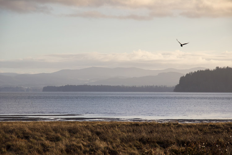
Grayland Beach 2021-2022
Grayland Population 953 SS The Grayland Community has two markets, cafes, stores, gift shops and services that are are all located along coastal Washington Highway 105. Be careful when parking off narrow WA105. Slow Down!
There are many country homes and cranberry fields east of WA105. The many back roads east of WA105 in Grayland are very quiet, picturesque, and free of traffic ... great for bicycling or long walks. Whereas, West of WA105 are houses, cabins, State Parks, sand dunes, and the seashore.
The Grayland Beach Community is 6 miles south of the large Westport marina and Westport city, and 10 miles north of the small Tokeland marina. From Grayland to Raymond it is 27 miles to the southeast, and from Grayland to Aberdeen it is 23 miles to the northeast. The scenic road from Westport to Raymond, WA105, was completed in the 1960's.
In 2022, I plan to camp four days and three nights at Grayland Beach State Park every
month. I will stay in a Yurt (winter) or a
tent.
My Reports.
Therefore, Grayland Beach will be the central point for my explorations of
the southern side of Gray's Harbor and the northern side of Willapa Bay.
This webpage will cover my exploration of the beaches of Grayland State Park,
the area 30 miles north and south of Grayland, Westport, from Grayland to
Aberdeen (WA105), and from Grayland to Raymond (WA105).
Grayland Beach: Google Maps
"There are those to whom place is unimportant,
But this place, where sea and fresh water meet,
Is important�
Where the hawks sway out into the wind,
Without a single wing beat,
And the eagles sail low over the fir trees,
And the gulls cry against the crows
In the curved harbors,
And the tide rises up against the grass
Nibbled by sheep and rabbits�.
I sway outside myself
Into the darkening currents,
Into the small spillage of driftwood,
The waters swirling past the tiny headlands."
-
Theodore Roethke, The Rose, 1964
"Once in his life a man ought to concentrate his mind on the remembered
earth, I believe. He ought to give himself up to a particular
landscape in his experience, to look at it from as many angles as he can, to
wonder about it, to dwell upon it. He ought to imagine that he touches
it with his hands at every season and listens to the sounds that are made
upon it. He ought to imagine the creatures there and all the faintest
motions of the wind. He ought to recollect the glare of moon and all
the colors of the dawn and dusk."
- N. Scott Momaday
Grayland Village Images SS
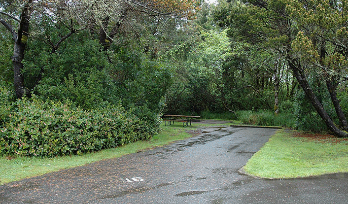
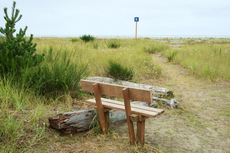
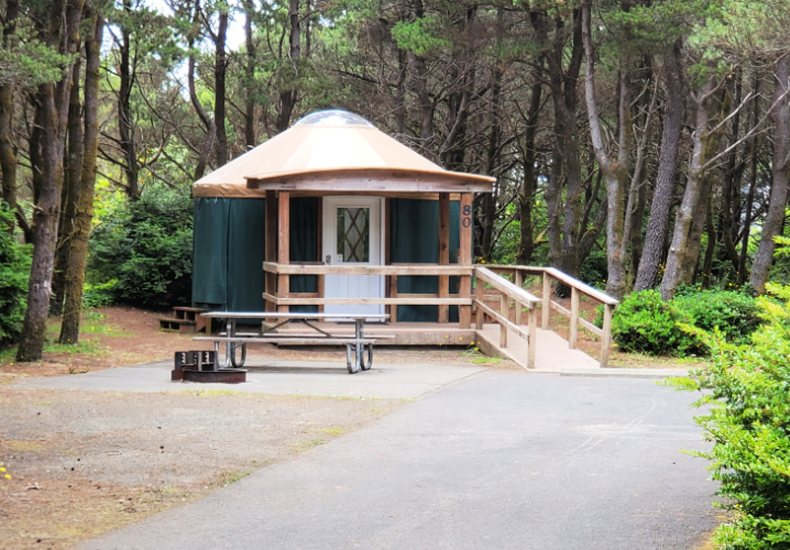
Camping at Grayland Beach State Park Images Reservations A yurt site costs $80 per night, and a tent site $25 per night in 2021.
Grayland Beach SP Images Grayland Beach SP Printed PDF Brochure Westport SS
Grayland Beach SP is just four miles south of Twin Harbors State Park
Grayland Beach: My Cloud Hands Blog posts about Grayland Beach with commentary and photographs.
Grayland Stores: The Local Market,
Grayland ACE True
Value Hardware Store,
Pomegranate Gifts. Westport Stores
Grayland Food: Wheelhouse Restaurant, Long's Bar/Grill, The Local Market. Other stores were closed. Westport Shop & Kart Supermarket
Grayland Cranberries: Cranberry Road Winery Cranberry Museum Furlow Pickers 1933 Cranberry Bogs Driving Tour in Grayland Cranberry Coastal Bogs
Washington's Cranberry Coast. By Sydney Stevens for the Pacific
Coast Cranberry Research Foundation. Arcadia, 2014, 128 pages.
Images of America Series.
History of the cranberry farmers in Grayland and Long Beach.
Grayland: Food/Cooking Westport Timberland Library Bicycling Walking Beachcombing Fishing or shopping in nearby Westport.
Grayland Birding: Midway Beach Road
"Located just south of Grayland Beach State Park, the beach access area near Midway Beach Road is a popular spot for shorebirds migrating through the region. In the spring months, there will be over twenty species of shorebirds in this area, highlighted by the �Streaked� Horned Larks and Lapland Longspurs that frequent this stretch of beach. Even in the off-season, huge flocks of pelicans have been spotted near this area, which is quite rare to see this far north. With eagles constantly flying around and the occasional blue heron sighting, Midway Beach is a fun place to avoid the more crowded parks and have a great time birding."Grayland Beach Area Vehicle Access Roads to Drive on the Beach: Midway Beach Road, Cranberry Beach Road, Bonge,
Grayland Beach Area Vehicle Parking Closer to Shore [all have restrooms except for North Cove]: Tokeland, North Cove, Westport Jetty, Westport Lighthouse.
Grayland: Tai Chi and Chinese Yoga by Michael P. Garofalo. I camp at Grayland State Park, mostly in mid-month. For Qigong (Chi Kung, Chinese Yoga) I practice the Eight Section Brocade. I practice the Yang Style of Taijiquan using the Long 108 Form and the Short 24 Form and the Eight Immortals Cane Form. My Qualifications? Grayland: Taoism. Let's walk the tide line at Grayland and talk Taoism. Sit in the shade of shore pines and savor the sayings of Lao Tzu. Ponder Process Philosophy.
Grayland Beach State Park Clam Digging at Low Tide SEE Clam Digging
Grayland Beach Beachcombing: "Grayland has hands down the best beachcombing in the Grays Harbor County. Grayland is part of a 12 mile stretch of sandy beach line with plentiful sand dollars, driftwood, bullwhip kelp, sea creatures, cool rocks, shells and incredible amounts of flotsam. The locals host an annual Driftwood art and Glass float hunt each year. Because of this, beachcombing can get competitive, especially after a big storm. Arrive early to inspect the high tide line and follow the tide out. You can drive on this beach, but beware of soft sand at the beach approaches to the north. The best shell and driftwood collections are to the south. Cross a few streams and you will soon find the sand scattered with driftwood, moon shells and periwinkles." 5 Best
Grayland Beach SP Surf Fishing SEE Surf Fishing Nearby Westport has many jetty, dock, boardwalk, pier, and charter boat fishing options.
Grayland Beach SP Images Westport SS
Grayland Beach SP Printed PDF Brochure
Reservations Made Online
This campground is very popular in the summer months and during clamming
season. Over 90% of people camping here during the rainy season (from
October to April) are using trailers, truck camper shells, RVs big and
small, vans, etc. I make reservations well in advance for a nice yurt.
Why? Affordable and sheltered from 72 inches of rain.
Reports and
Photos about my
Camping Adventures
in 2021 and 2022
At Grayland Beach State Park and Twin Harbors State Park
Booked = Reserved
Make Your
Own Reservations
Online
Cloud Hands Blog Posts about
Grayland Beach and
Willapa
Bay and
Grays
Harbor
1st Camp: 2021 September
Reports
1
2
3
Yurt Campsite at Grayland Beach State Park for two nights
2nd Camp: 2021 October
Reports
4
5
6
7
Cabin Campsite at Twin Harbors State Park for three nights
3nd Camp: 2021 October Reports
8
9 10 11
Yurt Campsite at Grayland Beach State Park for three nights Booked
4rd Camp: 2021 November Reports
12 13 14 15
Cabin Campsite at Twin Harbors State Park for three nights Booked
5th Camp: 2021 December Reports
16 17 18 19
Cabin Campsite at Twin Harbors State Park for three nights
Booked
6th Camp: 2022 January
Reports 20 21 22 23
Yurt Campsite at Nehalem Bay State Park, Oregon, for 3 nights Booked
7th Camp: 2022 February Reports 3 nights in a Yurt
8th Camp: 2022 March Reports 3 nights in a Yurt
9th Camp: 2022 April Reports 3 nights in a Tent
10th Camp: 2022 May Reports 3 nights in a Tent
11th Camp: 2022 June Reports 3 nights in a Tent
12th Camp: 2022 July Reports 3 nights in a Tent
Four Days at Grayland, Campsite by the Sea, On a Corner of the Sea
Grayland Beach SP Yurt Campsites Video of All Campsites My Photos
Grayland Beach SP Weather Current Weather Report and Week Ahead Predictions for Grayland Grayland averages 76 inches of rain each year.
Grayland Beach SP Activities I enjoy: Sitting and staring, thinking and day dreaming, walking around, reading, photography, surf fishing, clam digging, long vigorous walks, practicing Taijiquan or Qigong, beachcombing for little treasures, kite flying, frolicking in the surf, playing games, doing nature studies, playing a harmonica, smelling the sea, listening to the waves, writing, working with tools, reading, string figure playing, using waders, cell phone usage, staying warm, ... For rest, I sit and stare, sit or lay down in my beach tent, play games, lay on the cushion in the back of my my Junior RV Ford Escape or sit inside the Escape for warmth, doze and sleep. I have a stove, teapot, and hot water for tea and coffee and instant foods. I bring a variety of fresh fruits, nuts, dried fish or beef, good bread, and goodies to eat; and, bring a couple of grams of cannabis and apricot brandy. I enjoy reading books like: The Sound of the Sea: Seashells and the Fate of the Oceans, by Cynthia Barnett. I stay in a tent, a yurt, or a cottage or motel by the sea.
My favorite drive from Vancouver to Grayland Beach is from Longview to Westport, Tour 1.
Another alternative is to drive north on the Interstate 5 Freeway from Vancouver to Chelais, for 79 miles, an easy and safe drive. Then, drive west on WA Road 6 though Pe Ell to Raymond, for 52 miles. You will drive on an excellent two lane road (WA 6) through lovely forested country and agricultural valleys, rolling hills, and encounter very little traffic. Then, drive northwest on WA 105 along the beautiful coast road from Raymond through Tokeland and north to Grayland, for 27 miles. Total distance: 158 miles, about 4 hours of easy driving with very little traffic from Chelais to Grayland. An easy effort for my Ford Escape.
Agate Hunting on the Washington Coast. By M. J. Grover. 2021, 108 pages.
Beachcombing Tips Magazine Top Spots Northwest
Pacific Northwest Beachcombing Grayland Beach
The Beachcomber's Companion: An Illustrated Guide to Collecting and Identifying Beach Treasures. By Anna Marlis Burgard. 2018, 128 pages.
Beachcomber's Guide to the Seashore Life in the Pacific Northwest. By J. Duane Sept. Harbor, 2009, 224 pages.
Beachcombing at Miramar: The Quest for an Authentic Life. By Richard Bode. 1997, 208 pages.
Beachcombing the Pacific. By Amos L. Wood. Schiffer Publishing, 1987. Index, 225 pages. VSCL.
The Essential Guide to Beachcombing and the Strandline. By Steve Trewhella and Julie Hatcher. 2015, 304 pages.
The New Beachcomber's Guide to the Pacific Northwest guide to the flora and fauna of the inter-tidal areas of beaches.
A Naturalist's Guide to the Hidden World of Pacific Northwest Dunes
Books on Beach Activities and Coastal Nature Studies
5 Best Beachcombing Beaches in Grays Harbor
Beachcombing is very interesting for those closely following the changes of the tides each day, the major seasonal differences, the intensity of storm conditions, and the biotic communities by the seashore.
Just walk the beautiful beaches of Grayland. Savor the enjoyment in walking outdoors by the sea shore.
To be a fisherman is to first cast your bait into the water; to be a beachcomber is first to walk.
Beachside Day-Use "Campsites" or Picnic Sites
Drive to a Beachside Picnic Site (sort of a Day-Use "Campsite"):
You can usually day camp from 8 am to 5 pm; weather, tides, season, and surf conditions
permitting. You cannot camp on the beach at night.
Know the tide information and surf conditions and expected weather. What season are you in? What at storm conditions? Know the current legal rules and regulations regarding driving in the area you are in. Are you on public land or private land? Know what your vehicle can do and cannot do on the firm moist beach sand. Avoid getting stuck. Drive safely a short distance to the selected beach "campsite." The vast stretches of the dry sand dune environment are for walker's only.
"Recreational use is the province of the Washington State Parks and
Recreation Commission. The commission has established driving
regulations to protect the beach and its visitors. A "drivable beach"
is defined as the area of firm, wet stand upland from the clam beds over
which the tide ebbs and flows daily. This area is considered hard
enough to support the weight of an ordinary passenger vehicle and provide
traction for the tires. The dry sand area is everything upland from
the water line, except for this strip of firm wet sand that is designated as
drivable beach. Parking is permitted only in the landward 100 feet of
the drivable beach."
- Amos L. Wood, Beachcombing the Pacific
Obviously, you can carry a lot more recreational and comfort gear in a car to a day use "campsite" or picnic site. At Grayland Beach I can drive to the beach on gravel Cranberry Road, then up to a half mile or so north or south on hard packed sand to a nice spot. I rarely drive more than a half mile from the gravel roads. I drive slowly and carefully in my Ford Escape AWD Titanium. This Ford SUV can carry enough for two people for beach day camping. When tent camping alone I set up my beach day camp as follows:
Use your vehicle as a shield against the cool ocean wind and sand spray. I also set up a small pop-up beach nylon half-tent. I have a low chair for the half-tent and a good higher camp chair. I have a Therma Rest self-inflating mattress for the back of my Ford Escape. Sometimes, when it is cold and windy, you will enjoy sitting or lying in your vehicle. I use wool blankets and warm clothing for beach day camping.
I bring my kitchen box, food box, and water. I use a one burner butane Coleman stove for cooking.
I bring surf fishing and clam digging gear. I bring gear for nature studies while walking the shore lines both at high and low tides. I bring stuff for my sit still hobbies: reading books, listening to MP3's, using my cellphone, playing string figures, tying fishing rigs, using the camera, flying kites ...
I don't burn wood at the beach. I keep and leave my campsite clean and neat.
Walking to Day-Use or Hourly-Picnic Use "Campsite": Wide sandy beaches are common at Ocean Shores, Twin Harbors, and Long Beach. It can be a very long walk from your tent campsite or a parking lot to the shore. Walking in sand is more strenuous. Thus, carrying a filled backpack, a low chair, and a half-tent, food, water ... and walking through sand dunes and beaches would challenge many an older person's (I'm 75) arms and legs. Thus, if you want to carry more while walking to the beach for a day campsite you will prefer (even as a solo tent camper) using a small beach wagon-cart. Better yet, at Grayland Beach, I drive to my selected beach "day campsite."
Beaches on the Washington Coast
Bicycling on long bike paths, quiet country roads, on dirt trails, on quiet coastal city streets, or on big tire bikes on the sandy shore ... all readily available in the Region.
A Birder's Guide to Coastal Waqshington. By Bob Morse, 2001. Featuring Ocean Shores, Long Beach Peninsula, Forks, Westport, Tokeland, and 160 Birding Hot Spots. Detailed coverage of birding locations near Westport and how to get there. Excellent resource! RWMorse, 2001, 270 pages, ring-bound. VSCL. FVRL
Pelagic Boat Trips for watching oceanic seabirds out of Westport Marina in the summer months.
Bottle Beach State Park Near Westport SS Bird Watching Area, Mudflats, Swamps
Birds of the Pacific Northwest. By John Shewey and Tim Blount. Timber Press Field Guide, 2017, 560 pages.
Johns River Wildlife Area Images Near Westport SS History Game Farm Road off 105 Walking trails, boat launch, bird watching.
Birds of Washington Field Guide. By Stan Tekiela. Adventure Pubs., 2001, 332 pages.
Jetties, marina, and pier in Westport.
American Birding Association Field Guide to the Birds of Washington. By Dennis Paulson and Brian Small. Scott and Nix, 2020, 368 pages.
Jetty and small marina and wetlands around Tokeland. Tokeland Population 200 Willapa Bay Images
In the Spring, many birds flock to the shallow waters and river estuaries of both Grays Harbor and Willapa Bay.
Driving Tours of Mike Garofalo
Tour 1:
Longview to Westport (WA4, US101,WA105)
Columbia River, Willapa Bay (East and North Sides of the Willapa Bay),
Raymond, Grayland, Westport
Driving west and north for 131 miles.
Tour 2: Westport to Aberdeen (WA105)
Tour 3: Westport to Raymond (WA105)
More Notes on Driving From Vancouver to Grays Harbor and Willapa Bay
Forks Population 3,500 OP Olympic Park Region
Four Days in Grayland by Michael P. Garofalo
Four Days in Grayland, Part I Grays Harbor and Willapa Bay: A Traveler's Hypertext Notebook and Guide
Four Days in Grayland, Part II Grayland Beach: A Camper's Hypertext Notebook, Studies, and Comments
Four Days in Grayland, Part III Photographs, Blog Posts, and Notes from 2021-2022
Four Days in Grayland, Part IV Reflections of a Beachcomber: Poetry, Short Essays, Reports, Commentary, Quotations
Hiking, Walking, Hiking Trails, Walking Paths, Bicycle Paths, Beachcombing
Ocean Beaches, 15 miles of wide sandy beaches and sand dunes from North Cove to Westport.
Johns River Wildlife Area Images Near Westport SS History Game Farm Road off 105 Walking trails, boat launch
Walking Quotations, Reflections, and Information. Compiled by Michael P. Garofalo.
Westport State Park - Westport Light Trail Images Westport Dunes Trail SS
Bottle Beach State Park Near Westport SS Bird Watching Area, Mudflats, Swamps
Willapa Hills State Park Trail Near South Bend-Raymond, and 56 miles to Chelais. Former railroad route
Native American tribes have lived in the Grays Harbor region for over 8,000 years. They were expert fishermen, hunters and gatherers. They made good canoes, were expert sea fishermen, and could travel considerable distances by canoe. They built more weather secure wood homes inland for winter, and temporary shelter camps near shorelines, rivers, and lakes for better seasonal hunting and gathering. They knew when the bird migrations, or peak razor clam times, or best kelp beds, or seasonal salmon runs would provide more needed food for eating and drying. The abundant local natural resources for food, and the ingenuity and customs of these hardy people provided life for countless generations.
Native American coastal tribes in the Olympic Peninsula, Chelais River Valley, Grays Harbor and Willapa Bay areas included: Chelais, Chinook, Clatsop, Copalis, Cowlitz, Hoh, Makah, Klallam, Muckleshoot, Niqqually, Quinault, Queets, Quileute, Shoalwater Bay, and Willapa. Here is a list of some of the books I have read about Native American People and the Cultures of the coastal Northwest.
On May 7, 1792, a Yankee commercial sailing ship from Boston arrived in Grays Harbor. The Captain of this merchant vessel was Robert Gray. He and Captain George Vancouver were exploring and documenting this area at the same time in separate sailing ships. Later that year, Captain Gray, in his ship Columbia, crossed the bar and entered the Columbia River at Astoria. The Spanish, Russians, French, British and Americans were all fur trapping in these areas from Vancouver Island to the Columbia River.
By 1805, President Jefferson had the Lewis and Clark Expedition survey and document American interests from St. Louis, Missouri, to the Northwest Pacific coast. Fort Vancouver Washington was founded in 1825 by The Hudson Bay Company. The Treaty of 1818 and Oregon Treaty of 1846 between England and USA were significant. All the Olympic Peninsula covered in this webpage became a Territory of the USA in 1848, and Washington became a State of the USA in 1889.
Settlement by Europeans began in the 1850-1870's in Grays Harbor and Willapa Bay coastal areas. The Europeans developed many fishing, lumber, farm, commercial, retail, shipping, tourism, professional and other businesses. Tourism in Ocean Shores, Aberdeen, Westport, Long Beach and Ilwaco has been important since 1960. However, Northwest coastal winters are wet, cold, windy, and only for tougher tourist souls. It is very hard to make a living in these small coastal towns of the Olympic Peninsula, so incomes, opportunities, and populations are still low in the area.
Documentation, maps, research, books, libraries, Net ... The Native American Cultures of the northwest coast were fishermen, hunters, and gatherers. They had no iron tools. They were preliterate cultures of storytellers, singers, dancers, and chanters. The Europeans coming after 1790 were sailors, traders, merchants, farmers, explorers, as well as storytellers, singers and dancers; and, a few were writers, map makers (William Clark), accountants, administrators (John McLoughlin), scientists (David Douglas), reporters, and book users. The University of Washington was founded in 1861. What I can know about the past rests largely on my reading research, travels to museums and locales, and my curiosity. This webpage primarily covers Grays Harbor and Pacific Counties.
The Last Wilderness: A History of the Olympic Peninsula
The Pacific Northwest: An Interpretive History By Carlos Arnaldo Schwantes, 1996.
Coast Country: A History of Southwest Washington. By Lucile Saunders McDonald, 1966.
Contested Boundaries: A New Pacific Northwest History. By David J. Jepsen and David J. Norberg. Wiley-Blackwell, 2017, 416 pages. FVRL
Kite Flying NS SS WB
Kite Store: Ocean Shores Kites, and one store in Westport
The wide beaches of Ocean Shores and Twin Harbors are excellent for flying kites.
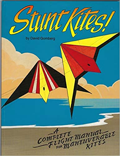
Stunt Kites: A Complete Flight Manual of Maneuverable Kites. By David Gomberg. Cascade Kites, 1994, 89 pages. VSCL.
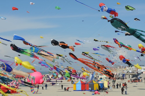
Kites: I own a variety of kites. I fly single string kites. I fly two string stunt kites. Yes, you can learn to launch a site by yourself. The beaches at Twin Harbors or Ocean Shores are very wide and there is plenty of room for safe kite flying.
Libraries in the area are part of the Timberland Regional Public Library System. Besides nice, clean, and comfortable facilities these public libraries offer books, media, Net access, magazines, etc. Often, the local public library has information on local history, recreation, travel, and natural history. I worked for the County of Los Angeles Public Library System from 1974-1998. I currently have library cards at the Fort Vancouver Regional Library System (FVRL) and the Timberland Regional Library System (TRL).
Mushrooms of the Pacific Northwest. By Steve Trudell and Joe
Ammirati, 2009.
Music Playing I own a wide variety of albums in MP3 format that I loaded on a memory chip into my cellphone. I bring earphones and a small USB bluetooth speaker.
Musical Instrument Playing: My harmonicas [C, Am] Bring your guitar, flute, harmonica ...
Native American tribes have lived in the Grays Harbor region for over
8,000 years. They were expert fishermen and canoe travelers.
Such tribes in the Olympic Peninsula and Chelais River Valley and Grays
Harbor included: Chelais, Chinook, Copalis, Hoh, Makah, Klallam, Muckleshoot,
Niqqually, Quinault, Shoalwater Bay. Here is a list
of some of the books I have read about Native American People and Cultures
of the Northwest. Read more History of Native
Americans in this area.
Photography: I have all the gear for a Canon Single Lens Reflex
camera. I own a Samsung A20 cellphone with a very good camera.
Eventually, by the end of 2022, all the photographs in Four Days in
Grayland will
have been taken by either Michael P. Garofalo or Blanche Karen Garofalo.
I use software from Corel Paint Shop Pro 2020.
Seasons and Months
Winter Season
Damp, cold, an average of 47F high, and often rainy weather. Bring
your rain gear.
Beachcombing,
Clam Digging Crabbing Reading Walking
Quotations and Poetry
Fishing
Put on good (examples):
rain pants,
rain coat, boots, and warm clothes and use an umbrella to go walking and
beachcombing.
If your walking in the surf or shallow rivers or surf fishing you might need
chest waders.
Use indoor facilities (museums, libraries, stores,
cafes/bars, your car) to deal with the rain, wind, chilly days, and fog of
the coast.
If you don't have hobbies to do while just sitting indoors, then
get some.
Nature
Studies
Take care when driving on wet roads and encountering pooled water on WA105;
and take care in fogging mornings.
Storm Watching
Spring Season
May and June have mild, an average of 56F high, and fairly clear
weather.
Bird
Migrations Clam Digging
Beachcombing Fishing Kite
Flying Walking Bicycling
Festivals/Contests
Quotations and Poetry
Nature
Studies Reading
Summer Season
The weather is pleasant, an average of 65F high, and rain free.
Fishing
Tourists/Families Kite Flying
Beachcombing Surfing
Walking
Bicycling Festivals
Quotations and Poetry
Nature
Studies Tent Camping
Reading
Autumn Fall Season
The weather is pleasant in early Autumn, and colder and wetter in later
Autumn. A range of 52F to 67F highs; and 7 to 18 days of rain each
month. Bring your rain gear.
Activities
Quotations and Poetry
Nature
Studies
Fishing Reading
Clamming Season
Beachcombing
By the Shore: Explore the Pacific Northwest Like a Local by Nancy Blakey, 2018. Roughly arranged by the four seasons.
Every Month of the Year: Beachcombing, Fishing, Camping, Reading, Observing, Learning, Exploring, Your Hobbies
January
Weather: 12 inches of rain total from 18 days.
Quotations and Poetry
Yurt Camping
Storm Watching
February
Weather: 8 inches of rain total from 15 days.
Quotations and Poetry
Yurt Camping
Storm Watching
March
Weather: 8 inches of rain total from 17 days.
Quotations and Poetry
Yurt Camping
Whale Watching
May
June
July
August
Weather: 2 inches of rain total from 3 days.
Quotations and Poetry
Walking
Kites Fishing
Tent Camping
Boat trips for watching birds on the ocean
September
Cranberries,
Cranberry harvesting
Quotations and Poetry
Weather: 4 inches of rain total from 7 days.
Surf Fishing for Red Tail Surf Perch
Clam Digging Variable Season
Walking
Kites Fishing
Tent Camping
Salmon runs in the rivers
October
Cranberries Cranberry harvesting,
Festival Fun Run/Walk
Quotations and Poetry
Surf Fishing
Weather: 7 inches of rain total from 13 days.
Clam Digging Variable Season Halloween
Yurt Camping
Salmon runs in the rivers
November
December
Storm Watching, Winter Storms, Extreme High Tides, Flooding
Storm Watching Article in The Daily News about a November 60 mph wind storm wave surge with photo of the Westport Tower by Greg Jacobs.
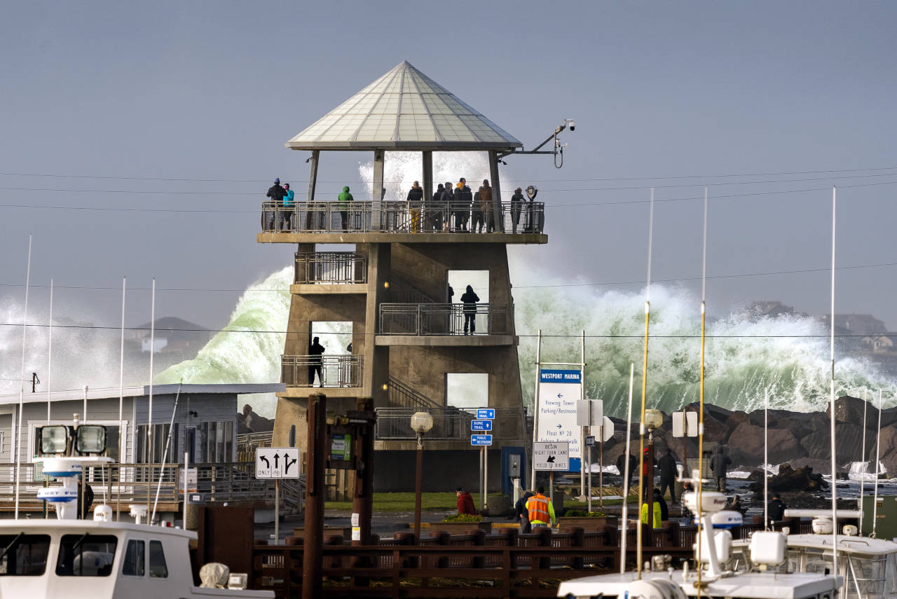
Where to Storm Watch on the Grays Harbor Coast and Tips for Storm Watching by Douglas Scott.
Twin Harbors Beaches are those sandy, wide, ocean facing beaches from Westport to Tokeland. Westport is on the south shore entrance to Grays Harbor and Tokeland is on the north shore entrance to Willapa Bay. Hence, the area is called "Twin Harbors." Midway Road Beach, Grayland Beach State Park, Twin Harbors State Park, and Westhaven State Park are all parts of the Twin Harbors Beaches Area. Clam season announcements refer to Twin Harbors regulations.
Weather, Climate, Air, Clouds, Fog, Wind, Rain, Frost
Annual
Climate or Weather Patterns in Westport or Ocean Shores
in Grays Habor
| Month | High | Low | Rainfall Inches | Rain Days |
| January | 47 | 38 | 12 | 18 |
| February | 50 | 38 | 8 | 15 |
| March | 53 | 40 | 8 | 17 |
| April | 56 | 42 | 6 | 14 |
| May | 60 | 46 | 3 | 10 |
| June | 64 | 50 | 2 | 7 |
| July | 67 | 53 | 1 | 3 |
| August | 68 | 54 | 2 | 3 |
| September | 67 | 51 | 4 | 7 |
| October | 60 | 46 | 7 | 13 |
| November | 52 | 41 | 13 | 18 |
| December | 47 | 37 | 12 | 18 |
"Occasionally also termed "Cool-summer Mediterranean climate", this subtype of the Mediterranean climate (Csb) is a less common form of the Mediterranean climate. As stated earlier, regions with this subtype of the Mediterranean climate experience warm (but not hot) and dry summers, with no average monthly temperatures above 22 �C (72 �F) during its warmest month and an average in the coldest month between 18 and −3 �C (64 and 27 �F) or, in some applications, between 18 and 0 �C (64 and 32 �F). Also, at least four months must average above 10 �C (50 �F). Cool ocean currents and upwelling are often the reason for this cooler type of Mediterranean climate. The other main reason for this cooler type is the altitude. Winters are rainy and can be mild to chilly. In a few instances, snow can fall on these areas. Precipitation occurs in the colder seasons, but there are a number of clear sunny days even during the wetter seasons. Csb climates are found in in the Pacific Northwest (namely western Washington, western Oregon and southern portions of Vancouver Island in British Columbia." - Wikipedia
Current Weather Report and Week Ahead Predictions for Westport Westport averages 76 inches of rain each year. Westport Climate
The summer high in August is around 68 degrees. The winter low in January is 38. There are 127 sunny days in Westport. Westport gets some kind of precipitation, on the average, 193 days per year or 53% of the year. Precipitation is rain, snow, sleet, or hail that falls to the ground. Westport averages 1 inch of snow a year.
Westport
Westport Population: 2,100 SS
Google Map
Images
Westport is a busy small fishing port. The marina features a long wide boardwalk, many gift and food shops on Westhaven Drive, and many beautiful boats moving in and out of the docks. There are many jetties and rock groins that were built to protect the Westport Harbor area. Around the marina are many cabins, motels, and RV parks. Warehouses and fish processing plants set a backdrop for the marina. There is fishing from the south jetty, harbor jetty, boardwalks, docks, and a quite long pier. In this area is a dramatic four story observation tower, lighthouse and a maritime museum.
Westport Weather: Current Weather Report and Week Ahead Predictions for Westport Westport averages 76 inches of rain each year.
The marina features many highly regarded charter fishing boats and
services.
Westport Charter Fishing Services
Images of charter fishing out of Westport.
I've read that some boats
charter out for whale watching and bird watching. Back in the
1890's, Westport Harbor welcomed sea vessels hunting whales.
Westport Marina is the largest on the Pacific Coast of Washington.
"Westport is the "sports fishing capital of the world" and can be quite busy during the summer salmon, halibut, and albacore tuna season. Salmon fishing is also done in the boat basin as is crabbing for Rock and Dungeoness Crabs. Surf fishing for Sea Perch occurs along the southern beaches and jetty fishing for Sea Bass, Greenling, Perch, and Ling Cod is common. Whale watching trips both inside the harbor and on the ocean are popular from early March through May." - Bob Morse
South of the Westport marina is Montesano Main Street with services, supplies, supermarket, banks, stores, cafes, coffee, churches, schools, library, medical, motels, etc., all for a working class city of 2,100 people.
There is surfing and boogie boarding at the south jetty. Westhaven State Park. Picnic areas, restrooms, beachcombing, surf fishing, beach trails, surfing.
The majority of the in-land homes and apartments are older, smaller, showing the effects of the sea climate, and humbler. Small is beautiful, and affordable for family median incomes of $41,000. A few large beautiful homes and big condominiums in prime high dune locations overlooking the sea near the Lighthouse area.
I tent or yurt camp at Grayland Beach State Park, and sometimes at the larger Twin Harbors Beach State Park. Both are close to Westport.
Westport is 25 miles southwest from Aberdeen. Westport is 33 miles north of Raymond. Westport is 6 miles north of the Grayland Beach Community.
You are allowed to drive safely, weather and tides permitting, on the "driveable beach" from the Westport Lighthouse to Grayland's Cranberry Beach Road.
On a clear day you can see across the bar of Grays Harbor (5 miles) to the many large condominiums, large expensive homes, big hotels and extensive development on Ocean Shores that were built after 1990. Also, from the Westport tower you can see off into the north the the Quinault River mountain ranges.
Westport Sightseeing An extensive hypertext Visitor's Guide to Westport
Westport: Grays Harbor Lighthouse State Park A long paved bike path connects to light house, Westhaven and Westport docks.
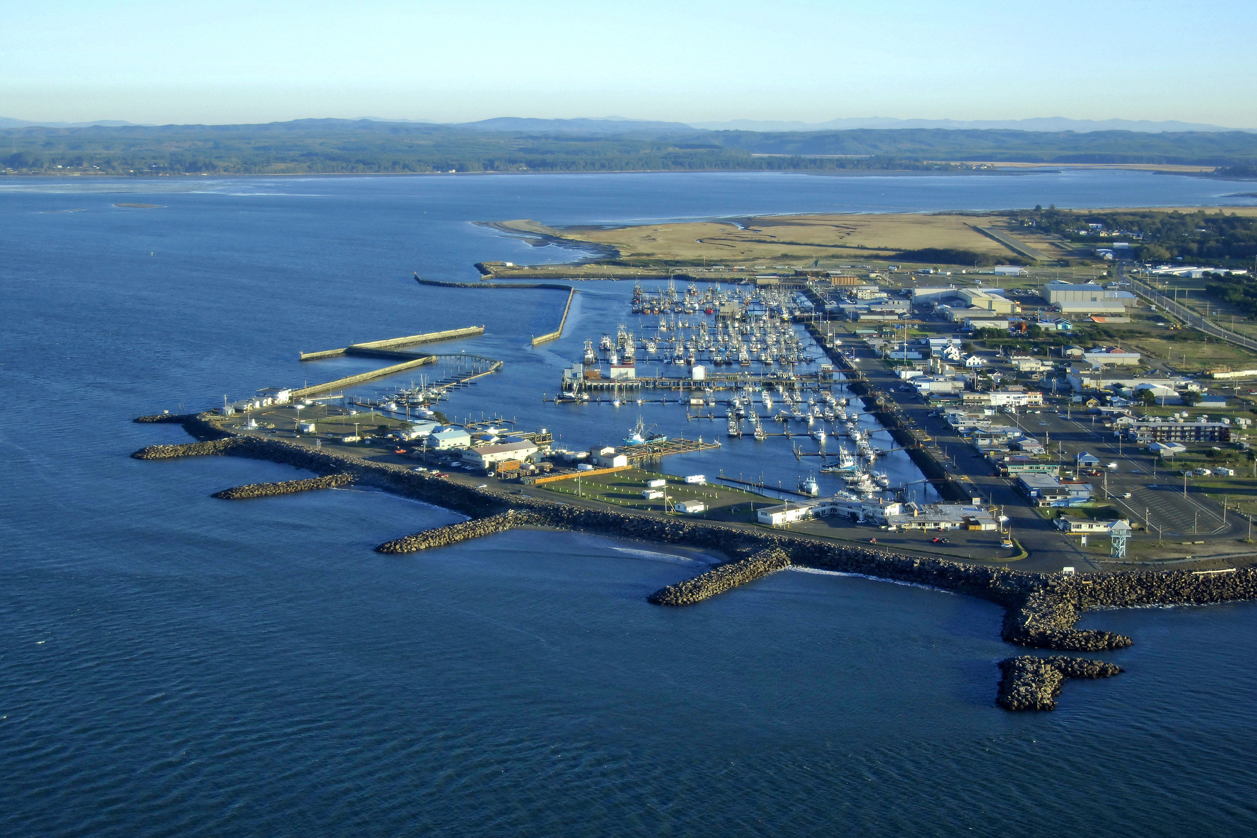
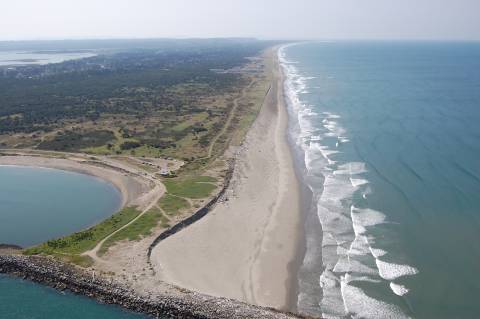
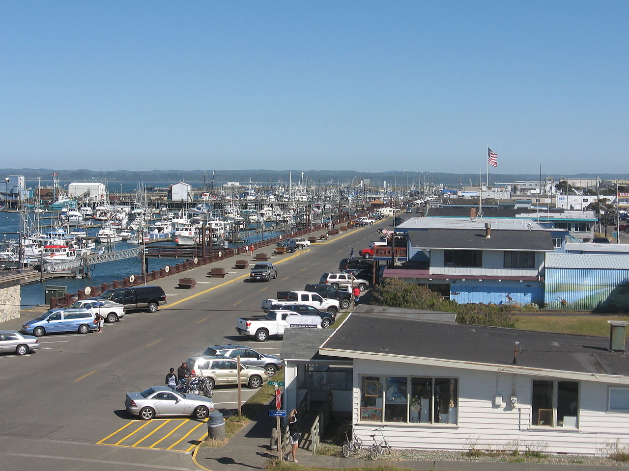
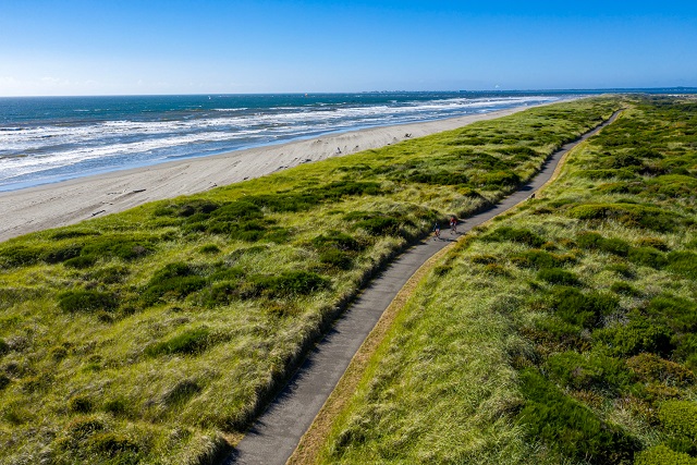
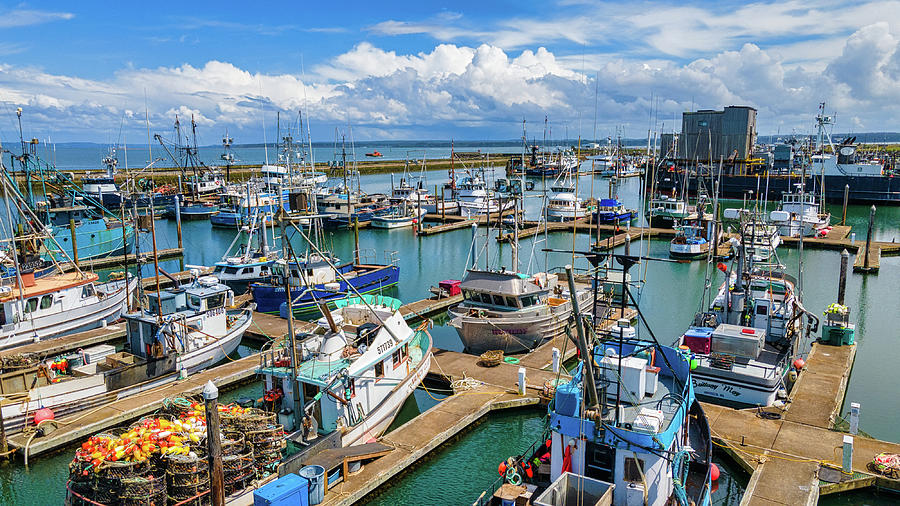
Westport: Maritime Museum
Westport: Pier, Float Dock 20, Fisherman's Boardwalk Images
Westport SEE ALSO Fishing, Clam Digging, Cranberries, Crabbing, Jetties, Kites, Beachcombing
Westport Lodging Chateau Westport Resort is the largest. Plenty of RV parks, B&B, and homes for rent.
Westport: Things to Do
Activities
Westport: Twin Harbors State Park
Westport: South Jetty Fishing SS
Westport Winery and Garden Resort SS 13 miles east of Wesport on WA105
Westport Weather: Current Weather Report and Week Ahead Predictions for Westport Westport averages 76 inches of rain each year.
Nearby Attractions for Westport
Bottle Beach State Park Near Westport SS Bird Watching Area, Mudflats, Swamps
Grayland Beach State Park 6 miles south of Westport. Beach access, picnic, restrooms. My Campsite by the Sea!
Johns River Wildlife Area Images Near Westport SS History Game Farm Road off 105 Walking trails, boat launch, river estuary
Tokeland Population 200 Willapa Bay Images Small harbor, boat ramps, jetty, RV parks. Shoalwater Casino. Restaurant. Historic hotel.
Day Trips from Westport [Round Trip]
Aberdeen Area 60 miles
Ocean Shores Area 96 Miles
Quniault Lake and Quinault Rain Forest Area 150 miles
Raymond and South Bend Area 90 miles
Comments, Notes, Topics, Introduction
Traveling from Vancouver to Westport or Ocean Shores
We live in Vancouver, Washington, a suburb of Portland Metro. We are a retired couple in our mid 70's.
The first way to get to Westport (Tour 1) is as follows: From Kelso-Longview to US101 near Naselle via WA4 it is 62 (100 km) miles. From Naselle to Raymond it is 36 miles (57 km), and from Raymond to Westport on WA105 it is 33 miles (53 km); for a total driving distance of 131 miles (210 km). These are all well maintained State and Federal highways, wide, nicely paved, generally flat, with ample turnout options, and small communities and towns (Cathlamet, Skamokawa, Rosburg, South Bend, Raymond and Westport) for supplies and services along the roads.
This is very scenic drive that will take you along the north side of the Columbia River, through the Willapa Hills, winding along fertile river valleys, weaving along the east and north sides of the dramatic wide Willapa Bay, passing over numerous beautiful river estuaries, looking around in the small coastal towns, and finally cruising by the wide straight beaches of Westport.
The second way we can drive to Ocean Shores or Westport is as follows: Drive north on the Interstate 5 Freeway from Vancouver to Olympia, for 100 miles. Drive from Olympia to Aberdeen on a divided four lane highway, WA 8 and WA 12, for 50 miles. Drive from Aberdeen to either Ocean Shores or Westport, two lane highway, for about 25 miles. A total distance of 175 miles, one way, for a 4.5 hour drive or less. This route can be very busy with heavy traffic going to and from the Ocean Shores and Aberdeen areas from the big cities of Olympia, Tacoma, and Seattle. You can take WA 12 from Centralia to Elma and save some driving distance to Ocean Shores, and avoid the Olympia area traffic congestion. There are a number of scenic alternate routes to get to Westport.
The third way we can drive to Westport is: Drive north on the Interstate 5 Freeway from Vancouver to Chelais, for 79 miles. Drive west on WA 6 though Pe Ell to Raymond, for 52 miles. You will drive on an excellent two lane road (WA 6) through lovely forested country and agricultural valleys, and encounter very little traffic. Then, drive northwest on WA 105 along the coast from Raymond through Tokeland and north to Westport, for 33 miles. Total distance: 164 miles, about 4 hours of easy driving with very little traffic from Chelais to Westport. I camp at Grayland Beach State Park or Twin Harbors State Park, both within 6 miles south of Westport. This drive is more peaceful, less stressful, and more beautiful than the drive to Ocean Shores.
A round trip to either Westport or Ocean Shores from Vancouver, and some local driving, is around 400 miles. My Ford Escape AWD Titanium can get around 25 mpg. Current regular gasoline prices can go up to $4.00 a gallon. Therefore, gasoline costs for this 400 mile round trip adventure run about $65.00.
US Highway 101 is THE ROAD in the
Olympic Peninsula region.
It is a two lane road the entire distance on US 101 from Ilwaco to
Olympia, 352 miles. Slow down and enjoy the drive. Be
careful when coming upon bicyclists. Be careful of cross traffic
from little roads, lanes, and driveways. Drive north from Ilwaco on the Columbia River
up the Willapa Bay, then to Raymond, then Aberdeen (70 miles).
Drive north from Aberdeen to Hoquiam, Lake Quinault, Forks, and Lake
Crescent (141 miles). Drive east to Port Angeles, Sequim, and
Discovery Bay (55 miles). Drive south on US 101 down the Hood
Canal to Hoodsport, Shelton, and Olympia (86 miles). I grew up in
the Bandini barrio in East Los Angeles in 1950 just four blocks from
US 101.
In 2022, I plan to camp four days and three nights at
Grayland Beach State Park every
month. I will stay in a yurt (Oct-Mar) or a tent (Apr-Sep).
Therefore, Grayland Beach will be the central point for my explorations of
the southern side of Gray's Harbor and the northern side of Willapa Bay.
Here are
My Reports on Camping.
I go camping in a tent or yurt by myself in both Washington and
Oregon. I mostly camp on the Washington coast. I go camping with Karen, my
wife, sometimes, in a Yurt. We are experienced campers. We also travel
and stay together yurts, cabins, cottages, B&B, motels, hotels,
casinos, and resorts on the Washington
and Oregon Coast.
Four Days in Grayland, Part I Grays Harbor and Willapa Bay: A Traveler's Hypertext Notebook and Guide.
Four Days in Grayland, Part II Grayland Beach: A Camper's Hypertext Notebook, Studies, and Comments.
Four Days in Grayland, Part III Reports and photos of my Grayland Beach camping adventures.
Four Days in Grayland, Part IV Reflections of a
Beachcomber: Poetry, Short Essays, Commentary January
2022-
I strongly recommend that you use the online
reservation system to reserve a tent campground site or yurt
campground site at the Grayland Beach State Park. The campground
was full all the times I have visited Grayland Beach. You will
need to think and plan ahead. During peak
summer usage, during kite flying events and contests, during peak low tide clamming
season dig openings, surf perch fishing contests, salmon runs, etc., the beaches and
coastal cities are always very crowded and the campsites are far less or not available.
I always reserve a yurt campsite or tent campsite online many months
ahead of time.
State Parks varing during the "off season" of "lower" usage
(September 15 - May 15 each year) often it is
first come first served only with no reservations for tent campsites
(e.g., Ocean City SP).
Ocean City State Park. Here are some images of the campground. This is a good campground that is very close to Ocean Shores. There are beautiful forested campsites. It is quiet. You can sometimes reserve a campsite online for $25.00, but at other times first come first served. There are some full utility campsites. No yurts or cabins. From the campground you can take a long walk to the beach. Lot's of marshes and swampy areas near the campground. There are many streets that lead out to the beach in Ocean Shores, and you can drive on the beach in Washington. The campground is about four miles from the Ocean Shores business center. My Camp: 2021 08 18-20. NS
Twin Harbors State Park Westport. This is a busy, large, and decent campground close to Westport. Here are some images of this campground. April, Karen, Mick, and I have stayed in nice clean wood cabins and camped at Twin Harbors SP for two years. Shore pines. We plan to do clam digging, fishing, nature walks, seaside exploring, kite flying, sumptuous meals, dog walks, hunting for mushrooms, chit chat, drinking, staring at the waves ... My Camp: 2020 08. Our Camp: 2020 10 4-7. Our Camp: 2021 10, 3-6. SS. A campsite here costs $25 a night, and a wood cabin or Yurt rental for $80.00. Nearby Grayland State Park is also an option for the Westport area.
Grayland Beach State Park My 'Campsite by the Edge of the Sea.' Grayland Beach and Community. Westport You can book specific Yurts and campsites all year online.
Bruceport County Park South Bend Wallapa Bay Lovely setting on cliffside but mostly rough, small, unleveled campsites.
Cape Disappointment State Park WB Ilwaco Yurts and tent campsites.
Fort Stevens State Park Oregon Astoria Yurts and tent campsites.
Nehalem Bay State Park Oregon Manzanita Yurts and tent campsites.
For camping at Grayland Beach State
Park
during the colder and wetter months of November through March,
I prefer using
a Yurt (@ $80 per night).
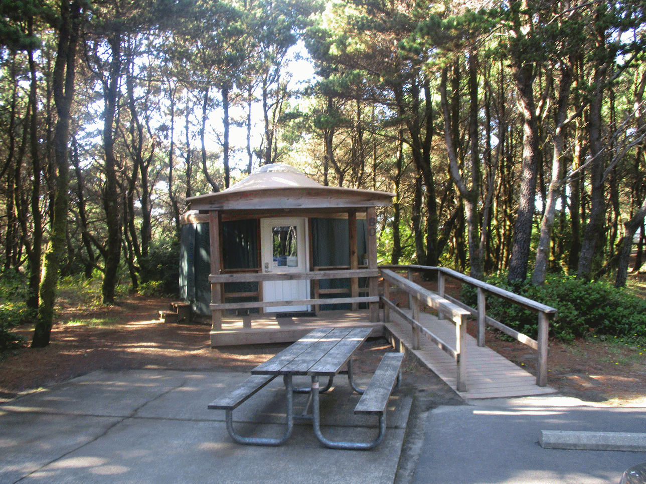
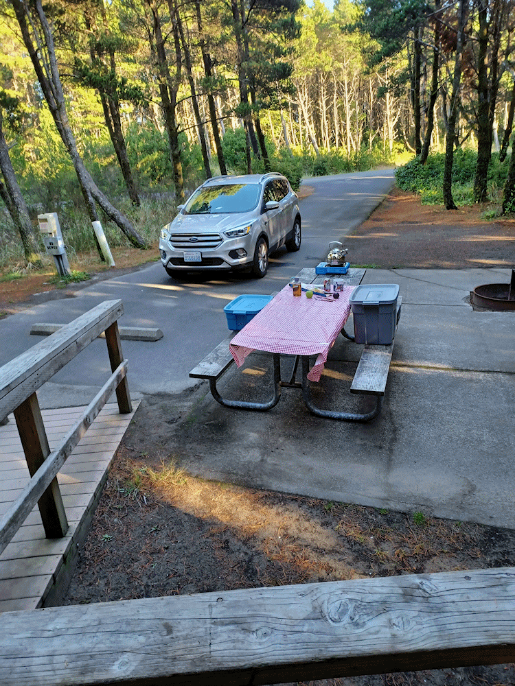
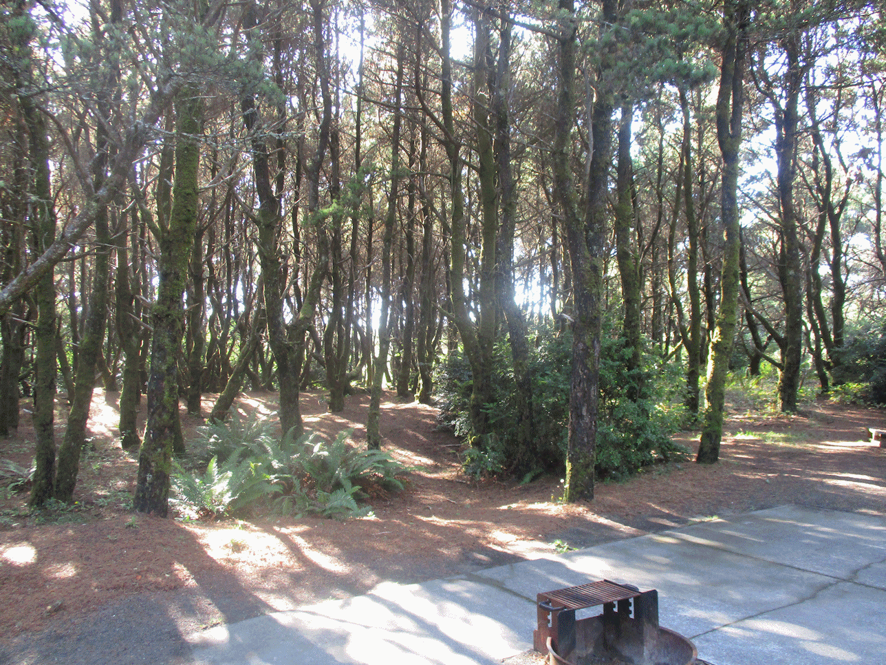
I think a Yurt is just dandy for one or two people. First, you are in a campground in a forest of shore pines, adjacent to sand dunes, and can easily walk to the beach. Second, I prefer a Yurt so as have a secure place to stay warm and dry, off the ground, out of the wind, and out of the rain. Third, $80 a night to reserve a Yurt is cheaper than a typical cottage, B&B, motel or hotel room cost in Westport or Aberdeen. Fourth, all the Yurts I have used are clean, neat, and simple. Fifth, cooking and eating at your Yurt campsite can save you money and travel time. Sixth, you can avoid contact with other people during in this COVID pandemic.
A canvas Yurt is a circular domed tent 16 feet in diameter and 10 feet high. It has a skylight vent, screened windows (closed or open), hardwood floors, heavy canvas and plastic covers, and a locking door. It has a 120 AC electrical outlet, a light, and an electric heater. It has a padded bunk bed and a padded futon couch bed, a small table, and sometimes wood chairs. I bring a extension cord and small electric lamp for reading, a comfortable chair, and a small portable table.
Each Yurt site has a small to large raised covered deck outside the front door. The site includes a picnic table and a fireplace pit. There is usually a nice paved driveway in front of the Yurt. There is room for a tent and most Yurt campsites.
Rules vary in Washington and Oregon about how many people can reserve and use a Yurt site, adding tents to a Yurt site, adding extra cars to a Yurt site, adding an RV or trailer or truck and boat to a Yurt site, adding pets to a Yurt site, etc. Some Yurts have handicapped access. I costs me $80.00 per night to reserve a Yurt site at Grayland Beach State Park (no extra fees/taxes).
You cannot cook inside a Yurt; you must cook at the outside picnic table. You can eat at the picnic table or on the covered porch.
You cannot smoke inside a Yurt. You may or may not be allowed to make a fire in the fireplace. There is often a ban on any kind of camp fires during dry seasons.
A Yurt does not have a toilet. You must use the public restrooms. There are public restrooms nearby. In a tent or yurt I have secure containers for safely storing my urine; so that I don't have to make any nighttime trips outside the yurt to pee. Some of us old people need to pee more often at night. Dispose of your black/yellow water in the morning in the public restroom. Use simple, clean, smell free, and dry alternatives.
A Yurt does not have water inside the Yurt. There are numerous public water spigots in the campground and at Yurt campsites.
Both Yurt and many tent campsites do have major RV and trailer electrical and water services for $30.00 more.
You bring your own bedding, covers, play and recreational gear, cooking kitchen, food, clothing, gear and supplies.
Beach Activities I enjoy: Sitting and staring, thinking and day dreaming, walking around, reading, photography, surf fishing, clam digging, long vigorous walks, practicing Taijiquan or Qigong, beachcombing for little treasures, kite flying, frolicking in the surf, playing games, doing nature studies, playing a harmonica, smelling the sea, listening to the waves, writing, working with tools, reading, using waders, staying warm, ... For rest, I sit and stare, sit or lay down in my beach tent, lay on the cushion in the back of my my Junior RV Ford Escape or sit inside the Escape for warmth, doze and sleep. I have a stove, teapot, and hot water for tea and coffee and instant foods. I bring a variety of fresh fruits, nuts, dried fish or beef, good bread, and goodies to eat; and, bring a couple of grams of cannabis and apricot brandy.
You are allowed to drive your automobile on Washington coast beaches. This is a significant advantage. I don't drive far from the gravel road entrance to get to a quiet empty spot to set up my day beach camp. My AWD Ford Escape, Junior RV, handles beach driving with ease. At Grayland Beach State Park, there is a paved and gravel road from 105 to the beach called Cranberry Beach Road that is adjacent to the north side of Grayland Beach State Park.
Beach Day-Use Campsites NS SS
Be prepared at all times with plenty of good outdoor clothing to make you safe and comfortable in the cool, windy and damp environment of the Northwest seashore. It is often cold, foggy, breezy, and overcast and the sea temperatures are low [55 F�]. Only a few diehard surfers in wetsuits brave swimming in the jetty summer swells at Westport. This ain't Huntington Beach in SoCal! Plan to dress for cold weather!! Wear sturdy shoes for long walks and beachcombing; and waterproof boots for wading in the water. Waders might be needed for clam digging and surf fishing. Bring some rain gear, towels, poncho. If you get wet, clothes dry slowly or not at all; therefore, have plenty of warm outdoor clothes to change into if you get wet. The proper clothing can make outdoor activity comfortable and ready for adventures in all kinds of coastal weather.
SUV RVing: How to Travel, Camp, Sleep, Explore, and Thrive in the
Ultimate Tiny House. By Tristan Higbee. 2016, 115 pages.
VSCL.
Traveling and Car Camping: Equipment Choices, Checklists, and Organizing Ideas for Your Tent Camping Trips. By D. W. Penn. 2019, 143 pages. VSCL.
Karen and I have lived in the City of
Vancouver, in Clark County, in the Southwestern side of the State of Washington,
since April of 2017. I write about these short travel
adventures in my Cloud Hands Blog.
Follow the adventures by the Category Labels:
Oregon,
Southwestern Washington,
Washington,
Travel,
Camping. We have traveled a number of times in the State of Washington and have stayed in motels, hotels, bed
and breakfasts, cabins, yurts, or campgrounds in the following cities or areas:
Bay View State Park near Mr. Vernon, Bellingham, Cape Disappointment State Park, Kalaloch, Lake
Crescent, La Wis Wis Campground near Packwood, Long Beach, Horseshoe Lake below Mount Adams, Kanasat-Palmer State
Park near Enumclaw, Grayland Beach State Park near Westport, Kennewick, Leavenworth, Seattle, Seaview, Skamokava, Spokane, Spirit Lake near Mt. St.
Helens, Toppenish, Twin Harbors State Park near Westport, Vancouver, Wenatchee, Whidby Island,
Winthrop, and Yakima.
An Explorer's Guide: Washington. By Denise Fainberg. Woodstock,
Vermont, Second Edition, 2012. Index, 512 pages. ISBN:
978-0881509748. VSCL.
Here is the "Bridge of the Gods Legend" told by the Klickitats.
"In their tale, the chief of all the gods, Tyhee
Saghalie and his two sons, Pahto (also called Klickitat) and Wy'east, traveled
down the Columbia River from the Far North in search of a suitable area to
settle. They came upon an area that is now called The
Dalles and thought they had never seen a land so beautiful. The sons
quarreled over the land and to solve the dispute, their father shot two arrows
from his mighty bow; one to the north and the other to the south. Pahto followed
the arrow to the north and settled there while Wy'east did the same for the
arrow to the south. Saghalie then built Tanmahawis, the Bridge of the Gods, so
his family could meet periodically. When the two sons of Saghalie both
fell in love with a beautiful maiden named Loowit, she could not choose between
them. The two young chiefs fought over her, burying villages and forests in the
process. The area was devastated and the earth shook so violently that the huge
bridge fell into the river, creating the Cascades
Rapids of the Columbia River Gorge. For punishment, Saghalie struck
down each of the lovers and transformed them into great mountains where they
fell. Wy'east, with his head lifted in pride, became the volcano known today as Mount
Hood, and Pahto, with his head bent toward his fallen love, was turned into Mount
Adams. The fair Loowit became Mount
St. Helens, known to the Klickitats as Louwala-Clough which means "smoking
or fire mountain" in their language (the Sahaptin called
the mountain Loowit)." ![]()
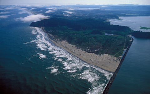
Atomic Frontier Days: Hanford and the American West. By John M.
Findlay and Bruce W. Hevly. Emil and Kathleen Sick Book Series in Western
History and Biography. University of Washington Press, 2011. Index,
bibliography, notes, 384 pages. ISBN: 978-0295990972. FVRL.
The story of the Hanford nuclear products production plants (1942-1990) and
toxic nuclear waster storage (1950-) along the Columbia River; and the
development of the nearby cities of Richmond, Kennewick, and Pasco, Washington.
Beacon Rock State
Park. Columbia River Gorge.
Blog
Posts to the Cloud Hands Blog by Mike Garofalo regarding travel adventures
in Washington State.
By Archie Satterfield. Woodstock, Vermont, The Countryman Press, 2010.
165 pages. ISBN: 9780881508253. VSCL.
Battle Ground Lake
State Park, Clark County, Washington. Campground, yurts, lake fishing,
hiking. Nearby
Moulton Falls is popular.
Images.
Lewisville Park, a Clark County Regional Park, is just a few miles north of
the City of Battle Ground - a lovely riverside park. [I once watched at
this park a few people being Baptized in the river on a summer day.]
The Beachcomber's Guide to Seashore Life in the Pacific Northwest.
By J. Guane Sept. Harbor Publishing, 1999, 244 pages. VSCL.
Bridge
of the Gods - Ancient Avalanche. Cascade Locks area of the Columbia
River.
Bridge of the Gods. Columbia River bridge near Cascade Locks and
Bonneville Dam.
Bridging a Great Divide: The Battle for the Columbian River Gorge. By
Kathie Durbin. Oregon State University Press, 2013, 312 pages, Index,
bibliography, notes. VSCL.
Cape
Disappointment State Park near
Seaside and
Ilwaco,
Washington. I've camped at the state park before, and stayed at a motel
and cabin in Seaside. We attended the kite festival in Seaside in August
of 2018. I once went to the emergency hospital in Ilwaco in 2017.
Contested Boundaries: A
New Pacific Northwest History. By David J. Jepsen and David J. Norberg.
2017, 388 pages.
La Center Bottoms Natural Area, Clark County, Washington. Near the
town of La Push.
Clark County,
City of Vancouver,
Washington. Local travel for us. We live in the unincorporated
northeast area of Vancouver, the Orchards area.
Fort Vancouver was established
in 1825. Washington became a State in 1889. The new
Vancouver Grand Street Pier and Waterfront.
Columbia Gorge Getways: 12 Weekend Adventures, From Towns to Trails.
By Laura O. Foster. Towns to Trails Media, 2019. 266 pages.
Hikes in Clark County are covered on pages 22-35. VSCL.
Columbia Gorge Interpretative Center
Museum. Near Bridge of the Gods and Skamania Lodge.
Columbia Gorge
Discovery Center and Museum; Official interpretive center for the
Columbia River Gorge National Scenic
Area. Columbia River Gorge
Association.
The Dalles,
Oregon.
Columbia River Gorge:
National Scenic Area. 25th Anniversary Commemorative Edition.
Photography by Peter Marbach. Text by Janet Cook. Woodburn, Oregon,
Beautiful American Publishing Co., 2011. 112 pages. ISBN:
978-0898028775. VSCL.
The Complete Hiker, Revised and Expanded.
By John Long and Michael Hodgson. International Marine, Ragged Mountain
Press, 2nd Edition, 2000. Index, 243 pages. ISBN: 9780071358188. VSCL.
The Dalles,
Oregon. The Dalles
Dam was built on the Columbia River in 1957.
Columbia Gorge Discovery Center and
Museum; Official interpretive center for the
Columbia River Gorge National Scenic
Area. Columbia River Gorge
Association.
Fort Dalles military
outpost from 1838-1866. This particular area was a major Native American
trading center for at least 10,000 years; and also near the traditional
Celilo Falls fishing
site. Population: 13,600.
Images.
Day Hiking Columbia River Gorge. By Craig Romano. Seattle,
Washington, The Mountaineers Books, 2011. Index, 287 pages. ISBN:
978-594853685. VSCL.
Day Hiking North Cascades: Mount Baker, Mountain Loop Highway, San Juan Islands
By Craig Romano. Seattle, Washington, The Mountaineers Books, 2008.
Index, 356 pages. ISBN: 9781594850486. VSCL.
Day Hiking, South Cascades: Mt. St. Helens, Mt. Adams,
and the Columbia Gorge.
By Dan A. Nelson. Photography, B&W, by Alan L. Bauer. Seattle,
Washington, The Mountaineers Books, 2007. Day Hiking Series. Index,
284 pages. ISBN: 9781594850455. VSCL.
Day Hiking in
California, Oregon and Washington. A hypertext notebook by Mike
Garofalo.
Druid,
Nature Religions, and New
Age Spirituality, Mysticism, and Travel in Nature. Place and
Spirituality. Wee Folk,
Devas, and Nature Spirits.
Ecomysticism: The Profound Experience of Nature as Spiritual
Guide. By Cal Von Essen, M.D.. Rochester,
Vermont, Bear and Co., 2007. Index, bibliography, 274 pages. ISBN:
9781591431183. VSCL.
Druid and New Age
Spirituality, Mysticism, and Travel in Nature.
Exploring Washington's Past: A Road Guide to History. By Ruth Kirk and
Carmela Alexander. Seattle, University of Washington Press, Revised
Edition, 1995. Index, Reading List, 543 pages. ISBN: 0295974435.
VSCL. An excellent travel guide for automobile travelers in Washington.
Fishing the Rivers and Lakes of
Washington
Flyfisher's Guide to Washington. By Greg Thomas. The Wilderness
Adventures Flyfisher's Guide Series. Wilderness Adventures Press, 2013.
500 pages. ISBN: 978-185106582. VSCL.
Fort Vancouver Public
Library, Vancouver, Washington
Gifford Pinchot National Forest: Southern Trail Guide. Mt. Adams
Ranger District. Seattle, Washington, Northwest Interpretive Association.
76 pages. VSCL.
Hidden Washington: Including Seattle, Puget Sound, San Juan Islands, Olympic Peninsula, Cascades, and Columbia River Gorge
By Eric Lucas. Berkeley, California, Ulysses Press, 5th Edition, 2005. Index, 406 pages.
ISBN: 1569754861. VSCL.
Hiking the Columbia River Gorge: A Guide to the Area's
Greatest Hiking Adventures. By Russ Schneider. Revised by Jim
Yuskavitch. 253 pages. Helena, Montana, Falcon Guides, 2004, Third
Edition, 2014. VSCL.
Hiking Washington's Mount Adams Country.
By Fred Barstad. A Guide to the Mount Adams, Indian Heaven, and
Trapper Creek Wilderness Areas of Washington's Southern Cascades. Helena,
Montana, Falcon Books, 2004. 234 pages. ISBN: 0762730900. VSCL.
Hood River, Oregon, Columbia River Gorge. Population: 7,100.
Images.
Kayaking Alone. By Mike Barenti. Published by the
University of Nebraska Press, 2008, 244 pages, bibliography. This
book tells about kayaking alone for 900 miles from Idaho's
mountains to the Pacific Ocean. He follows the Snake River from the
mountains of Idaho until it reaches the confluence with the Columbia at the
Tri-Cities Area of Pasco, Richland, and Kennewick. The Yakima River also
meets the Columbia in this area. The author was a reporter for the Yakima
newspaper for a number of years. Then, he travels down the Columbia
through the Gorge and then past Portland, Longview and onto Astoria. He
has many comments about the fish situation in the Columbia, the many dams, and
the development of "civilization" along the Columbia. He interviews many
people on his solo journey in a kayak. FVRL.
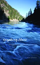
The Lewis and Clark Journals: An American Epic of Discovery. The Abridgment of the Definitive Nebraska Edition. Edited with an introduction by Gary E. Moulton. Lincoln, University of Nebraska Press, 2003. EBook. VSCL.
The Longstreet Highroad Guide to the Northwest Coast. By Allan and
Elizabeth May. Atlanta, Georgia, Longstreet Press, 2000. Index, 370
pages. VSCL.
Maryhill Museum. Near Dalles,
Oregon, on the Washington side of the Columbia River.
Maryhill State Park.
Moon Olympic Peninsula.
By Jeff Burlingame. A Moon Handbook. Avalon Travel Pub., 2nd
Edition, 2015. Index, 216 pages. ISBN: 9781631210068. VSCL.
Nature Religions, Druids,
and New Age Spirituality,
Mysticism, and Travel in Nature. Place and Spirituality.
Wee Folk, Devas, and
Nature Spirits.
The New Complete Walker: The Joys and Techniques of Hiking and Backpacking
By Colin Fletcher. Alfred A. Knopf, 1968, 1974. Index, 470 pages.
ISBN: 0394480996. VSCL.
The North Cascades Highway: A Roadside Guide to America's Alps. By
Jack McLeod. Seattle, University of Washington Press, 2013. Index,
104 pages. ISBN: 978-0295993164. VSCL.
North Cascades: The Story Behind the Scenery. By Saul Weisberg.
KC Publications, 1988. 48 pages. ISBN: 978-0887140211. VSCL.
Olympic National Park and Peninsula. By Nicky
Leach. A photographic collection. Olympic Peninsula: A Timeless
Refuge. Mariposa, CA, Sierra Press, 1998. 32 pages. ISBN:
0939365677. VSCL.
The Olympic Peninsula. By Ericka Chickowski. Moon Spotlight
Books. Avalon Travel, 2009. 100 pages. ISBN: 9781598802719.
VSCL.
The Pacific Northwest: An
Interpretive History. By Carlos Arnaldo Schwantes. Revised and
enlarged edition, 1996. Lincoln, Nebraska, University of Nebraska Press,
1989, 1996. Index, bibliography, 568 pages. ISBN: 978-0803292284.
Professor Schwantes, Ph.D., is a field historian and author. VSCL.
Pacific Northwest Camping Destinations: RV and Car Camping Destinations in
Oregon, Washington, and British Columbia. By Mike Church and Terri Church.
Rolling Homes Press, 3rd Edition, 2012. 608 pages. ISBN:
9780982310120.
The Pacific Northwest Garden Tour. By Donald Olson. The 60 best
gardens to visit in Oregon, Washington, and British Columbia. Portland,
Oregon, Timber Press, 2014. Index, 300 pages. ISBN: 978-160469-4512.
VSCL.
Parks and Places we have visited near our home in Vancouver, Washington:
Captain William Clark Regional Park, Washougal, Clark County
La Center Bottoms Natural Area, near Woodland, Clark County
Columbia Gorge Discovery Center and Museum, The Dalles, Oregon
Columbia River Renaissance Trail, Vancouver, Clark County
Lacamas Lake Regional Park, Camas, Clark County
Lewisville Park, Battle Ground, Clark County
Orchards Community Park, Clark County A nearby (2.5 miles away) park where I walk in the forest. A nice circular path takes about 25 minutes of walking to complete.
Oxbow Regional Park, Multnomah County. Camping, fishing, hiking by the Sandy River.
Parks in Clark County, Washington Alphabetical List.
Portland Rose Garden, Multnomah County, Oregon
Portland Japanese Garden, Multnomah County
Portland Nursery. Both Division and Stark Nurseries.
Portland Parks and Recreation Finder, Multnomah County
Ridgefield National Wildlife Refuge, Ridgefield, Clark County
Steigerwald Lake National Wildlife Refuge, Washougal, Clark County
Vancouver Lake Regional Park, City of Vancouver, Clark County
Washington Park, Portland, Multnomah County, Oregon
Washougal Waterfront Park, Washougal, Clark County
Paradise Point State Park, Clark County. Near the Ailani Casino. Located along the Lewis River. Interstate 5 nearby makes noise. Camping, hiking, swimming, fishing.
Photographing Washington: A Guide to the Natural Landmarks of the Evergreen
State. By Greg Vaughan. Alta Loma, CA, Photo Trip USA Pub.,
2013. Index, 317 pages. ISBN: 9780916189198. Vancouver Public
Library.
Quick Escapes: Pacific Northwest. By Marilyn McFarlane. Guilford,
Connecticut, The Globe Pequot Press, Fifth Edition, 2001. Index, 323
pages. 32 Weekend trips from Portlant, Seattle, and Vancouver, B.C.
ISBN: 0762709405. VSCL.
Ridgefield,
Washington.
Ridgefield National Wildlife Refuge.
A River Lost: The Life and Death of the Columbia River. By Blaine
Harden. W.W. Norton and Co., Revised 2012. 288 pages. ISBN:
978-0393342567. VSCL.
River of Promise: Lewis and Clark on the Columbia. By David L.
Nicandri. Dakota Institute Press, 2009, index, bibliography, notes, 349
pages. FVRL. This library book is part of the Keith McCoy Northwest
History Collection funded through the Fort Vancouver Regional Library [FVRL]
Foundation of Clark County, Washington.
The Spokane River. Edited by Paul Lindholdt. University of
Washington Press, 2018. Index, biographies, reading list, 282 pages.
FVRL.
Song Upon the Rivers: The Buried History of the French-Speaking Canadiens
and M�tis from the Great Lakes and the Mississippi across to the Pacific.
By Robert Foxcurran, Michael Bouchard, Sebastien Malette. Baraka Books,
2016. 448 pages. ISBN: 978-1771860819.
Travel Checklist.
Here is my 2003 Ford Explorer travel gear and camping gear and hiking gear Checklist from February 2019. Excel format.
Traveler's History of
Washington: A Roadside Historical Guide. By Bill Gulick. Caldwell,
Idaho, Caxton Press, 2005. Index, 559 pages. ISBN: 0870043714.
VSCL.
Undaunted Courage: Meriwether Lewis, Thomas Jefferson,
and the Opening of the American West. By Stephen E. Ambrose. Simon and
Schuster, Touchstone, 1996. 521 pages. Paperbound book. VSCL.
Walking - Bibliography.
Research by Mike Garofalo.
Washington
Photographs by John Marshall. Text by Ruth Kirk. Oversized table
book. Portland, Oregon, Graphic Arts Center Publishing Co., 2003.
160 pages. ISBN: 978-0932575647. VSCL.
Washington Byways: 56 of Washington's Best Backcounty Drives. By Tony
Huegel. Berkeley, California, Wilderness Press, 2003. 164 pages.
ISBN: 0899972993. From the Vancouver Public Library.
Washington Lake Maps and Fishing Guide. By Bill McMillan. Edited
and illustrated by Esther Appel. Frank Amato Publications, 2012. 48
pages. ISBN: 978-1571884770. VSCL.
Washington, Oregon and the Pacific Northwest. Lonely Planet Series.
By Brendan Sainsbury, Celeste Brash, John Lee, and Becky Ohlsen. Lonely
Planet Press, 2017. Indexes, 480 pages. ISBN: 978-1786573360. VSCL.
Washington's Pacific Coast: A Guide to Hiking, Camping, Fishing & Other Adventures
By Greg Johnston. Seattle, Washington, Mountaineers Books, 2015.
Index, 318 pages. ISBN: 9781594859397. VSCL.
Washington River Maps and Fishing Guide. By Doug Rose. Frank
Amato Publications, 2013. 87 pages. ISBN: 978-1571885135. VSCL.
Excellent resource for river trips and fishing.
Washington's Best Fishing Waters. Wilderness Adventures Press, 2nd
Edition, 2007. 161 pages. ISBN: 978-1932098525. VSCL.
Washington Wild Roads.
80 Scenic Drives to Camping, Hiking Trails and Adventures. By Seabury
Blair Jr. Seattle, Washington, Sasquatch Books, 2012. Index, 251
pages. ISBN: 978-1570618154. VSCL.
Washougal,
Washington. On the Columbia River near Vancouver, WA.
Waterfront Park.
Captain William Clark Park.
Steigerwald Lake National
Wildlife Refuge.
Water Falls
White Salmon,
Washington, Columbia Gorge. Across from Hood River. Population: 2,200.
The Wild Cascades, Forgotten Parkland.
By Harvey Manning. San Francisco, California, Sierra Club, 1965. 159
pages. VSCL. Beautiful photographs, color and B&W, of the Cascades.
Wild in the City: Exploring the Intertwine: The Portland-Vancouver Region's
Network of Parks, Trails, and Natural Areas. By Michael C. Houck and M. J.
Cody. Corvallis, Oregon, Oregon State University Press, 2nd Edition, 2011.
Index, 427 pages. ISBN:
9780870716126. VSCL.
Woodland,
Washington.
Lewis River
dams and reservoirs east of Woodland.
Hulda Klager's Lilac Gardens.
Vancouver Lake Regional Park, Clark County, Washington.
Views Washington. A Collection of Photographs
by Chris Jacobson. Emeral Point Press, 2006. 48 pages.
We have traveled a little in the State of Washington and have stayed in motels, hotels, bed
and breakfasts, yurts, campgrounds, or cabins in the following cities or areas:
Bay View State Park near Mr. Vernon, Bellingham, Ellensburg, Kalaloch, Lake
Crescent, La Wis Wis Campground near Packwood, Long Beach, Horseshoe Lake below Mount Adams, Kanasat-Palmer State
Park near Enumclaw, Kennewick, Ocean City State Park near Ocean Shores, Seattle, Seaside, Skamokava, Spirit Lake near Mt. St.
Helens, Spokane, Vancouver, Toppenish, Twin Harbors State Park near Westport, Wenatache, Whidby Island,
Winthrop, and Yakima.
We purchased a home in Vancouver, Washington, in June of 2017.
In June of 2019 we enjoyed at trip to northern Washington. Day 1: Vancouver to Bellingham via Interstate 5 and 405. Good views of Mt. Ranier. Day 2: Bellingham via 9 to Sedro-Woodley, then on Route 20 through the North Cascades National Park, over Washington Pass, and down to Methrow River Valley and the town of Winthrop. Day 3: Twisp, Okanogan, Omak, apple orchards, Lake Chelan, Columbia River, Wenatchee. Day 4: Apple orchards everywhere, Route 2, Levingston, Monroe, Seattle, Olympia, Vancouver.
In November of 2019, we traveled to Kennewick, Hanford Reservation, and Ellensburg.
VSCL = Valley Spirit Center Collection, Vancouver, Washington. Home
library collection of Mike and Karen.
FVRL = Fort Vancouver Regional Library of Clark County, Washington.
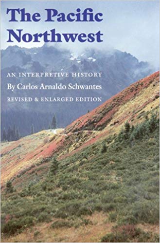
Maps of Washington
I have always enjoyed reading and using maps since I was a child. I used the Bandini Branch of the County of Los Angeles Public library when I was a child. The library was three blocks from my childhood home in Bandini, unincorporated East Los Angeles, Los Angeles County, California. I used many maps in books at this library. I went to St. Alphonsus Elementary School K-8, from 1951-1959, and this school was three blocks from the old East Los Angeles Library near Garfield High School. I was the Librarian III In-Charge of the new East Los Angeles Library on 3rd St. (Fetterly) from 1975-1980. I used many maps from these libraries in my youth, and my brother Paul and I owned many maps.
When I travel in my Ford Explorer, I always carry a variety of paper maps, guides, books, and pamphlets. I have a Sumsung Galaxy 7 cell phone, a Samsung Galaxy Tab A, and a Garmin GPS eTrek 30X for electronic access to information, maps, ebooks, photos, documents, and directional apps. I keep a Discover Pass and other passes, licenses, and official documentation ready on hand in the Explorer as I travel.
I carry various good magnifying glasses, and use one to read maps. A lamp and flashlight for safety, and for map and book reading at night or dim light conditions are essential. A notebook with writing tools is also carried. Here is my 2019 travel and camping Checklist.
I now use the following maps and travel guides for the State of Washington:
Clark County, Washington. GM Johnson City Map Series. Vancouver, B.C., 2015, 2017. ISBN: 978-1-770684300. VSCL. I have one copy for home use, and I keep another copy in the Ford. This is an excellent map for the County in which we now live. An essential tool. A traditional folding map. Good detail on backcountry roads.
Columbia River Gorge National Scenic Area. National Geographic Map, Trails Illustrated, Topographic Map, 2009.
Washington Road & Recreation AtlasWashington: DeLorme Atlas and Gazetter. Detailed topographic maps, back roads, recreation sites, GPS Grids. Yarmouth, Maine, DeLorme Publications, 2016, 12th Edition. Indexes, 104 pages. ISBN: 0-89933329X. VSCL. An oversized map book. I keep this map in my Ford Explorer. An essential tool for travelers. Very convenient to use.
Maps I Use. By Mike Garofalo. 2019-
Mount St. Helens, Mount Adams, Gifford Pinchot National Forest. National Geographic. Trails Illustrated Topographic Map. 2010.
Washington State Map by Rand McNally. Easy to read oversized print. Some city maps. 2013. ISBN: 0528882104.
Washington State Map by G.M. Johnson Publishers. Includes maps of many cities. ISBN: 9781770682900.
Washington State Scenic Byways Road Map
Oregon/Washington Map. American Automobile Association (AAA). Updated on a regular basis.
Tour Book Guide Washington. American Automobile Association (AAA). Updated on a regular basis.
The American Automobile Association (AAA). They offer many detailed maps of areas and cities in the State of Washington. Free to AAA members, or sold to non-AAA members. Very useful travel guides and trip planning services are also available to AAA members. I use dozens of their maps and guides.
I use two electronic navigation devices. First, I use my Samsung Galaxy 7 cell phone. A variety of cell phone applications can help with navigation, orienting, mapping, travel routes, travel guides, information, emergencies, communications, phone, text, email, etc. Second, I use a Garmin eTrek 30X Handheld Navigator GPS device. The Garmin GPS is a full featured GPS device and equipped with applications for navigation, orienting, mapping, routes, directions, travel records, geocaching, specialized maps, games, survival, hiking, etc.
Here are three books I use on the subject of GPS, navigation and maps:
The Complete Idiot's Guide to Geocaching. Editors and staff on
Geocaching.Com. Alpha Press, 3rd Edition, 2012. 368 pages.
Explore the Latest Adventures in the Exciting and Popular GPS Adventure.
ISBN: 978-1615641949. VSCL.
Wilderness Navigation: Finding Your Way Using Map, Compass, Altimeter, and GPS.
By Bob Burns and Mike Burns. Seattle, Washington, Mountaineers Books, 3rd Edition, 2015.
Index, 190 pages. ISBN: 978-01594859458. VSCL.
Using GPS. By Bruce Gibbs. Falcon Guides, 3rd Edition, 2014.
87 pages. Basic Illustrated Series. ISBN: 978-0762750818. VSCL.
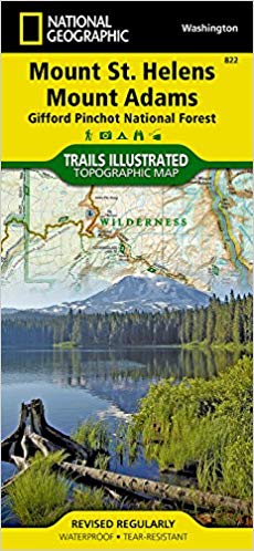
Traveling the Rivers of Washington: Sightseeing, Fishing, Nature Studies
Washington River Maps and Fishing Guide. Edited By Doug Rose. Frank
Amato Publications, 2013. 87 pages. ISBN: 978-1571885135. VSCL.
Excellent resource for river trips and fishing.
Washington's Best Fishing Waters. Wilderness Adventures Press, 2nd
Edition, 2007. 161 pages. ISBN: 978-1932098525. VSCL.
Washington Lake Maps and Fishing Guide. By Bill McMillan. Edited
and illustrated by Esther Appel. Frank Amato Publications, 2012. 48
pages. ISBN: 978-1571884770. VSCL.
Flyfisher's Guide to Washington. By Greg Thomas. The Wilderness
Adventures Flyfisher's Guide Series. Wilderness Adventures Press, 2013.
500 pages. ISBN: 978-185106582. VSCL.
Columbia River (Lower): Bonneville to Pacific Ocean including Portland.
Fish n Map Company. Detailed maps. Waterproof plastic.
Oregon River Maps and Fishing Guide. Edited By Doug Rose. Frank
Amato Publications, 2014. 88 pages. ISBN: 978-1571885142. VSCL.
Many rivers flow north from the Oregon Cascades into the Columbia River:
Willamette, Sandy, Hood, John Day, Deschutes. Excellent resource for river trips and fishing.
Native Americans of Northern California, Oregon and Washington
Indian Peoples of the Northwestern United States of America
The Chinook Indians: Traders of the Lower Columbia River. Robert H. Ruby and John A. Brown. University of Oklahoma Press, 1988, 372 pages. VSCL.
A Guide to the Indian
Tribes of the Pacific Northwest. By Robert H. Ruby, John A. Brown,
Cary C. Collins. Norman, University of Oklahoma, Third Edition, 2010.
Index, 415 pages. ISBN: 978-0806140247. FVRL.
Braiding Sweetgrass: Indigenous Wisdom, Scientific Knowledge, and the Teachings
of Plants.
By Robin Wall Kimmerer. Milkweed Editions, 2013, 390 pages. VSCL.
Indian Legends of the Pacific Northwest
By Ella E. Clark. Illustrated by Robert Bruce Inverarity. Berkeley,
University of California Press, 1953, 2003. Glossary, 225 pages.
ISBN: 9780520239265. VSCL.
Ishi In Two Worlds. A biography of the last wild Indian in North
America. By Theodora Kroeber. With a foreword by Lewis Gannett.
Berkeley, University of California Press, 1961, 1989. Bibliography, 255
pages. ISBN: 0520006755. Ishi, the last surviving member of
the Yahi tribe, wandered into Oroville, California, in 1911. His people
had been hunted and killed by white Christians who wanted their land and hated
heathens. VSCL.
Mount Shasta, California: Bibliography, Links, Lore, Quotes. Myth
and Legends, Native American, Spiritual Vortex, Sacred Mountain, Mystical Mountain, New Age and NeoPagan Lore. By Mike Garofalo.
Myths and Legends of the Pacific Northwest. Selected by Katharine
Berry Judson. Introduction by Jay Miller. Lincoln, University of
Nebraska Press, 1997. 145 pages. ISBN: 0803275951. VSCL.
Native American Museums, Historic Places, Cultural Sites in the United States
Native Peoples of the Olympic Peninsula: Who We Are. Edited by Jacilee
Wray. Second Edition. University of Oklahoma, 2015, 224 pages.
VSCL.
Native Peoples of the
Northwest: A Traveler's Guide to Land, Art, and Culture. By Jan
Halliday and Gail Chehak. In cooperation with the Affiliated Tribes of the
Northwest Indians. Seattle, Sasquatch Books, Second Edition, 2000.
Index, appendices, map, 319 pages. ISBN: 1570612412. An excellent handbook
for traveling to Native American reservations, museums, cultural centers,
historical sites, businesses, festivals, artists, tours, etc., in the Northwest
including British Columbia. VSCL.
Native Ways: California Indian Stories and Memories. Edited
by Malcolm Margolin and Yolanda Montijo. Berkeley, Heyday Books, 1995.
Index, 127 pages. ISBN: 09305887378. VSCL.
Shasta Indian Tales. Compiled by Rosemary Holsinger.
Illustrated by P. I. Piemme. Happy Camp, Naturegraph Pub., 1982, 2006.
48 pages. ISBN: 0879611294. VSCL.
Standing Ground: Yurok Indian Spirituality, 1850-1990
By Thomas Buckley. Berkeley, University of California Press, 2002.
Index, references, notes, 325 pages. ISBN: 0520233891. VSCL.
String Figures and Games
from the Native Peoples of the Northwestern United States. By Mike
Garofalo.
The Wintun Indians of California: And Their Neighbors
By Peter M. Knudtson. Happy Camp, California, Naturegraph Pub., 1977.
Index, 95 pages. Includes map of the tribal territory in the North
Sacramento Valley in Northern California. ISBN: 087961062X. The
Nomlaki group of the Wintu peoples lived in the Red Bluff and Corning area in
Northern California.
The remnants of these people now operate the
Rolling Hills Casino in Corning.
VSCL.
Wisdom of the Elders: Sacred Native Stories of Nature. By David
Suzuki. Contributions by Peter Knudtson. Bantam Books, 1993, 274
pages.
We have visited many Native American
museums in these areas:
Makah Indian Museum, Neah Bay, Washington.
Maidu Museum and Historic Site, Roseville, California.
High Desert Museum, Bend, Oregon:
Plateau Indian Nations:
Nez Perce, Umatilla, Warm Springs, Yakama, Spokane and Colville.
Quinalt Cultural Center and Museum, Taholah, Washington
Yurok Villiage, Patrick's Point State Park, Trinidad, California
Columbia Gorge Discovery Center and Museum, near Dalles, Oregon. Plateau Indian Nations.
Native American Arts and Crafts
Activities
Enjoy Anywhere, All Ages, Non-Electronic, Hands-On
Strings on Your Fingers. By Michael P. Garofalo. Hypertext document from 2003-2011.
Coloring Books
Totem Poles: Coloring Pages for Kids and Kids at Heart. By Hands on Art History. 54 pages. VSCL.
Northwest Native Arts: Creative Colors 2, Volume 2. By Robert Stanley. 24 pages. VSCL.
Pacific Northwest Art: Coloring Pages for Kids and Kids at Heart. By Hands on Art History. Volume 15. 54 pages. VSCL.
Art play
with crayons, pencils, pens.
Playing a portable musical instrument. Native American flutes, drums, and songs provide many challenging and uplifting musical options. Or, a simple Hohner harmonica, a German product after 1857, or a small guitar or ukulele, can open doors to pleasures galore. When Lewis and Clark's Discover Corps traveled in 1805, Victor, a guide for the regiment, played the violin well, and would entertain at meetings and parties with Native Peoples along their travels to the Pacific Ocean. Listening to well played music delights and is popular with most people. It might have increased Victor's popularity with attractive young native women.
These many tribes living along the fecund Columbia River valleys were completely wiped out by waves of viral and bacterial epidemics from 1815-1850. Whole villages died from smallpox, imported by some European. These Native Americans had lived in the areas of southwestern Washington, north of the Columbia River, from Portland to Longview, for over 5,000 years or more.
Natural History of Northern California, Oregon, and Washington
All About Weeds. By Edwin Rollin
Spencer. Illustrated by Emma Bergdolt. New York, Dover Publications, 1940, 1957. ISBN: 0486230511. VSCL.
The Audubon Society Field Guide to North
American Wildflowers - Western Region By Richard Spellenberg. New York,
Alfred A. Knopf, 1979, 1988. ISBN: 0394504313. VSCL.
Birds of Northern California. By David Fix and Andy Bezener.
Lone Pine Field Guide. Lone Pine Pub., 2000. Color illustrations,
range maps, index, 384 pages. ISBN: 155105227X. VSCL.
Deserts (National Audubon Society Nature Guides)
Byt James A. MacHahon. New York, Alfred A. Knopf, 1986. Index, 637
pages. ISBN; 0394731395. VSCL.
Edible and Useful Plants of
California. By Charlotte Bringle Clarke. Berkeley, University of
California Press, 1977. ISBN: 0520032616. VSCL.
Field Guide to Oregon Rivers
By Tim Palmer. Corvallis, Oregon State University Press, 2014.
Index, resources lists, 319 pages.
ISBN: 978-0870716270. VSCL.
A Field Guide to Pacific States
Wildflowers By Theodore F. Niehaus and Charles L. Ripper. Peterson Field
Guide Series. Boston, Houghton Mifflin Co., 1976. ISBN: 0395216249.
VSCL.
Humboldt Redwoods State Park: A Complete Guide
By Jerry and Gisela Rohde. Illustrated by Larry Eifert. Includes the
Avenue of the Giants Tour. Eureka, California, Miles and Miles, 1992.
Index, 297 pages. Good information on natural history of this forest.
ISBN: 0936810254. VSCL.
The National Audubon Society Field Guide to the Pacific Northwest
By Peter Alden and Dennis Paulson. New York, Alfred Knopf, 1998.
Index, resource lists, guides, maps, and color illustrations, 448 pages.
ISBN: 0679446796. VSCL.
Natural History of the Pacific Northwest. By Daniel Mathews.
Timber Press, 2017. Index, 584 pages. ISBN: 978-1604696356.
VSCL.
Northern California Gardening: Bibliography, Links,
Resources, Notes
Plants and Animals of the Pacific Northwest. An Illustrated Guide
to the Natural History of Western Oregon, Washington, and British Columbia.
By Eugene N. Kozloff. Seattle, University of Washington Press, Greystone
Books, 1976. Index, color photographs, bibliography, 264 pages.
ISBN: 029595597X. VSCL.
Roadside Geology of Northern and Central California
By David D. Alt and Donald W. Hyndman. Missoula, Montana, Mountain Press
Pub., 1975. Index, 249 pages. ISBN: 087842055X. VSCL.
Roadside Geology of
Oregon. By Marli B. Miller. Missoula, Montana, Mountain Press
Publishing, Second Edition, 2014. Index, 386 pages. ISBN:
978-0878426317. VSCL.
Roadside Geology of
Washington. By Marli B. Miller and Darrel S. Cowan.
Photographs by Marli B. Miller. Missoula, Montana, Mountain Press, Second
Edition, 2017. Index, 278 pages. ISBN: 7-0878426775. VSCL.
Seashore Life of the Northern Pacific Coast By Eugene N. Kozloff.
An illustrated guide to Northern California, Oregon, Washington, and British
Columbia. Seattle, University of Washington Press, 1973, 1993.
Index, black and white illustrations, 370 pages. ISBN:0295960841.
VSCL.
Southern California: Geology Field Guide Series.
By Robert P. Sharp. Kendall/Hunt Pub. Co., 1972, Revised edition, 1976.
Index, 208 pages. ISBN: 0840312725. VSCL.
Stokes Backyard Bird Book. The Complete Guide to Attracting,
Identifying, and Understanding the Birds in Your Backyard. By Donald and
Lillian Stokes. Rodale Press, 2003. Index, 312 pages. ISBN:
1579548644. VSCL.
Our Home, Gardens and Yard in Red
Bluff, California, North Sacramento Valley Lists of animals and
plants in our area. Birds, weeds, mammals, trees ...
Washington Rocks!
A Guide to Geologic Sites in the Evergreen State. By Eugene Kiver, Chad
Pritchard, and Richard Orndorff. Missoula, Montana, Mountain Press, 2016.
Index, 130 pages. ISBN: 978-0878426546. Excellent photographs.
VSCL.
Weeds of the West By Tom D. Whitson, Editor. Authors:
Tom D. Whitson, Larry C. Burrill, Steven A. Dewey, David W. Cudney, B.E. Nelson,
Richard D. Lee, and Robert Parker. Newark, California, The Western Society of
Weed Science, 1992. 630 pages. ISBN: 0941570134, Revised in
1992. Excellent color photographs of all the plants described. VSCL.
Notes on My Day Hiking Adventures
The first long day hike I remember is walking down from Glacier Point to the Yosemite Valley floor (4 miles) when I was around 11 years of age. I backpacked on the High Sierra Trail from Sequoia National Park to Mt. Whitney Portal (72 miles) when I was 19. I day hiked all the mountains around Los Angeles and San Bernardino in my younger years. I've hiked in the many desert areas of Eastern California, Nevada, and Arizona. I stayed in Bishop and day hiked in the Eastern Sierra every autumn in my 50's. We lived in Red Bluff, California, from 1998 to 2017, and have day hiked scores of times in Northern California and Oregon.
My current personal fitness program in 2019 includes: walking, light weightlifting, taijiquan, and gardening. I am now 73 years of age. Because of heart disease and diabetes, my exercise activity is less than in my 50's and 60's. My days of hiking up to the top of 10,000 foot mountains are likely over forever.
I write about these short travel adventures in my Cloud Hands Blog. Follow the adventures by the Category Labels: Oregon, Southwestern Washington, Washington, Travel
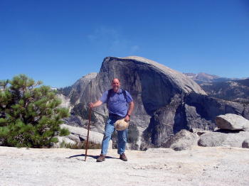
In 2006, my brother Philip and I hiked 11 miles to the top of North Dome in Yosemite National Park.
![]()
A Brief Biography of Michael P. Garofalo
This webpage was last modified, revised, reformatted, improved, or updated on October 12, 2021.
This webpage (Grays Harbor and Willapa Bay) was first published on the Internet on October 1, 2021.
2017-2022 Vancouver, Clark County, Columbia River Valley, Washington, WA
Portland, Portland
Metropolitan,Willamette River Valley
City of Vancouver, Washoughal, Camas, Ridgefield, Woodland, Columbia River
Valley, Kalama, Longview,
Battle Ground, Lewis River Reservoirs, Randle, Cougar, Yakima,
1998-2017 Red Bluff, Tehama County, North Sacramento Valley, California
Red Bluff, Tehama County,
North Sacramento Valley, Northern Central California, U.S.A.
Cities in the area: Oroville, Paradise, Durham, Chico, Hamilton City, Orland,
Willows,
Corning,
Rancho Tehama, Los Molinos, Tehama, Proberta, Gerber, Manton, Cottonwood,
Anderson, Shasta Lake, Palo Cedro, and Redding, CA, California.
Walking - The Ways of Walking - Homepage
Paths to Fitness and Well Being
Cloud Hands: Taijiquan, Bagua, Xing Yi, Swordsmanship
� Green Way Research, Vancouver, Washington, 2017 -
Green Way Research, Red Bluff, California, 1998-2017

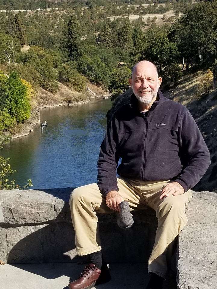
Mike Garofalo at the Klickitat River in Southwest Washington, 2019
Return to the Alphabetical Index of Mike Garofalo's Hypertext Documents