Looking North Looking South
Grays Harbor Westport Grayland Beach Tokeland Willapa Bay
My Driving Tours Beach Nature Studies Books History Notes
Weather Maps Seasons and Months Blog Reports
Beachcombing Beach Terrain Bird Watching Clam Digging Day Picnics Food Bibliography
Kites Oysters Mushrooms Native Indian Cultures Photography Reading Libraries
Surf Fishing Swimming Walking Yurt Camping Foraging
Cloud Hands Blog
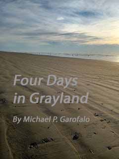
Four Days in Grayland
Green Way Research
Looking
North
Looking South
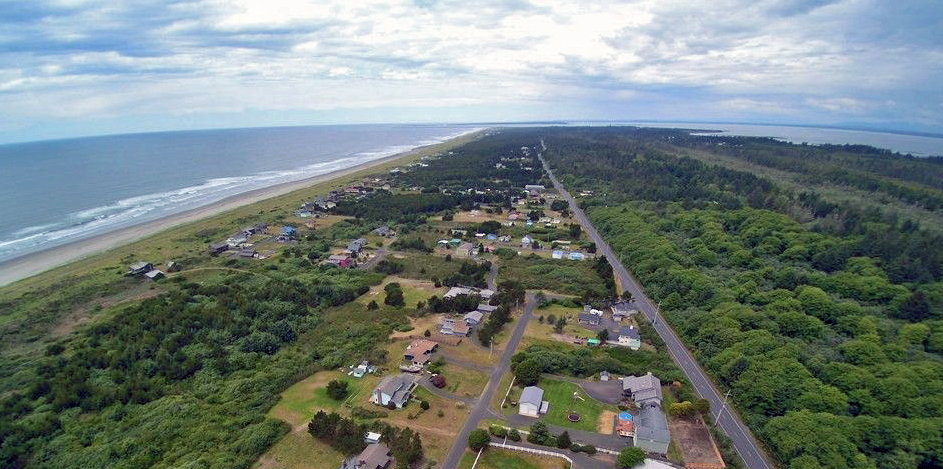
Grayland Beach
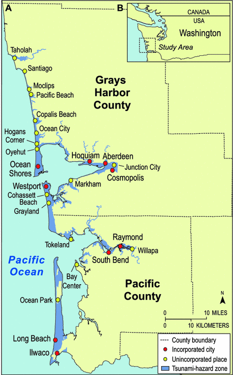
Grayland Unincorporated community with a population of 953.
Grayland Beach: Google Maps
Grayland Village Images
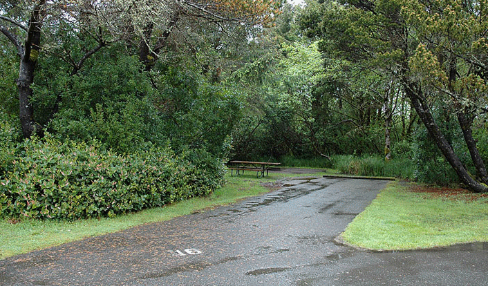
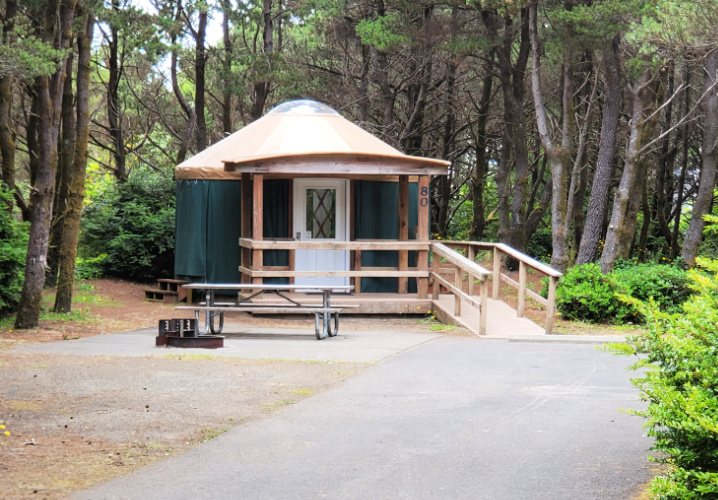
Camping at Grayland Beach State Park
Images
Reservations A
yurt site costs $80 per night, and a tent site $25 per night in 2021.
Some very beautiful Yurt camping sites here. Great for off season
camping.
Grayland Beach SP Images Grayland Beach SP Printed PDF Brochure Westport
Grayland Beach SP is just four miles south of Twin Harbors State Park
Grayland Beach: My Cloud Hands Blog posts about Grayland Beach with commentary and photographs.
Grayland Stores: The Local Market,
Grayland ACE True
Value Hardware Store,
Pomegranate Gifts. Westport Stores
Grayland Food: Wheelhouse Restaurant, Long's Bar/Grill, The Local Market. Other stores were closed. Westport Shop & Kart Supermarket
Facebook: Grayland Beach State Park Family photos at the beach.
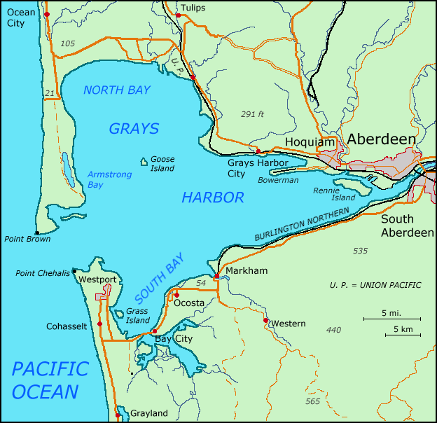
The Grayland Beach Community is 6 miles south of the large Westport marina and Westport city, and 16 miles north of the small Tokeland marina. From Grayland to Raymond it is 27 miles to the southeast, and from Grayland to Aberdeen it is 23 miles to the northeast. The scenic road from Westport to Raymond, WA105, was completed in the 1960's.
The Grayland Community has two markets, cafes, stores, gift shops and services that are are all located along coastal Washington Highway 105. Be careful when parking off narrow WA105. Slow Down! Local students attend school in Westport.
There are many country homes and cranberry fields east of WA105. The many back roads east of WA105 in Grayland are very quiet, picturesque, and free of traffic ... great for bicycling or long walks. Whereas, West of WA105 are houses, cabins, State Parks, sand dunes, and the seashore.
I have camped at Grayland Beach State Park and Twin Harbors State Park many times in the past. In 2022, I plan to camp four days and three nights again in the area. I have plans in place for many solo coastal yurt camping adventures in 2022, from beaches at Cape Lookout OR to Pacific Beach WA.
Therefore, Grayland Beach will be the central point for my explorations of
the southern side of Gray's Harbor and the northern side of Willapa Bay.
This webpage will cover my exploration of the beaches of Grayland Beach State Park,
and the area 50 miles north and south of Grayland. Many of the seasonal
coastal activities are the same from Cape Lookout to Pacific Beach.
Grayland Beach is a community of people living on the coast of Washington,
in the Twin Harbors area of Southwestern coastal Washington State.
Grayland Beach is 16 miles from the Tokeland Marina (entrance to Willapa
Bay) and 10 miles from Westport Marina (entrance to Grays Harbor Bay); thus,
it is between two bays or harbors, and often referred to as the "Twin
Harbors" area.
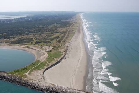
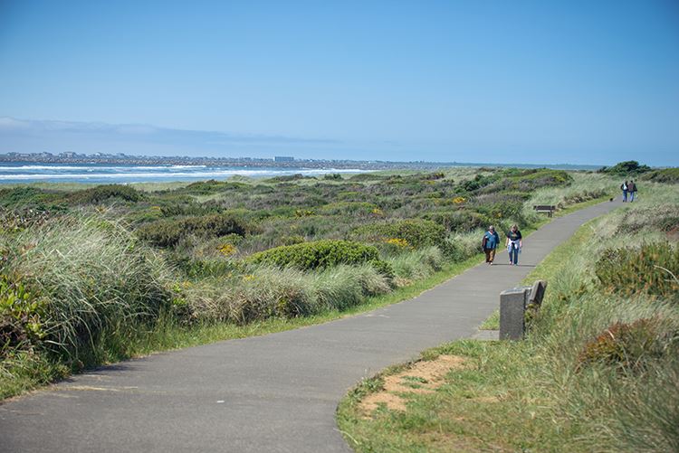
There are 18 miles of wide sandy beaches, grassy sand dunes, and shore pine
forests from Westport Light State Park to the North Cove area near Tokeland.
There is visually a degree of grayness in the sand and sea and grey clouds
bringing wind and rain from the Pacific Ocean.
Watching the wind fling grey sand along the rolling grey ground as the sun
sets below the sea.
For me, "Grayland" is a marker, post, theme, metaphor, symbol, or sign of
my camping travels to these geographical coastal areas in my 75th year.
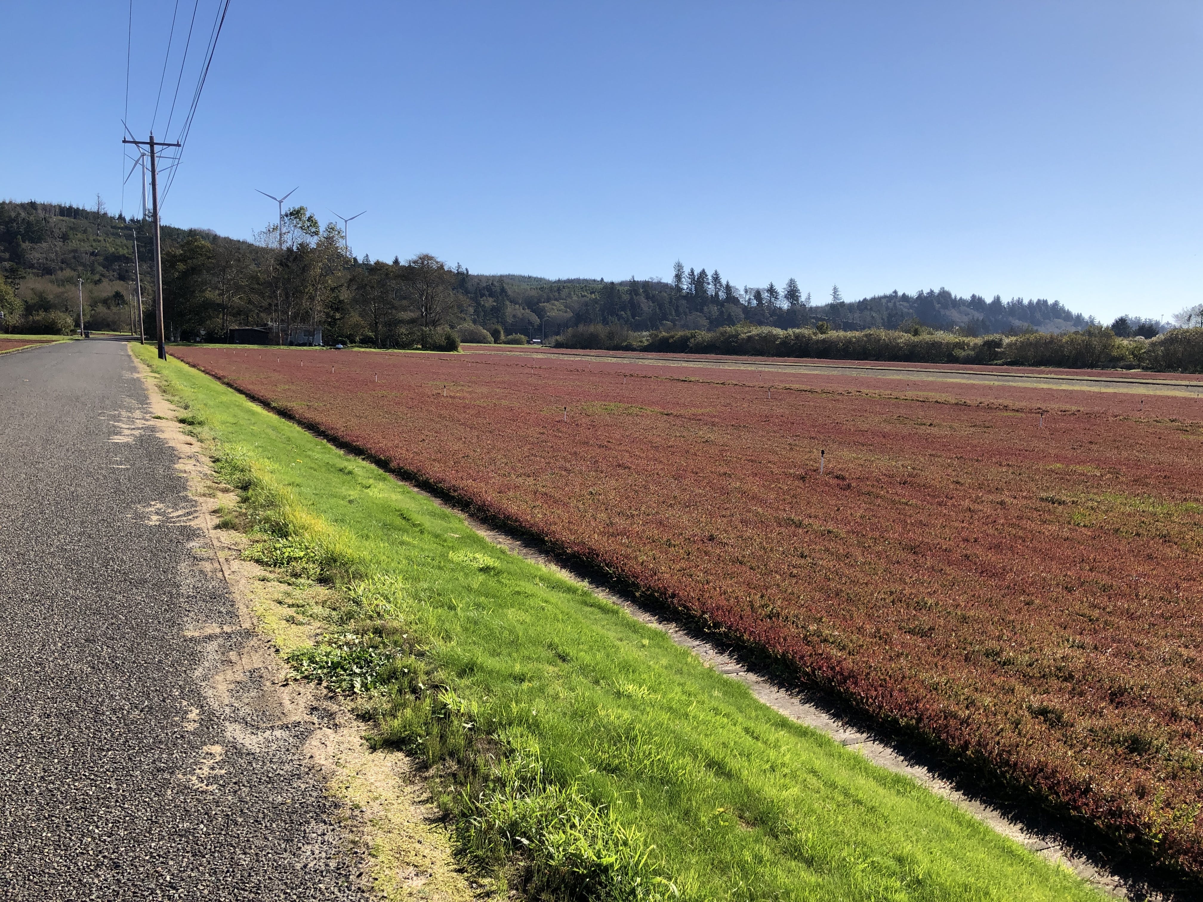
Grayland Cranberries: Cranberry Road Winery Cranberry Museum Furlow Pickers 1933 Cranberry Bogs Driving Tour in Grayland Cranberry Coastal Bogs
Washington's Cranberry Coast. By Sydney Stevens for the Pacific
Coast Cranberry Research Foundation. Arcadia, 2014, 128 pages.
Images of America Series.
History of the cranberry farmers in Grayland and Long Beach.
Grayland: Food/Cooking Westport Timberland Library Bicycling Walking Beachcombing Fishing or shopping in nearby Westport.
Grayland Birding: Midway Beach Road
"Located just south of Grayland Beach State Park, the beach access area near Midway Beach Road is a popular spot for shorebirds migrating through the region. In the spring months, there will be over twenty species of shorebirds in this area, highlighted by the �Streaked� Horned Larks and Lapland Longspurs that frequent this stretch of beach. Even in the off-season, huge flocks of pelicans have been spotted near this area, which is quite rare to see this far north. With eagles constantly flying around and the occasional blue heron sighting, Midway Beach is a fun place to avoid the more crowded parks and have a great time birding."Grayland Beach Area Vehicle Access Roads to Drive on the Beach: Midway Beach Road, Cranberry Beach Road, Bonge Ave.,
Grayland Beach Area Vehicle Parking Closer to Shore [all have restrooms except for North Cove]: Tokeland, North Cove, Westport Jetty, Westport Lighthouse.
Grayland: Tai Chi and Chinese Yoga by Michael P. Garofalo. I camp at Grayland State Park, mostly in mid-month. For Qigong (Chi Kung, Chinese Yoga) I practice the Eight Section Brocade. I practice the Yang Style of Taijiquan using the Long 108 Form and the Short 24 Form and the Eight Immortals Cane Form. My Qualifications? Grayland: Taoism. Let's walk the tide line at Grayland and talk Taoism. Sit in the shade of shore pines and savor the sayings of Lao Tzu. Ponder Process Philosophy.
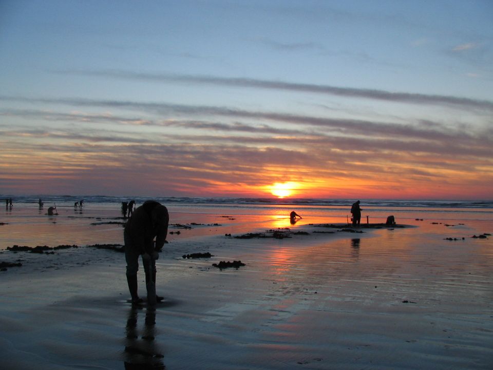
Grayland Beach State Park Clam Digging at Low Tide SEE Clam Digging
Grayland Beach Beachcombing: "Grayland has hands down the best beachcombing in the Grays Harbor County. Grayland is part of a 12 mile stretch of sandy beach line with plentiful sand dollars, driftwood, bullwhip kelp, sea creatures, cool rocks, shells and incredible amounts of flotsam. The locals host an annual Driftwood art and Glass float hunt each year. Because of this, beachcombing can get competitive, especially after a big storm. Arrive early to inspect the high tide line and follow the tide out. You can drive on this beach, but beware of soft sand at the beach approaches to the north. The best shell and driftwood collections are to the south. Cross a few streams and you will soon find the sand scattered with driftwood, moon shells and periwinkles." 5 Best
Grayland Beach SP Surf Fishing SEE Surf Fishing Nearby Westport has many jetty, dock, boardwalk, pier, and charter boat fishing options. Nearby is Tokeland Marina, docks, jetty, pier, boat launch, parking, restrooms.
Grayland Beach SP Images Westport SS
Grayland Beach SP Printed PDF Brochure
Reservations Made Online
This campground is very popular in the summer months and during clamming
season. Over 90% of people camping here during the rainy season (from
October to April) are using trailers, truck camper shells, RVs big and
small, vans, etc. I make reservations well in advance for a nice yurt.
Why? Affordable and sheltered from 72 annual inches of rain.
Kenanna RV Park, Grayland Cabins, RV-Trailers, Tents
Grayland: VRBO Rentals: Houses, Cabins
"There are those to whom place is unimportant,
But this place, where sea and fresh water meet,
Is important�
Where the hawks sway out into the wind,
Without a single wing beat,
And the eagles sail low over the fir trees,
And the gulls cry against the crows
In the curved harbors,
And the tide rises up against the grass
Nibbled by sheep and rabbits�.
I sway outside myself
Into the darkening currents,
Into the small spillage of driftwood,
The waters swirling past the tiny headlands."
-
Theodore Roethke, The Rose, 1964
"Once in his life a man ought to concentrate his mind on the remembered
earth, I believe. He ought to give himself up to a particular
landscape in his experience, to look at it from as many angles as he can, to
wonder about it, to dwell upon it. He ought to imagine that he touches
it with his hands at every season and listens to the sounds that are made
upon it. He ought to imagine the creatures there and all the faintest
motions of the wind. He ought to recollect the glare of moon and all
the colors of the dawn and dusk."
- N. Scott Momaday
Yurt Camping at Northwest Beaches and Northwest Outdoor
Activities and Travels
Southwest Coastal Washington and Northwest Coastal Oregon
Photographs, Blog Posts, Doing/Seeing
Reports from Michael P. Garofalo
1st Yurt Camp: 2021 September
Reports
1
2
3
Yurt Campsite at Grayland Beach State Park, WA, for two nights
Booked
Booked = Reserved Online in Advance
Near Grayland, Westport, Aberdeen, Tokeland, Raymond
2nd Yurt Camp: 2021 October
Reports
4
5
6
7
Cabin Campsite at Twin Harbors State Park, WA, for three nights
Booked
Mick, April and I went together on this trip.
Near Westport, Grayland, Aberdeen, Tokeland, Raymond, Pe El, Chelais
3nd Yurt Camp: 2021 October Reports
8
9 10
11
Yurt Campsite at Grayland Beach State Park, WA, for three nights Booked
Near Grayland, Westport, Aberdeen, Tokeland, Raymond, Pe El, Vader
4rd Yurt Camp: 2021 November Reports
12
13
14
15
Cabin Campsite at Twin Harbors State Park, WA, for three nights Booked
Mick and I went together. Mick had much success in razor clam digging.
Near Westport, Grayland, Aberdeen, Tokeland, Raymond, Pe El, Chelais
5th Yurt Camp: 2021 December
Reports 16a
16b
17
18
19
Yurt Campsite at Cape Disappointment State Park, WA, for three nights
Booked
Near Long Beach, Seaview, Ilwaco, Naselle, Chinook
6th Yurt Camp: 2022 January
Reports
20
21
22
23a
23b
Yurt Campsite at Nehalem Bay State Park, Oregon, for 3 nights Booked
Near Manzanita, Cannon Beach, Nehalem Bay, Rockaway Beach, Seaside, Fort
Clatsop, Old Houses, Raining
7th Yurt Camp: 2022 February
Reports
24a
24b
25
26
27
Yurt Campsite at Cape Lookout State Park, Oregon, for 3 nights Booked
Tillamook, Tillamook Bay, Netarts Bay, Netarts, Oceanside, Bayocean, Sand Lake, Pacific City,
Tillamook State Forest
8th Yurt Camp: 2022 March
Reports
28
29
30
31
Yurt Campsite at Grayland Beach State Park, WA, for 3 nights
Booked
Near Westport, Aberdeen, Grayland, Tokeland, Raymond
9th Yurt Camp: 2022 April Reports
32
33
34
35
Yurt Campsite at Grayland Beach State Park, WA, for three nights
Booked
Near Westport, Grayland, Aberdeen, Tokeland, Raymond, Doty, Vader, Chelais
10th Yurt Camp: 2022 May
Reports 36 37 38 39 39b
Yurt Campsite at Pacific Beach State Park, WA, for 3 nights
Near Pacific Beach, Moclips, Copalis Beach, Lake Quinault, Ocean Shores, Aberdeen
11th Yurt Camp: 2022 September
40 41 42
Yurt Campsite at Cape Disappointment State Park, WA, for 3 nights, Booked
Near Seaside, Ilwaco, Long Beach, Wallapa Bay
12th Camp: 2022 October
Reports 44 45 46 47
Yurt Campsite at Cape Lookout State Park, OR, for 3 nights, Booked.
Near Tillamook, Tillamook Bay, Netarts Bay, Netarts, Oceanside, Bayocean, Sand Lake, Pacific City,
Tillamook State Forest
13th Camp: 2022 November
Reports 48 49
50 51
Yurt Campsite at Grayland Beach State Park, WA, for 3 nights, Booked
Near Westport, Raymond, Clamming with Mick and April
15th Camp: 2023 January
Reports 56 57 58 59
Bullard's Beach State Park, OR, for 3 nights, Booked
Near Bandon, Port Orford
Winter 2023: Karen's Hip Replacement Surgery, Mike's Heart Ablation Surgery.. No Travel
16th Travel: 2023 April Reports
60
Hood River The Dalles, Pendelton, OR, for 2 nights
17th Camp: 2023 May Reports
Grayland Beach State Park, WA, for 3 nights, Booked
Near Westport, Raymond
18th Travel: 2023 June Reports
Quinault Lake and Rain Forest, WA, for 4 nights, Needs Reservations
Near
Aberdeen, Lake Quinault
19th Yurt Camp: 2023 June Reports
Bullard's Beach State Park, OR, for 3 nights, Booked
Near Bandon, Coos Bay
20th Travel: 2023 July Reports
Sunrise Peak, Ellensburg, Yakima, OR, for 4 nights, Needs Reservations
21st Travel: 2023 August Reports
19th Yurt Camp: 2023 September Reports
Pacific Beach State Park, WA, for 3 nights, Booked
Near Ocean Shores, Pacific Beach
20th Yurt Camp: 2023 October Reports
Nehalem Bay State Park, OR, for 3 nights, Booked
Near Manzanita, Tillamook, Seaside, Nehalem
21th Cabin Camp: 2023 November Reports
Fort Stevens Cape Lookout State Park, OR, Dates TBD
Near Astoria, Seaside, Illwaco
22nd Yurt Camp: 2023 December Reports
Cape Lookout State Park, OR, Dates TBD
Near Tillamook
23nd Yurt Camp: 2024 January Reports
Beverly Beach State Park, OR, Dates TBD
Near Depoe Bay, Lincoln City, Newport
24nd Yurt Camp: 2024 February Reports
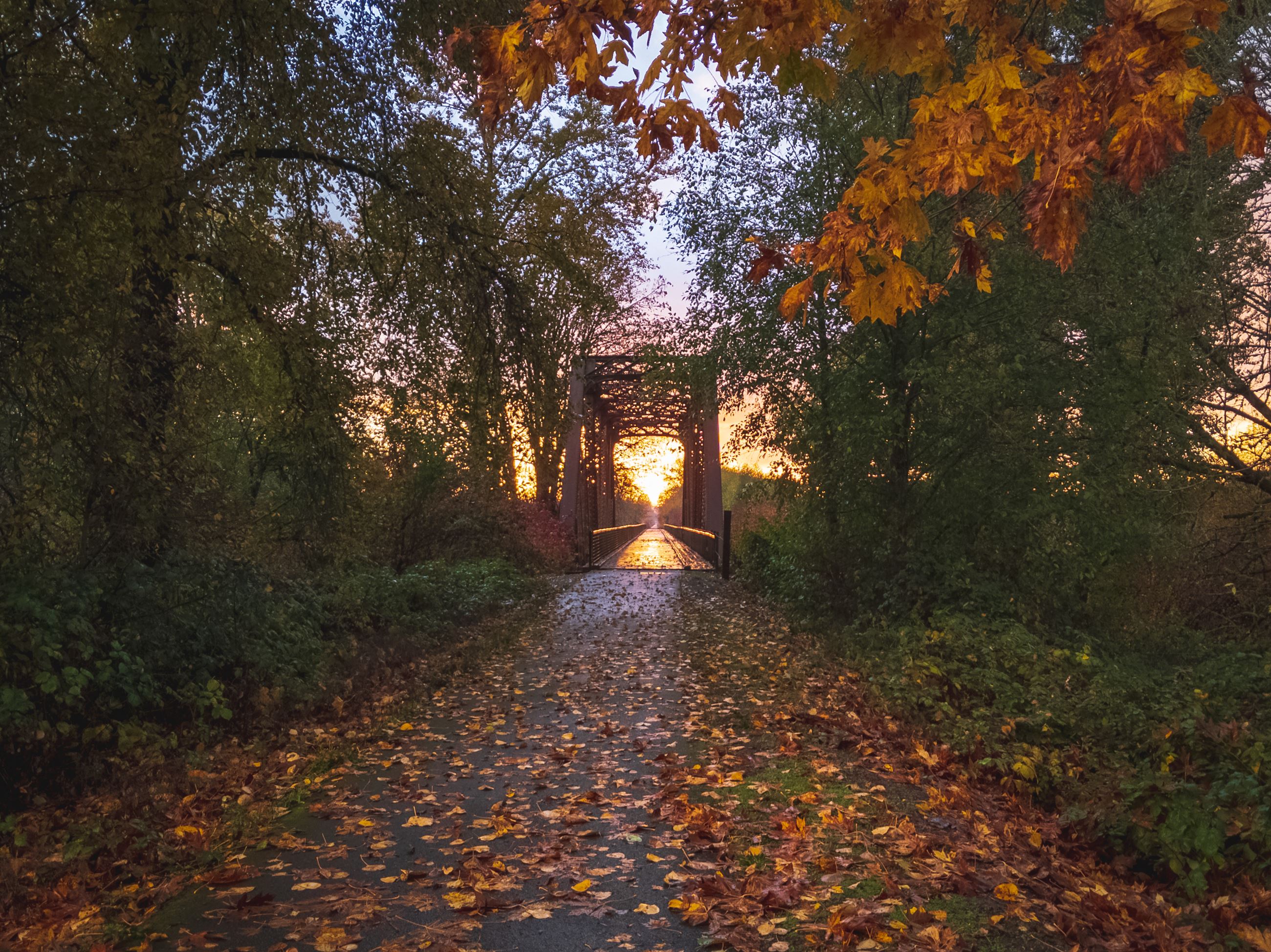
Four Days at Grayland, Campsite by the Sea, On a Corner of the Sea
Grayland Beach SP Yurt Campsites Video of All Campsites My Photos
Grayland Beach SP Weather Current Weather Report and Week Ahead Predictions for Grayland Grayland averages 76 inches of rain each year.
Grayland Beach Nature Studies
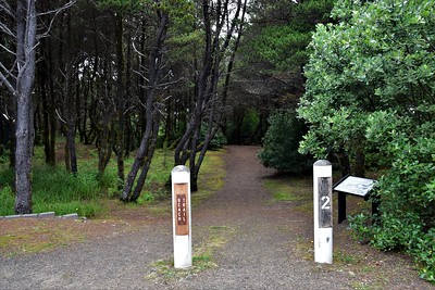
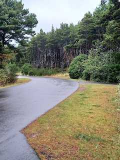
(Grayland Beach SP Trail 2 to the Surf; Camping at Yurt 80)
The elevation of Grayland is 26 Feet, probably at WA105. Roughly, a 1 foot rise per 100-200 feet inland from the shoreline.
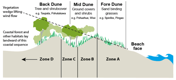
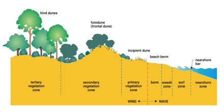
Zone 1
Charts Above : Zone D, Back Dune, Hind Dunes, Tertiary Vegetation Zone.
Highway WA105, Grayland Community, Homes, Businesses, State
Parks, Services, Lodging, etc., in about 1,000 -2,000 yards both east and
west of WA105 on flat ground. On the flat ground up to 2 miles east of
WA105 there are primarily cranberry bogs. The bogs start at North
Cove, Smith-Anderson road, and go all the way down to the Westport area - about
8 miles.
There are mixed trees and shrubs and charming small homes on some of the back roads east of WA105.
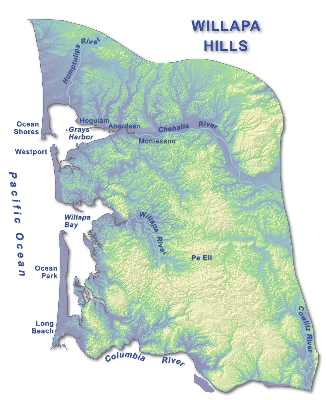
Trees in the Willapa Hills. Reference
Sources: e.g., A Naturalist's Guide to the Hidden World of the
Pacific Northwest, PND 2016, p.253 for the Shore Pine insect Community.
Zone 2
Charts Above: Zone D, Back Dune, Hind Dunes; some Zone C, Fore-Dune Area;
C & D Tertiary and Secondary Vegetation Zone.
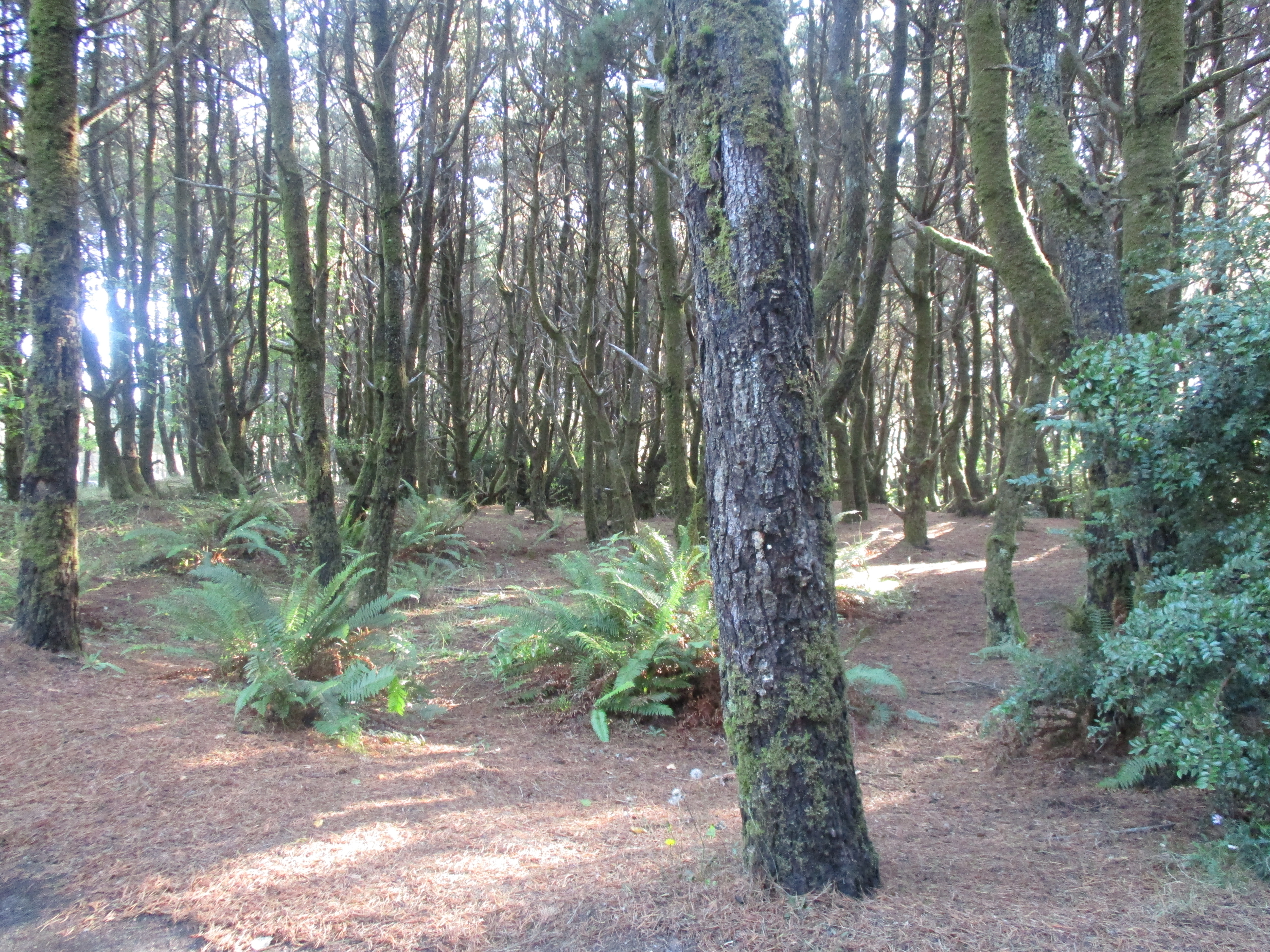
Grayland Beach State Park - Shore Pine Forest
Shore Pine Forest, ferns, Barrow Lake (swamps/ponds/marshy areas), deciduous
trees in sunny areas along campground roads.
The campground area is within a
shore pine
(pinus contorta) forest. These trees "are highly adaptable and
can grow from dunes and bogs to rocky hilltops and are tolerant of low
nutrient conditions and salt spray."
Campground Map
Reference Sources: e.g., PND 2016, p.253 for
Shore Pine Community.
Zone 3
Charts Above: Zone B, Mid Zone, Incipient Dune.
Mixed low flowers, shrubs, sand dunes, fewer trees more low
plants
In this area, the trail is narrow, and with many plants on either side.
Reference Sources: e.g., PND 2016, p.253 for
dune communities.
Zone 4
Above Charts: Zones B & A, Primary Vegetation Zone
Grass, sand, extreme high winter storm tide wood debris,
beachcombing little, no trees or shrubs, some vines
Just follow all the previous footprints and walk your way to and from the
campground. Walking in sand can be strenuous for some.
You can safely walk anywhere here.
"Ammophila (synonymous
with Psamma P. Beauv.) is a genus of flowering
plants consisting of two or three very similar species of grasses.
The common
names for these grasses include marram grass, bent grass, and beach grass."
Reference Sources: e.g., PND 2016, p.253 for
dune communities.
Zone 5
Charts Above: Zone A, Fore Dune, Beach Berm
Sand, no plants, beachcombing better, storm tide debris.
Reference Sources:
Zone 6
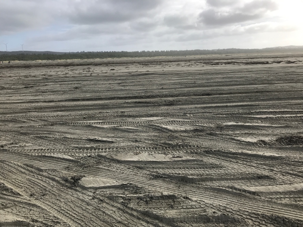
Charts Above: Zone A, Fore Dune, Beach Face; Beach Berm, Surf Zone.
Average High Tide Line, Swash Zone, Beachcombing Prime.
This Zone has some Vehicle Drivable areas closer to shore in firm wet sand - walkers
should stay alert.
To find your way back to Trail 2 look up at the five large wind turbines in
the low hills east of Grayland. Aim your walk at the two turbines on
the right, follow all the previous foot prints in Zone 5 until you see the
big Trail 2 post. Just follow all the previous footprints and huff and
puff across the long way back to camp. Or, use your binoculars to spot the
big Trail 2 post to help you getting back to camp.
Reference Sources: e.g., New Beachcomber's
Guide to the Pacific Northwest, 2019, BG 2016
Zone 7
Charts Above: Zone A, Fore Dune, Beach Face; Beach Berm, Surf Zone.
Average Low Tide Line in Surf Zone
During the clamming season the low tide line and minus low tide line are
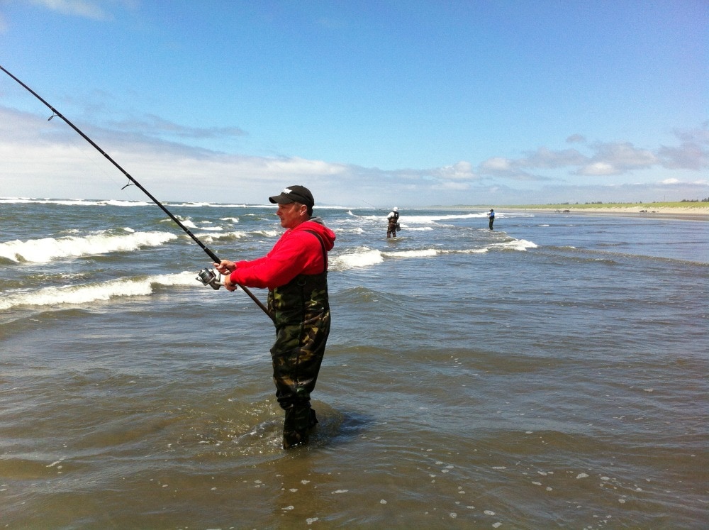
filled with people digging clams. Surf fishing in 1 to 2 feet of surf
is common.
This is where you get your feet wet, and beware of sneaker waves.
Search here for sand crabs and ghost shrimp.
Reference Sources:
Zone 8
Charts Above: Nearshore Bar, Nearshore Berm.
Ocean, Underwater, Sub-tidal
From the shoreline to about 500 yards into the ocean it ranges from 2-10
foot deep, at 1,000 yards from the shoreline the ocean is 20-30 feet deep,
and at 3,000 yards it is around 30-40 feet deep.
Immensity: It is 4,700 miles across the Pacific Ocean from Grayland to
Vladivostok, Russia.
Reference Sources:
Between the Tides in Washington and Oregon: Exploring Beaches and Tidepools.
By Ryan P. Kelly, Terrie Klinger, and John J. Meyer. University of
Washington, 2022, 280 pages.
Beachcomber's Guide to the Seashore Life in the Pacific Northwest. By J. Duane Sept. Harbor, 2009, 224 pages.
The Essential Guide to Beachcombing and the Strandline. By Steve Trewhella and Julie Hatcher. 2015, 304 pages.
The New Beachcomber's Guide to the Pacific Northwest guide to the flora and fauna of the inter-tidal areas of beaches.
Exploring the Seashore in British Columbia, Washington, and Oregon: A Guide to Shorebirds and Intertidal Plants and Animals. By Gloria Snively, and illustrated by Mark Wynja and Philip Croft. Gordon, 2003, 240 pages.
The Pacific Northwest Coast: Living with the Shores of Oregon and Washington. By Paul D. Komar. Duke University, 1998, 216 pages.
Beachcombing - Links, Books, Articles
Beachcombing Tips Magazine Top Spots Northwest
Pacific Northwest Beachcombing Grayland Beach
Agate Hunting on the Washington Coast. By M. J. Grover. 2021, 108 pages.
The Beachcomber's Companion: An Illustrated Guide to Collecting and Identifying Beach Treasures. By Anna Marlis Burgard. 2018, 128 pages.
A Beachcomber's Guide to Fossils. By Bob and Pam Gale. University of Georgia, 2020, 544 pages.
Beachcombing at Miramar: The Quest for an Authentic Life. By Richard Bode. 1997, 208 pages.
Beachcombing the Pacific. By Amos L. Wood. Schiffer Publishing, 1987. Index, 225 pages. VSCL.
A Naturalist's Guide to the Hidden World of Pacific Northwest Dunes
Books on Beach Activities and Coastal Nature Studies
5 Best Beachcombing Beaches in Grays Harbor
The Beachcomber's Guide to Fossils. By Bob and Pam Gale. University of Georgia, 2020, 544 pages.
Beachcombing is very interesting for those closely following the changes of the tides each day, the major seasonal differences, the intensity of storm conditions, and the biotic communities by the seashore.
Just walk the beautiful beaches of Grayland. Savor the enjoyment in walking outdoors by the sea shore.
To be a fisherman is to first cast your bait into the water; to be a beachcomber is first to walk.
See Also:
Beachcombing
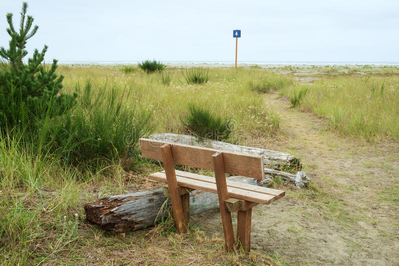
Beachside Day-Use "Campsites" or Picnic Sites
All wide sandy beaches from Moclips to Cape
Disappointment
Drive to a Beachside Picnic Site (sort of a Day-Use "Campsite"):
You can usually day camp from 8 am to 5 pm; weather, tides, season, and surf conditions
permitting. You cannot camp on the beach at night.
Know the tide information and surf conditions and expected weather. What season are you in? What at storm conditions? Know the current legal rules and regulations regarding driving in the area you are in. Are you on public land or private land? Know what your vehicle can do and cannot do on the firm moist beach sand. Avoid getting stuck. Drive safely a short distance to the selected beach "campsite." The vast stretches of the dry sand dune environment are for walker's only.
"Recreational use is the province of the Washington State Parks and
Recreation Commission. The commission has established driving
regulations to protect the beach and its visitors. A "drivable beach"
is defined as the area of firm, wet stand upland from the clam beds over
which the tide ebbs and flows daily. This area is considered hard
enough to support the weight of an ordinary passenger vehicle and provide
traction for the tires. The dry sand area is everything upland from
the water line, except for this strip of firm wet sand that is designated as
drivable beach. Parking is permitted only in the landward 100 feet of
the drivable beach."
- Amos L. Wood, Beachcombing the Pacific
Obviously, you can carry a lot more recreational and comfort gear in a car to a day use "campsite" or picnic site. At Grayland Beach I can drive to the beach on gravel Cranberry Road, then up to a half mile or so north or south on hard packed sand to a nice spot. I rarely drive more than a half mile from the gravel roads. I drive slowly and carefully in my Ford Escape AWD Titanium. This Ford SUV can carry enough for two people for beach day camping. When tent camping alone I set up my beach day camp as follows:
Use your vehicle as a shield against the cool ocean wind and sand spray. I also set up a small pop-up beach nylon half-tent. I have a low chair for the half-tent and a good higher camp chair. I have a Therma Rest self-inflating mattress for the back of my Ford Escape. Sometimes, when it is cold and windy, you will enjoy sitting or lying in your vehicle. I use wool blankets and warm clothing for beach day camping.
I bring my kitchen box, food box, and water. I use a one burner butane Coleman stove for cooking.
I bring surf fishing and clam digging gear. I bring gear for nature studies while walking the shore lines both at high and low tides. I bring stuff for my sit still hobbies: reading books, listening to MP3's, using my cellphone, playing string figures, tying fishing rigs, using the camera, flying kites ...
I don't burn wood at the beach. I keep and leave my campsite clean and neat.
Walking to Day-Use or Hourly-Picnic Use "Campsite": Wide sandy beaches are common at Ocean Shores, Twin Harbors, and Long Beach. It can be a very long walk from your tent campsite or a parking lot to the shore. Walking in sand is more strenuous. Thus, carrying a filled backpack, a low chair, and a half-tent, food, water ... and walking through sand dunes and beaches would challenge many an older person's (I'm 75) arms and legs. Thus, if you want to carry more while walking to the beach for a day campsite you will prefer (even as a solo tent camper) using a small beach wagon-cart. Better yet, at Grayland Beach, I drive to my selected beach "day campsite."
Beaches on the Washington Coast
Bicycling on long bike paths, quiet country roads, on dirt trails, on quiet coastal city streets, or on big tire bikes on the sandy shore ... all readily available in the Region.
A Birder's Guide to Coastal Waqshington. By Bob Morse, 2001. Featuring Ocean Shores, Long Beach Peninsula, Forks, Westport, Tokeland, and 160 Birding Hot Spots. Detailed coverage of birding locations near Westport and how to get there. Excellent resource! RWMorse, 2001, 270 pages, ring-bound. VSCL. FVRL
Coastal Washington Shorebirds and Waterbirds. By Ruth McCausland. 116 pages.
Birds of Washington Field Guide. By Stan Tekiela. Adventure Pubs., 2001, 332 pages.
American Birding Association Field Guide to the Birds of Washington. By Dennis Paulson and Brian Small. Scott and Nix, 2020, 368 pages.
Birds of the Pacific Northwest. By John Shewey and Tim Blount. Timber, 2017, 560 pages.
Birds of Washington State. By Brian Bell and Gregory Kennedy.
Partners, 2017, 284 pages.
Pelagic Zone
(Epipelagic) Boat Trips for watching oceanic seabirds out of Westport Marina in
the summer months.
Birds from the Northwest Perspective
Seabirds of the Pacific Northwest
Birding in Willapa Bay Wildlife Refuge
Notable Shorebirds in Washington
"Spring provides shorebird migration spectacles, and summer offers a tremendous diversity of breeding species from the rain forest inhabitants of the Olympics, alpine tundra breeders in the Cascades and desert shrub steppe specialties in the Columbia Basin. Spring is the season of migration spectacles, the shorebird passage through Grays Harbor, seabird migration offshore, Sandhill Cranes through the Columbia Basin. Landbird migration can be good too, particularly in the riparian areas and desert oases of eastern Washington. Several bird festivals at this time provide the out-of-town birder with a great introduction to local birding and birders; look for the Othello crane festival and the Grays Harbor shorebird festival on the web."
Bottle Beach State Park Near Westport SS Bird Watching Area, Mudflats, Swamps, low shrubs.
Grays Harbor National Wildlife Refuge
Johns River Wildlife Area Images Near Westport SS History Game Farm Road off 105 Walking trails, boat launch, bird watching.
Jetties, marina, and pier in Westport.
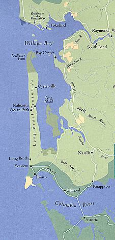
Jetty and small marina and wetlands around Tokeland. Tokeland Population 200 Willapa Bay Images
Martha Jordan Birding Trail, Ledbetter Point, Long Beach Peninsula
In the Spring, many birds flock to the shallow waters and river estuaries of both Grays Harbor and Willapa Bay.
Clam Digging
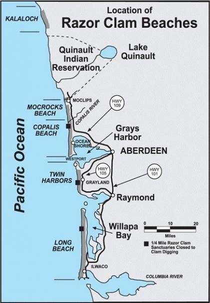
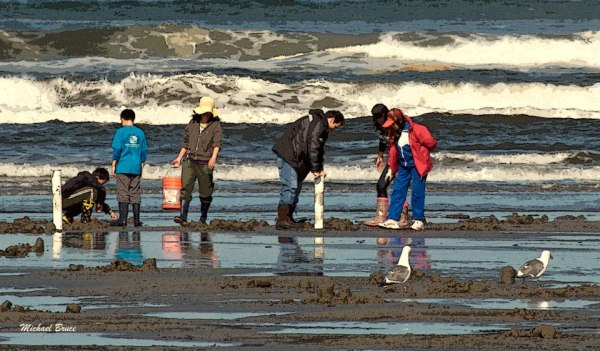
Clam Digging Razor Clams Washington State Fish and Wildlife
Clam Digging Razor Clam Rules and Best Beaches for Digging
Clam Digging Seasonal Schedule [Sept-Dec 2021]
Clam Digging Tides Grays Harbor
Clam Digging and Crabbing in Washington. By John A. Johnson. Adventure North Publishing, 1997, 125 pages. VSCL.
Clam Digging and Crabbing in Oregon. By John A. Johnson. VSCL.
Clamming in the Pacific Northwest. By Ken Axt. Frank Amato, 2016, 88 pages. VSCL.
Clam Digging Reports of Michael P. Garofalo
Clam Digging Grayland and Twin Harbors This stretch of beach is referred to in books as the 'Twin Harbors' Beaches.
Preparing and Cooking Razor Clams
The Secret Life of Clams: The Mysteries and Magic of Our Favorite Shellfish. By Anthony D. Dredericks. Skyhorse, 2014, 286 pages. FVRL
Clam Digging Tools: Waist waders with attached boots. Waterproof
top as needed. Waterproof and warm gloves, hat, and warm clothing.
Cylindrical clams digging tube (metal or plastic) and a clam shovel (11'x31").
Headlamps for night clamming. Mesh basket for holding razor clams.
Snacks in your pocket. Friends to have fun with at the seashore. Your
fishing license in your jacket.
If you work at shellfishing and have some luck then you will need: A clam
opening knife and cutting pad. Pot in camp big enough to clean and
cook clams, oysters, or crabs. Surf fishing for redtail surf perch is supposed to be very good using clam baits on the high tide
immediately after the razor clammers have dug at low tide.
Driving Tours of Mike Garofalo
Tour 1:
Longview to Westport (WA4, US101,WA105)
Longview, Columbia River, Nasel, Willapa Bay (East and North Sides of the Willapa Bay),
South Bend, Raymond, Tokeland, Grayland, Westport
Driving west and north for 131 miles.
Fishing, Surfcasting, Jetty
Fishing, Pier Fishing
Fishing Washington State Fishing Regulations NS SS
Fishing: The Complete Guide to Surfcasting: Tackle, Technique, Species, Locations and More. By Joe Cermele. Burford, 2011, 288 pages. VSCL.
Grayland Beach and Twin Harbors Beach Surf Fishing
Surf Fishing Grayland Images
Fishing from the North Jetty in Ocean Shores Ilwaco Jetty and Docks Cape Disappointment Jetty South Jetty in Westport
Fishing in freshwater rivers, streams and lakes in Washington
Fishing Biography: Casting Into the Light, 2019. A fisherwomen's lifetime of fishing adventures and friendships and surfcasting around Martha's Vineyard MA. TRL
How to Catch Redtail Surf Perch UTube 2 oz round weight, Gulp Sandworm Nereis Camo dried, # 2 hook, 2 hook rig
Light Tackle Surf Perch Fishing. J. D. Richey. 2014, 52 pages. VSCL.
11 Best Beaches for Surf Perch Fishing in Washington and Oregon
Redtail Surf Perch - Wikipedia
Washington River Maps and Fishing Guide. Excellent resource for river trips and fishing.
Westport: Fishing from the South Jetty in Westport.
Tokeland Population 200 Willapa Bay Images Small marina, jetty, boat ramps, RV parks. Shoalwater Casino. Restaurant. Historic hotel.
Westport: Fishing and crabbing from the Docks, Boardwalks, and Pier at Westport.
Fishing My surfcasting rod is an 11 foot Fiblink Surf Spinning Fishing Rod, 4 piece. Reel: KastKing Sharky Baitfeeder III Spinning Reel. Line: Kast King Braided line, 30 lib, 327 yards, Moss Green. Tackle box with surf fishing and jetty fishing gear. I have a valid current Washington fishing license and shell fishing license.
Surf fishing for redtail surf perch is supposed to be very good using clam baits on the high tide immediately after the razor clammers have dug at low tide.
Casting into the Light: Tales of a Fishing Life. By Janet Messineo, 2019. Surf fishing in Marthas Vineyard, MA.
Whale watching tours out of Westport Marina in the Spring.
"When the smelt spawn in the Cowlitz River, the gulls go into a feeding frenzy that lasts for weeks. Kelso, Washington is known as the "Smelt Capital of the World" Smelt Fish The eulachon (Thaleichthys pacificus) found in the Northeast Pacific and adjacent rivers, Story of poor smelt run on the Cowlitz on March 1, 2017. Later winter runs of smelt were essential to fishing subsistence for Native Peoples of the Northwest, and the smelt fish oil was prized and traded widely.
Washington's Pacific Coast: A Guide to Hiking, Camping, Fishing & Other Adventures
By Greg Johnston. Seattle, Washington, Mountaineers Books, 2015.
Index, 318 pages. ISBN: 9781594859397. VSCL.
Washington River Maps and Fishing Guide. By Doug Rose. Frank Amato Publications, 2013. 87 pages. ISBN: 978-1571885135. VSCL. Excellent resource for river trips and fishing.
Washington's Best Fishing Waters. Wilderness Adventures Press, 2nd Edition, 2007. 161 pages. ISBN: 978-1932098525. VSCL.
See Also: Beachcombing
Berries, Cranberries Birds and Waterfowl Clam Digging Fishing Food and Seafood Foraging Mushrooms Oysters Rock Hounding
Food, Cooking, Eating, Seafood, Campsite Cooking, Shellfish, Food Markets, Seafood Markets
Since you do not cook in yurts, and I am not fond of cooking myself, I eat
foods and drinks requiring no refrigeration or cooking; and, I dine out
often at local restaurants. Also, since I am camping at at coastal Yurt
campsite, I tend to eat fish or shellfish. My vehicle is small, so not
bringing cooking stove, pots and pans, ice box, etc., saves space in the
vehicle.
Westport has three seafood markets. I like Brady's Oysters which is located at the west end of the large bridge that spans the South Bay area of Grays Harbor near Westport. They have a nice variety of fresh fish, canned fish and shellfish goods, and naughty T shirts (oyster-sex). Merino's right at the Westport marina docks has a seafood market, and I have eaten their fish and chips take out many times (lingcod is the best) while in Westport. If they are open when I am in the area (Monday noon to Thursday noon) I will try the Tokeland Hotel's Wandering Goose Restaurant, the Wheelhouse Restaurant in Grayland, and Bennett's Fish Shack in Westport. Goose Point and Ekone Taylor Oysters are in Bay Center on Willapa Bay. In Tokeland there is Nelson's Crab Specialty Market.
All the small towns in the area have food markets with foods to compliment seafood dishes and campground cooking. I have my favorite restaurants and fish markets near Yurt campsites in Tillamook, Manzanita, Astoria, Long Beach, South Bend, Westport, and Ocean Shores. My Yurt camping blog reports highlight local eateries and seafood options.
Check out my comments regarding food and eating while solo Yurt camping.
The Magic of Tinned Fish: Elevate Your Cooking with Canned Anchovies,
Sardines, Mackerel, Crab and Other Amazing Seafood. By Chris McDade.
Artisan, 2021, 208 pages. VSCL. Recipes, history, resources,
online ordering. VSCL.
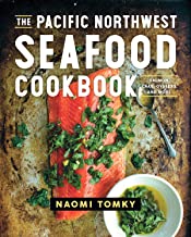
The Pacific Northwest Seafood Cookbook: Salmon, Crab, Oysters and More. By Naomi Tomsky. Countryman Press, 2019, 256 pages. VSCL.
Flannel John's Razor Clam and Oyster Cookbook: Tastes from Willapa Bay and the Long Beach Peninsula. By Tim Murphy, 2016, 52 pages.
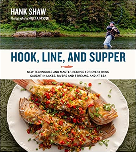
Hook, Line and Supper. By Hank Shaw. H & H, 2021, 336 pages.
The Tinned Fish Cookbook. By Bart van Olphen. Experiment, 2020, 144 pages.
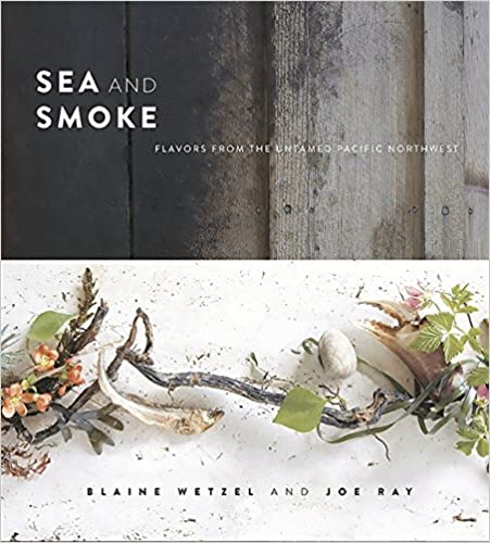
Sea and Smoke: Flavors from the Untamed Pacific Northwest. By Blaine Wetzel and Joe Ray. Running Press, 2015, 272 pages.
Oysters Clams Redtail Surf Perch
Shell Fish Canned: I enjoy eating tin canned shellfish (Conservas: Mussels, Oysters, Crab, Clams, Sardines, Salmon, Mackerel, etc.) from canners such as Jose Gourmet from Lisbon, Portugal; Ramon Pena from Galicia, Spain; Ekone Oysters from Willapa Bay, Washington; Nelson's Crab, Willapa Bay; Bela sardines from Portugal; albacore tuna from Westport, WA, etc.

Foraging Washington: Finding, Identifying, and Preparing Edible Wild
Foods. By Christopher Nyerges. Falcon, 2017, 272 pages.
Pacific Northwest Foraging for Beginners. By Paul Macy. 2021, 210 pages.
Pacific Northwest Medicinal Plants: Identify, Harvest and Use. By Scott Kloos. Timber, 2017, 416 pages.
Mushrooms of the Pacific Northwest. By Steve Trudell and Joe Ammirati. Timber, 2009, 352 pages.
The Native American Healing Herbs Bible. By Sacheen Winona. 2021, 237 pages.
Plants of the Pacific Northwest Coast. By Jim Pojar and Andy MacKinnon. Partners, 2004, 528 pages.
Wild Berries of the Northwest. By J. Duane Sept. Calypso, 2015, 96 pages.
See Also: Beachcombing
Berries, Cranberries Birds and Waterfowl Clam DiggingFishing Food and Seafood Foraging Mushrooms Oysters Rock Hounding Walking
Four Days in Grayland by Michael P. Garofalo
Four Days in Grayland, Part I Grays Harbor, Willapa Bay and More: A Traveler's Hypertext Notebooks and Guides
Four Days in Grayland, Part II Grayland Beach: A Camper's Hypertext Notebook, Studies, and Comments
Four Days in Grayland, Part III Photographs, Blog Posts, Reports, and Notes from 2021-2022
Four Days in Grayland, Part IV Reflections of a Beachcomber: Poetry, Short Essays, Reports, Commentary, Quotations
Hiking and Walking
Trails, Paths, Roads, Bicycle Paths, Beachcombing
A walker can pretty much go anywhere, fairly safely. I assume the
walker is in good physical condition and is properly equipped.
We can walk on sidewalks, paved streets, gravel roads, dirt and sand paths,
on the shoreline, in the surf, over rocky jetties, down wooden pathways,
over fields, through forests, on mountain trails ... pretty much anywhere.
Bicyclists and electric bicyclists have many of the same options.
When beachcombing, be alert and careful around the vehicles driving on Washington beaches. Most drivers are careful, safe, and reasonable. Most Grayland beaches are quite wide. However, always be alert for those few hot doggers driving unsafely. Can they see you? Are you safe? Walk when the beaches are not crowded in the off season and on non-clam digging days.
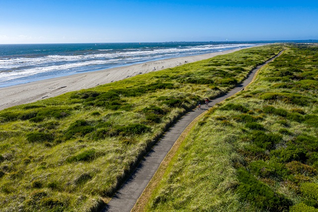
Ocean Beaches, 15 miles of wide sandy beaches
and sand dunes from North Cove to Westport.
Johns River Wildlife Area Images Near Westport SS History Johns River Road off 105 Walking and biking trails, boat launch, bank fishing.
Discovery Bicycling and Walking Trail 9 miles paved from Ilwaco to Long Beach on the Long Beach Peninsula.
Walking Quotations, Reflections, and Information. Compiled by Michael P. Garofalo.
Grays Harbor National Wildlife Refuge
Westport State Park - Westport Light Trail Images Westport Dunes Paved Trail SS
Long Beach Peninsula Beaches 28 Miles of wide, flat beaches and low sand dunes, swamps, lakes, wetlands, cranberry fields.
Ocean Shores to Moclips, Grays Harbor, 20 miles of wide, flat beaches and low sand dunes.
Martha Jordan Birding Trail, Ledbetter Point, Long Beach Peninsula
Bottle Beach State Park Near Westport SS Bird Watching Area, Mudflats, Swamps, wood raised trail in swamps/sloughs.
Shifting Sands Nature Trails in Twin Harbors State Park near Westport
Willapa Hills State Park Trail Near South Bend-Raymond, and 56 miles to Chelais. Former railroad route
Where to Walk the Beaches in Grays Harbor
Walking and Hiking Quotations, Poetry, Sayings, Bibliography, Information
Ocean Beaches, miles and miles of wide sandy beaches and sand dunes for walking and beachcombing.
Griffiths-Priday State Park, Images, Hike along the Copalis River to the sea NS One Park Ranger's favorite.
Oyhut Wildlife Recreation Area, Ocean Shores NS Hiking Trails Images
Willapa Bay National Wildlife Refuge Many areas in Willapa Bay with parking, restrooms, and hiking trails.
You can walk the back roads around Grayland, amid the cranberry bogs, and there is little auto traffic.
PDX Hiking 365: A Year-Round Guide to Hiking in Northwest Oregon and Southwest Washington. By Matt Reeder. Ruddy Hill, 2018, 322 pages.
Coastal Hikes: A Guide to West Coast Hiking in British Columbia and Washington State. By Philip Stone. Wild Isle, 2007, 183 pages.
Hiking in Southwest Washington and Northwest Oregon
The Walking Man. By Jiro Taniguchi. 2019, 232 pages.
A Walk on the Beach: Tales of Wisdom from an Unconventional Woman. By Joan Anderson. Crown, 2005, 240 pages.
Urban Trails in Vancouver, Washington: Longview, Battle Ground, Camas, Yacolt. By Craig Romano. Seattler, Mountaineers Books, 2020, index, 221 pages. VSCL. Book.
NW Coast: Trail Map and Guide. Covers the North Coast of Oregon and the South Coast of Washington. Salem, www.adventuremapgs.net., 2013. A waterproof map. Details for hiking and biking.
Marine Weather Pocket Guide: A Field Reference. By Jeff Renner. Seattle, Mountaineers Books, 2017. A waterproof folding info sheet.
Native American tribes have settled in and used the Grays Harbor region for 2,000 years. They were expert fishermen, hunters and gatherers. They made good canoes, were expert sea fishermen, and could travel considerable distances by canoe. They built more weather secure wood homes inland for winter, and temporary shelter camps near shorelines, rivers, and lakes for better seasonal hunting and gathering. They knew when the bird migrations were best for huntinga, or the peak razor clam or crab gathering times, or the best kelp beds, or seasonal salmon and smelt runs that would provide more needed food for drying and and oils for cooking. The abundant local natural resources for food, and the ingenuity and customs of these hardy people provided a relatively stable life for countless generations.
Native American coastal tribes in the Olympic Peninsula, Chelais River Valley, Grays Harbor and Willapa Bay areas included: Chelais, Chinook, Clatsop, Copalis, Cowlitz, Hoh, Makah, Klallam, Muckleshoot, Niqqually, Quinault, Queets, Quileute, Shoalwater Bay, and Willapa. Here is some of my research about the indigeneous native peoples of southwestern Washington State.
On May 7, 1792, a Yankee commercial sailing ship from Boston arrived in Grays Harbor. The Captain of this merchant vessel was Robert Gray. He and Captain George Vancouver were exploring and documenting this area at the same time in separate sailing ships. Later that year, Captain Gray, in his ship Columbia, crossed the bar and entered the Columbia River at Astoria. The Spanish, Russians, French, British and Americans were all fur trapping in these areas from Vancouver Island to the Columbia River.
By 1805, President Jefferson had the Lewis and Clark Expedition survey and document American interests from St. Louis, Missouri, to the Northwest Pacific coast. Fort Vancouver in Clark County, Washington, across the Columbia River from current Portland, was founded in 1825 by The Hudson Bay Company. Fort Vancouver was a major agricultural and livestock center. The Treaty of 1818 and the Oregon Treaty of 1846 between England and USA were significant. All the Olympic Peninsula covered in this webpage became a Territory of the USA in 1848, and Washington became a State of the USA in 1889.
Settlement by Europeans began in the 1850-1870's in Grays Harbor and Willapa Bay coastal areas. The Europeans developed many fishing, lumber, farm, commercial, retail, shipping, tourism, professional and other businesses. Tourism in Ocean Shores, Aberdeen, Westport, Long Beach and Ilwaco has been important since 1950. However, Northwest coastal winters are wet, cold, windy, and only for tougher tourist souls. It is very hard to make a living in these small coastal towns of the Olympic Peninsula, so incomes, opportunities, and populations are still low in the area.
Documentation, maps, research, books, libraries, Net ... The Native American Cultures of the northwest coast were fishermen, hunters, and gatherers. They had no iron tools. They were preliterate cultures of storytellers, singers, dancers, and chanters. The Europeans coming after 1790 were sailors, traders, merchants, farmers, explorers, as well as storytellers, singers and dancers; and, a few were writers, map makers (William Clark), accountants, administrators (John McLoughlin), scientists (David Douglas), reporters, and book users. The University of Washington was founded in 1861. What I can know about the past rests largely on my reading research, travels to museums and locales, and my curiosity. This webpage primarily covers Grays Harbor and Pacific Counties.
The Last Wilderness: A History of the Olympic Peninsula
The Pacific Northwest: An Interpretive History By Carlos Arnaldo Schwantes, 1996.
Coast Country: A History of Southwest Washington. By Lucile Saunders McDonald, 1966.
Contested Boundaries: A New Pacific Northwest History. By David J. Jepsen and David J. Norberg. Wiley-Blackwell, 2017, 416 pages. FVRL
Native Peoples of Southwest Washington. By Michael P. Garofalo
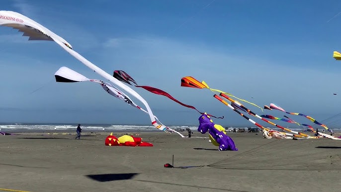
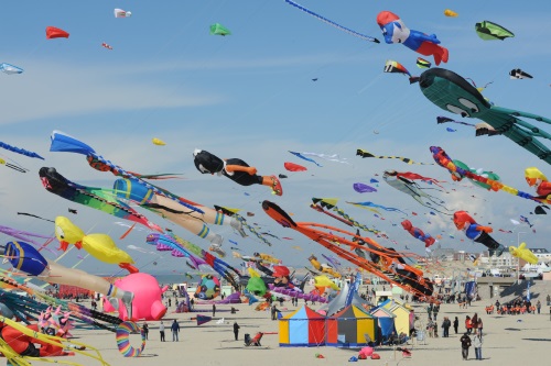
Kite Flying
The wide, flat, sandy beaches of Southwestern Washington are excellent
locations for flying
kites. From Copalis to Ocean Shores, from Westport to Grayland, from
Ocean Beach to Long Beach ... miles and miles of wide flat beaches for
flying kites. A very popular Spring and Summer sport along coastal
Washington.
There are retail stores and gift shops that sell kites in Ocean Shores, in Westport, and in Long Beach. I thought Ocean Shores Kites had a wide inventory of kites. There is Wind World in Long Beach. I have purchased kites from The Kite Company in Newport, Oregon; and from Into the Wind in Boulder, Colorado.
Long Beach is famous for its World Kite Museum. They host many events. They host the Washington State International Kite Festival every third week in August. They have many exhibits and video tours. Online collections of photographs. We attended the Kite Festival in 2018.
I own a variety of kites. I fly single string kites. I fly two string stunt kites. Yes, you can learn to launch a site by yourself. The beaches at Twin Harbors or Grayland or Cape Disappointment are very wide and there is plenty of room for safe kite flying. Since you can drive on many wide sandy beaches in Southwestern Washington, you can easily set up a beach day camp for kite flying and other activities.
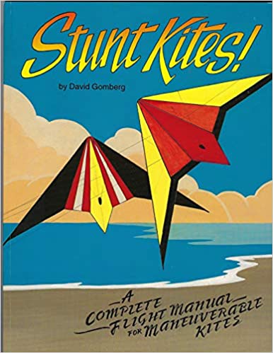
Stunt Kites: A Complete Flight Manual of Maneuverable Kites. By David Gomberg. Cascade Kites, 1994, 89 pages. VSCL.
Kites for Everyone: How to Make and Fly Them. By Margaret Greger. Dover, 128 pages, 2006. VSCL.
The Magnificent Book of Kites. By Maxwell Eden. Black Dog, 466 pages, 1998. VSCL.
Many public libraries in the Southwestern Washington area are part of the Timberland Regional Public Library System (TRL) or the Fort Vancouver Regional Library System (FVRL). Besides nice, clean, warm, and comfortable facilities these public libraries offer books, media, chairs, tables, Net access, magazines, etc. Often, the local public library has information on local history, recreation, travel, and natural history. Clean restrooms are available.
I live in Vancouver, Washington. I use the Cascade Branch and Salmon Creek Branch of the Fort Vancouver Regional Library System (FVRL). I use their online catalog. I reserve and pick up books and browse the shelves at these two Branches in the Vancouver area. I am very satisfied with the quality of public library services in Clark County, and many and growing number of Branches in the FVRL.
The Timberland Regional Public Library System (TRL) has Branches in Naselle, Ilwaco, Ocean Beach, South Bend, Raymond, Shoalwater, Westport, Aberdeen, Hoaquaim, Ocean Shores, etc. I use their online catalog to reserve books. When traveling in these coastal areas, I use these nice facilities. I browse the shelves at these Branches. On cold and raining days, a warm library, good lights and a chair all make for a few hours of enlightened rest reading.
I worked for the County of Los Angeles Public Library System from 1974-1998. I currently have library cards at both the Fort Vancouver Regional Library System (FVRL) and the Timberland Regional Public Library System (TRL). Any book or video from these libraries are included in my many bibliographies and reading lists.
Mushroom Foraging
Mushrooms of the Pacific Northwest. By Steve Trudell and Joe
Ammirati, 2009.
Foraging Mushrooms in Washington: Finding, Identifying, and Preparing Edible Wild Mushrooms. By Jim Meuninck. Falcon, 2019, 184 pages.
Foraging Washington: Finding, Identifying, and Preparing Edible Wild Foods. By Christopher Nyerges. Falcon, 2017, 272 pages.
I have watched many people hunting for mushrooms at both Twin Harbors and Grayland Beach State Parks. There were even signs at Cape Disappointment about not picking mushrooms. Obviously, knowledge and skill at a higher level are required when gathering and cooking mushrooms.
Music
Music Playing I own a wide variety of albums in MP3 format that I loaded on a memory chip into my cellphone. I bring earphones and a small USB Bluetooth speaker. You could bring CDs, audiotapes, or DVDs and their portable players for additional musical selections.
Musical Instrument Playing: My harmonicas [C, D, Am]. Bring your guitar, flute, harmonica ... Find a place, alone, in the gray sand and surf, and indulge your musical pleasures.
Native
Peoples of Southwest Washington. By Michael P. Garofalo.
Oysters in Willapa Bay
Oyster History on Willapa Bay, Schooner Trade, Boom Years, Fishery to
Farm. The Sou'wester Fall, 2005. By the Pacific County
Historical Society, South Bend.
Willapa Bay and the Oysters. By Nancy Lloyd. Oysterville Hand Print, 1999, 61 pages.
Oysters: A Celebration in the Raw. By Jeremy Sewall and Marion Lear Swaybill. Abbeyville Press, 2016, 216 pages.
The Essential Oyster: A Salty Appreciation of Taste and Temptation. By Rowan Jacobsen. Booomsbury, 2016, 304 pages.
Many cafes and restaurants in the coastal areas serve oyster dishes.
My photography notes, tips, research are found at Photography.
Everyday I use a Canon Power Shot SX740 HS. It is a small full featured and powerful compact "point and shoot" mid-level digital camera.
I own a Samsung Galaxy A20 cellphone with an excellent camera, and am now using T-Mobile for Internet access.
I have all the gear for a Canon Single Lens Reflex digital SLR EOS Rebel T7/2000D camera.
Eventually, by the end of 2022, I hope the majority of the photographs in Four Days in Grayland will have been taken by either Michael P. Garofalo or Blanche Karen Garofalo.
Photography Arts, Graphic Arts, and Concrete Poetry
Southwest Coastal Washington and
Northwest Coastal Oregon
Seasons and Months
Weather, Events, Activities, Celebrations, Cycles, Traditions,
Gatherings, Foods, Plants
Highlights, Sports, Seasonal Cycles, Fishing Seasons, Indian Annual Lifestyle Patterns
Winter Season
Damp, cold, an average of 47F high, and often rainy weather. Bring
your rain gear.
Beachcombing,
Clam Digging Crabbing Reading Walking
Quotations and Poetry
Fishing
Put on effective
rain pants,
rain coat,
boots, and warm clothes, and use an umbrella to go walking and
beachcombing.
If your walking in the surf or shallow rivers or surf fishing you might need
chest waders or
muck boots.
Use indoor facilities (museums, libraries, stores,
cafes/bars, your car) to deal with the rain, wind, chilly days, and fog of
the coast.
If you don't have hobbies to do while just sitting indoors, then
get some.
Nature
Studies
Take care when driving on wet roads and encountering pooled water on the
roads, and take care driving on fogging mornings.
Watch out for overflowing rivers and creeks, water on roads, washouts,
temporarily closed roads, reported flooding problems.
Storm Watching
January
Weather: 12 inches of rain total from 18 days, average high of 47�F
(8C).
Quotations and Poetry for
January
Yurt Camping
Storm Watching
Reading
Fewer tourists at the coast, no tent campers, cold and wet days.
Watch out for overflowing rivers and creeks, water on roads,
washouts, temporarily closed roads, and reported flooding problems.
Beachcombing
Long walks in deserted areas. Bring your wet weather rain gear and
waterproof shoes.
Native Peoples: Storytelling, making crafts, repairing
nets and other material goods, arts.
Native Peoples: Very difficult in January to find fresh food by fishing, hunting,
and gathering. The people had to rely primarily on dried and
stored foods.
February
Weather: 8 inches of rain total from 15 days. An
average high daily temperature of
50�F (10C).
Quotations and Poetry for
February
Yurt Camping
Storm Watching
Beachcombing
Reading
Fewer tourists at the coast, no tent campers, cold and wet days.
Long walks in deserted areas. Bring your muck boots and rain gear.
Native Peoples: Dip Netting
eulachon (candlefish,
smelt) and cold smoking for preservation
Cowlitz People Annual Activities Cycle
Native Peoples: Storytelling, making crafts, repairing
nets and other material goods, arts; smelt fish (candlefish) run
Native Peoples: Difficult in February to find fresh food by fishing, hunting,
and gathering. The people had to rely primarily on dried and
stored foods.
March
Weather: 8 inches of rain total from 17 days. An
average high daily temperature of 53�F (11C).
Quotations and Poetry for
March
Yurt Camping
Few campers and tourists on the coast.
Whale Watching
Reading
Beachcombing
An increase in the number of birds in the estuaries.
Native Peoples: Collection of new
salmonberry shoots; smelt fish (candlefish) run
Native Peoples: Fishing, hunting, gathering, foraging, preparing resources
for food and clothing; rely primarily on dried and stored foods.
Spring Season
May and June have mild, an average of 56F high, and fairly clear
weather.
Bird
Migrations Clam Digging
Beachcombing Fishing Kite
Flying Walking Bicycling
Festivals/Contests
Quotations and Poetry
Nature
Studies
Reading
April
Weather: 6 inches of rain total from 14 days. An
average high daily temperature of 56�F (13C).
Quotations and Poetry for
April
Fishing in the many rivers and streams that flow into Willapa Bay
and Grays Harbor
Bird Migration Peak - Bottle Beach, Midway Road, Estuaries, Grays
Harbor Refuge, Willapa Refuge
Fishing
Whale Watching
Beachcombing
Yurt Camping
Reading
Native Peoples: Sturgeon
Fishing. Chinook Salmon Run
Native Peoples: Fishing, hunting, gathering, foraging, preparing resources for food and clothing.
May
Weather: 3 inches of rain total from 7 days.
Bird Migration Peak - Bottle Beach, Midway Road, Estuaries, Grays
Harbor Refuge, Willapa Refuge Areas
Fishing in the many rivers and streams that flow into Willapa Bay and Grays
Harbor
More tourists and fishermen. Campgrounds busier. More families
on weekends. Cafes and stores open more.
Quotations and Poetry for
May
Walking
Reading
Kite Flying
Fishing
Whale Watching
Yurt Camping
Beachcombing
Native Peoples: Spring Chrinook salmon, collection of nettles, horsetail, cedar bark, tules, cattails, hunting.
Native Peoples: Digging camas roots and processing in earth ovens, hunting,
fishing
Native Peoples: Fishing, hunting, gathering, foraging, preparing resources for food and clothing.
June
Weather: 2 inches of rain total from 7 days.
Quotations and Poetry for June
Walking
Kite Flying
Fishing
Yurt Camping
Beachcombing
Children are out of school for summer vacation. Busy
season at beach.
Fishing in the many rivers and streams that flow into Willapa Bay
and Grays Harbor
Reading
Native Peoples: Digging camas roots and processing in
earth ovens
Native Peoples: Fishing, hunting, gathering, foraging, preparing resources for food and clothing.
Summer Season
The weather is pleasant, an average of 65F high, and rain free.
Fishing
Tourists/Families Kite Flying
Beachcombing Surfing
Walking
Bicycling Festivals
Quotations and Poetry
Nature
Studies Yurt Camping
Reading
Children are out of school for summer vacation. Busy
season at beach.
July
Weather: 1 inch of rain total from 3 days.
Quotations and Poetry for July
Walking
Kite Flying
Fishing
Yurt Camping
Boat trips for watching birds on the ocean
Reading
Children are out of school for summer vacation. Busy
season at beach.
Native Peoples: Lamprey, huckleberries, mountain goat wool, beargrass
Native Peoples: Fishing, hunting, gathering, foraging, preparing resources for food and clothing.
Berries, Cranberries,
Wild Berries, Berry Foraging
August
Weather: 2 inches of rain total from 3 days.
Quotations and Poetry for
August
Walking
Kite Flying
Fishing
Yurt Camping
Boat trips for watching birds on the ocean
Some kinds of wild berries are ready for harvesting.
Reading
Children are out of school for summer vacation. Busy
season at beach.
Kite flying International Festival in Long Beach
Berries, Cranberries,
Wild Berries, Berry Foraging
Native Peoples: Lamprey, huckleberries, mountain goat
wool, beargrass
Native Peoples: Fishing, hunting, gathering, foraging, preparing resources for food and clothing.
September
Weather: 4 inches of rain total from 7 days
Cranberries,
Cranberry harvesting
Quotations and Poetry for
September
Surf Fishing for Red Tail Surf Perch
Clam Digging Variable Season
Walking
Kite Flying
Fishing
Yurt Camping
Salmon runs in the rivers
Some kinds of wild berries are ready for harvesting
Reading
Fewer tourists at the coast.
Berries, Cranberries,
Wild Berries, Berry Foraging
Native Peoples: Gather wapato, acorns and hazelnuts, deer-hunting season
Native Peoples: Fishing, hunting, gathering, foraging, preparing resources for food and clothing.
Autumn Fall Season
The weather is pleasant in early Autumn, and colder and wetter in later
Autumn.
A range of 52F to 67F highs; and 7 to 18 days of rain each
month. Bring your rain gear.
Activities
Quotations and Poetry
Nature
Studies
Fishing Reading
Clamming Season
Beachcombing
October
Weather: 7 inches of rain total from 13 days.
Cranberries Cranberry harvesting,
Festival Fun Run/Walk
Quotations and Poetry for
October
Fishing
Kite Flying
Clam Digging Variable Season Halloween
Yurt Camping
Salmon runs in the rivers
Some kinds of wild berries are ready for harvesting
Reading
Fewer tourists at the coast, except for clam digging approved days.
Gather wapato, acorns and hazelnuts, deer-huting season
Native Peoples: Fishing, hunting, gathering, foraging, preparing resources for food and clothing,
storing foods.
November
December
Weather: 12 inches of rain total from 18 days.
An average high daily temperature of 47�F
(8.3C).
Quotations and Poetry for
December
Yurt Camping
Christmas activities and lights. Music.
Long walks in deserted areas. Bring your muck boots.
Storm Watching
Watch out for overflowing rivers and creeks, water on roads, washouts,
temporarily closed roads, auto problems.
Fewer tourists at the coast, except for clam digging approved days. No
tent campers because of rain, wind, and chilly weather.
Reading
Native Peoples: Storytelling, making crafts, repairing nets and other
material goods, arts.
All deciduous trees empty of their leaves; wet bare limbs and
evergreens combined.
Native Peoples: Very difficult in December to find fresh food by fishing, hunting,
and gathering. The people had to rely primarily on dried and
stored foods.
By the Shore: Explore the Pacific Northwest Like a Local by Nancy Blakey, 2018. Roughly arranged by the four seasons.
Every Month of the Year: Beachcombing, Fishing, Camping, Reading, Walking, Observing, Learning, Exploring, Your Hobbies
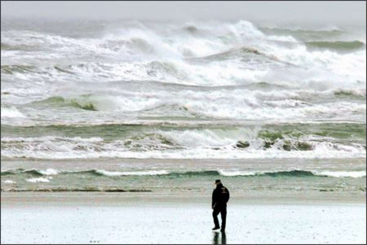
Storm Watching, Winter Storms, Extreme High Tides, Flooding
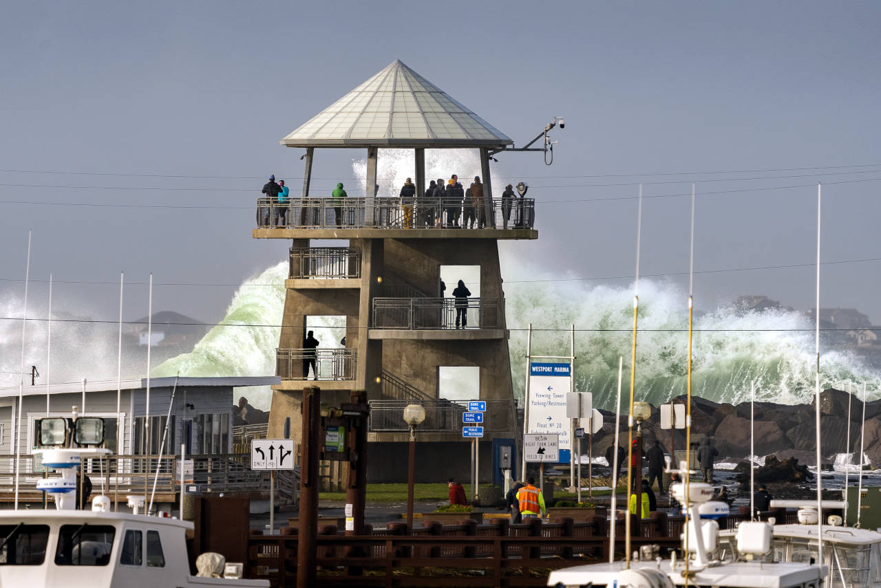
Storm Watching Article in The Daily News about a November 60 mph wind storm wave surge with photo of the Westport Tower by Greg Jacobs.
Where to Storm Watch on the Grays Harbor Coast and Tips for Storm Watching by Douglas Scott.
Twin Harbors Beaches are those sandy, wide, ocean facing beaches from Westport to Tokeland. Westport is on the south shore entrance to Grays Harbor and Tokeland is on the north shore entrance to Willapa Bay. Hence, the area is called "Twin Harbors." Midway Road Beach, Grayland Beach State Park, Twin Harbors State Park, and Westhaven State Park are all parts of the Twin Harbors Beaches Area. Clam season announcements refer to Twin Harbors regulations.
Swimming, Boogie Boarding, Wading, and Surfing
Cold ocean water all year. The average annual water temperature on the coast in Westport is 52�F. Summer high of 57�F in the surf.
The seasonal air temperatures are often too cold for wading, splashing, and playing in the crashing cold waves.
Only hardy and determined people can stay in this environment for long. Nearly all of the people doing these surf sports are wearing wetsuits.
No lifeguards. Unpredictable surf conditions. Rogue waves. Warnings at every beach road entrance that it is dangerous to get in the surf.
I've seen surfers at the south jetty at Westhaven State Park in Westport. I have seen some waders in the shallow surf and some boogie boarders in the summer from Long Beach to Ocean Shores.
The beaches are flat, sandy, and appear to give good footing. Surf pounds straight to sandy shores.
Sometimes, I will walk the sea shore in shallow water when exploring tide changes. I have Bogs muck boots for long walks and stays in the shallow surf. I also have used full waders when clam digging and surf fishing.
I have never waded, swam, body surfed, boogie boarded, or surfed in Washington or Oregon. The last time I body surfed was in 1997 at Bolsa Chica Beach and Huntington Beach, California.
Weather, Climate, Air, Clouds, Fog, Wind, Rain, Frost
Annual
Climate or Weather Patterns in Westport or Ocean Shores
in Grays Habor
| Month | High | Low | Rainfall Inches | Rain Days |
| January | 47 | 38 | 12 | 18 |
| February | 50 | 38 | 8 | 15 |
| March | 53 | 40 | 8 | 17 |
| April | 56 | 42 | 6 | 14 |
| May | 60 | 46 | 3 | 10 |
| June | 64 | 50 | 2 | 7 |
| July | 67 | 53 | 1 | 3 |
| August | 68 | 54 | 2 | 3 |
| September | 67 | 51 | 4 | 7 |
| October | 60 | 46 | 7 | 13 |
| November | 52 | 41 | 13 | 18 |
| December | 47 | 37 | 12 | 18 |
"Occasionally also termed "Cool-summer Mediterranean climate", this subtype of the Mediterranean climate (Csb) is a less common form of the Mediterranean climate. As stated earlier, regions with this subtype of the Mediterranean climate experience warm (but not hot) and dry summers, with no average monthly temperatures above 22 �C (72 �F) during its warmest month and an average in the coldest month between 18 and −3 �C (64 and 27 �F) or, in some applications, between 18 and 0 �C (64 and 32 �F). Also, at least four months must average above 10 �C (50 �F). Cool ocean currents and upwelling are often the reason for this cooler type of Mediterranean climate. The other main reason for this cooler type is the altitude. Winters are rainy and can be mild to chilly. In a few instances, snow can fall on these areas. Precipitation occurs in the colder seasons, but there are a number of clear sunny days even during the wetter seasons. Csb climates are found in in the Pacific Northwest (namely western Washington, western Oregon and southern portions of Vancouver Island in British Columbia." - Wikipedia
Current Weather Report and Week Ahead Predictions for Westport Westport averages 76 inches of rain each year. Westport Climate
The summer high in August is around 68 degrees. The winter low in January is 38. There are 127 sunny days in Westport. Westport gets some kind of precipitation, on the average, 193 days per year or 53% of the year. Precipitation is rain, snow, sleet, or hail that falls to the ground. Westport averages 1 inch of snow a year.
Average annual water temperature on the coast in Westport is 52�F, by the seasons: in winter 49�F, in spring 50�F, in summer 57�F, in autumn 54�F. Minimum water temperature (46�F) in Westport it happens in March, maximum (59�F) in August.
Westport
Westport Population: 2,100 SS
Google Map
Images
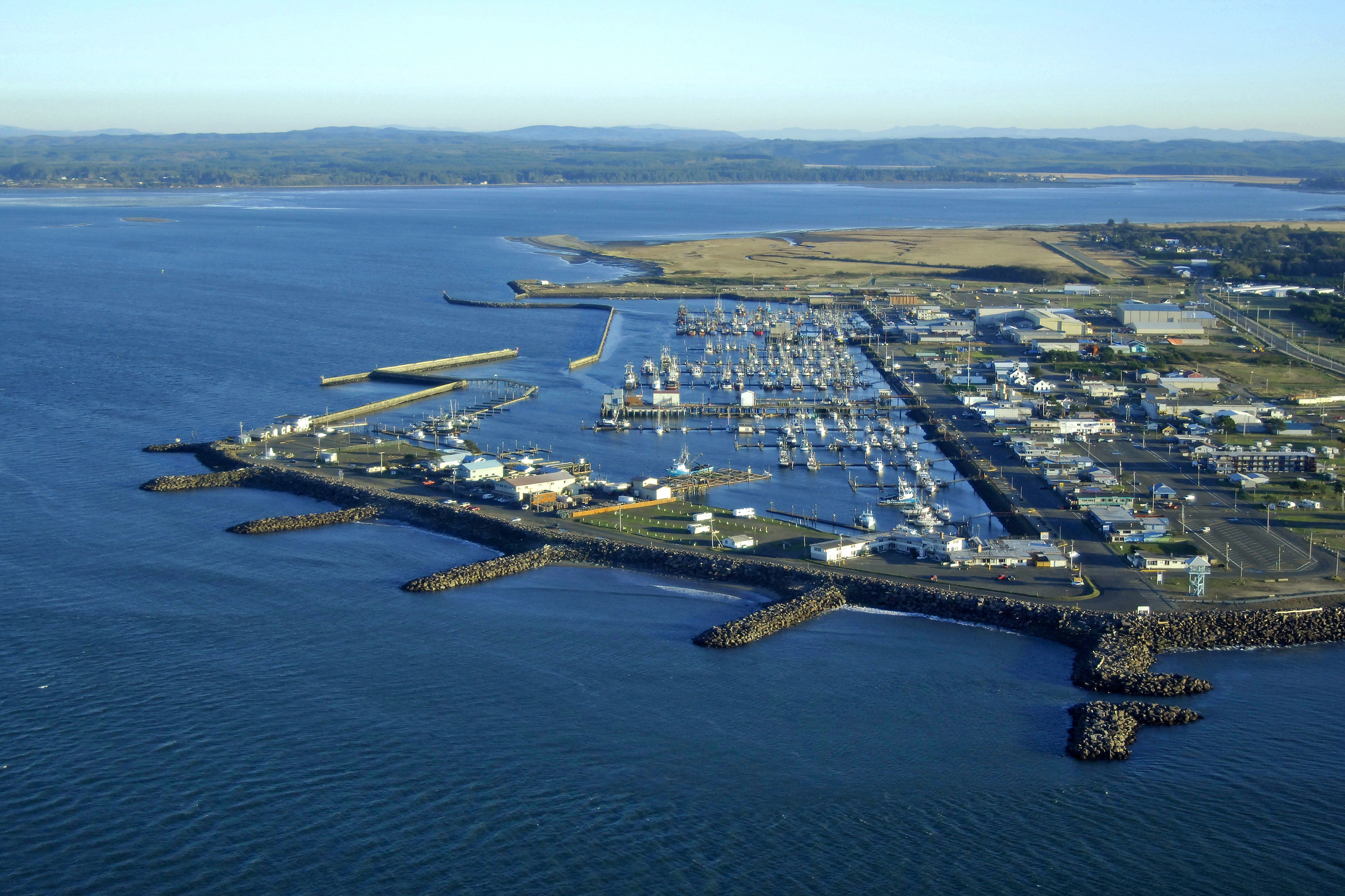
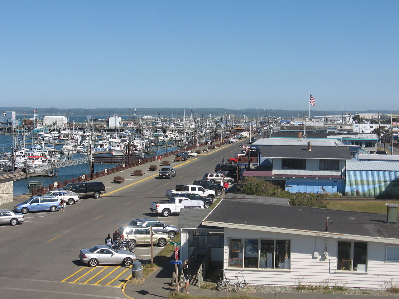
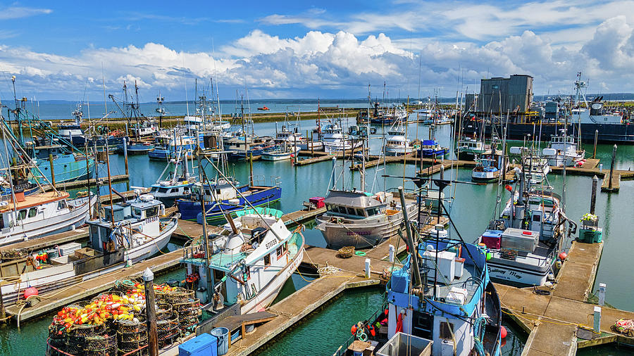
Westport is a busy small fishing port. The marina features a long wide boardwalk, many gift and food shops on Westhaven Drive, and many beautiful boats moving in and out of the docks. There are many jetties and rock groins that were built to protect the Westport Harbor area. Around the marina are many cabins, motels, and RV parks. Warehouses and fish processing plants set a backdrop for the marina. There is fishing from the south jetty, harbor jetty, boardwalks, docks, and a quite long pier. In this area is a dramatic four story observation tower, lighthouse and a maritime museum.
Westport Weather: Current Weather Report and Week Ahead Predictions for Westport Westport averages 76 inches of rain each year.
The marina features many highly regarded charter fishing boats and
services.
Westport Charter Fishing Services
Images of charter fishing out of Westport.
I've read that some boats
charter out for whale watching and bird watching. Back in the
1890's, Westport Harbor welcomed sea vessels hunting whales.
Westport Marina is the largest on the Pacific Coast of Washington.
"Westport is the "sports fishing capital of the world" and can be quite busy during the summer salmon, halibut, and albacore tuna season. Salmon fishing is also done in the boat basin as is crabbing for Rock and Dungeoness Crabs. Surf fishing for Sea Perch occurs along the southern beaches and jetty fishing for Sea Bass, Greenling, Perch, and Ling Cod is common. Whale watching trips both inside the harbor and on the ocean are popular from early March through May." - Bob Morse
South of the Westport marina is Montesano Main Street with services, supplies, supermarket, banks, stores, cafes, coffee, churches, schools, library, medical, motels, etc., all for a working class city of 2,100 people.
There is surfing and boogie boarding at the south jetty. Westhaven State Park. Picnic areas, restrooms, beachcombing, surf fishing, beach trails, surfing.
The majority of the in-land homes and apartments are older, smaller, showing the effects of the sea climate, and humbler. Small is beautiful, and affordable for family median incomes of $41,000. A few large beautiful homes and big condominiums in prime high dune locations overlooking the sea near the Lighthouse area.
I tent or yurt camp at Grayland Beach State Park, and sometimes at the larger Twin Harbors Beach State Park. Both are close to Westport.
Westport is 25 miles southwest from Aberdeen. Westport is 33 miles north of Raymond. Westport is 6 miles north of the Grayland Beach Community.
You are allowed to drive safely, weather and tides permitting, on the "driveable beach" from the Westport Lighthouse to Grayland's Cranberry Beach Road.
On a clear day you can see across the bar of Grays Harbor (5 miles) to the many large condominiums, large expensive homes, big hotels and extensive development on Ocean Shores that were built after 1990. Also, from the Westport tower you can see off into the north the the Quinault River mountain ranges.
Westport Sightseeing An extensive hypertext Visitor's Guide to Westport
Westport - Birding and Activities
Westport: Grays Harbor Lighthouse State Park A long paved bike path connects to light house, Westhaven and Westport docks.
Westport: Maritime Museum
Westport - A History By Kate Kershner
Westport: Pier, Float Dock 20, Fisherman's Boardwalk Images
Westport SEE ALSO Fishing, Clam Digging, Cranberries, Crabbing, Jetties, Kites, Beachcombing
Westport Lodging Chateau Westport Resort is the largest. Plenty of RV parks, B&B, and homes for rent.
Westport: Things to Do
Activities
Westport: Twin Harbors State Park
Westport: South Jetty Fishing SS
Westport Winery and Garden Resort SS 13 miles east of Wesport on WA105
Westport Weather: Current Weather Report and Week Ahead Predictions for Westport Westport averages 76 inches of rain each year.
The River Pioneers: Early Days on Grays Harbor. By Edwin Van Syckle. Pacific Search Press and Friends of the Aberdeen Public Library, 1982, index, 423 pages. FVRL. Excellent coverage of the life of Indians in the area, the development of the area from 1820-1920, geography, settlement locations, noted pioneers, economy, etc. Nice photographs from the era. Mr. Van Syckle was writer and editor for the Aberdeen Daily World newspaper for 50 years.
Nearby Attractions for Westport
Bottle Beach State Park Near Westport SS Bird Watching Area, Mudflats, Swamps
Grayland Beach State Park 6 miles south of Westport. Beach access, picnic, restrooms. My Campsite by the Sea!
Johns River Wildlife Area Images Near Westport SS History Game Farm Road off 105 Walking trails, boat launch, river estuary
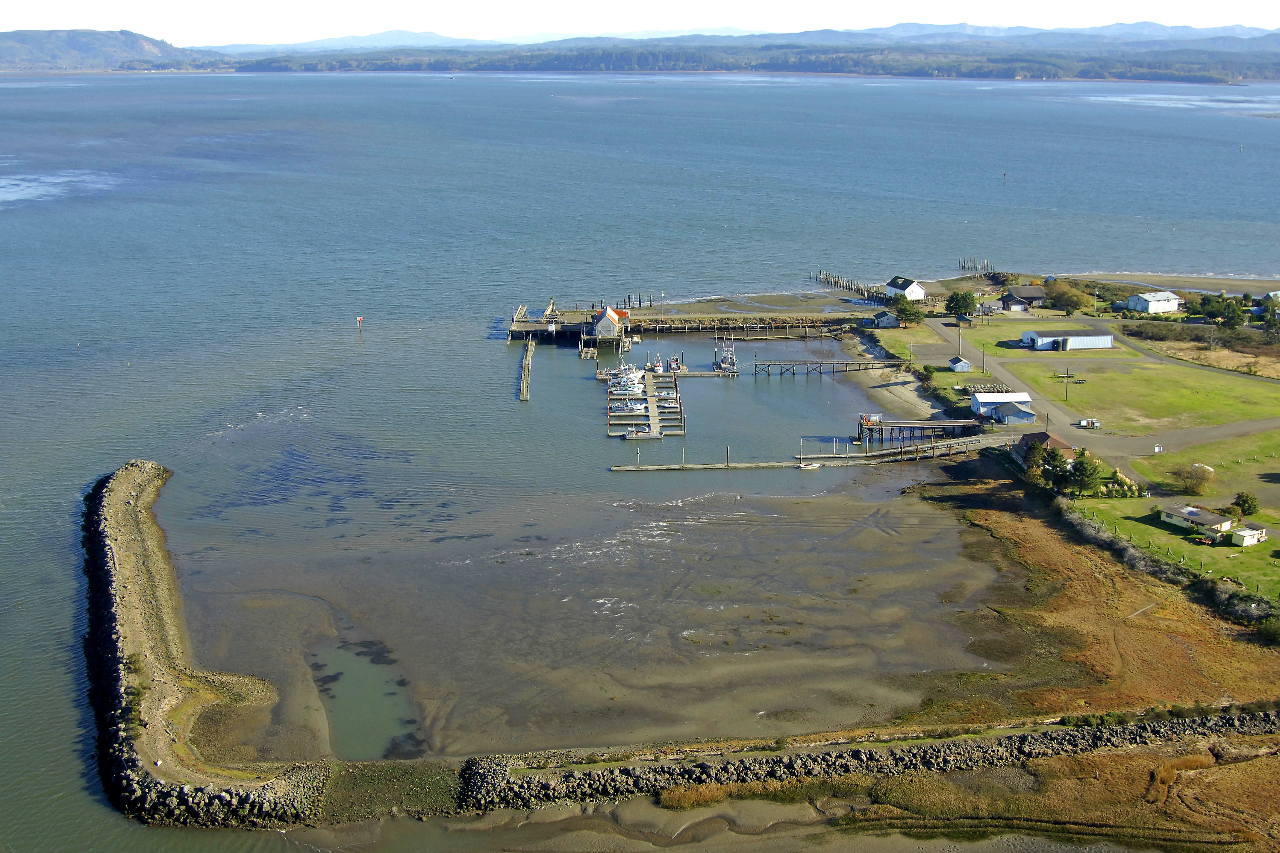
Tokeland Population 200 Willapa Bay Images Small harbor, boat ramps, jetty, RV parks. Shoalwater Casino. Restaurant. Historic hotel.
Day Trips from Westport [Round Trip]
Aberdeen Area 60 miles
Ocean Shores Area 96 Miles
Quniault Lake and Quinault Rain Forest Area 150 miles
Raymond and South Bend Area 90 miles
Tokeland Population 200 Willapa Bay North Images Small harbor. Pier. Boat launch. Jetty.
Tokeland Hotel Open since 1885.
The Wandering Goose Restaurant (Breakfast at 8 am, Dinner at 5) in the Tokeland Hotel
Georgetown Station Gas and Food
WA Road 105 at Shoalwater Indian Casino. Gas station, food store, cafe, history gallery, casino.
Tokeland: Nelson Crab: Specialty Market; Offering local canned tuna, salmon, and dungness crab, etc. Wines, gifts.
Willapa Bay National Wildlife Refuge Images
Shoalwater Indian Reservation Library FVRL outlet. Culture
Shoalwater Indian Reservation Casino Images
"In the days before European settlement the shores of Shoalwater Bay were a mix of a bountiful natural environment and many native villages. The north end of the bay around the present day reservation was populated predominantly by Lower Chehalis speaking peoples. The Southern end of the bay, near present day Bay Center and southward was inhabited by Willapa Chinook peoples. The original territory of the Shoalwater Bay peoples was a vast network of waterways along the coast. For the Lower Chehalis Shoalwater�s village of �Naaphs Chaahts� (today�s reservation) was the southern tip of the territory. From there it extended northward to �ts-a-lis� the lower Chehalis word for Westport, meaning �place of sand�. Early explorers pronounced the word �Chehalis� and gave this name to the river and the people living up river who later became the Chehalis tribe. From Westport the territory went east up the Chehalis river to present day Satsop, Washington." Source
North Cove Parking Area on WA105, Northcove Beach Access
Smith Anderson Road leads to many beautiful cranberry bogs.
Seashore Conservation Area State Park near North Cove or Tokeland
Old Highway 105 into former North Cove
Beach Driving Access = A paved and/or gravel road leading to the drivable beach area.
Warrenten Cannery Road Beach Driving Access Very long sand dunes and beach, dry sand road, sketchy access and warnings.
Midway Beach Road Beach Driving Access
Grayland Community
Grayland Beach State Park It is 10 miles from Grayland SP to the Westport Marina.
Cranberry Beach Road Beach Driving Access Restrooms, picnic area
Grayland Beach Oba State Park Walking Beach Access
Bonge Ave Beach Driving Access
General Notes by Mike Garofalo about Willapa Bay:
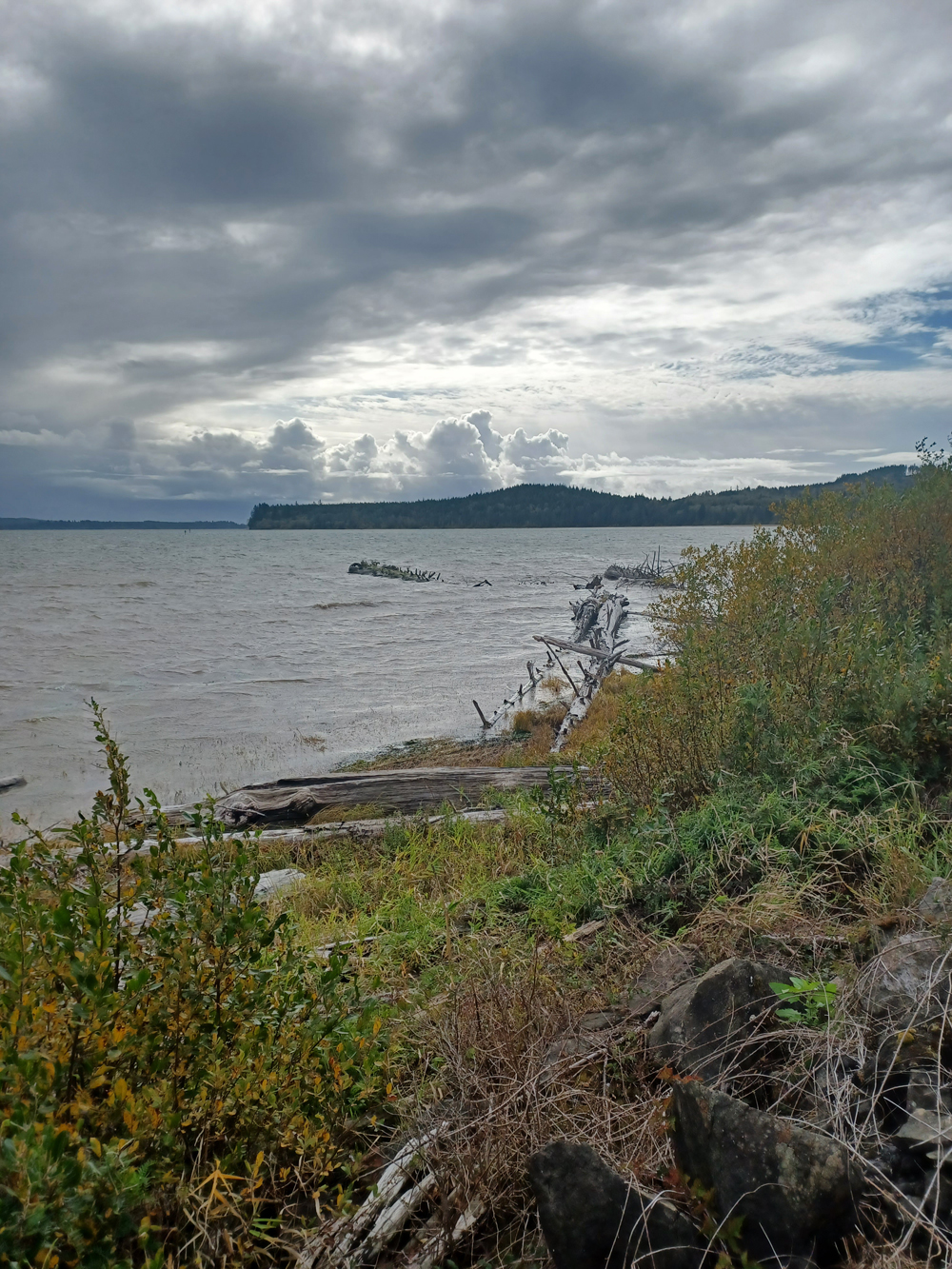
Willapa Bay
Willapa Bay Information, Travel, Guides, Driving Tours, Towns, Highlights, Coastal Activities
Willapa Bay Images WB
Willapa Bay is in Pacific County with a Population of 20,920.
Willapa Bay: Willapa Hills
Willapa Bay: Detailed Map
Willapa Bay
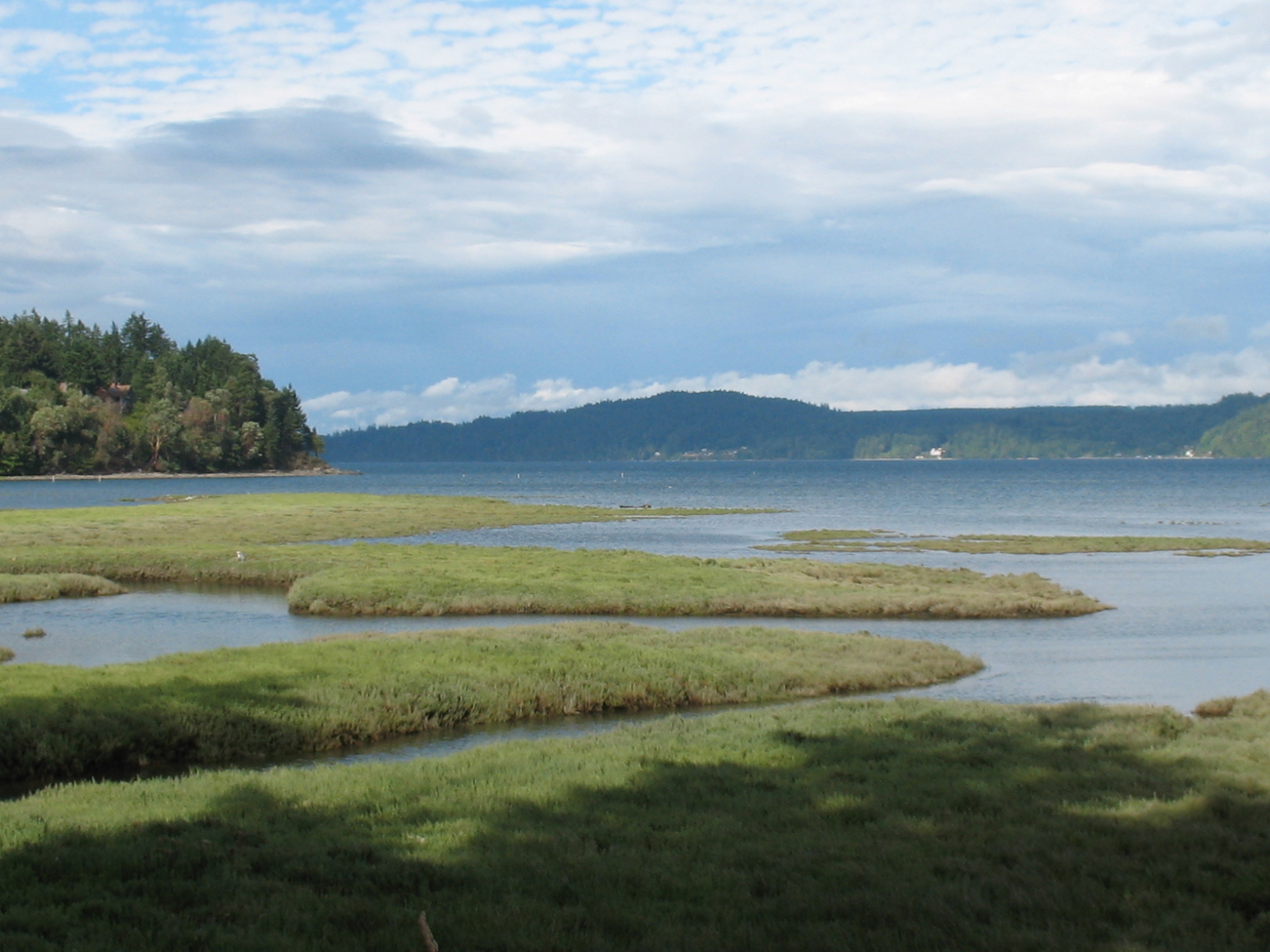
Estuaries
There are many estuaries
at the mouths of the various rivers that flow into
Willapa Bay, and the Bay itself is an estuary.
Maps of Grays Harbor and Willapa Bay
Comments, Notes, Topics, Introduction
Yurt Camping at Pacific Northwest Beaches
Solo and Couple Yurt Camping During the Off-Season
(October-May)
Four Days in Grayland
By Michael P. Garofalo
Part I: Southwestern
Coastal Washington
Grays Harbor, Willapa Bay, Long Beach Peninsula, Lower Columbia River,
Oregon
A Traveler's Hypertext Notebooks, Studies, Guides, and Resources
Part II: Grayland Beach
A Coastal Yurt Camper's Hypertext Notebook
Studies, Readings, Activities, Seasons, Information, and Tips
Part III: Doing and Seeing
Photographs, Blog Posts, and Reports from 2021-2022
The Four Days in Grayland Series began in September, 2021.
Southwestern Washington
Notebooks
Lower Columbia River (North Side) from Ilwaco east to Camas
Olympia
to Vancouver, Interstate 5 Corridor South
Northwest Coastal Oregon: Astoria to Cape Lookout
Yurt
and Cabin Camping in the Coastal Northwest
Counties in Southwestern Washington
Bibliography, Reading Lists, Sources, Links, Documents
Four Days in Grayland Homepage
Alphabetical Index to
Four Days in Grayland
Bay Center, WA: Yurt Camping, KOA
Boating, Charter Boats for Fishing or Tours (Westport, Ilwaco, Aberdeen, Astoria)
Agate Hunting, Coastal Geology, Rock Hounding
Berries, Cranberries, Wild Berries, Berry Foraging
Beverly Beach State Park, Depoe Bay, OR: Yurt Camping
Bibliography - General Information for Traveler's and Campers
Blog Reports of Monthly Yurt Camping Trips
Boat Usage, Kayaking, Canoeing
Books, Suggested Reading, Best Books
Bullard's Beach State Park, Bandon, OR: Yurt Camping
Cape Disappointment State Park, Ilwaco, WA: Yurt Camping
Charter Boats for Fishing and Tours (Westport, Ilwaco, Aberdeen, Astoria)
Population 425,000 Cities: Vancouver, Camas, Washougal, Ridgefield, Battle Ground By Michael P. Garofalo. Blogging since 2005.Columbia River from Ilwaco to Vancouver, WA
Columbia River Gorge, WA and Oregon
Counties in Southwestern Washington
Population 102,000 Cities: Longview, Kelso; Columbia River, Mt. St. Helens, Cowlitz River, CascadesCranberries, Wild Berries, Berry Foraging
Day Picnics and Day Camping at the Beach
, Beachcombing, Agate Hunting, Sea Shell GatheringDriving on the Beach in Washington
Driving Tour #1: Longview to Westport, WA
Facebook of Michael P. Garofalo
, Beachcombing, WalkingFort Stevens State Park, Astoria, WA: Yurt Camping
Four Days in Grayland Photographs and Blog Posts (Most Recent First)
, Rock Hounding, Agate Hunting : Camping in Yurts or Small Cabins, Camping ComfortsGood Books, Reading Lists, Bibliography
Gorge of the Columbia River, WA and Oregon
Grayland Beach State Park, Westport, WA: Yurt Camping
Population 74,000 Cities: Aberdeen, Hoquiam, Westport, Montesano Hypertext Notebooks of Michael P. GarofaloHiking Quotations, Sayings, Poems
Indians, Native Peoples in the Area
Information, Bibliography, Reading, Resources
Interstate 5 Travel Corridor from Olympia to Vancouver, Driving South
Population 75,000 Cities: Centralia, ChelaisLogging and Timber Mills Industry
Lower Columbia River from Ilwaco East to Washougal, WA
Marinas and Docks: Westport, Tokeland, South Bend, and Ilwaco, WA
Months and Seasonal Activities
Native Peoples in the Coastal Southwestern Washington and Coastal Oregon
Native Peoples, Lower Columbia River, North Side - Bibliography
Native Peoples Northwest - Bibliography
Nehalem Bay State Park, Manzanita, OR: Yurt Camping
Northwest Coastal Oregon: Astoria to Cape Lookout
Olympia south to Vancouver, Interstate 5 Travel Corridor, WA
, From Astoria to Cape Lookout, Highway 101Pacific Beach State Park, Copalis, WA: Yurt Camping
Population 23,000 Cities: Raymond, South Bend, Long Beach, Ilwaco of Monthly Yurt Camping TripsQuinault River, Quinault Lake, Quinault Rain Forest, WA
Reading, Information, Bibliography, Resources
Reading, Bibliography - General Information
of Monthly Yurt Camping Trips , Agate Hunting, Coastal Geology , Beachcombing, Agate Hunting (Clams, Mussels, Oysters) and SeaweedSouth Beach State Park, Newport, OR: Yurt Camping
Southwestern Washington - Notebooks, Studies, Travel
Southwestern Washington Home Alternate A
, String Games and Play (he he)Studies in Southwestern Washington
Swimming, Boogie Boarding, and Surfing
Timber Industry, WA and Oregon
Tour Driving #1: Longview to Westport, WA
Twin Harbors State Park, Westport, WA: Yurt Camping
Videos from some Yurt Camping Trips
Population 4,000 Cities: Cathlamet, SkamokawaWalking Quotations, Sayings, Poems
Washington - Southwestern - Travel
Willapa Bay - Bibliography, Resources, Reading, WA
Yurt Camping Reports
A Brief Biography of Michael P. Garofalo
This webpage was last modified, revised, reformatted, improved, or updated on May 1, 2022.
This webpage (Grays Harbor and Willapa Bay) was first published on the Internet on October 1, 2021.
2017-2022 Vancouver, Clark County, Columbia River Valley, Washington, WA
Portland, Portland
Metropolitan,Willamette River Valley
City of Vancouver, Washoughal, Camas, Ridgefield, Woodland, Columbia River
Valley, Kalama, Longview,
Battle Ground, Lewis River Reservoirs, Randle, Cougar, Yakima,
1998-2017 Red Bluff, Tehama County, North Sacramento Valley, California
Red Bluff, Tehama County,
North Sacramento Valley, Northern Central California, U.S.A.
Cities in the area: Oroville, Paradise, Durham, Chico, Hamilton City, Orland,
Willows,
Corning,
Rancho Tehama, Los Molinos, Tehama, Proberta, Gerber, Manton, Cottonwood,
Anderson, Shasta Lake, Palo Cedro, and Redding, CA, California.
Walking - The Ways of Walking - Homepage
Paths to Fitness and Well Being
Cloud Hands: Taijiquan, Bagua, Xing Yi, Swordsmanship
� Green Way Research, Vancouver, Washington, 2017 -
Green Way Research, Red Bluff, California, 1998-2017

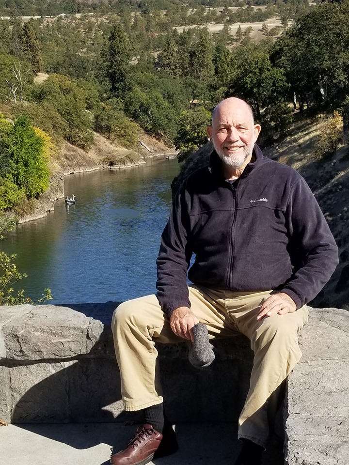
Mike Garofalo at the Klickitat River in Southwest Washington, 2019
Return to the Alphabetical Index of Mike Garofalo's Hypertext Documents