Cape Disappointment Ilwaco Chinook Naselle Skamokawa
Cathlamet Longview Cowlitz River Kelso Kalama
Woodland Lewis River Ridgefield Vancouver
Clark County Camas Washougal Columbia Gorge
Cloud Hands Blog
Bibliography
Four Days in Grayland
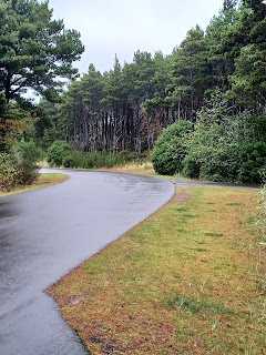
Cape Disappointment State Park near Seaside and Ilwaco, Washington. I've camped at the state park before, and stayed at a motel and cabin in Seaside. We attended the kite festival in Seaside in August of 2018. I once went to the emergency hospital in Ilwaco in 2017.
Cape Disappointment State Park CR Camping, Yurts, Fishing, Trails Images
Cape Disappointment Lighthouse In operation since 1856.
Cape Disappointment Weather
Lewis and Clark Interpretative Center History Wikipedia
Discovery Bicycling and Walking Trail
Fort Canby State Park is the old name for Cape Disappointment State Park
Travel Adventure and Ghost Tales and History
"Cape Disappointment State Park (formerly Fort Canby State Park) is a public recreation area on Cape Disappointment, located southwest of Ilwaco, Washington, on the bottom end of Long Beach Peninsula, the northern headlands where the Columbia River meets the Pacific Ocean. The state park's 2,023 acres (819 ha) encompass a diverse landscape of old-growth forest, freshwater lakes, freshwater and saltwater marshes, and oceanside tidelands. Park sites include Fort Canby, the Lewis and Clark Interpretive Center, North Head Lighthouse, and Cape Disappointment Lighthouse.[2] Cape Disappointment is one of several state parks and sites in Washington and Oregon that are included in Lewis and Clark National Historical Park.[3]"
Four Days in Grayland by Michael P. Garofalo. Travels in Southwestern Coastal Washington State.
Ilwaco Population 1,200. City and marina on north shore of the Columbia River nearest to the Pacific. On shallow Baker's Bay.
Work on the north jetty at the mouth of the Columbia River Bar began in 1915. Work on the south jetty at the Columbia in Oregon began in 1885.
Illwaco NOKSKA'ITMITHLS (Chinook Name) On the Columbia River at Cape Disappointment and Baker's Bay
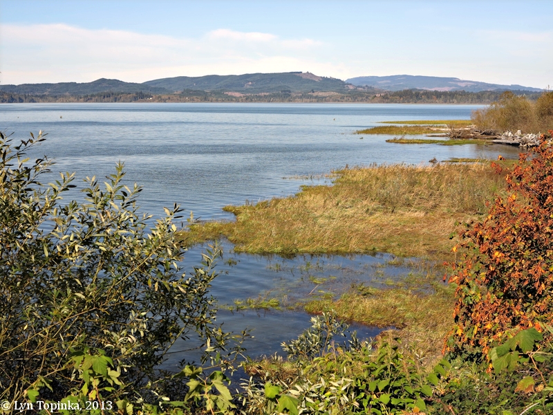
Chinook River
Chinookan Peoples of the Lower Columbia. Edited by Robert T. Boyd, Kenneth M. Amers, and Tony A. Johnson. University of Washington, 2015, 464 pages.
Ilwaco Images Boardwalk Wildlife
American Indian Place Names in Washington
Ilwaco Cape Disappointment State Park CR Camping, Yurts, Fishing, Trails
Discovery Bicycling and Walking Trail
Ilwaco Fishing Charter Boats Images
"Ilwaco: this town was named for the son-in-law of Chinook Chief Comcomly, Elowahka Jim which then became Ilwaco. ... The name �Mukilteo� means �good camping ground.� Nahcotta: this community is named for Chinook chief Nahcati who was friendly with the American settlers when the town was established in 1888."
Ilwaco: Jetty Fishing Pier Fishing Dock Fishing
Ilwaco Library TRLS
Ilwaco: Port of Ilwaco
Ilwaco Ocean Beach Hospital
Ilwaco Museum: Columbia Pacific Heritage Museum and gift shop.
Ilwaco: Baker's Bay
Ilwaco - Chinook Indian People
Steamboats on the Lower Columbia River from 1850-
Columbia River Boat Cruising Guide
Ilwaco Railway and Navigation Company
Ilwaco Shopping
Ilwaco: Images of Port and Docks
Ilwaco Things to Do in Ilwaco
Ilwaco Long Beach Peninsula
Four Days in Grayland by Michael P. Garofalo. Travels in Southwestern Coastal Washington State.
Chinook - Wikipedia Population 450. Images
Chinook: Travel Port Port-Estuary
Chinook: Baker's Bay Gray's Bay
Chinook Food Columbia River Road House Old Fishtrap Seafood and Spirits
Chinook Dock Boat Launch
Naselle: Naselle River Images Store Gas Inland from the Columbia River. The Naselle River flows into the south end of Willapa Bay
Naselle Library TRLS
Naselle is about six miles east of the junction of US101 and WA4. Junction of US101 and WA4. Johnston's Landing. Along the wide Naselle River valley, and near the bridge over the Naselle River. The Naselle River flows into the south end of Willapa Bay. Parking near the bridge. 62 miles east of Exit 39/I5.
Fort Columbia Historical State Park South of Naselle
Megler-Astoria Bridge South of Naselle
Chinook Village
Junction of US101 and WA4. Johnston's Landing. Along the
wide Naselle River valley, and near the bridge over the Naselle River.
The Naselle River flows into the south end of Willapa Bay. Parking
near the bridge. 62 miles east of Exit 39/I5.
Junction of WA4 and WA401. Head south on WA401 if you want to get to the Ilwaco/Astoria Bridge.
Skamokawa Images Population: 150 people. Market.
The road WA4 turns inland from Skamokawa most of the way to Naselle.
You will be driving through the forests of the Willapa
Hills.
Evidence of logging is everywhere.
Vista Park Kayaking B&B Campground at Vista Park, yurts, boat ramp, playgrounds, yurts.
Skamokava Museum
Julia Butler Hansen National Wildlife Refuge Images Large refuge for deer. Viewing Station. Beautiful low areas inland. Access to the shores of the Columbia River. GMM 34.
Columbian White-Tailed Deer National Wildlife Refuge Viewing Station.
Gray's River Valley
Gray's River Covered Bridge Some beautiful small river valleys in these areas along WA4.
Deep River Images Boat Launch
Rosburg Population 416 Store
Four Days in Grayland by Michael P. Garofalo. Travels in Southwestern Coastal Washington State.
Cathlamet Population 532 CR Images On WA4 Marina, ramp, cabins, fishing, stores, hotel, County Counthouse.
Wahkiakum Ferry Nearby ferry across the Columbia from Island to Westport, Oregon.
"Cathlamet: this town is named for the Cathlamet Indian tribe, a Penutian-speaking group linguistically and culturally related to the Multnomah, Clackamas, and Wasco-Wishram. The designation �Cathlamet� (also spelled �Kathlamet�) is said to mean �stone� in reference to the rocky course of the Columbia River in their traditional homeland."
Puget Island or Little Island Norwegian settlement.
Wahkiakum County Population 4,000 Cities: Cathlamet, Skamokawa, Grays River. The County courthouse is in Cathlamet.
Columbia River Boat Cruising Guide
Julia Butler Hansen (1907-1988) From Cathlamet: Washington State Legislator, U.S. Congresswoman (second woman Democratic Congresswoman elected).
Julia Butler Hansen National Wildlife Refuge Images Large refuge for deer. Viewing Station. Beautiful low areas inland. Access to the shores of the Columbia River. GMM 34.
Longview
Population 37,520
Images CR
By the Cowlitz River (the boundary between Kelso and Longview) and the Columbia River.
Kelso is part of the Longview, Washington Metropolitan Statistical Area, which has a population of 102,410.
Steamboats on the Lower Columbia River from 1850-
Sacajawea Park and Japanese Gardens
Lewis County Population 76,000 County Seat in Chelais.
Lewis and Clark Bridge over the Columbia River from Longview to Rainer, Oregon. Built in 1930.
Trip from Longview to Westport Photos and Information
Cowlitz Indian Nation Offices and Services
Columbia River Boat Cruising Guide
Four Days in Grayland by Michael P. Garofalo. Travels in Southwestern Coastal Washington State.
Interstate 5 Travel Corridor, Olympia to Longview
Lower Columbia River, North Side, Ilwaco to Washougal
Urban Trails in Vancouver, Washington: Longview, Battle Ground, Camas, Yacolt. By Craig Romano. Seattle, Mountaineers Books, 2020, index, 221 pages. VSCL. Book.
Kelso City Population 12,975 Images Full Services Many industries and commercial buildings by the Copwlitz.
Kelso Business at Interstate 5 Exit 39.
Cowlitz River 105 miles long
"Built on the site of the Cowlitz Indian village of Tiahanakshih, the area that became Kelso was settled in 1847 by Peter Crawford, a Scottish surveyor who laid out the town site in 1884 and named it for his hometown in Scotland. The city's economy is based chiefly on lumbering, fishing, dairying, and fruit growing."
"When the smelt spawn in the Cowlitz River, the gulls go into a feeding frenzy that lasts for weeks. Kelso, Washington is known as the "Smelt Capital of the World"
Smelt Fish The eulachon (Thaleichthys pacificus) found in the Northeast Pacific and adjacent rivers,
Story of poor smelt run on the Cowlitz on March 1, 2017.
Cowlitz River 105 miles long. "The Cowlitz River is a river in the state of Washington in the United States, a tributary of the Columbia River. Its tributaries drain a large region including the slopes of Mount Rainier, Mount Adams, and Mount St. Helens. The Cowlitz has a 2,586-square-mile (6,698 km2) drainage basin,[5][6] located between the Cascade Range in eastern Lewis County, Washington and the cities of Kelso and Longview. The river is roughly 105 miles (169 km) long, not counting tributaries. Major tributaries of the Cowlitz River include the Cispus River and the Toutle River, which was overtaken by volcanic mudflows (lahars) during the May 1980 eruption of Mount St. Helens."
Cowlitz River 105 miles long
Cowlitz Prairie, Cowlitz Farm, Cowlitz Landing and the Cowlitz Mission Cowlitz Landing on the Cowlitz River was the start of the overland route to Puget Sound.
Fort Cowlitz (1839-1860) Cowlitz Farm
Cispus River 54 miles long
"The Cowlitz River is a river in the state of Washington in the United States, a tributary of the Columbia River. Its tributaries drain a large region including the slopes of Mount Rainier, Mount Adams, and Mount St. Helens. The Cowlitz has a 2,586-square-mile (6,698 km) drainage basin,[5][6] located between the Cascade Range in eastern Lewis County, Washington and the cities of Kelso and Longview. The river is roughly 105 miles (169 km) long, not counting tributaries. Major tributaries of the Cowlitz River include the Cispus River and the Toutle River, which was overtaken by volcanic mudflows (lahars) during the May 1980 eruption of Mount St. Helens. ajor tributaries of the Cowlitz River include the Cispus River and the Toutle River, which was overtaken by volcanic mudflows (lahars) during the May 1980 eruption of Mount St. Helens."
Dams on the Cowlitz River: Mossy Rock Dam and Riffe Lake/Reservoir, Mayfield Dam and Mayfield Lake, Packwood Dam and Packwood Lake.
Kalama City
Images Population 2,400 Stores,
gas, motel, cafe, antiques, services.
Adjacent to Interstate 5 with three freeway exits. South of Longview.
Kalama River Images 45 miles long.
"On Monday, December 22, 1919, a group of Kalama residents meets at the Kalama Business Men�s Club to discuss the formation of a port district. Kalama is located in Cowlitz County in Southwestern Washington, north of Vancouver. After circulating petitions and holding a hearing, Port of Kalama will be formed in an election held on March 17, 1920. Kalama citizens will elect Hite Imus, J. G. Gruver, and F. L. Jenkins as commissioners. The Port of Kalama boasts access to the Columbia River, a railway, and later (1950s), Interstate 5. In the 1920s, the Port will lease property to tie mills, shingle mills, and other timber operators. In the 1960s, it will become a focal point for the area�s wheat industry, leasing a new grain terminal to North Pacific Grain Growers Inc. The Port will also provide the site for a phenol plant for Dow Chemical. In the 1980s, the Port will build its second grain terminal, bringing Peavey Grain Company to Kalama. In 2009, the Port of Kalama�s more than 20 industrial tenants will employ some 900 people."
Lewis County Population 76,000 County Seat in Chelais.
McMenamins Restaurant and Hotel
Columbia River Boat Cruising Guide
Kalama Riverbank Park Picnic, fishing, totem poles, restrooms, grass, paved walking trail on the dyke
Blog Posts to the Cloud Hands Blog by Mike Garofalo regarding travel adventures in Washington State.
Woodland Area and the Lewis River
Woodland City Population 5,600. Images Adjacent to Interstate 5. A full range of stores, services, markets, motels, etc.
Woodland, Washington.
Lewis River dams and reservoirs east of Woodland. This river is 95 miles long. "The North Fork is impounded for hydroelectricity and flood control in its middle course by Swift Dam, forming Swift Reservoir; Yale Dam, forming Yale Lake; and Merwin Dam, forming Lake Merwin.
La Center City Population 2,800
La Center Bottoms Natural Area, Clark County, Washington. Near the town of La Push.
Lewis River Gifford Pinchot National Forest
Cowlitz Indian People Some tribal services in La Center
Cougar Population 122
Blog Posts to the Cloud Hands Blog by Mike Garofalo regarding travel adventures in Washington State.
Paradise Point State Park, Clark County. Near the Ilani Casino. Located along the Lewis River. Interstate 5 nearby makes noise. Camping, hiking, swimming, fishing.
Battle Ground Lake
State Park, Clark County, Washington. Campground, yurts, lake fishing,
hiking.
Moulton Falls is popular. Images.
Lewisville Park, a Clark County Regional Park, is just a few miles north of the City of Battle Ground - a lovely riverside park. [I once watched at this park a few people being Baptized in the river on a summer day.]
Clark County Fairgrounds and Event Center
Clark County, City of Vancouver, Washington. Local travel for us. We live in the unincorporated northeast area of Vancouver, the Orchards area. Fort Vancouver was established in 1825. Washington became a State in 1889. The new Vancouver Grand Street Pier and Waterfront.
Blog Posts to the Cloud Hands Blog by Mike Garofalo regarding travel adventures in Washington State.
Orchards Community Park, Clark County A nearby (2.5 miles away) park where I walk in the forest. A nice circular path takes about 25 minutes of walking to complete.
Parks in Clark County, Washington Alphabetical List.
Vancouver Lake Regional Park, City of Vancouver, Clark County
Clark County, Washington. GM Johnson City Map Series. Vancouver, B.C., 2015, 2017. ISBN: 978-1-770684300. VSCL. I have one copy for home use, and I keep another copy in the Ford. This is an excellent map for the County in which we now live. An essential tool. A traditional folding map. Good detail on backcountry roads.
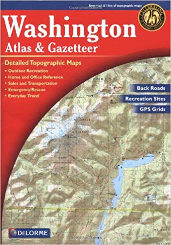
Washington: DeLorme Atlas and Gazetter. Detailed topographic maps, back roads, recreation sites, GPS Grids. Yarmouth, Maine, DeLorme Publications, 2016, 12th Edition. Indexes, 104 pages. ISBN: 0-89933329X. VSCL. An oversized map book. I keep this map in my Ford Explorer. An essential tool for travelers. Very convenient to use.
Yacolt Population 1,796 Basic services
Amboy Population 1,608 Basic services
Lewis River Gifford Pinchot National Forest
Ridgefield City
Images Population 4,700 The small town
is on a bluff above the lowlands by the Columbia River.
Ridgefield - Chinook House Cathlapotle Plankhouse
Cathlapotle and its Inhabitants 1792-1860. By Robert Boyd. U.S. Fish and
Wildlife Service, Portland, Oregon, 2011. Index, 209 pages, many maps and
charts, place name index, detailed bibliography, art work. FVRL. Fascinating
study of native people living the area from For Vancouver to Ilwaco, on both
sides of the lower Columbia River. I believe there is also one plankhouse
reconstructed at Fort Stevens State Park in Oregon. I visited Native
American plankhouses and shelters in Northern California at Patrick's Point
State Park.
Ridgefield National Wildlife Refuge, Ridgefield, Clark County This large refuge includes an auto tour through the wetlands, sloughs, bogs, and lowlands along the Columbia River. A few trails from this road are open only in the summer. Many birds winter here. A second area of the refuge consists of a walking path over the railroad, a reconstructed Chinoon style plankhouse, and many walking trails through these lowlands (soaked in winter).
Ridgefield Information and Travel
Ridgefield Marina On a slough of the Columbia. Kayak rentals, small boat launch, mooring, picnic tables, fishing, restrooms, parking lot.
Blog Posts to the Cloud Hands Blog by Mike Garofalo regarding travel adventures in Washington State.
Vancouver, City,
Washington
Images Population 187,000. Incorporated city
in 1857.
Karen and I have lived in the City of
Vancouver, in Clark County, in the Southwestern area of the State of Washington,
since April of 2017.
We live in the unincorporated northeast area of Vancouver: Orchards, Five
Corners, Sunset, Brush Prairie.
I write about these short travel adventures in my Cloud Hands Blog.
Follow the adventures by the Category Labels: Oregon, Southwestern Washington, Washington, Travel, Camping, Yurt Camping, and Four Days in Grayland.
Columbia River Renaissance Trail, Vancouver, Clark County
Feral Heathen Restaurant, Brewery, Catering, Winery, Event Housing and Center. My son is the Executive Chef at the Feral Heathen.
Fort Vancouver Public Library, Vancouver, Washington
"The Vancouver area was inhabited by a variety of Native American tribes, most recently the Chinook and Klickitat nations, with permanent settlements of timber longhouses.[7] The Chinookan and Klickitat names for the area were reportedly Skit-so-to-ho and Ala-si-kas, respectively, meaning "land of the mud-turtles".[8][9] First European contact was made by William Robert Broughton in 1792,[10][11] with approximately half of the indigenous population dead from smallpox before the Lewis and Clark Expedition camped in the area in 1806.[7] Within another fifty years, other actions and diseases such as measles, malaria and influenza had reduced the Chinookan population from an estimated 80,000 "to a few dozen refugees, landless, slaveless and swindled out of a treaty".[7]"
Clark County Historical Museum
Vancouver Port Developed in 1912.
Fort Vancouver National Historical Monument Site
Fort Vancouver (1825-1850)
Vancouver (1850-1930)
Vancouver (1930-1960-)
Vancouver (1960-)
Portland, Oregon, is directly across the Columbia River from Vancouver, Washington. You cross the Columbia River on either the old metal drawbridge on Interstate 5 or the large concrete bride on Interstate 205. Both cities have large ports and commercial and industrial buildings on the Columbia.
Fort Vancouver National Historical Monument Site
The first successful agricultural enterprise in the Northwest started in 1825 at Fort Vancouver. The Hudson Bay Company established and operated this growing community on the shores of the Columbia River. They raised enough grain and vegetables and fruits (apples) to export. They started the first herds of horses, cattle, pigs, goats, ducks, sheep, etc. Unfortunately, the 1830's epidemics killed 90% of the Native Peoples on both sides of the Lower Columbia River. Fort Vancouver was the trade center for buying and selling the pelts of many animals killed by hunters; and exporting them to China and Boston. They exported and imported via the Columbia River and the Pacific. Over 600 people were employed at Fort Vancouver. They used the many wide and flat areas around Vancouver for agricultural and commercial development. European arts and crafts were integrated into daily life by the river. Vancouver and Portland began to emerge in the 1860's as major business, commercial and industrial centers, and both are still flourishing in 2022. The first ocean going sail and steamboats came to Fort Vancouver in 1836; and the Columbia steamboat made regular runs from Astoria to Fort Vancouver/Portland starting in 1850.
Fort Vancouver Site Friends Bookstore Friends of Fort Vancouver
Steamboats on the Lower Columbia River from 1850-
Three Creeks Salmon Creek Library FVRL
Blog Posts to the Cloud Hands Blog by Mike Garofalo regarding travel adventures in Washington State.
Orchards Community Park, Clark County A nearby (2.5 miles away) park where I walk in the forest. A nice circular path takes about 25 minutes of walking to complete.
Cowlitiz Indian Nation Offices in Vancouver
Lewisville Park, Battle Ground, Clark County
Parks in Clark County, Washington Alphabetical List.
Proto-Cathedral of St. James the Greater Catholic Church
Clark County Courthouse is in Vancouver
Bicycling and Walking Trail Maps for Vancouver and Clark County
Walking Trails Map for Clark County
Vancouver Lake Regional Park, City of Vancouver, Clark County
Columbia River Boat Cruising Guide
Historical Highways from Vancouver to Castle Rock
Interstate 5 Travel Corridor, Olympia to Longview, Driving South
Lower Columbia River, North Side, Ilwaco to Washougal
Paul Kane's Great Nor-West. By Sheila Urbanek and Diane F. Eaton. UBC, 1995, 176 pages. Artist traveled to Fort Vancouver in 1845.
Urban Trails in Vancouver, Washington: Longview, Battle Ground, Camas, Yacolt. By Craig Romano. Seattle, Mountaineers Books, 2020, index, 221 pages. VSCL. Book.
Camas City Population 26, 000. Images
Camas Paper Mills of Georgia Pacific
Camas Shopping Downtown Shops and Services
Camas History with Photos
Excellent and detailed.
"Kamas" or "quamash" are non-Native approximations of the Indian word for a
blue-flowered plant of the lily family, the bulbs of which were considered a
delicacy by Native Americans from the Great Plains to the Pacific Coast. The
plant was abundant where the Washougal River joins the Columbia, and the area
was named "La Camas" by French Canadian trappers of the Hudson's Bay Company,
who also named La Camas Lake and La Camas Creek (which in later years were
shortened to "Lacamas").
Among the Indians who treasured the bulbs were the Watlala, one of several bands
of Chinookan speakers referred to collectively by white explorers as the
"Cascades people." These small bands appear to have been independent family
groups -- fishers, hunters, and gatherers who ranged along the Columbia on
either side of its lower rapids. Archaeological digs on Lady Island, separated
from the mainland by Camas Slough, have unearthed prehistoric ceramic artifacts
that indicate human presence as long ago as 2,000 to 2,500 years."
"The naming of "Camas". Blossoming with clusters of showy deep blue flowers, something like a hyacinth in habit, the Camas Lily was eagerly sought by Columbia river valley Indians, since its bulb was an important part of their diet. Grown in meadows and marshes, it was harvested in mid-summer and prepared for eating, cooking in primitive baking pits, first being wrapped in swamp grass before contact with hot stones. When the cooked bulbs were dry, they were reduced to a flour from which bread could be made. When boiled in water, the bulbs yielded a molasses that was treasured for use on important festival occasions."
Lacamas Lake Regional Park, Camas, Clark County Hiking trails, fishing, swimming, kayaking.
Blog Posts to the Cloud Hands Blog by Mike Garofalo regarding travel adventures in Washington State.
Washougal City Population 14,000.
Images
Washougal Shopping Pendleton Store
Washougal River 33 miles long. Includes a fish hatchery and fishing sites.
Dougan Falls: There are many Washougal River cascade falls and swimming holes.
Captain William Clark Regional Park, Washougal, Clark County Restrooms, trails, exhibits. Fishing by the Columbia. Some sandy beaches for wading.
Bicycling Trails and walking paths (paved) along the River
Steigerwald Lake National Wildlife Refuge, Washougal, Clark County
Blog Posts to the Cloud Hands Blog by Mike Garofalo regarding travel adventures in Washington State.
Washougal Waterfront Park, Washougal, Clark County
Interstate 5 Travel Corridor, Olympia to Longview, Driving South
Lower Columbia River, North Side, Ilwaco to Washougal
Bridge of the Gods, Mountains of Fire: A Return to the
Columbia Gorge. Text and photos by Chuck Williams. Elephant Mountain
Arts, Hood River, Oregon and Friends of the Earth. 1993, 191 pages. FVRL.
Excellent coverage of the Native Peoples of the Columbia River from John Day Dam
to Astoria. Nine-tenths of the Native population along the river died from
communicable diseases from 1800-1840. History of European settlement from
1830 to 1900.
Columbia Gorge Discovery Center and Museum, The Dalles, Oregon
Bridge
of the Gods - Ancient Avalanche. Cascade Locks area of the Columbia
River.
Interstate 5 Travel Corridor, Olympia to Longview, Driving South
Lower Columbia River, North Side, Ilwaco to Washougal
Here is the "Bridge of the Gods Legend" told by the Klickitats.
"In their tale, the chief of all the gods, Tyhee Saghalie and his two sons, Pahto (also called Klickitat) and Wy'east, traveled down the Columbia River from the Far North in search of a suitable area to settle. They came upon an area that is now called The Dalles and thought they had never seen a land so beautiful. The sons quarreled over the land and to solve the dispute, their father shot two arrows from his mighty bow; one to the north and the other to the south. Pahto followed the arrow to the north and settled there while Wy'east did the same for the arrow to the south. Saghalie then built Tanmahawis, the Bridge of the Gods, so his family could meet periodically. When the two sons of Saghalie both fell in love with a beautiful maiden named Loowit, she could not choose between them. The two young chiefs fought over her, burying villages and forests in the process. The area was devastated and the earth shook so violently that the huge bridge fell into the river, creating the Cascades Rapids of the Columbia River Gorge. For punishment, Saghalie struck down each of the lovers and transformed them into great mountains where they fell. Wy'east, with his head lifted in pride, became the volcano known today as Mount Hood, and Pahto, with his head bent toward his fallen love, was turned into Mount Adams. The fair Loowit became Mount St. Helens, known to the Klickitats as Louwala-Clough which means "smoking or fire mountain" in their language (the Sahaptin called the mountain Loowit)."
Bridging a Great Divide: The Battle for the Columbian River Gorge. By Kathie Durbin. Oregon State University Press, 2013, 312 pages, Index, bibliography, notes. VSCL.
Bridge of the Gods. Columbia River bridge near Cascade Locks and Bonneville Dam.
Beacon Rock State Park. Columbia River Gorge.
Blog Posts to the Cloud Hands Blog by Mike Garofalo regarding travel adventures in Washington State.
Columbia River Boat Cruising Guide
Columbia Gorge Getways: 12 Weekend Adventures, From Towns to Trails. By Laura O. Foster. Towns to Trails Media, 2019. 266 pages. Hikes in Clark County are covered on pages 22-35. VSCL.
Columbia Gorge Interpretative Center
Museum. Near Bridge of the Gods and Skamania Lodge.
Columbia Gorge
Discovery Center and Museum; Official interpretive center for the
Columbia River Gorge National Scenic
Area. Columbia River Gorge
Association.
The Dalles,
Oregon.
Columbia River Gorge:
National Scenic Area. 25th Anniversary Commemorative Edition.
Photography by Peter Marbach. Text by Janet Cook. Woodburn, Oregon,
Beautiful American Publishing Co., 2011. 112 pages. ISBN:
978-0898028775. VSCL.
The Dalles, Oregon. The Dalles Dam was built on the Columbia River in 1957. Columbia Gorge Discovery Center and Museum; Official interpretive center for the Columbia River Gorge National Scenic Area. Columbia River Gorge Association. Fort Dalles military outpost from 1838-1866. This particular area was a major Native American trading center for at least 10,000 years; and also near the traditional Celilo Falls fishing site. Population: 13,600. Images. We have traveled through and visited this town and area many times. It is adjacent to Interstate 84.
Day Hiking Columbia River Gorge. By Craig Romano. Seattle,
Washington, The Mountaineers Books, 2011. Index, 287 pages. ISBN:
978-594853685. VSCL.
A River Lost: The Life and Death of the Columbia River. By Blaine
Harden. W.W. Norton and Co., Revised 2012. 288 pages. ISBN:
978-0393342567. VSCL.
River of Promise: Lewis and Clark on the Columbia. By David L.
Nicandri. Dakota Institute Press, 2009, index, bibliography, notes, 349
pages. FVRL. This library book is part of the Keith McCoy Northwest
History Collection funded through the Fort Vancouver Regional Library [FVRL]
Foundation of Clark County, Washington.
Blog Posts to the Cloud Hands Blog by Mike Garofalo regarding travel adventures in Washington State.
Bibliography, Traveler's Guides, History
An Explorer's Guide: Washington. By Denise Fainberg. Woodstock, Vermont, Second Edition, 2012. Index, 512 pages. ISBN: 978-0881509748. VSCL.
Atomic Frontier Days: Hanford and the American West. By John M.
Findlay and Bruce W. Hevly. Emil and Kathleen Sick Book Series in Western
History and Biography. University of Washington Press, 2011. Index,
bibliography, notes, 384 pages. ISBN: 978-0295990972. FVRL.
The story of the Hanford nuclear products production plants (1942-1990) and
toxic nuclear waster storage (1950-) along the Columbia River; and the
development of the nearby cities of Richmond, Kennewick, and Pasco, Washington.
Blog
Posts to the Cloud Hands Blog by Mike Garofalo regarding travel adventures
in Washington State.
Contested Boundaries: A
New Pacific Northwest History. By David J. Jepsen and David J. Norberg.
2017, 388 pages.
The Complete Hiker, Revised and Expanded.
By John Long and Michael Hodgson. International Marine, Ragged Mountain
Press, 2nd Edition, 2000. Index, 243 pages. ISBN: 9780071358188. VSCL.
Day Hiking North Cascades: Mount Baker, Mountain Loop Highway, San Juan Islands
By Craig Romano. Seattle, Washington, The Mountaineers Books, 2008.
Index, 356 pages. ISBN: 9781594850486. VSCL.
Day Hiking, South Cascades: Mt. St. Helens, Mt. Adams,
and the Columbia Gorge.
By Dan A. Nelson. Photography, B&W, by Alan L. Bauer. Seattle,
Washington, The Mountaineers Books, 2007. Day Hiking Series. Index,
284 pages. ISBN: 9781594850455. VSCL.
Day Hiking in
California, Oregon and Washington. A hypertext notebook by Mike
Garofalo.
Druid,
Nature Religions, and New
Age Spirituality, Mysticism, and Travel in Nature. Place and
Spirituality. Wee Folk,
Devas, and Nature Spirits.
Ecomysticism: The Profound Experience of Nature as Spiritual
Guide. By Cal Von Essen, M.D.. Rochester,
Vermont, Bear and Co., 2007. Index, bibliography, 274 pages. ISBN:
9781591431183. VSCL.
Druid and New Age
Spirituality, Mysticism, and Travel in Nature.
Exploring Washington's Past: A Road Guide to History. By Ruth Kirk and
Carmela Alexander. Seattle, University of Washington Press, Revised
Edition, 1995. Index, Reading List, 543 pages. ISBN: 0295974435.
VSCL. An excellent travel guide for automobile travelers in Washington.
Fishing the Rivers and Lakes of
Washington
Flyfisher's Guide to Washington. By Greg Thomas. The Wilderness
Adventures Flyfisher's Guide Series. Wilderness Adventures Press, 2013.
500 pages. ISBN: 978-185106582. VSCL.
Gifford Pinchot National Forest: Southern Trail Guide. Mt. Adams
Ranger District. Seattle, Washington, Northwest Interpretive Association.
76 pages. VSCL.
Hidden Washington: Including Seattle, Puget Sound, San Juan Islands, Olympic Peninsula, Cascades, and Columbia River Gorge
By Eric Lucas. Berkeley, California, Ulysses Press, 5th Edition, 2005. Index, 406 pages.
ISBN: 1569754861. VSCL.
Hiking the Columbia River Gorge: A Guide to the Area's
Greatest Hiking Adventures. By Russ Schneider. Revised by Jim
Yuskavitch. 253 pages. Helena, Montana, Falcon Guides, 2004, Third
Edition, 2014. VSCL.
Hiking Washington's Mount Adams Country.
By Fred Barstad. A Guide to the Mount Adams, Indian Heaven, and
Trapper Creek Wilderness Areas of Washington's Southern Cascades. Helena,
Montana, Falcon Books, 2004. 234 pages. ISBN: 0762730900. VSCL.
Hood River, Oregon, Columbia River Gorge. Population: 7,100.
Images.
Kayaking Alone. By Mike Barenti. Published
by the University of Nebraska Press, 2008, 244 pages, bibliography. This book
tells about kayaking alone for 900 miles from Idaho's mountains to the Pacific
Ocean. He follows the Snake River from the mountains of Idaho until it reaches
the confluence with the Columbia at the Tri-Cities Area of Pasco, Richland, and
Kennewick. The Yakima River also meets the Columbia in this area. The author
was a reporter for the Yakima newspaper for a number of years. Then, he travels
down the Columbia through the Gorge and then past Portland, Longview and onto
Astoria. He has many comments about the fish situation in the Columbia, the
many dams, and the development of "civilization" along the Columbia. He
interviews many people on his solo journey in a kayak. FVRL.
The Lewis and Clark Journals: An American Epic of Discovery. The Abridgment of the Definitive Nebraska Edition. Edited with an introduction by Gary E. Moulton. Lincoln, University of Nebraska Press, 2003. EBook. VSCL.
The Longstreet Highroad Guide to the Northwest Coast. By Allan and
Elizabeth May. Atlanta, Georgia, Longstreet Press, 2000. Index, 370
pages. VSCL.
Maryhill Museum. Near Dalles,
Oregon, on the Washington side of the Columbia River.
Maryhill State Park.
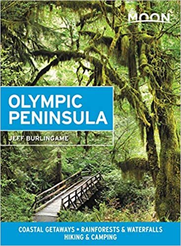
Moon Olympic Peninsula.
By Jeff Burlingame. A Moon Handbook. Avalon Travel Pub., 2nd
Edition, 2015. Index, 216 pages. ISBN: 9781631210068. VSCL.
Nature Religions, Druids,
and New Age Spirituality,
Mysticism, and Travel in Nature. Place and Spirituality.
Wee Folk, Devas, and
Nature Spirits.
The New Complete Walker: The Joys and Techniques of Hiking and Backpacking
By Colin Fletcher. Alfred A. Knopf, 1968, 1974. Index, 470 pages.
ISBN: 0394480996. VSCL.
The North Cascades Highway: A Roadside Guide to America's Alps. By
Jack McLeod. Seattle, University of Washington Press, 2013. Index,
104 pages. ISBN: 978-0295993164. VSCL.
North Cascades: The Story Behind the Scenery. By Saul Weisberg.
KC Publications, 1988. 48 pages. ISBN: 978-0887140211. VSCL.
Olympic National Park and Peninsula. By Nicky
Leach. A photographic collection. Olympic Peninsula: A Timeless
Refuge. Mariposa, CA, Sierra Press, 1998. 32 pages. ISBN:
0939365677. VSCL.
The Olympic Peninsula. By Ericka Chickowski. Moon Spotlight
Books. Avalon Travel, 2009. 100 pages. ISBN: 9781598802719.
VSCL.
The Pacific Northwest: An
Interpretive History. By Carlos Arnaldo Schwantes. Revised and
enlarged edition, 1996. Lincoln, Nebraska, University of Nebraska Press,
1989, 1996. Index, bibliography, 568 pages. ISBN: 978-0803292284.
Professor Schwantes, Ph.D., is a field historian and author. VSCL.
Pacific Northwest Camping Destinations: RV and Car Camping Destinations in
Oregon, Washington, and British Columbia. By Mike Church and Terri Church.
Rolling Homes Press, 3rd Edition, 2012. 608 pages. ISBN:
9780982310120.
The Pacific Northwest Garden Tour. By Donald Olson. The 60 best
gardens to visit in Oregon, Washington, and British Columbia. Portland,
Oregon, Timber Press, 2014. Index, 300 pages. ISBN: 978-160469-4512.
VSCL.
Photographing Washington: A Guide to the Natural Landmarks of the Evergreen
State. By Greg Vaughan. Alta Loma, CA, Photo Trip USA Pub.,
2013. Index, 317 pages. ISBN: 9780916189198. Vancouver Public
Library.
Quick Escapes: Pacific Northwest. By Marilyn McFarlane. Guilford,
Connecticut, The Globe Pequot Press, Fifth Edition, 2001. Index, 323
pages. 32 Weekend trips from Portlant, Seattle, and Vancouver, B.C.
ISBN: 0762709405. VSCL.
Ridgefield,
Washington.
Ridgefield National Wildlife Refuge.
The Spokane River. Edited by Paul Lindholdt. University of
Washington Press, 2018. Index, biographies, reading list, 282 pages.
FVRL.
Song Upon the Rivers: The Buried History of the French-Speaking Canadiens
and M�tis from the Great Lakes and the Mississippi across to the Pacific.
By Robert Foxcurran, Michael Bouchard, Sebastien Malette. Baraka Books,
2016. 448 pages. ISBN: 978-1771860819.
Travel Checklist.
Here is my 2003 Ford Explorer travel gear and camping gear and hiking gear Checklist from February 2019. Excel format.
Traveler's History of
Washington: A Roadside Historical Guide. By Bill Gulick. Caldwell,
Idaho, Caxton Press, 2005. Index, 559 pages. ISBN: 0870043714.
VSCL.
Undaunted Courage: Meriwether Lewis, Thomas Jefferson,
and the Opening of the American West. By Stephen E. Ambrose. Simon and
Schuster, Touchstone, 1996. 521 pages. Paperbound book. VSCL.
Walking - Bibliography.
Research by Mike Garofalo.
Washington
Photographs by John Marshall. Text by Ruth Kirk. Oversized table
book. Portland, Oregon, Graphic Arts Center Publishing Co., 2003.
160 pages. ISBN: 978-0932575647. VSCL.
Washington Byways: 56 of Washington's Best Backcounty Drives. By Tony
Huegel. Berkeley, California, Wilderness Press, 2003. 164 pages.
ISBN: 0899972993. From the Vancouver Public Library.
Washington Lake Maps and Fishing Guide. By Bill McMillan. Edited
and illustrated by Esther Appel. Frank Amato Publications, 2012. 48
pages. ISBN: 978-1571884770. VSCL.
Washington, Oregon and the Pacific Northwest. Lonely Planet Series.
By Brendan Sainsbury, Celeste Brash, John Lee, and Becky Ohlsen. Lonely
Planet Press, 2017. Indexes, 480 pages. ISBN: 978-1786573360. VSCL.
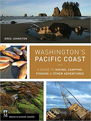
Washington's Pacific Coast: A Guide to Hiking, Camping, Fishing & Other Adventures
By Greg Johnston. Seattle, Washington, Mountaineers Books, 2015.
Index, 318 pages. ISBN: 9781594859397. VSCL.
Washington River Maps and Fishing Guide. By Doug Rose. Frank
Amato Publications, 2013. 87 pages. ISBN: 978-1571885135. VSCL.
Excellent resource for river trips and fishing.
Washington's Best Fishing Waters. Wilderness Adventures Press, 2nd
Edition, 2007. 161 pages. ISBN: 978-1932098525. VSCL.
Washington Wild Roads.
80 Scenic Drives to Camping, Hiking Trails and Adventures. By Seabury
Blair Jr. Seattle, Washington, Sasquatch Books, 2012. Index, 251
pages. ISBN: 978-1570618154. VSCL.
Washougal,
Washington. On the Columbia River near Vancouver, WA.
Waterfront Park.
Captain William Clark Park.
Steigerwald Lake National
Wildlife Refuge.
Water Falls
White Salmon,
Washington, Columbia Gorge. Across from Hood River. Population: 2,200.
The Wild Cascades, Forgotten Parkland.
By Harvey Manning. San Francisco, California, Sierra Club, 1965. 159
pages. VSCL. Beautiful photographs, color and B&W, of the Cascades.
Wild in the City: Exploring the Intertwine: The Portland-Vancouver Region's
Network of Parks, Trails, and Natural Areas. By Michael C. Houck and M. J.
Cody. Corvallis, Oregon, Oregon State University Press, 2nd Edition, 2011.
Index, 427 pages. ISBN:
9780870716126. VSCL.
Vancouver Lake Regional Park, Clark County, Washington.
Views Washington. A Collection of Photographs
by Chris Jacobson. Emeral Point Press, 2006. 48 pages.
We have traveled a little in the State of Washington and have stayed in motels, hotels, bed
and breakfasts, yurts, campgrounds, or cabins in the following cities or areas:
Bay View State Park near Mr. Vernon, Bellingham, Ellensburg, Kalaloch, Lake
Crescent, La Wis Wis Campground near Packwood, Long Beach, Horseshoe Lake below Mount Adams, Kanasat-Palmer State
Park near Enumclaw, Kennewick, Ocean City State Park near Ocean Shores, Seattle, Seaside, Skamokava, Spirit Lake near Mt. St.
Helens, Spokane, Vancouver, Toppenish, Twin Harbors State Park near Westport, Wenatache, Whidby Island,
Winthrop, and Yakima.
We purchased a home in Vancouver, Washington, in June of 2017.
In June of 2019 we enjoyed at trip to northern Washington. Day 1: Vancouver to Bellingham via Interstate 5 and 405. Good views of Mt. Ranier. Day 2: Bellingham via 9 to Sedro-Woodley, then on Route 20 through the North Cascades National Park, over Washington Pass, and down to Methrow River Valley and the town of Winthrop. Day 3: Twisp, Okanogan, Omak, apple orchards, Lake Chelan, Columbia River, Wenatchee. Day 4: Apple orchards everywhere, Route 2, Levingston, Monroe, Seattle, Olympia, Vancouver.
In November of 2019, we traveled to Kennewick, Hanford Reservation, and Ellensburg.
VSCL = Valley Spirit Center Collection, Vancouver, Washington. Home
library collection of Mike and Karen.
FVRL = Fort Vancouver Regional Library of Clark County, Washington.
Blog Posts to the Cloud Hands Blog by Mike Garofalo regarding travel adventures in Washington State.
Maps of Washington
I have always enjoyed reading and using maps since I was a child. I used the Bandini Branch of the County of Los Angeles Public library when I was a child. The library was three blocks from my childhood home in Bandini, unincorporated East Los Angeles, Los Angeles County, California. I used many maps in books at this library. I went to St. Alphonsus Elementary School K-8, from 1951-1959, and this school was three blocks from the old East Los Angeles Library near Garfield High School. I was the Librarian III In-Charge of the new East Los Angeles Library on 3rd St. (Fetterly) from 1975-1980. I used many maps from these libraries in my youth, and my brother Paul and I owned many maps.
When I travel in my Ford Explorer, I always carry a variety of paper maps, guides, books, and pamphlets. I have a Sumsung Galaxy 7 cell phone, a Samsung Galaxy Tab A, and a Garmin GPS eTrek 30X for electronic access to information, maps, ebooks, photos, documents, and directional apps. I keep a Discover Pass and other passes, licenses, and official documentation ready on hand in the Explorer as I travel.
I carry various good magnifying glasses, and use one to read maps. A lamp and flashlight for safety, and for map and book reading at night or dim light conditions are essential. A notebook with writing tools is also carried. Here is my 2019 travel and camping Checklist.
I now use the following maps and travel guides for the State of Washington:
Clark County, Washington. GM Johnson City Map Series. Vancouver, B.C., 2015, 2017. ISBN: 978-1-770684300. VSCL. I have one copy for home use, and I keep another copy in the Ford. This is an excellent map for the County in which we now live. An essential tool. A traditional folding map. Good detail on backcountry roads.
Columbia River Gorge National Scenic Area. National Geographic Map, Trails Illustrated, Topographic Map, 2009.
Washington Road & Recreation AtlasWashington: DeLorme Atlas and Gazetter. Detailed topographic maps, back roads, recreation sites, GPS Grids. Yarmouth, Maine, DeLorme Publications, 2016, 12th Edition. Indexes, 104 pages. ISBN: 0-89933329X. VSCL. An oversized map book. I keep this map in my Ford Explorer. An essential tool for travelers. Very convenient to use.
Maps I Use. By Mike Garofalo. 2019-
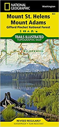
Mount St. Helens, Mount Adams, Gifford Pinchot National Forest. National Geographic. Trails Illustrated Topographic Map. 2010.
Washington State Map by Rand McNally. Easy to read oversized print. Some city maps. 2013. ISBN: 0528882104.
Washington State Map by G.M. Johnson Publishers. Includes maps of many cities. ISBN: 9781770682900.
Washington State Scenic Byways Road Map
Oregon/Washington Map. American Automobile Association (AAA). Updated on a regular basis.
Tour Book Guide Washington. American Automobile Association (AAA). Updated on a regular basis.
The American Automobile Association (AAA). They offer many detailed maps of areas and cities in the State of Washington. Free to AAA members, or sold to non-AAA members. Very useful travel guides and trip planning services are also available to AAA members. I use dozens of their maps and guides.
I use two electronic navigation devices. First, I use my Samsung Galaxy 7 cell phone. A variety of cell phone applications can help with navigation, orienting, mapping, travel routes, travel guides, information, emergencies, communications, phone, text, email, etc. Second, I use a Garmin eTrek 30X Handheld Navigator GPS device. The Garmin GPS is a full featured GPS device and equipped with applications for navigation, orienting, mapping, routes, directions, travel records, geocaching, specialized maps, games, survival, hiking, etc.
Here are three books I use on the subject of GPS, navigation and maps:
The Complete Idiot's Guide to Geocaching. Editors and staff on
Geocaching.Com. Alpha Press, 3rd Edition, 2012. 368 pages.
Explore the Latest Adventures in the Exciting and Popular GPS Adventure.
ISBN: 978-1615641949. VSCL.
Wilderness Navigation: Finding Your Way Using Map, Compass, Altimeter, and GPS.
By Bob Burns and Mike Burns. Seattle, Washington, Mountaineers Books, 3rd Edition, 2015.
Index, 190 pages. ISBN: 978-01594859458. VSCL.
Using GPS. By Bruce Gibbs. Falcon Guides, 3rd Edition, 2014.
87 pages. Basic Illustrated Series. ISBN: 978-0762750818. VSCL.
Traveling the Rivers of Washington: Sightseeing, Fishing, Nature Studies
Washington River Maps and Fishing Guide. Edited By Doug Rose. Frank
Amato Publications, 2013. 87 pages. ISBN: 978-1571885135. VSCL.
Excellent resource for river trips and fishing.
Washington's Best Fishing Waters. Wilderness Adventures Press, 2nd
Edition, 2007. 161 pages. ISBN: 978-1932098525. VSCL.
Washington Lake Maps and Fishing Guide. By Bill McMillan. Edited
and illustrated by Esther Appel. Frank Amato Publications, 2012. 48
pages. ISBN: 978-1571884770. VSCL.
Flyfisher's Guide to Washington. By Greg Thomas. The Wilderness
Adventures Flyfisher's Guide Series. Wilderness Adventures Press, 2013.
500 pages. ISBN: 978-185106582. VSCL.
Columbia River (Lower): Bonneville to Pacific Ocean including Portland.
Fish n Map Company. Detailed maps. Waterproof plastic.
Oregon River Maps and Fishing Guide. Edited By Doug Rose. Frank
Amato Publications, 2014. 88 pages. ISBN: 978-1571885142. VSCL.
Many rivers flow north from the Oregon Cascades into the Columbia River:
Willamette, Sandy, Hood, John Day, Deschutes. Excellent resource for river trips and fishing.
Information, Bibliography, Sources, Readings about Willapa Bay
Coast Country: A History of Southwest Washington. By Lucile McDonald.
Long Beach, Midway Printery, 1989. Index, 183 pages. TRLS = Timberland
Regional Library System, WA [I pick up my reserved books and videos as
the Westport Branch of the TRLS.].
The Historical and Regional Geography of the Willapa Bay Area, Washington. By Jean Hazeltine. South Bend, 1956, 308 pages. FVRL
Shoalwater Willapa., By Douglas Allen. Snoose Peak Publishing, South Bend, WA, 2004. Index, notes, sources, 286 pages. TRLS.
Telling Our Stories: Voices of Grays Harbor. By students of the Evergreen State College, Grays Harbor Campus. Gorham Printing, Centralia, WA, 2012. 155 pages. TRLS.
A Tidewater Place: Portrait of the Willapa Ecosystem. By The Willapa Alliance, Long Beach, WA, 1993. Color photographs and text, 50 pages. TRLS.
Willapa Bay: The Longstreet Highroad Guide to the Northwest Coast has good coverage on Willapa Bay.
Willapa Bay Blog Reports and Photographs by Michael P. Garofalo.
The Northwest Coast: Or, Three Years' Residence in Washington Territory. By James Gilchrist Swan. Adesite Press, 2017, 448 pages.
Information, Books, Guides, Reference Books, Field Guides, Handbooks
Grayland Beach, Willapa Bay, Grays Harbor, Olympic Peninsula, and the Pacific Northwest
Useful Books for Your Vehicle While Traveling:
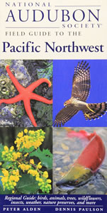
National Audubon Society Field Guide to the Pacific Northwest. By Peter Alden and Dennis Paulson. Knopf, 1998, 488 pages. Regional Guide (Washington and Oregon): birds, animals, trees, wildflowers, insects, weather, nature preservers, etc. This is a handy, small, and sturdy field guide for enthusiasts of natural history studies. Over 1,500 small colored photographs, some maps and drawings. I carry in my car along with camera, binoculars, magnifying glass, tools, and walking backpack (with 10 essentials) and recreational supplies. VSCL.
Washington: DeLorme Atlas and Gazetter. Detailed topographic maps, back roads, recreation sites, GPS Grids. Yarmouth, Maine, DeLorme Publications, 2016, 12th Edition. Indexes, 104 pages. ISBN: 0-89933329X. VSCL. An oversized map book. I keep this map in my Ford Escape. An essential tool for travelers. Very convenient to use. Since I drive on paved roads, this book provides sufficient detail for my needs. Handy for home study.
Also, use more detailed maps, as needed, such as good County maps, topographic maps, walking and hiking guides, fishing guides, birding guides, local tourist maps, etc. And, Google NAV and Google Maps on your cellphone can really provide detailed information and directions.
Useful Books for Your Picnic Table by the Sea
The Flora and Fauna of the Pacific Northwest. By Collin Varner. University of Washington Press, 2018, 462 pages. Over 1,000 outstanding large photographs of 800 species of the most frequently observed plants and animals of the region. What you are likely to see in Washington and Oregon from the seashore to 60 miles inland. This book is oversized and heavy - like a large photography book on your coffee table at home. VSCL.
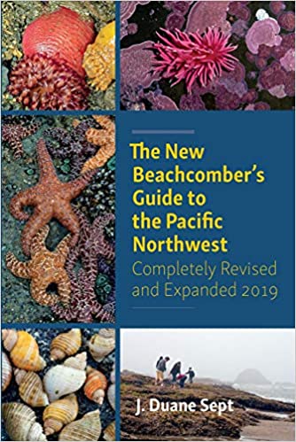
The New Beachcomber's Guide to the Pacific Northwest. By J. Duane Sept. Harbor Publishing, 2019, 416 pages. Covering the Pacific Northwest most common shoreline-dwelling flora and fauna. Focused on the kinds of inter-tidal marine life you might find on the shorelines of Washington and Oregon. Hundreds of colored photographs and good descriptions. Handy book for your backpack when heading out to walk the shore an hour before low tide ends; and the glossy paper stock would probably hold up in field conditions. VSCL.
Bring any book you like to enjoy at your sunny picnic table or comfy camp chair.
Nature Studies in Grayland Beach, Willapa
Bay, Grays Harbor, the Olympic Peninsula, and
the Pacific Northwest
Useful Books for Your Campsite or Home Study
A Birder's Guide to Coastal Waqshington. By Bob Morse. Featuring Ocean Shores, Long Beach Peninsula, Forks, Westport, Tokeland, and 160 Birding Hot Spots. R. W. Morse Co., 2001, Index, 249 pages, spiral bound text. VSCL. Detailed coverage of birding locations and how to get there.
Beachcombing SEE Beachcombing
A Coast of Scenic Wonders: Coastal Geology and Ecology of the OUter Coast of Oregon and Washington and the Strait of Juan de Fuca. By Miles O. Hayes, Jacqueline Michel, and Joseph Holmes. Pandion Books, 2020, 229 pages.
The Flora and Fauna of the Pacific Northwest. By Collin Varner. University of Washington, 2018, 462 pages. VSCL. Outstanding photographs, larger size.
Grayland Beach Nature Studies. By Michael P. Garofalo. 2021-
More Northwest Coastal Field Guides
National Audubon Society Field Guide to the Pacific Northwest. By Peter Alden and Dennis Paulson. Knopf, 1998, 488 pages. This is a handy and sturdy field guide for enthusiasts of natural history studies. I carry in my car along with binoculars, magnifying glass, and supplies in my backpack. VSCL.
Natural History of the Pacific Northwest Mountains. By Daniel Mathews. Timber Press Field Guide, 2017, Index, 583 pages. VSCL.
A Naturalist's Guide to the Hidden World of Pacific Northwest Dunes. By George Poinar Jr. Oregon State University, 2016, 288 pages. VSCL. PND 2016
The New Beachcomber's Guide to the Pacific Northwest. By J. Duane Sept. Harbor Publishing, 2019, 416 pages. VSCL. BG 2016
The Northwest Coast: A Natural History. By Stewart T. Schultz. Timber Press, 1990, index, 389 pages. VSCL.
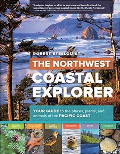
The Northwest Coastal Explorer. By Robert Steelquist. Timer Press, 2016, 282 pages. Overview of key features with pictures and text. VSCL.
Plants of the Pacific Northwest. By Jim Pojar and Andy MacKinnon. Partners, 2004, 528 pages.
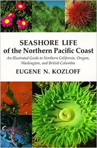
Seashore Life of the Northern Pacific Coast: An Illustrated Guide to Northern California, Oregon, Washington, and British Columbia. By Eugene N. Kozloff. University of Washington, 1983, 378 pages. A technical scientific presentation. VSCL.
Seashore of the Pacific Northwest. By Ian Sheldon. Lone Pine, 1998, 192 pages. VSCL.
The Sound of the Sea: Seashells and the Fate of the Oceans. By Cynthia Barnett. W.W. Norton, 2021, 432 pages. VSCL.
Wildlife of the Pacific Northwest. Tracking and Identifying Mammals, Birds, Reptiles, Amphibians, and Invertebrates. By David Moskowitz. Timber Press, 2010, 364 pages. VSCL.
Books in my personal home library (VSCL) about Washington State.
Automobile Traveling in Grays Harbor, Willapa Bay, the Olympic
Peninsula, and the Pacific Northwest
Useful Books for Home Study and Your Automobile Library
History, Events, Accommodations, Highlights, Sightseeing, Cities, Parks
Washington: DeLorme Atlas and Gazetter. Detailed topographic maps,
back roads, recreation sites, GPS Grids. Yarmouth, Maine, DeLorme
Publications, 2016, 12th Edition. Indexes, 104 pages. ISBN:
0-89933329X. VSCL. An oversized map book. I keep this map in
my
Ford Escape. An essential tool for travelers. Very convenient
to use. Detailed!
The Last Wilderness: A History of the Olympic Peninsula. By Murray Morgan. University of Washington, 2019, 262 pages. VSCL.
The Longstreet Highroad Guide to the Northwest Coast. By Allan and Elizabeth May. Atlanta, Georgia, Longstreet Press, 2000. Index, 370 pages. VSCL. For both home and filed use.
Moon Olympic Peninsula: Coastal Getaways, Rainforests, Waterfalls, Hiking and Camping Travel Guide. By Jeff Burlingame. Moon Travel, 2021, 256 pages. Covers the coastal towns and travel highlights from Forks south to Grays Harbor, Willapa Bay, and Illwaco. For home and field use. VSCL.
Washington's Pacific Coast: A Guide to Hiking, Camping, Fishing & Other Adventures
By Greg Johnston. Seattle, Washington, Mountaineers Books, 2015.
Index, 318 pages. ISBN: 9781594859397. VSCL.
By the Shore: Explore the Pacific Northwest Like a Local. By Nancy Blakey. Sasquatch Books, 2018, 256 pages. VSCL.
Pacific Northwest, Fodor's Travel. 22nd Edition, 2020.
The Pacific Northwest: An Interpretive History. By Carlos Arnaldo Schwantes. Revised and enlarged edition, 1996. Lincoln, Nebraska, University of Nebraska Press, 1989, 1996. Index, bibliography, 568 pages. ISBN: 978-0803292284. Professor Schwantes, Ph.D., is a field historian and author. VSCL.
Books in my personal home library (VSCL) about Washington State.
Washington River Maps and Fishing Guide. Edited By Doug Rose. Frank Amato Publications, 2013. 87 pages. ISBN: 978-1571885135. VSCL. Excellent resource for river trips and fishing.
Washington Road & Recreation Atlas
Beachcombing, Kite Flying, Fishing, Clamming, Crabbing, Walking,
Camping and other Seashore Activities in
this Region
Grays Habor, Willapa Bay, Olympic Peninsula, Pacific Northwest
Beachcombing Fishing Digging Razor Clams Oysters Kites Walking
The Essential Guide to Beachcombing and the Strandline. By Steve
Trewhella and Julie Hatcher. Princeton University Press, 2015, 304
pages.
The New Beachcomber's Guide to the Pacific Northwest. By J. Duane Sept. Harbor Publishing, 2019, 416 pages. VSCL.
By the Shore: Explore the Pacific Northwest Like a Local. By Nancy Blakey. Sasquatch Books, 2018, 256 pages. VSCL. Roughly arranged by the four seasons. Good on Puget Sound coastal activities. Coastal activities, projects, sightseeing, events.
The Flora and Fauna of the Pacific Northwest. By Collin Varner. University of Washington, 2018, 462 pages. VSCL. Outstanding photographs, larger size.
A Naturalist's Guide to the Hidden World of Pacific Northwest Dunes. By George Poinar Jr. Oregon State University, 2016, 288 pages. VSCL.
More Northwest Coastal Field Guides
The Northwest Coastal Explorer. By Robert Steelquist. Timer Press, 2016, 282 pages. Overview of key features with pictures and text. VSCL.
Washington's Pacific Coast: A Guide to Hiking, Camping, Fishing & Other Adventures
By Greg Johnston. Seattle, Washington, Mountaineers Books, 2015.
Index, 318 pages. ISBN: 9781594859397. VSCL.
Books in my personal home library (VSCL) about travel in Southwestern Washington State.
Four Days in Grayland
By Michael P. Garofalo
Part I: Southwestern Washington
Grays Harbor, Willapa Bay, Long Beach Peninsula, Lower Columbia River
A Traveler's Hypertext Notebooks, Guides, and Resources
Part II: Grayland Beach
A Beach Camper's
Hypertext Notebook,
Studies, Readings, Activities, Seasons, and Tips
The Four Days in Grayland Series began in September, 2021.
Southwestern Washington
Lower Columbia River from Ilwaco to Vancouver
Northwest Coastal Oregon: Astoria to Cape Lookout
Yurt
Camping at Coastal State Parks in the Northwest
Four Days in Grayland Homepage
Alphabetical Index to
Four Days in Grayland
Boating, Charter Tours (Westport, Ilwaco, Aberdeen, Astoria)
Agate Hunting, Coastal Geology, Rock Hounding
Berries, Cranberries, Wild Berries, Berry Foraging
Bibliography - General Information for Traveler's and Campers
Blog Reports of Monthly Yurt Camping Trips
Cowlitz Indians
Cranberries, Wild Berries, Berry Foraging
Day Picnics and Day Camping at the Beach
Driftwood Gathering, Beachcombing, Agate Hunting, Sea Shell Gathering
Driving on the Beach in Washington
Facebook of Michael P. Garofalo
Foraging, Beachcombing, Walking
HomepageFour Days in Grayland Photographs and Blog Posts (Most Recent First)
Geology Coastal, Rock Hounding, Agate Hunting
Glamping: Camping in Yurts or Small Cabins, Camping Comforts
Green Way Research Hypertext Notebooks of Michael P. Garofalo
Hiking Quotations, Sayings, Poems
Indians, Native Peoples in the Area
Marinas and Docks: Westport, Tokeland, South Bend, and Ilwaco
Oregon - Northwest Coast, From Astoria to Cape Lookout
Photographs of Monthly Yurt Camping Trips
Reading, Information, Bibliography, Resources
Reading, Bibliography - General Information
Reports of Monthly Yurt Camping Trips
Rock Hounding, Agate Hunting, Coastal Geology
Sea Shell Gathering, Beachcombing, Agate Hunting
Southwestern Washington - Travel
Swimming, Boogie Boarding, and Surfing
Videos from some Yurt Camping Trips
Walking Quotations, Sayings, Poems

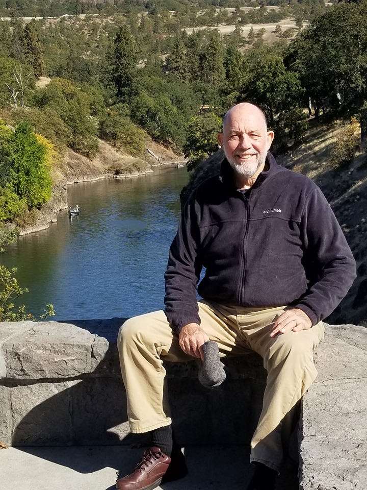
Mike Garofalo at the Klickitat River in Southwest Washington, 2019
Return to the Alphabetical Index of Mike Garofalo's Hypertext Documents