This webpage primarily covers Grays Harbor County and Pacific County in southwestern coastal Washington State.
I live in
Vancouver,
Clark County, Southwestern Washington. The overall scope of my travel interests on this webpage
are in the Southwestern Washington geographical area that is west of Interstate 5 from Vancouver to Olympia,
and all of coastal Washington from Taholah on
the Quinault River to Ilwaco on the
Columbia River; and, finally along the Columbia
River from Ilwaco to Longview via WA4, and down south to along the
Columbia River to Vancouver on I5. Therefore, it also includes
some traveler's information about Clark, Clallam, Cowlitz, Jefferson, Lewis,
Mason, Thurston, and Wahkiakum Counties in Southwestern Washington State.
Since, to get to Grays Harbor or Willapa Bay from Vancouver, I must drive
170 miles though many of these Counties and the Willapa Hills, I have come
to know these beautiful areas quite well. Here are some Maps of the
areas of travel.
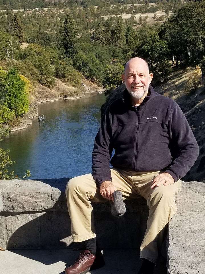
I am 75 years of age and enjoy camping along coastal southwestern Washington. Here is my brief biography, Webpages index, Blog, Email, and Face-Book.
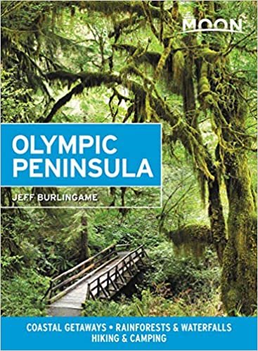
Two good books that cover, for traveler's, the overall coastal territory that is the subject of this hypertext notebook: Moon Olympic Peninsula by Jeff Burlingame, 2021; and the Longstreet Highroad Guide to the Northwest Coast by Allan and Elizabeth May, 2000. More books!
Keys: NS = North side of Grays Harbor Bay
SS = South side of Grays Harbor WB =
Willapa Bay
OP = Olympic Peninsula north of Lake Quinault
CR =
Columbia River WH = Willapa Hills
Alphabetical Index to the Grays
Harbor and Willapa Bay Areas
A Traveler's Hypertext Notebook and Guide by Mike Garofalo
Aberdeen Population 16,900 NS Largest city on the southwest Pacific coast of Washington.
Aberdeen Images
Aberdeen Lady Washington Sailing Vessel NS
Aberdeen: Polson Museum Aberdeen Timberland Library
Aberdeen Stores: Shopping Restaurants Cannabis
Grays Harbor Historical Seaport in Aberdeen
Around Aberdeen and Matawan. By Helen Henderson. Arcadia, 1996, 128 pages. Images of America Series. History, photographs.
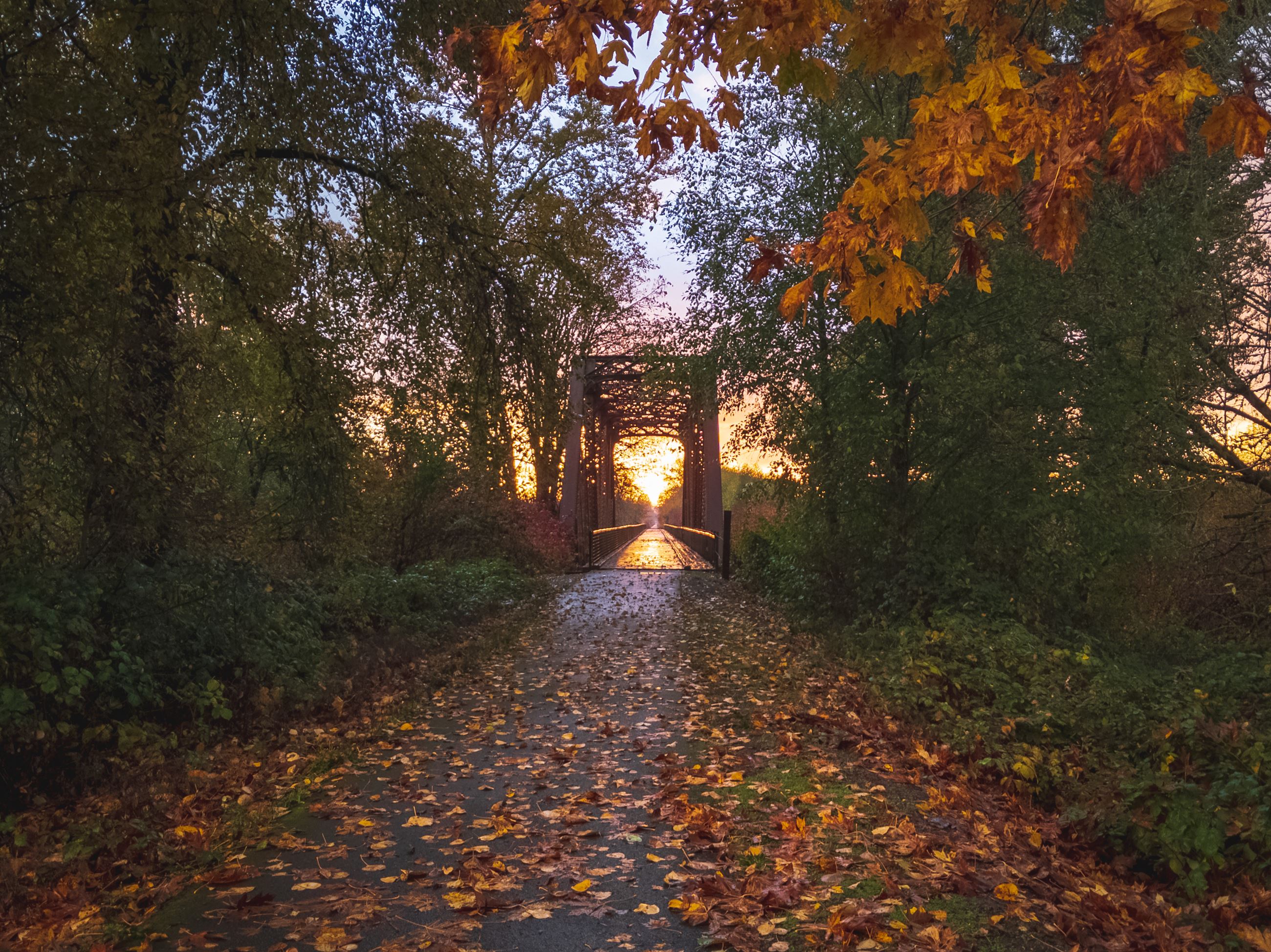
Autumn Season
Beachcombing NS SS WB OP
Beachcombing Tips Magazine Top Spots Northwest Pacific Northwest Beachcombing Grayland Beach
Beachcombing the Pacific. By Amos L. Wood. Schiffer Publishing, 1987. Index, 225 pages. VSCL.
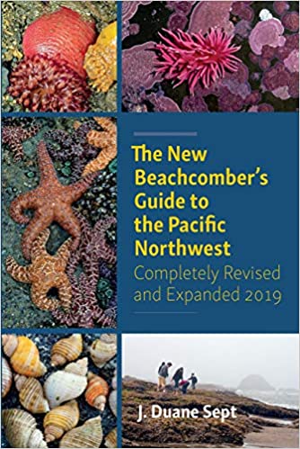
The New Beachcomber's Guide to the Pacific Northwest guide to the flora and fauna of the inter-tidal areas of beaches.
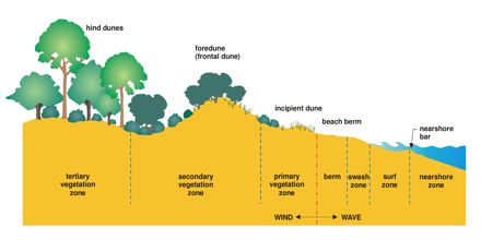
A Naturalist's Guide to the Hidden World of Pacific Northwest Dunes
Books on Beach Activities and Coastal Nature Studies
5 Best Beachcombing Beaches in Grays Harbor
Beachcoming is very interesting for those closely following the tides, seasonal differences, storm conditions, biotic communities by the sea. Success is first just walking along the beaches of Grayland. It is the enjoyment in walking outdoors by the sea shore. To be a fisherman is to first cast your bait into the water; to be a beachcomber is first to walk.
Beachside Day-Use "Campsites" or Picnic Sites
A Birder's Guide to Coastal Washington. By Robert Morse. RWMorse, 2001, 270 pages, ring-bound. VSCL. FVRL
Birds of the Pacific Northwest. By John Shewey and Tim Blount. Timber Press Field Guide, 2017, 560 pages.
Birds of Washington Field Guide. By Stan Tekiela. Adventure Pubs., 2001, 332 pages.
American Birding Association Field Guide to the Birds of Washington. By Dennis Paulson and Brian Small. Scott and Nix, 2020, 368 pages.
Boat launch ramps: SS: Johns River, Tokeland NS: Tokeland, Smith Creek WB: Raymond, South Bend, Palix River
Books, Guides, Reference Books SEE Information
Bottle Beach State Park Near Westport SS Bird Watching Area, Mudflats, Swamps
Campsite at the Edge of the Sea
Canoeing and Kayaking are popular in the calmer rivers, lakes, and gentle bays at high tide. There are many options and boat ramps in the area.
Cannabis Stores in the Area: Longview, Cathlamet, Naselle, South Bend, Long Beach, Aberdeen, and Ocean Shores. Washington legalized the growing, sale, and recreational use of marihuana by adults in 2012.
Cape Disappointment State Park WB Near Ilwaco.
Cathlamet Population 532 CR Images On WA4
Cedar River Willapa Bay
Cellphone service is good in these areas. I use the T-Mobile/Sprint Network on a Samsung Galazy A32 5G cellphone.
Centralia and Chelais, Southwestern Washington
Centralia
Population 18,183
Images
On Interstate 5 between Portland and Olympia
WA6 Junction Timber industry, farming, city, businesses,
tourism.
Centralia is 84 miles south of Seattle.
Centralia Outlets Shopping
Business
Directory
Centralia: Weyerhaeuser Timber Company The company owns most of the Willapa Hills forests to the west of Centralia.
Chehalis
Population 7,259
Images Chehalis is 88 miles north of Portland, and 28 miles
south of Olympia.
On Interstate 5 between Portland and Olympia.
About 12 miles north of the I5/WA12 Junction near Mary's Corner.
Timber industry, farming, city, businesses,
tourism.
Grand Mond Great Wolf Lodge and Waterpark
Lucky Eagle Rochester Indian Hotel and Casino
Chehalis River Images Newaukum River
Chehalis Reservation Confederated Tribes
Native Indians of Southwestern Washington
Clam Digging NS SS
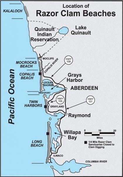
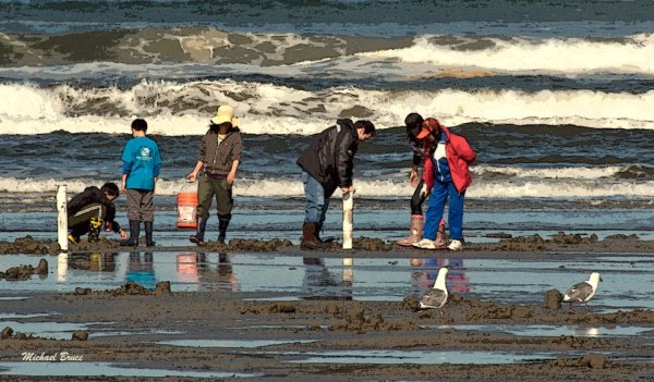
Clam Digging Razor Clams Washington State Fish and Wildlife
Clam Digging Razor Clam Rules and Best Beaches for Digging
Clam Digging Seasonal Schedule [Sept-Dec 2021]
Clam Digging Tides Grays Harbor
Clam Digging and Crabbing in Washington. By John A. Johnson. Adventure North Publishing, 1997, 125 pages. VSCL.
Clam Digging and Crabbing in Oregon. By John A. Johnson.
Clamming in the Pacific Northwest. By Ken Axt. Frank Amato, 2016, 88 pages. VSCL.
Clam Digging Grayland and Twin Harbors This stretch of beach is referred to in books as the 'Twin Harbors' Beaches.
Preparing and Cooking Razor Clams
The Secret Life of Clams: The Mysteries and Magic of Our Favorite Shellfish. By Anthony D. Dredericks. Skyhorse, 2014, 286 pages. FVRL
Clam Digging Tools: Waist waders with attached boots. Waterproof
top as needed [mine is
Riverruns]. Waterproof and warm gloves, hat, and warm clothing.
Clam shovels (9"x18" and 11'x31") and one cylindrical plastic clam digging tool.
Headlamps for night clamming. Mesh basket for holding razor clams.
Snacks in your pocket. Friends to have fun with at the seashore.
If you work at shellfishing and have some luck then you will need: A clam
opening knife and cutting pad. Pot in camp big enough to clean and
cook clams, oysters, or crabs.
Surf fishing for redtail surf perch is supposed to be very good using clam baits on the high tide
immediately after the razor clammers have dug at low tide.
Crabbing, Crab Fishing NS SS WB
Clam Digging and Crabbing in Washington. By John A. Johnson. Adventure North Publishing, 1997, 125 pages. VSCL.
Crab Fishing Tools:
Crab Fishing SEE ALSO Fishing, Clam Digging
Cohasset Beach Village, Population 700. SS
Copalis
Beach NS WA 109
Copalis Rock NS
Damon Point State Park, Ocean Shores NS
Designated Census Area = DSA = A village, small town, burg, neighborhood, tiny city, settlement, cluster of homes, e.g., Bay City, Grayland.
Driving Tours of Mike Garofalo
Tour 1:
Longview to Westport (WA4, US101,WA105)
Longview,
Columbia River, Willapa Hills, Willapa Bay (East and North Sides), Tokeland,
Grayland Beach,
Westport
Driving west then north for 131 miles (210 km)
Tour 2:
Grayland Beach (Westport) to Raymond
Driving South and East on WA105 for 33 miles
Tour 3: Grayland Beach (Westport) to Aberdeen
Driving North and East on WA105
Tour 4: Long Beach Peninsula,
Willapa Bay - West Side (WA103)
Driving north on WA 103 for 20 miles.
Tour 5: Aberdeen to Ocean Shores
Tour 6 Ocean Shores to Taholah
Tour 7: Vancouver to Olympia (Interstate 5)
Tour 8: Chelais to Raymond (WA6)
Tour 9: Olympia to Aberdeen (WA8, WA12)
Tour 10: Aberdeen to Lake Quinault and Rain Forest (US101)
Elma
Population 3,100. NS
Fiction, Novels, Short Stories, Poetry
Fishing, Surfcasting, Jetty
Fishing, Pier Fishing NS SS WP OP
Fishing Washington State Fishing Regulations NS SS
Fishing: The Complete Guide to Surfcasting: Tackle, Technique, Species, Locations and More. By Joe Cermele. Burford, 2011, 288 pages. VSCL.
Grayland Beach and Twin Harbors Beach Surf Fishing
Surf Fishing Grayland Images
Fishing from the North Jetty in Ocean Shores Ilwaco Jetty and Docks Cape Disappointment Jetty South Jetty in Westport
Fishing in freshwater rivers, streams and lakes in Washington
Fishing Biography: Casting Into the Light, 2019. A fisherwomen's lifetime of fishing adventures and friendships and surfcasting around Martha's Vineyard MA. TRL
How to Catch Redtail Surf Perch UTube 2 oz round weight, Gulp Sandworm Nereis Camo dried, # 2 hook, 2 hook rig
Light Tackle Surf Perch Fishing. J. D. Richey. 2014, 52 pages. VSCL.
11 Best Beaches for Surf Perch Fishing in Washington and Oregon
Redtail Surf Perch - Wikipedia
Washington River Maps and Fishing Guide. Excellent resource for river trips and fishing.
Westport: Fishing from the South Jetty in Westport.
Westport: Fishing and crabbing from the Docks, Boardwalks, and Pier at Westport.
Fishing My surfcasting rod is an 11 foot Fiblink Surf Spinning Fishing Rod, 4 piece. Reel: KastKing Sharky Baitfeeder III Spinning Reel. Line: Kast King Braided line, 30 lib, 327 yards, Moss Green. Tackle box with surf fishing and jetty fishing gear. I have a valid current Washington fishing license and shell fishing license.
Surf fishing for redtail surf perch is supposed to be very good using clam baits on the high tide immediately after the razor clammers have dug at low tide.
Casting into the Light: Tales of a Fishing Life. By Janet Messineo, 2019. Surf fishing in Marthas Vineyard, MA.
Food, Cooking, Eating, Campsite Cooking, Food Markets,
Seafood Markets
Forks
Population 3,500 OP Olympic Park Region
Four Days in Grayland by Michael P. Garofalo
Four Days in Grayland, Part I A Grays Harbor: A Traveler's Hypertext Notebook, Guide and Studies
Four Days in Grayland, Part I B Willapa Bay: A Traveler's Hypertext Notebook, Guide and Studies
Four Days in Grayland, Part II Grayland Beach: A Camper's Hypertext Notebook, Studies, and Comments
Four Days in Grayland, Part III Photographs, Blog Posts, and Comments from 2021-2022
Four Days in Grayland, Part IV Reflections of a Beachcomber: Poetry, Short Essays, Reports, Quotations, Commentary
Grayland Beach
Grayland Population 953 SS
The Grayland Community has two markets, cafes, stores, gift shops and services
that are are all located
along coastal Washington Highway 105. Be careful when parking off
narrow WA105. Slow Down!
Four Days in Grayland, Part II Grayland Beach: A Camper's Hypertext Notebook, Studies, and Comments. October 2021-
Grayland Beach - Detailed Webpage Nature Studies, Information, Camping Guide
There are many country homes and cranberry fields east of WA105. The many back roads east of WA105 in Grayland are very quiet, picturesque, and free of traffic ... great for bicycling or long walks. Whereas, West of WA105 are houses, cabins, State Parks, sand dunes, and the seashore.
The Grayland Beach Community is 6 miles south of the large Westport marina and 10 miles north of the small Tokeland marina. From Grayland to Raymond it is 27 miles to the southeast, and from Grayland to Aberdeen it is 23 miles to the northeast. The scenic road from Westport to Raymond, WA105, was completed in the 1960's.
In 2022, I plan to camp four days and three nights at Grayland Beach State Park every
month. I will stay in a yurt (winter) or a tent.
My reports.
Therefore, Grayland Beach will be the central point for my explorations of
the southern side of Gray's Harbor and the northern side of Willapa Bay.
Four Days in Grayland, Part II Grayland Beach: A Camper's Hypertext Notebook, Studies, and Comments. October 2021-
Reports and Photos about my Grayland Beach State Park Camping Adventures in 2021 and 2022:
My favorite drive from Vancouver to Grayland Beach is from Longview to Westport, Tour 1.
Another alternative is to drive north on the Interstate 5 Freeway from Vancouver to Chelais, for 79 miles, an easy and safe drive. Then, drive west on WA Road 6 though Pe Ell to Raymond, for 52 miles. You will drive on an excellent two lane road (WA 6) through lovely forested country and agricultural valleys, rolling hills, and encounter very little traffic. Then, drive northwest on WA 105 along the beautiful coast road from Raymond through Tokeland and north to Grayland, for 27 miles. Total distance: 158 miles, about 4 hours of easy driving with very little traffic from Chelais to Grayland. An easy effort for my Ford Escape.
Grayland Beach Nature Studies
(Grayland Beach SP Trail 2 to the Surf; Camping at Yurt 80)
Grays Harbor Images NS SS
Grays Harbor National Wildlife Refuge NS
Grays Harbor Nautical Charts for Small Boats Detailed maps.
Grays Harbor Visitors Guide NS SS
Grays Harbor Talk News and Information
Northwest Washington Coast Ecoregion
Grays Harbor Cities: Aberdeen, Hoquiam, Ocean Shores, Westport
The River Pioneers: Early Days on Grays Harbor. By Edwin Van Syckle. Pacific Search Press, Aberdeen, 1982, 423 pages. FVRL.
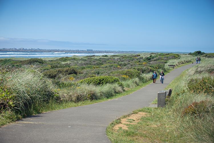
Hiking Trails, Walking Paths,
Beachcombing
Ocean Beaches, miles and miles of wide sandy beaches and sand dunes for walking and beachcombing.
Griffiths-Priday State Park, Images, Hike along the Copalis River to the sea NS One Park Ranger's favorite.
Johns River Wildlife Area Images Near Westport SS History Game Farm Road off 105 Walking trails, boat launch
Oyhut Wildlife Recreation Area, Ocean Shores NS Hiking Trails Images
Walking Quotations, Reflections, and Information. Compiled by Michael P. Garofalo.
Westport State Park - Westport Light Trail Images Westport Dunes Trail SS
Willapa Hills State Park Trail 56 miles From Chelais to South Bend Former railroad route
Native Peoples have consistently lived in the Grays Harbor region for over 2,000 years. They were expert fishermen, hunters and gatherers. They made good canoes, were expert sea fishermen, and could travel considerable distances by canoe. They built more weather secure wood homes inland for winter, and temporary shelter camps near shorelines, rivers, and lakes for better seasonal hunting and gathering. They knew when the bird migrations, or peak razor clam times, or best kelp beds, or seasonal salmon runs would provide more needed food for eating and drying. The abundant local natural resources for food, and the ingenuity and customs of these hardy people provided life for countless generations. They lived in groups of families, roles were defined, moved a lot by foot, were preliterate, and hunters and gatherers. Various peoples and small tribes have traveled through the Northwest for over 9,000 years.
Native American coastal tribes in the Olympic Peninsula, Chelais River Valley, Grays Harbor and Willapa Bay areas included: Chelais, Chinook, Clatsop, Copalis, Cowlitz, Hoh, Makah, Klallam, Muckleshoot, Niqqually, Quinault, Queets, Quileute, Shoalwater Bay, and Willapa. Here is a list of some of the books I have read about Native American People and the Cultures of the coastal Northwest.
On May 7, 1792, a Yankee commercial sailing ship from Boston arrived in Grays Harbor. The Captain of this merchant vessel was Robert Gray. He and Captain George Vancouver were exploring and documenting this area at the same time in separate sailing ships. Later that year, Captain Gray, in his ship Columbia, crossed the bar and entered the Columbia River at Astoria. The Spanish, Russians, French, British and Americans were all fur trapping in these areas from Vancouver Island to the Columbia River.
By 1805, President Jefferson had the Lewis and Clark Expedition survey and document American interests from St. Louis, Missouri, to the Northwest Pacific coast. Fort Vancouver Washington was founded in 1825 by The Hudson Bay Company. The Treaty of 1818 and Oregon Treaty of 1846 between England and USA were significant. All the Olympic Peninsula covered in this webpage became a Territory of the USA in 1848, and Washington became a State of the USA in 1889.
Settlement by Europeans began in the 1850-1870's in Grays Harbor and Willapa Bay coastal areas. The Europeans developed many fishing, lumber, farm, commercial, retail, shipping, tourism, professional and other businesses. Tourism in Ocean Shores, Aberdeen, Westport, Long Beach and Ilwaco has been important since 1960. However, Northwest coastal winters are wet, cold, windy, and only for tougher tourist souls. It is very hard to make a living in these small coastal towns of the Olympic Peninsula, so incomes, opportunities, and populations are still low in the area.
Documentation, maps, research, books, libraries, Net ... The Native American Cultures of the northwest coast were fishermen, hunters, and gatherers. They had no iron tools. They were preliterate cultures of storytellers, singers, dancers, and chanters. The Europeans coming after 1790 were sailors, traders, merchants, farmers, explorers, as well as storytellers, singers and dancers; and, a few were writers, map makers (William Clark), accountants, administrators (John McLoughlin), scientists (David Douglas), reporters, and book users. The University of Washington was founded in 1861. What I can know about the past rests largely on my reading research, travels to museums and locales, and my curiosity. This webpage primarily covers Grays Harbor and Pacific Counties.
The Last Wilderness: A History of the Olympic Peninsula
The Pacific Northwest: An Interpretive History By Carlos Arnaldo Schwantes, 1996.
Coast Country: A History of Southwest Washington. By Lucile Saunders McDonald, 1966.
Contested Boundaries: A New Pacific Northwest History. By David J. Jepsen and David J. Norberg. Wiley-Blackwell, 2017, 416 pages. FVRL
They Tried to Cut it All: Grays Harbor--Turbulent Years of Greed and Greatness. By Edwin Van Syckle. Pacific Search Press, 1981. Index, 308 pages.
The River Pioneers: Early Days on Grays Harbor. By Edwin Van Syckle. Pacific Search Press and Friends of the Aberdeen Public Library, 1982, index, 423 pages. FVRL. Excellent coverage of the life of Indians in the area, the development of the area from 1820-1920, geography, settlement locations, noted pioneers, economy, etc. Nice photographs from the era. Mr. Van Syckle was writer and editor for the Aberdeen Daily World newspaper for 50 years.
Hoquaim
Hoquiam Population 8,700.
Images NS Adjacent to Aberdeen. Logging,
fishing, tourism, stores, services.
Timber Industry
Fishing Industry
Ilwaco
Population 936 WB CR
Images A major port on the north side of the Columbia River.
Ilwaco-Astoria bridge This bridge is 14 miles long. Construction finished in 1966. This bridge spans the mouth of the Columbia River Bar.
Jetty Fishing SEE Fishing
Johns River SS
Johns River Wildlife Area - North Willapa Bay Unit Near Raymond SS
Johns River Wildlife Area Images Near Westport SS History Game Farm Road off 105 Walking trails
Kalaloch Campground OP
The oceanside campground is near a motel, cottages, restaurant, and grocery.
Kalaloch is 74 miles north of Aberdeen.
Kayaking and Canoeing are popular in the calmer rivers, lakes, and gentle bays at high tide. There are many options and boat ramps in the area.
Kite Flying NS SS WB
Kite Store: Ocean Shores Kites, and one store in Westport
The wide beaches of Ocean Shores and Twin Harbors are excellent for flying kites.
Stunt Kites: A Complete Flight Manual of Maneuverable Kites. By David Gomberg. Cascade Kites, 1994, 89 pages. VSCL.
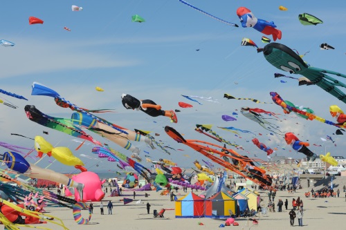
Kites: I own a variety of kites. I fly single string kites. I fly two string stunt kites. Yes, you can learn to launch a site by yourself. The beaches at Twin Harbors or Ocean Shores are very wide and there is plenty of room for safe kite flying.
Lake Quinault
OP
Images This beautiful lake is 43 miles north of Aberdeen.
Lodge Camping, Trails, boating, fishing.
Quinault Rain Forest
Lake Sylvia State Park NS Images
Libraries in the area are part of the Timberland Regional Public Library System. Besides nice, clean, and comfortable facilities these public libraries offer books, media, Net access, magazines, etc. Often, the local public library has information on local history, recreation, travel, and natural history. I worked for the County of Los Angeles Public Library System from 1974-1998. I currently have library cards at the Fort Vancouver Regional Library System (FVRL) and the Timberland Regional Library System (TRL).
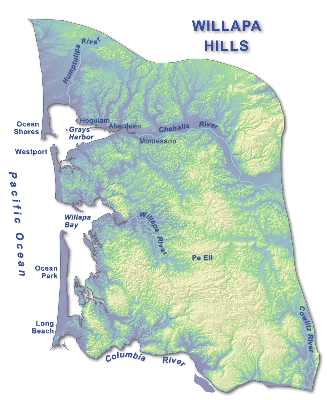
Logging, Milling, Forestry, Timber, Trees: Willapa Hills
The Willapa Hills are in the area 60 miles east of Willapa Bay. Generally, it is hilly, forested, with some farms in small river valleys, and with a few small towns by the sea. The Willapa Hills are the lowest uplands in the entire Pacific Coast Range system. The highest point is 3,087-foot Boistfort Peak. Mostly much lower hills close to the sea.
Willapa Hills Images WH CR
"The Willapa Hills is a geologic, physiographic, and geographic region in southwest Washington. When described as a physiographical province, the Willapa Hills are bounded by the Pacific Ocean to the west, the Columbia River to the south, the Olympic Mountains to the north, and the Cascade Range to the east.[1] Some definitions place the Puget Lowland physiographic province east of the Willapa Hills.[2] Included within the province are the Black Hills, the Doty Hills, and a number of broad river valleys, some of which open up into broad estuaries on the Pacific such as Grays Harbor and Willapa Bay.[2] Other definitions do not include the Black Hills.[3] The USGS GNIS defines the Willapa Hills as bounded by the Columbia River to the south and the Chehalis River to the north, without giving specific east and west bounds.[4] The Willapa Hills are one of the Pacific Coast Ranges, which continue north as the Olympic Mountains and south, across the Columbia River, as the Oregon Coast Range." Wikipedia
Logging began in the 1850's. Originally, the old growth forests had complex late-successional forests of Sitka Spruce, Western Hemlock, Western Red Cedar, Douglas Fir, Maples, Poplar, Cottonwoods, Shore Pines, and many types of shrubs and vines.
The Willapa Hills forests are very dense with harvestable timber. Examples of a "working sustainable forest" are quite evident in the 2021 huge clear cuts on the hills and with the reforestation efforts and replants at various heights going back decades. Weyerhaeuser Timber Industries have huge private holdings in the Willapa Hills.
"Forest lands in the Willapa Bay area are dominated by commercial timberlands. In fact, most of the forested acreage within the refuge and the Willapa Bay watershed is second or third growth timber. Very little "old growth", or late-successional, forest exists. One estimate states that less than one percent of the original coastal old growth remains. The largest old growth parcel in the refuge is the 274-acre Cedar Grove located on Long Island. Many of the 6,000 forested acres on the refuge are comprised of even-aged forest stands lacking in biological diversity." Willapa Forest, U.S. Fish and Wildlife
They Tried to Cut It All: Grays Harbor─Turbulent Years of Greed and Greatness. By Edwin Van Syckle. Seattle, Pacific Search Press, 1981, 308 pages. FVRL.
Forest Conservation.
Willapa Hills Images WH CR
Overstory -- Zero: Real Life in Timber Country. By Robert Leo Heilman. 1995. Logging in Oregon.
Long Beach Population 1,390. WB. Long Beach 29 mile Peninsula. Library
Longview Population 37,520 Images CR Junction of WA4 and Interstate 5. By the Cowlitz River. Longview/Ranier (1930) bridge.
Montesano
Population 4,000. NS
Images
County Seat of Grays County
Morocks Beach NS WA109
Mushrooms of the Pacific Northwest. By Steve Trudell and Joe
Ammirati, 2009.
Music Playing I own a wide variety of albums in MP3 format that I loaded on a memory chip into my cellphone. I bring earphones and a small USB bluetooth speaker.
Musical Instrument Playing: My harmonicas [C, Am] Bring your guitar, flute, harmonica ...
Native American tribes have lived in the Grays Harbor region for over
8,000 years. They were expert fishermen and canoe travelers.
Such tribes in the Olympic Peninsula and Chelais River Valley and Grays
Harbor included: Chelais, Chinook, Copalis, Hoh, Makah, Klallam, Muckleshoot,
Niqqually, Quinault, Shoalwater Bay. Here is a list
of some of the books I have read about Native American People and Cultures
of the Northwest. Read more History of Native
Americans in this area.
Naselle: Naselle River Images CR Close to the junction of US101 and WA4. Settled by Finnish people.
Natural History NS SS
Northern California Travel and Beaches
North Jetty,
Fishing, Ocean Shores NS
North Jetty, Fishing,
Ocean Shores NS An Asian couple's fun fishing adventure to
the jetty.
North Jetty, Images, Ocean Shores NS
Ocean City State Park. Here are some images of
the campground. This is my favorite campground very close to Ocean Shores. There are beautiful forested campsites.
It is quiet. You can reserve a campsite online for $25.00. There
are some full utility campsites. No yurts or cabins. From the campground you can take a
long walk to the beach. There are many streets that lead out to the
beach in Ocean Shores, and you can drive on the beach in Washington.
The campground is about four miles from the Ocean Shores business center.
My Camp: 2021 08 18-20. NS WA109 Includes
Oyehut-Hogans Corner. There are small lakes, swamps, and forested
wetlands in this area.
Ocean City State Park Current Weather Reservations
Ocean City
Village, Population 200, NS
Ocean Shores Population 5,500 NS Ocean Shores was created by real estate developers in 1960. It offers wealthy residents of Seattle, Tacoma, and Olympia the opportunity to own a really nice home and property at the Pacific seashore. There are many large hotels that line the seashore in the main business area. There are many gift shops, restaurants, and services for tourists and residents. The many homes and condominiums on the 6 mile peninsula are very nice and big. A big contrast from Westport or Hoquiam. North Jetty is very convenient to get to. Many roads providing beach driving access. Lots of walking and bicycling opportunities. This is a cool weather environment.
Ocean Shores Coastal Interpretative Center Library
Ocean Shores Tourist Information NS
Olympic Peninsula
The Last Wilderness: A History of the Olympic Peninsula OP
Oregon Travel and Beaches Information
Oyhut Wildlife Recreation Area, Ocean Shores NS Hiking Trails
Oysters in Willapa Bay
Oyster History on Willapa Bay, Schooner Trade, Boom Years, Fishery to Farm. The Sou'wester Fall, 2005. By the Pacific County Historical Society, South Bend.
Willapa Bay and the Oysters. By Nancy Lloyd. Oysterville Hand Print, 1999, 61 pages.
Oysters: A Celebration in the Raw. By Jeremy Sewall and Marion Lear Swaybill. Abbeyville Press, 2016, 216 pages.
The Essential Oyster: A Salty Appreciation of Taste and Temptation. By Rowan Jacobsen. Booomsbury, 2016, 304 pages.
Pacific City NS WA109
Paddling: Canoeing and Kayaking are popular in the calmer rivers, lakes, and gentle bays at high tide. There are many options and boat ramps in the area.
Pe Ell Population 632 In Lewis County Pe Ell is
23 miles west of Chelais via WA4.
Images Pe Ell is 29 miles east of Raymond via WA4.
In the
Willapa Hills. Nice public
restroom along the
Willapa Hills State Park Trail
in town. Corner store for supplies.
Rainbow Falls State
Park is 7 miles from Pe Ell.
Photography I have all the gear for a Canon Single Lens Reflex camera. I own a Samsung A20 cellphone with a very good camera.
Pier Fishing SEE Fishing
Plant Nurseries: Lael's Moon Garden Nursery, Rochester. Tsugawa's Nursery, Woodland
Quinault River
Lake Quinault, Quinault Rain Forest, Quinault
River
Lake Quinault is 52 miles north of Aberdeen, and 68 miles south of Forks.
Lake Quinault Lodge Photographs Built in 1926.
Quinault Lake Olympic National Park Region
Quinault Rain Forest: Six Stunning Hikes Around Lake Quinault
"The Quinault Rain Forest is a temperate
rain forest, which is part of the Olympic
National Park and the Olympic
National Forest in the U.S.
state of Washington in
Grays Harbor and Jefferson Counties.
The rain forest is located in the valley formed by the Quinault
River and Lake
Quinault. The valley is called the "Valley of the Rain Forest Giants"
because of the number of record size tree species located there. The largest
specimens of Western
Red Cedar, Sitka
Spruce, Western
Hemlock, Alaskan
Cedar and Mountain
Hemlock are found in the forest as well as five of the ten largest Douglas-firs.
The forest receives an average of 12 feet of rain per year. It is believed
to be the area with the greatest number of record size giant tree species in
the smallest area in the world. It does have the largest trees in the world
outside of the state of California and New
Zealand. Located on the western side of the Olympic
Mountains, the Quinault Valley was carved out by a glacier and ends at Lake
Quinault. The Qinault Rain Forest is a tourist area with a number
of resorts and lodges located on either side of Lake
Quinault."
- Quinault
Rain Forest
Quinault Valley Brochure "The Quinault Valley is a wilderness gateway to alpine meadows, jeweled lakes and ice-carved peaks. For shorter visits, the valley has a scenic loop drive and short trails through temperate rain forest in both Olympic National Park and Olympic National Forest. Quinault is located in the southwestern area of the park."
"Once the novelty wears off of the Hoh, after
the Queets has been attempted, and the Bogachiel has been fully hiked,
locals and visitors to Olympic National Park tend to settle on exploring the
Quinault Rainforest for the rest of eternity. Complete with an amazing
lake, fantastic day hikes, rustic, large lodges, and remote chalets, it is
hard to find a location more beautiful than the Quinault. For those
who like simple walks, the Rainforest Trail near Lake Quinault Lodge
consists of 13 miles of fun, easy to access, well-maintained trails. Along
the road to the more remote hikes, waterfalls plunge down along rocky
sections, flowing into the salmon-filled, eagle-lined Quinault River. The
region is beautiful, breathtaking, and the perfect example of rainforest
beauty. Capped off with the majestic views of mountains, waterfalls, and
wilderness from the Enchanted
Valley, the Quinault Rainforest
must be experienced to fully understand its majesty."
- Douglas Scott,
The Magical Rainforests of Olympic National Park
Quinault Rain Forest Nature Trail
Quinault Lake and Rain Forest Brochure Hiking map, trails, information.
Quinault Rain Forest Family Trip: Moss, Giant Spruce, and Rain
Quinault Rain Forest Bus Tours
"The Quinault Rain Forest is one of four rich temperate rain forest canopies
that lie within the west side of Washington�s Olympic Mountains. It begins
in the Mount Anderson drainage to the east and the Low Divide drainage to
the northwest. This majestic forest follows the paths of the North and East
Forks of the Quinault River. These forks meander down the valley and merge
into one Quinault River, which enters beautiful Lake Quinault. The Quinault
Rain Forest completely surrounds Lake Quinault, bringing its unique
biological community to the shoreline. Big Douglas firs, western red
cedar and pacific silver fir dominate the main forest upper canopy. Adding
to this rich dark green are the moisture dependent Sitka spruce and the
western hemlock. The forest canopy is open, allowing streams of sunlight to
reach the forest floor. These huge conifers along with the big leaf maple
and alder along the river bars comprise first impressions for those visiting
the Quinault Rain Forest. The Quinault Rain Forest understory is
comprised of fern, devil�s club, and hanging curtains of moss, which add a
rich bright, green hue. Indian-Plum, salmonberry, thimbleberry, blueberry
and wild blackberry bush flowers provide nectar for the rufous hummingbird
and bees. A variety of wild flowers and bright berries add their special
colors to this enchanted garden setting. Bear grass, skunk-cabbage,
twisted-stalk, trillium, bleeding heart, Indian paintbrush, and bunchberry
are a few that can be found. The forest floor�s covering is dotted with the
delightful earthy colors of mushrooms and lichens that abound in this damp
ecosystem."
-
Quinault Rain Forest
"Lake Quinault (/kwɪˈnɒlt/ or /kwɪˈnɔːlt/)
is a lake on
the Olympic
Peninsula in western Washington state.
It is located in the glacial-carved
Quinault Valley of the Quinault
River, at the southern edge of Olympic
National Park in the northwestern United States. One of the most
dominant features of Lake Quinault is its location within the Quinault
Rain Forest, a temperate rain forest. Area activities include
fishing (with permit from the Quinaults), scenic drives (a loop around the
lake is longer than 30 miles (48 km)), and hiking. The southern side of the
lake features a system of short hiking trails
maintained by the U.S.
Forest Service that are accessible to casual day hikers. he
southern side of the lake is home to the historic Lake
Quinault Lodge and the Rain Forest Resort Village and is encompassed by
the Olympic
National Forest. The Quinault Loop Trail on the south side of the
lake and the nearby Quinault Rain Forest Interpretive Trail connecting
campgrounds, trails, and the lodge, with excellent temperate rainforest
viewing. Each trail was designated a National
Recreation Trail in 1979. The north side of the lake is bordered mainly
by private homes and some small resorts located in Olympic
National Park. Lake Quinault receives an average of 332.92
centimeters (131.07 inches) of precipitation per year."
- Lake Quinault
- Wikipedia
Taholah Village at Pacific terminus of the Quinault River. Store, small museum. Quinault Indian Reservation territory.
"The Lake Quinault Loop is one of the state�s most
breathtaking scenic drives, dazzling everyone in the car any month of the
year. From visiting the World�s Largest Spruce Tree and exploring the beauty
of Merriman Falls, to enjoying the elk near the Kestner Cabin and picnicking
along the lake at July Creek, there are no wrong choices while driving
around Quinault. The best place to start is at the Lake Quinault
Lodge. Originally built in 1926, in the same style as the Old Faithful Inn
at Yellowstone, the two story, V-shaped structure is rumored to be the
location where President Franklin Delano Roosevelt decided to support the
creation of Olympic National Park. Watch for animals, enjoy moss draped
trees, see towering forests and enjoy the babbling brooks and numerous
roadside waterfalls found along this short, 34-mile loop drive. We have outlined
ten destinations to explore along the paved and dirt roads that circle
Lake Quinault, promising to give you a day�s worth of beautiful and stunning
must-stop destinations. For an added bonus, drive out to Graves Creek and
into Olympic National Park. Along this out and back gravel road, you�ll be
surrounded by unrivaled wilderness, huge trees dripping in moss, and endless
sights of ferns."
- Douglas Scott,
Lake Quinault Rain Forest Auto Loop Road
Rainbow Falls State
Park Chelais is 16 miles east of Rainbow Falls.
Trail
Raymond Population 2,900 Pacific County WB Largest town in Willapa Bay.
Reference Books, Books, Guides SEE Information
Reports about my Grayland Beach State Park Camping Adventures in 2022
Retreat at the Edge of the Sea
Salmon SEE ALSO Fishing
Satsop Population 700. NS Nuclear reactor site construction at Satsop never completed for Washington Nuclear Project in 1980's. On WA12.
Seaside Population. WB. Long Beach Pennisula.
Seasons of the Year, Months Key Events, Activities, Features, Characteristics, Climate and Weather
Shell Fishing SEE ALSO Clam Digging, Crabbing, Oysters, Fishing
Shell Fish Canned: I enjoy eating tin canned shellfish (Conservas: Mussels, Oysters, Crab, Clams, Sardines, Salmon, Mackerel, etc.) from canners such as Jose Gourmet from Lisbon, Portugal; Ramon Pena from Galicia, Spain; Ekone Oysters from Willapa Bay, Washington; Bela sardines from Portugal; etc.
South Bend Population 1,637 Pacific County County Seat WB Images
South Bend
Travel WB
South Jetty, Westport SS
South Jetty Fishing, Westport SS
South Jetty Fishing Images, Westport SS
Spring Season
Summer Season
Surf Fishing See Fishing NS SS WB
Taholah
Village at Pacific terminus of the Quinault River. NS
Quinault Reservation. End of WA109
Tokeland Population 200 Willapa Bay Images Small harbor. Shoalwater Casino. Restaurant.
Twin Harbors is often referred to by writers to be the area along WA105 from
Westport to Grayland to North Cove.
Twin Harbors Beach State Park This is a nice and busy campground close to Westport. My Camp: 2020 08. Our Camp: 2020 10 4-7. Our Camp: 2021 10, 3-6. SS April, Karen, Mick, and I have stayed in nice clean wood cabins and camped at Twin Harbors SP for two years. We plan to do clam digging, fishing, nature walks, seaside exploring, kite flying, sumptuous meals, dog walks, hunting for mushrooms, chit chat, drinking, staring at the waves ... Westport is a working class fishing port.
Twin Harbors State Park Images Westport Has yurts and cabins.
Twin Harbors State Park Yurt and Cabin Campsites Reservations
Travel in the Pacific Northwest
Vancouver, WA, Clark County I live in Vancouver in the Orchards Neighborhood. I moved there from Red Bluff, CA, in the summer of 2017. Vancouver is the fourth largest city in the State of Washington. Vancouver is part of the Portland Metropolitan Area of 2.7 million people.
Walking NS SS WB
Hiking and Walking Paths
Washington State Park Campsite Reservations
Washington Travel and Beaches Information
Weather
Annual Climate or Weather Patterns in Westport or Ocean Shores in Grays Habor
| Month | High | Low | Rainfall Inches | Rain Days |
| January | 47 | 38 | 12 | 18 |
| February | 50 | 38 | 8 | 15 |
| March | 53 | 40 | 8 | 17 |
| April | 56 | 42 | 6 | 14 |
| May | 60 | 46 | 3 | 10 |
| June | 64 | 50 | 2 | 7 |
| July | 67 | 53 | 1 | 3 |
| August | 68 | 54 | 2 | 3 |
| September | 67 | 51 | 4 | 7 |
| October | 60 | 46 | 7 | 13 |
| November | 52 | 41 | 13 | 18 |
| December | 47 | 37 | 12 | 18 |
"Occasionally also termed "Cool-summer Mediterranean climate", this subtype of the Mediterranean climate (Csb) is a less common form of the Mediterranean climate. As stated earlier, regions with this subtype of the Mediterranean climate experience warm (but not hot) and dry summers, with no average monthly temperatures above 22 �C (72 �F) during its warmest month and an average in the coldest month between 18 and −3 �C (64 and 27 �F) or, in some applications, between 18 and 0 �C (64 and 32 �F). Also, at least four months must average above 10 �C (50 �F). Cool ocean currents and upwelling are often the reason for this cooler type of Mediterranean climate. The other main reason for this cooler type is the altitude. Winters are rainy and can be mild to chilly. In a few instances, snow can fall on these areas. Precipitation occurs in the colder seasons, but there are a number of clear sunny days even during the wetter seasons. Csb climates are found in in the Pacific Northwest (namely western Washington, western Oregon and southern portions of Vancouver Island in British Columbia." - Wikipedia
Current Weather Report and Week Ahead Predictions for Westport Westport averages 76 inches of rain each year. Westport Climate
The summer high in August is around 68 degrees. The winter low in January is 38. There are 127 sunny days in Westport. Westport gets some kind of precipitation, on the average, 193 days per year or 53% of the year. Precipitation is rain, snow, sleet, or hail that falls to the ground. Westport averages 1 inch of snow a year.
Westport Population: 2100 SS Westport is a busy small fishing port. The marina features a long wide boardwalk, many gift and food shops, and many beautiful boats moving in and out of the docks. There are many jetties that were built to protect the Westport Harbor area. Around the marina are many cabins, motels, and RV parks. Warehouses and fish processing plants set a backdrop on the marina. There is fishing from the south jetty, harbor jetty, boardwalks, and a quite long pier. In this area is a dramatic four story observation tower. There is a maritime museum.
For More Information, Details, and Comments about Westport please go to Four Days in Grayland, Part II: Westport.
Westport Weather: Current Weather Report and Week Ahead Predictions for Westport Westport averages 76 inches of rain each year.
The marina features many highly regarded charter fishing boats. Westport Charter Fishing Services I've read that some boats charter out for whale watching and bird watching. Back in the 1890's, Westport Harbor welcomed sea vessels seeking whales.
South of the marina is the main street for a normal small city of 2,100 with services, supplies, supermarket, banks, churches, schools, library, medical, motels, etc.
There is surfing and boogie boarding at the south jetty. Westhaven State Park. Picnic, restrooms, beachcombing, surf fishing, beach trails, surfing.
The majority of the homes and apartments are older, smaller, showing the effects of the sea, and humbler. Nothing like the fancy and expensive homes, big hotels or new condominiums on Ocean Shores.
Twenty five percent of the population in Westport are retirees.
Westport is 25 miles southwest from Aberdeen. Westport is 6 miles north of Grayland Beach. You are allowed to drive safely, weather and tides permitting, on the beach from the South Jetty to Grayland's Cranberry Road.
Westhaven State Park, Westport SS
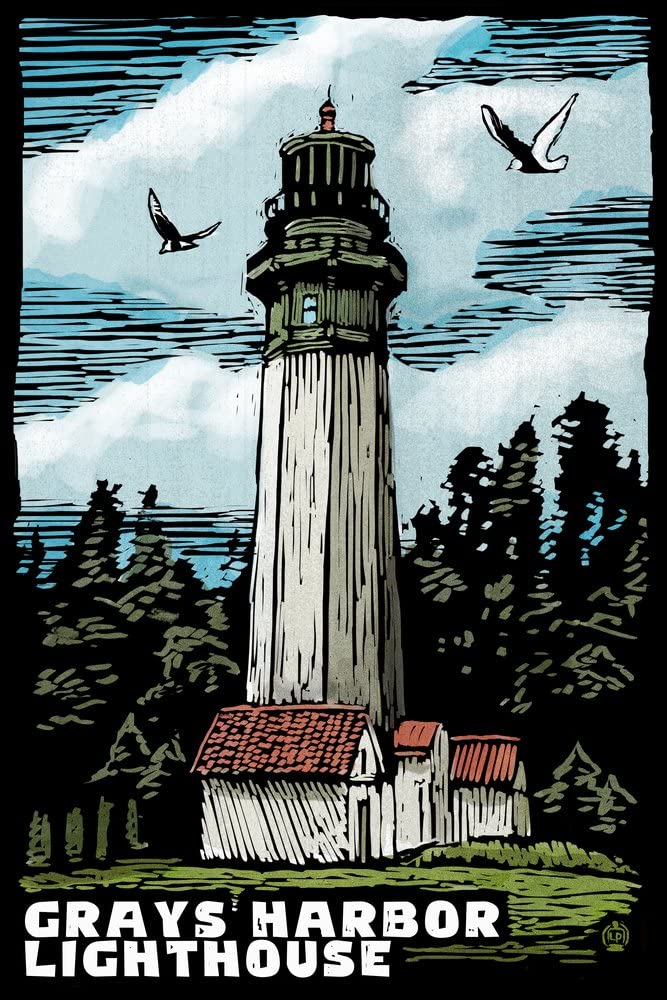
Westport: Grays Harbor Lighthouse State Park A long paved bike path connects to light house, Westhaven and Westport docks.
Westport: Pier, Float Dock 20, Fisherman's Boardwalk Images
Westport SEE ALSO Fishing, Clam Digging, Crabbing, Jetties, Kites, Beachcombing
Westport: Things to Do Activities
Westport: South Jetty Fishing SS
Westport: Twin Harbors State Park 400 campsites.
For More Information, Photos, Details, and Comments about Westport please go to Four Days in Grayland, Part II: Westport.
General Notes
Willapa Bay Images WB
Willapa Bay is in Pacific County with a Population of 20,920.
Willapa Bay: Willapa Hills
Willapa Bay: Detailed Map Marine Charts of shallow Willapa Bay Google Maps
Willapa Bay
Estuaries
There are many estuaries
at the mouths of the various rivers that flow into
Willapa Bay, and the Bay itself is an estuary.
"Willapa Bay is a major estuary on the Pacific Coast and at mean high tide encompasses approximately 70,400 acres (28,500 hectares). An estuary is defined as the area near the mouth of a river, or rivers, in the case of Willapa Bay, where oceanic tidal waters and freshwater currents collide and mix. Biologically, estuaries are among the most productive environments on earth and provide important habitat for a large variety of organisms. This high productivity is due basically to physical and biological processes unique to estuaries. Dissolved organic nutrients from detrital (dead plants and animals, and excrement) material enter the estuary from inflowing rivers. Saltwater pushed along the estuary bottom by the incoming tide brings in other nutrients of marine origin. Currents and tides circulate fresh and salt water, distributing and, to a certain extent, trapping dissolved and suspended matter. Deposition of these substances fertilizes the estuary and plant life flourishes. This plant life includes grasses, rushes, sedges of estuarine marshes, benthic algae (diatoms), epi-benthic algae, and eelgrass on intertidal sediments. Some plants are fed upon directly by fish and wildlife but most die and enter the food chain in the form of detritus or partly decomposed plant material. This detritus, suspended in the water and deposited on the bottom, is a high-quality food for consumers because of its high nutritional value. A number of studies have shown that many species of fish and invertebrates feed wholly or partially on detritus. Therefore, detritus feeders are the critical link between plant production and the production of higher consumers. Consequently, the ultimate ecological value of primary production in marshes occurs when detritus of marsh plant origin enters the food web of the estuary." Willapa Estuary
"An estuary is a partially enclosed coastal body
of brackish
water with one or more rivers or streams flowing into it, and with a
free connection to the open sea. Estuaries form a transition zone between
river environments and maritime environments and are an example of an ecotone.
Estuaries are subject both to marine influences such as tides,
waves, and the influx of saline water and to riverine influences such as
flows of freshwater and sediment. The mixing of seawater and freshwater
provides high levels of nutrients both in the water column and in sediment,
making estuaries among the most productive natural habitats in the world."
"Estuaries are a happy land, rich in the continent itself, stirred by the
forces of nature like the soup of a French chef; the home of myriad forms of
life from bacteria and protozoans to grasses and mammals; the nursery,
resting place, and refuge of countless things." - Stanely A.
Cain
Willapa Bay Climate 90 inches of rain each year in South Bend on Willapa Bay.
South Bend Climate 90 inches of rain each year. 30% of the oysters consumed in the USA come from Willapa Bay. Westport Climate
Northwest Washington Coast Ecoregion
Trees in the Willapa Forest: Coastal Temperate Rainforests, Late-successional coastal lowland forest
Logging in the Willapa Hills
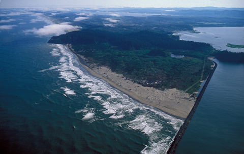
"Willapa Bay is a bay located on the southwest Pacific coast of Washington. The Long Beach Peninsula separates Willapa Bay from the greater expanse of the Pacific Ocean. With over 260 square miles (670 km2) of water surface. Willapa Bay is the second-largest estuary on the United States Pacific coast. Early settlers called the bay Shoalwater Bay and this name is found on old maps and charts of the region. Willapa Bay is fairly shallow: more than half of its surface area lies in the intertidal zone, and half of the volume of water inside it enters and leaves with every tide. The bay is an estuary formed when the Long Beach Peninsula, a long sand spit from the Columbia River to the south, partially enclosed the estuaries of several smaller rivers. It is a ria, which formed after the rise in sea level at the end of the last ice age flooded several small river valleys." - Wikipedia
Willapa Bay: The Longstreet Highroad Guide to the Northwest Coast has good coverage on Willapa Bay.
The Historical and Regional Geography of the Willapa Bay Area, Washington. By Jean Hazeltine. South Bend, 1956, 308 pages. FVRL
Shoalwater Willapa. By Allen Douglas. Snose Peak Pub., 2004, 287 pages. FVRL
Winter
Season
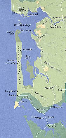
Driving Tour 2: Long Beach Peninsula, Willapa Bay - West Side WA103
Traveling the West Side of Willapa Bay
From Ilwaco to Ledbetter Point State Park on
the Long Beach
Peninsula (21 miles driving north) via WA103
Long Beach Peninsula. By Nancy L. Hobbs and Donella J. Lucero. Arcadia, 2005, 130 pages. History, photographs.
Friends of the Willapa Bay National Wildlife Refuge
Fort Columbia Historical State Park
Ilwaco
Population 936. CR Major port on the north shore of the Columbia River
nearest to the Pacific.
Ilwaco Images Boardwalk Wildlife
Ilwaco Railway and Navigation Company
Ilwaco Cape Disappointment State Park CR Camping, Yurts, Fishing, Trails
Long Beach Population 1,390. WB. Long Beach 29 mile Peninsula with wide sandy beaches facing the Pacific.
Long Beach WB Images Travel Lodging, shops, restaurants, rentals. Long Beach's 8 mile Discovery Bicycling Trail.
Long Beach Travel Opportunities
Willapa Bay National Wildlife Refuge WB The Long Island, Ledbetter Point, Lewis and Porter Point Units of the WBNWR.
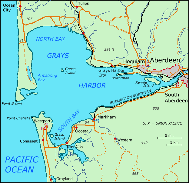
Maps of Grays Harbor and Willapa Bay
Information, Books, Guides, Reference Books, Field Guides, Handbooks
Grays Harbor, Willapa Bay, Olympic Peninsula, and the Pacific Northwest
Grays Harbor: History, Resources
The River Pioneers: Early Days on Grays Harbor. By Edwin Van Syckle. Pacific Search Press and Friends of the Aberdeen Public Library, 1982, index, 423 pages. FVRL. Excellent coverage of the life of Indians in the area, the development of the area from 1820-1920, geography, settlement locations, noted pioneers, economy, etc. Nice photographs from the era. Mr. Van Syckle was writer and editor for the Aberdeen Daily World newspaper for 50 years.
They Tried to Cut It All: Grays Harbor─Turbulent Years of Greed and Greatness. By Edwin Van Syckle. Seattle, Pacific Search Press, 1981, 308 pages. FVRL.
Useful Books for Your Vehicle While Traveling:
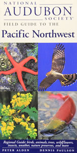
National Audubon Society Field Guide to the Pacific Northwest. By Peter Alden and Dennis Paulson. Knopf, 1998, 488 pages. Regional Guide (Washington and Oregon): birds, animals, trees, wildflowers, insects, weather, nature preservers, etc. This is a handy, small, and sturdy field guide for enthusiasts of natural history studies. Over 1,500 small colored photographs, some maps and drawings. I carry in my car along with camera, binoculars, magnifying glass, tools, and walking backpack (with 10 essentials) and recreational supplies. VSCL.
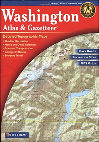
Washington: DeLorme Atlas and Gazetter. Detailed topographic maps, back roads, recreation sites, GPS Grids. Yarmouth, Maine, DeLorme Publications, 2016, 12th Edition. Indexes, 104 pages. ISBN: 0-89933329X. VSCL. An oversized map book. I keep this map in my Ford Escape. An essential tool for travelers. Very convenient to use. Since I drive on paved roads, this book provides sufficient detail for my needs. Handy for home study.
Also, use more detailed maps, as needed, such as good County maps,
topographic maps, walking and hiking guides, fishing guides, birding guides,
local tourist maps, etc.
And, Google NAV and Google Maps on your cellphone can really provide
detailed information and directions.
Useful Books for Your Picnic Table by the Sea
The Flora and Fauna of the Pacific Northwest. By Collin Varner. University of Washington Press, 2018, 462 pages. Over 1,000 outstanding large photographs of 800 species of the most frequently observed plants and animals of the region. What you are likely to see in Washington and Oregon from the seashore to 60 miles inland. This book is oversized and heavy - like a large photography book on your coffee table at home. VSCL.
The New Beachcomber's Guide to the Pacific Northwest. By J. Duane Sept. Harbor Publishing, 2019, 416 pages. Covering the Pacific Northwest most common shoreline-dwelling flora and fauna. Focused on the kinds of inter-tidal marine life you might find on the shorelines of Washington and Oregon. Hundreds of colored photographs and good descriptions. Handy book for your backpack when heading out to walk the shore an hour before low tide ends; and the glossy paper stock would probably hold up in field conditions. VSCL.
Bring any book you like to enjoy at your sunny picnic table or comfy camp chair.
Nature Studies in Grays Harbor, Willapa Bay, the Olympic Peninsula, and
the Pacific Northwest
Useful Books for Your Campsite or Home Study
The Flora and Fauna of the Pacific Northwest. By Collin Varner. University of Washington, 2018, 462 pages. VSCL. Outstanding photographs, larger size.
More Northwest Coastal Field Guides
National Audubon Society Field Guide to the Pacific Northwest. By Peter Alden and Dennis Paulson. Knopf, 1998, 488 pages. This is a handy and sturdy field guide for enthusiasts of natural history studies. I carry in my car along with binoculars, magnifying glass, and supplies in my backpack. VSCL.
Natural History of the Pacific Northwest Mountains. By Daniel Mathews. Timber Press Field Guide, 2017, Index, 583 pages. VSCL.
A Naturalist's Guide to the Hidden World of Pacific Northwest Dunes. By George Poinar Jr. Oregon State University, 2016, 288 pages. VSCL.
The New Beachcomber's Guide to the Pacific Northwest. By J. Duane Sept. Harbor Publishing, 2019, 416 pages. VSCL.
The Northwest Coast: A Natural History. By Stewart T. Schultz. Timber Press, 1990, index, 389 pages. VSCL.
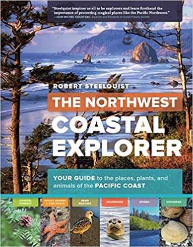
The Northwest Coastal Explorer. By Robert Steelquist. Timer Press, 2016, 282 pages. Overview of key features with pictures and text. VSCL.
Plants of the Pacific Northwest. By Jim Pojar and Andy MacKinnon. Partners, 2004, 528 pages.
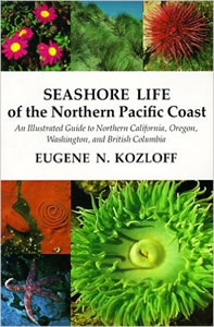
Seashore Life of the Northern Pacific Coast: An Illustrated Guide to Northern California, Oregon, Washington, and British Columbia. By Eugene N. Kozloff. University of Washington, 1983, 378 pages. A technical scientific presentation. VSCL.
Seashore of the Pacific Northwest. By Ian Sheldon. Lone Pine, 1998, 192 pages. VSCL.
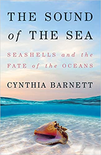
The Sound of the Sea: Seashells and the Fate of the Oceans. By Cynthia Barnett. W.W. Norton, 2021, 432 pages. VSCL.
Wildlife of the Pacific Northwest. Tracking and Identifying Mammals, Birds, Reptiles, Amphibians, and Invertebrates. By David Moskowitz. Timber Press, 2010, 364 pages. VSCL.
Books in my personal home library (VSCL) about Washington State.
Automobile Traveling in Grays Harbor, Willapa Bay, the Olympic
Peninsula, and the Pacific Northwest
Useful Books for Home Study and Your Automobile Library
History, Events, Accommodations, Highlights, Sightseeing, Cities, Parks
Washington: DeLorme Atlas and Gazetter. Detailed topographic maps,
back roads, recreation sites, GPS Grids. Yarmouth, Maine, DeLorme
Publications, 2016, 12th Edition. Indexes, 104 pages. ISBN:
0-89933329X. VSCL. An oversized map book. I keep this map in
my
Ford Escape. An essential tool for travelers. Very convenient
to use. Detailed!
The Last Wilderness: A History of the Olympic Peninsula. By Murray Morgan. University of Washington, 2019, 262 pages. VSCL.
The Longstreet Highroad Guide to the Northwest Coast. By Allan and Elizabeth May. Atlanta, Georgia, Longstreet Press, 2000. Index, 370 pages. VSCL. For both home and filed use.
Moon Olympic Peninsula: Coastal Getaways, Rainforests, Waterfalls, Hiking and Camping Travel Guide. By Jeff Burlingame. Moon Travel, 2021, 256 pages. Covers the coastal towns and travel highlights from Forks south to Grays Harbor, Willapa Bay, and Illwaco. For home and field use. VSCL.
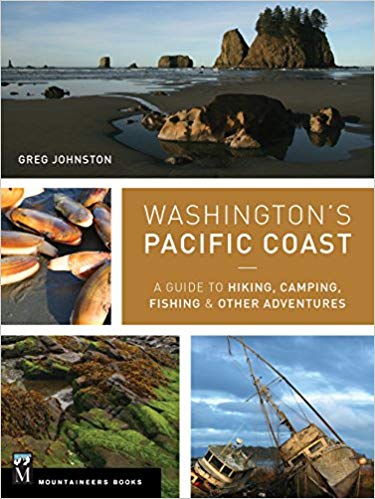
Washington's Pacific Coast: A Guide to Hiking, Camping, Fishing & Other Adventures
By Greg Johnston. Seattle, Washington, Mountaineers Books, 2015.
Index, 318 pages. ISBN: 9781594859397. VSCL.
By the Shore: Explore the Pacific Northwest Like a Local. By Nancy Blakey. Sasquatch Books, 2018, 256 pages. VSCL.
Pacific Northwest, Fodor's Travel. 22nd Edition, 2020.
The Pacific Northwest: An Interpretive History. By Carlos Arnaldo Schwantes. Revised and enlarged edition, 1996. Lincoln, Nebraska, University of Nebraska Press, 1989, 1996. Index, bibliography, 568 pages. ISBN: 978-0803292284. Professor Schwantes, Ph.D., is a field historian and author. VSCL.
Books in my personal home library (VSCL) about Washington State.
Washington River Maps and Fishing Guide. Edited By Doug Rose. Frank Amato Publications, 2013. 87 pages. ISBN: 978-1571885135. VSCL. Excellent resource for river trips and fishing.
Washington Road & Recreation Atlas
Beachcombing, Kite Flying, Fishing, Clamming, Crabbing, Walking,
Camping and other Seashore Activities in
this Region
Grays Habor, Willapa Bay, Olympic Peninsula, Pacific Northwest
The Essential Guide to Beachcombing and the Strandline. By Steve Trewhella and Julie Hatcher. Princeton University Press, 2015, 304 pages.
The New Beachcomber's Guide to the Pacific Northwest. By J. Duane Sept. Harbor Publishing, 2019, 416 pages. VSCL.
By the Shore: Explore the Pacific Northwest Like a Local. By Nancy Blakey. Sasquatch Books, 2018, 256 pages. VSCL. Roughly arranged by the four seasons. Good on Puget Sound coastal activities. Coastal activities, projects, sightseeing, events.
Fishing SEE Fishing Crabbing SEE Digging Razor Clams Oysters Kite Flying SEE Kites
The Flora and Fauna of the Pacific Northwest. By Collin Varner. University of Washington, 2018, 462 pages. VSCL. Outstanding photographs, larger size.
A Naturalist's Guide to the Hidden World of Pacific Northwest Dunes. By George Poinar Jr. Oregon State University, 2016, 288 pages. VSCL.
More Northwest Coastal Field Guides
The Northwest Coastal Explorer. By Robert Steelquist. Timer Press, 2016, 282 pages. Overview of key features with pictures and text. VSCL.
Washington's Pacific Coast: A Guide to Hiking, Camping, Fishing & Other Adventures
By Greg Johnston. Seattle, Washington, Mountaineers Books, 2015.
Index, 318 pages. ISBN: 9781594859397. VSCL.
Books in my personal home library (VSCL) about travel in Southwestern Washington State.
Deeper Reading
Landscape and Memory. By Simon Schama. Vintage, 1995, 655 pages. VSCL.
The Sound of the Sea: Seashells and the Fate of the Oceans. By Cynthia Barnett. W.W. Norton, 2021, 432 pages. VSCL.
Comments, Notes, Topics, Introduction
Traveling from Vancouver to Ocean Shores or Westport
We live in Vancouver, Washington, a suburb of the Portland Oregon Metropolitan Area. We are a retired couple in our mid 70's.
A round trip to either Westport or Ocean Shores from Vancouver, and some local driving, is around 400 miles. My Ford Escape AWD Titanium can get around 25 mpg. Current regular gasoline prices can go up to $4.00 a gallon. Therefore, gasoline costs for this 400 mile round trip adventure run about $65.00.
The first way to get to Westport (Tour 1) is as follows: From Kelso-Longview to US101 near Naselle via WA4 it is 62 (100 km) miles. From Naselle to Raymond it is 36 miles (57 km), and from Raymond to Westport on WA105 it is 33 miles (53 km); for a total driving distance of 131 miles (210 km). These are all well maintained State and Federal highways, wide, nicely paved, generally flat, with ample turnout options, and small communities and towns (Longview, Raymond and Westport) for supplies and services along the roads.
The distance from my home in Vancouver to Longview is 41 (65 km) miles via US Interstate 5. Thus, from Vancouver to Westport via this route it is 172 miles (276 km).
The second way we can drive to Ocean Shores or Westport as follows: Drive north on the Interstate 5 Freeway from Vancouver to Olympia, for 100 miles. Drive from Olympia to Aberdeen on a divided four lane highway, WA 8 and WA 12, for 50 miles. Drive from Aberdeen to either Ocean Shores or Westport, two lane highway, for 20 miles. A total distance of 170 miles, one way, for a 4.5 hour drive or less. This route can be very busy with heavy traffic going to and from the Ocean Shores and Aberdeen areas from the big cities of Olympia, Tacoma, and Seattle. You can take WA 12 from Centralia to Elma and save some driving distance to Ocean Shores, and avoid the Olympia area traffic congestion. There are a number of scenic alternate routes to get to Westport.
The third way we can drive to Westport is: Drive north on the Interstate 5 Freeway from Vancouver to Chelais, for 79 miles. Drive west on WA 6 though Pe Ell to Raymond, for 52 miles. You will drive on an excellent two lane road (WA 6) through lovely forested country and agricultural valleys, and encounter very little traffic. Then, drive northwest on WA 105 along the coast from Raymond through Tokeland and north to Westport, for 33 miles. Total distance: 164 miles, about 4 hours of easy driving with very little traffic from Chelais to Westport. I camp at Grayland Beach State Park or Twin Harbors State Park, both within 6 miles south of Westport. This drive is more peaceful, less stressful, and more beautiful than the drive to Ocean Shores.
US Highway 101 is THE ROAD in the
Olympic Peninsula region.
It is a two lane road the entire distance on US 101 from Ilwaco to
Olympia, 352 miles. Slow down and enjoy the drive. Be
careful when coming upon bicyclists. Be careful of cross traffic
from little roads, lanes, and driveways. Drive north from Ilwaco on the Columbia River
up the Willapa Bay, then to Raymond, then Aberdeen (70 miles).
Drive north from Aberdeen to Hoquiam, Lake Quinault, Forks, and Lake
Crescent (141 miles). Drive east to Port Angeles, Sequim, and
Discovery Bay (55 miles). Drive south on US 101 down the Hood
Canal to Hoodsport, Shelton, and Olympia (86 miles). I grew up in
the Bandini barrio in East Los Angeles in 1950 just four blocks from
US 101.
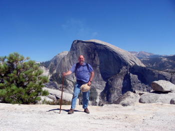
![]()
Karen and I have lived in the City of Vancouver, in Clark County, in the Southwestern side of the State of Washington, since April of 2017.
I write about these short travel adventures in my Cloud Hands Blog. Follow the adventures by the Category Labels: Oregon, Southwestern Washington, Washington, Travel, Camping.
We have traveled a number of times in the State of Washington and have stayed in motels, hotels, bed and breakfasts, cabins, yurts, or campgrounds in the following cities or areas: Bay View State Park near Mr. Vernon, Bellingham, Cape Disappointment State Park, Kalaloch, Lake Crescent, La Wis Wis Campground near Packwood, Long Beach, Horseshoe Lake below Mount Adams, Kanasat-Palmer State Park near Enumclaw, Grayland Beach State Park near Westport, Kennewick, Leavenworth, Seattle, Seaview, Skamokava, Spokane, Spirit Lake near Mt. St. Helens, Toppenish, Twin Harbors State Park near Westport, Vancouver, Wenatchee, Whidby Island, Winthrop, and Yakima.
An Explorer's Guide: Washington. By Denise Fainberg. Woodstock, Vermont, Second Edition, 2012. Index, 512 pages. ISBN: 978-0881509748. VSCL.
Atomic Frontier Days: Hanford and the American West. By John M.
Findlay and Bruce W. Hevly. Emil and Kathleen Sick Book Series in Western
History and Biography. University of Washington Press, 2011. Index,
bibliography, notes, 384 pages. ISBN: 978-0295990972. FVRL.
The story of the Hanford nuclear products production plants (1942-1990) and
toxic nuclear waster storage (1950-) along the Columbia River; and the
development of the nearby cities of Richmond, Kennewick, and Pasco, Washington.
Beacon Rock State
Park. Columbia River Gorge.
Blog
Posts to the Cloud Hands Blog by Mike Garofalo regarding travel adventures
in Washington State.
Battle Ground Lake
State Park, Clark County, Washington. Campground, yurts, lake fishing,
hiking. Nearby
Moulton Falls is popular.
Images.
Lewisville Park, a Clark County Regional Park, is just a few miles north of
the City of Battle Ground - a lovely riverside park. [I once watched at
this park a few people being Baptized in the river on a summer day.]
The Beachcomber's Guide to Seashore Life in the Pacific Northwest.
By J. Guane Sept. Harbor Publishing, 1999, 244 pages. VSCL.
Bridge
of the Gods - Ancient Avalanche. Cascade Locks area of the Columbia
River.
Here is the "Bridge of the Gods Legend" told by the Klickitats.
"In their tale, the chief of all the gods, Tyhee Saghalie and his two sons, Pahto (also called Klickitat) and Wy'east, traveled down the Columbia River from the Far North in search of a suitable area to settle. They came upon an area that is now called The Dalles and thought they had never seen a land so beautiful. The sons quarreled over the land and to solve the dispute, their father shot two arrows from his mighty bow; one to the north and the other to the south. Pahto followed the arrow to the north and settled there while Wy'east did the same for the arrow to the south. Saghalie then built Tanmahawis, the Bridge of the Gods, so his family could meet periodically. When the two sons of Saghalie both fell in love with a beautiful maiden named Loowit, she could not choose between them. The two young chiefs fought over her, burying villages and forests in the process. The area was devastated and the earth shook so violently that the huge bridge fell into the river, creating the Cascades Rapids of the Columbia River Gorge. For punishment, Saghalie struck down each of the lovers and transformed them into great mountains where they fell. Wy'east, with his head lifted in pride, became the volcano known today as Mount Hood, and Pahto, with his head bent toward his fallen love, was turned into Mount Adams. The fair Loowit became Mount St. Helens, known to the Klickitats as Louwala-Clough which means "smoking or fire mountain" in their language (the Sahaptin called the mountain Loowit)."
Bridge of the Gods. Columbia River bridge near Cascade Locks and
Bonneville Dam.
Bridging a Great Divide: The Battle for the Columbian River Gorge. By
Kathie Durbin. Oregon State University Press, 2013, 312 pages, Index,
bibliography, notes. VSCL.
Cape
Disappointment State Park near
Seaside and
Ilwaco,
Washington. I've camped at the state park before, and stayed at a motel
and cabin in Seaside. We attended the kite festival in Seaside in August
of 2018. I once went to the emergency hospital in Ilwaco in 2017.
Contested Boundaries: A
New Pacific Northwest History. By David J. Jepsen and David J. Norberg.
2017, 388 pages.
La Center Bottoms Natural Area, Clark County, Washington. Near the
town of La Push.
Clark County,
City of Vancouver,
Washington. Local travel for us. We live in the unincorporated
northeast area of Vancouver, the Orchards area.
Fort Vancouver was established
in 1825. Washington became a State in 1889. The new
Vancouver Grand Street Pier and Waterfront.
Columbia Gorge Getways: 12 Weekend Adventures, From Towns to Trails.
By Laura O. Foster. Towns to Trails Media, 2019. 266 pages.
Hikes in Clark County are covered on pages 22-35. VSCL.
Columbia Gorge Interpretative Center
Museum. Near Bridge of the Gods and Skamania Lodge.
Columbia Gorge
Discovery Center and Museum; Official interpretive center for the
Columbia River Gorge National Scenic
Area. Columbia River Gorge
Association.
The Dalles,
Oregon.
Columbia River Gorge:
National Scenic Area. 25th Anniversary Commemorative Edition.
Photography by Peter Marbach. Text by Janet Cook. Woodburn, Oregon,
Beautiful American Publishing Co., 2011. 112 pages. ISBN:
978-0898028775. VSCL.
The Complete Hiker, Revised and Expanded.
By John Long and Michael Hodgson. International Marine, Ragged Mountain
Press, 2nd Edition, 2000. Index, 243 pages. ISBN: 9780071358188. VSCL.
The Dalles,
Oregon. The Dalles
Dam was built on the Columbia River in 1957.
Columbia Gorge Discovery Center and
Museum; Official interpretive center for the
Columbia River Gorge National Scenic
Area. Columbia River Gorge
Association.
Fort Dalles military
outpost from 1838-1866. This particular area was a major Native American
trading center for at least 10,000 years; and also near the traditional
Celilo Falls fishing
site. Population: 13,600.
Images.
Day Hiking Columbia River Gorge. By Craig Romano. Seattle,
Washington, The Mountaineers Books, 2011. Index, 287 pages. ISBN:
978-594853685. VSCL.
Day Hiking North Cascades: Mount Baker, Mountain Loop Highway, San Juan Islands
By Craig Romano. Seattle, Washington, The Mountaineers Books, 2008.
Index, 356 pages. ISBN: 9781594850486. VSCL.
Day Hiking, South Cascades: Mt. St. Helens, Mt. Adams,
and the Columbia Gorge.
By Dan A. Nelson. Photography, B&W, by Alan L. Bauer. Seattle,
Washington, The Mountaineers Books, 2007. Day Hiking Series. Index,
284 pages. ISBN: 9781594850455. VSCL.
Day Hiking in
California, Oregon and Washington. A hypertext notebook by Mike
Garofalo.
Druid,
Nature Religions, and New
Age Spirituality, Mysticism, and Travel in Nature. Place and
Spirituality. Wee Folk,
Devas, and Nature Spirits.
Ecomysticism: The Profound Experience of Nature as Spiritual
Guide. By Cal Von Essen, M.D.. Rochester,
Vermont, Bear and Co., 2007. Index, bibliography, 274 pages. ISBN:
9781591431183. VSCL.
Druid and New Age
Spirituality, Mysticism, and Travel in Nature.
Exploring Washington's Past: A Road Guide to History. By Ruth Kirk and
Carmela Alexander. Seattle, University of Washington Press, Revised
Edition, 1995. Index, Reading List, 543 pages. ISBN: 0295974435.
VSCL. An excellent travel guide for automobile travelers in Washington.
Fishing the Rivers and Lakes of
Washington
Flyfisher's Guide to Washington. By Greg Thomas. The Wilderness
Adventures Flyfisher's Guide Series. Wilderness Adventures Press, 2013.
500 pages. ISBN: 978-185106582. VSCL.
Fort Vancouver Public
Library, Vancouver, Washington
Gifford Pinchot National Forest: Southern Trail Guide. Mt. Adams
Ranger District. Seattle, Washington, Northwest Interpretive Association.
76 pages. VSCL.
Hidden Washington: Including Seattle, Puget Sound, San Juan Islands, Olympic Peninsula, Cascades, and Columbia River Gorge
By Eric Lucas. Berkeley, California, Ulysses Press, 5th Edition, 2005. Index, 406 pages.
ISBN: 1569754861. VSCL.
Hiking the Columbia River Gorge: A Guide to the Area's
Greatest Hiking Adventures. By Russ Schneider. Revised by Jim
Yuskavitch. 253 pages. Helena, Montana, Falcon Guides, 2004, Third
Edition, 2014. VSCL.
Hiking Washington's Mount Adams Country.
By Fred Barstad. A Guide to the Mount Adams, Indian Heaven, and
Trapper Creek Wilderness Areas of Washington's Southern Cascades. Helena,
Montana, Falcon Books, 2004. 234 pages. ISBN: 0762730900. VSCL.
Hood River, Oregon, Columbia River Gorge. Population: 7,100.
Images.
The Lewis and Clark Journals: An American Epic of Discovery. The
Abridgment of the Definitive Nebraska Edition. Edited with an introduction by
Gary E. Moulton. Lincoln, University of Nebraska Press, 2003. EBook. VSCL.
The Longstreet Highroad Guide to the Northwest Coast. By Allan and
Elizabeth May. Atlanta, Georgia, Longstreet Press, 2000. Index, 370
pages. VSCL.
Maryhill Museum. Near Dalles,
Oregon, on the Washington side of the Columbia River.
Maryhill State Park.
Moon Olympic Peninsula.
By Jeff Burlingame. A Moon Handbook. Avalon Travel Pub., 2nd
Edition, 2015. Index, 216 pages. ISBN: 9781631210068. VSCL.
Nature Religions, Druids,
and New Age Spirituality,
Mysticism, and Travel in Nature. Place and Spirituality.
Wee Folk, Devas, and
Nature Spirits.
The New Complete Walker: The Joys and Techniques of Hiking and Backpacking
By Colin Fletcher. Alfred A. Knopf, 1968, 1974. Index, 470 pages.
ISBN: 0394480996. VSCL.
The North Cascades Highway: A Roadside Guide to America's Alps. By
Jack McLeod. Seattle, University of Washington Press, 2013. Index,
104 pages. ISBN: 978-0295993164. VSCL.
North Cascades: The Story Behind the Scenery. By Saul Weisberg.
KC Publications, 1988. 48 pages. ISBN: 978-0887140211. VSCL.
Olympic National Park and Peninsula. By Nicky
Leach. A photographic collection. Olympic Peninsula: A Timeless
Refuge. Mariposa, CA, Sierra Press, 1998. 32 pages. ISBN:
0939365677. VSCL.
The Olympic Peninsula. By Ericka Chickowski. Moon Spotlight
Books. Avalon Travel, 2009. 100 pages. ISBN: 9781598802719.
VSCL.
The Pacific Northwest: An
Interpretive History. By Carlos Arnaldo Schwantes. Revised and
enlarged edition, 1996. Lincoln, Nebraska, University of Nebraska Press,
1989, 1996. Index, bibliography, 568 pages. ISBN: 978-0803292284.
Professor Schwantes, Ph.D., is a field historian and author. VSCL.
Pacific Northwest Camping Destinations: RV and Car Camping Destinations in
Oregon, Washington, and British Columbia. By Mike Church and Terri Church.
Rolling Homes Press, 3rd Edition, 2012. 608 pages. ISBN:
9780982310120.
The Pacific Northwest Garden Tour. By Donald Olson. The 60 best
gardens to visit in Oregon, Washington, and British Columbia. Portland,
Oregon, Timber Press, 2014. Index, 300 pages. ISBN: 978-160469-4512.
VSCL.
Parks and Places we have visited near our home in Vancouver, Washington:
Captain William Clark Regional Park, Washougal, Clark County
La Center Bottoms Natural Area, near Woodland, Clark County
Columbia Gorge Discovery Center and Museum, The Dalles, Oregon
Columbia River Renaissance Trail, Vancouver, Clark County
Lacamas Lake Regional Park, Camas, Clark County
Lewisville Park, Battle Ground, Clark County
Orchards Community Park, Clark County A nearby (2.5 miles away) park where I walk in the forest. A nice circular path takes about 25 minutes of walking to complete.
Oxbow Regional Park, Multnomah County. Camping, fishing, hiking by the Sandy River.
Parks in Clark County, Washington Alphabetical List.
Portland Rose Garden, Multnomah County, Oregon
Portland Japanese Garden, Multnomah County
Portland Nursery. Both Division and Stark Nurseries.
Portland Parks and Recreation Finder, Multnomah County
Ridgefield National Wildlife Refuge, Ridgefield, Clark County
Steigerwald Lake National Wildlife Refuge, Washougal, Clark County
Vancouver Lake Regional Park, City of Vancouver, Clark County
Washington Park, Portland, Multnomah County, Oregon
Washougal Waterfront Park, Washougal, Clark County
Paradise Point State Park, Clark County. Near the Ailani Casino. Located along the Lewis River. Interstate 5 nearby makes noise. Camping, hiking, swimming, fishing.
Photographing Washington: A Guide to the Natural Landmarks of the Evergreen
State. By Greg Vaughan. Alta Loma, CA, Photo Trip USA Pub.,
2013. Index, 317 pages. ISBN: 9780916189198. Vancouver Public
Library.
Quick Escapes: Pacific Northwest. By Marilyn McFarlane. Guilford,
Connecticut, The Globe Pequot Press, Fifth Edition, 2001. Index, 323
pages. 32 Weekend trips from Portlant, Seattle, and Vancouver, B.C.
ISBN: 0762709405. VSCL.
Ridgefield,
Washington.
Ridgefield National Wildlife Refuge.
A River Lost: The Life and Death of the Columbia River. By Blaine
Harden. W.W. Norton and Co., Revised 2012. 288 pages. ISBN:
978-0393342567. VSCL.
River of Promise: Lewis and Clark on the Columbia. By David L.
Nicandri. Dakota Institute Press, 2009, index, bibliography, notes, 349
pages. FVRL. This library book is part of the Keith McCoy Northwest
History Collection funded through the Fort Vancouver Regional Library [FVRL]
Foundation of Clark County, Washington.
The Spokane River. Edited by Paul Lindholdt. University of
Washington Press, 2018. Index, biographies, reading list, 282 pages.
FVRL.
Song Upon the Rivers: The Buried History of the French-Speaking Canadiens
and M�tis from the Great Lakes and the Mississippi across to the Pacific.
By Robert Foxcurran, Michael Bouchard, Sebastien Malette. Baraka Books,
2016. 448 pages. ISBN: 978-1771860819.
Travel Checklist.
Here is my 2003 Ford Explorer travel gear and camping gear and hiking gear Checklist from February 2019. Excel format.
Traveler's History of
Washington: A Roadside Historical Guide. By Bill Gulick. Caldwell,
Idaho, Caxton Press, 2005. Index, 559 pages. ISBN: 0870043714.
VSCL.
Undaunted Courage: Meriwether Lewis, Thomas Jefferson,
and the Opening of the American West. By Stephen E. Ambrose. Simon and
Schuster, Touchstone, 1996. 521 pages. Paperbound book. VSCL.
Walking - Bibliography.
Research by Mike Garofalo.
Washington
Photographs by John Marshall. Text by Ruth Kirk. Oversized table
book. Portland, Oregon, Graphic Arts Center Publishing Co., 2003.
160 pages. ISBN: 978-0932575647. VSCL.
Washington Byways: 56 of Washington's Best Backcounty Drives. By Tony
Huegel. Berkeley, California, Wilderness Press, 2003. 164 pages.
ISBN: 0899972993. From the Vancouver Public Library.
Washington Lake Maps and Fishing Guide. By Bill McMillan. Edited
and illustrated by Esther Appel. Frank Amato Publications, 2012. 48
pages. ISBN: 978-1571884770. VSCL.
Washington, Oregon and the Pacific Northwest. Lonely Planet Series.
By Brendan Sainsbury, Celeste Brash, John Lee, and Becky Ohlsen. Lonely
Planet Press, 2017. Indexes, 480 pages. ISBN: 978-1786573360. VSCL.
Washington's Northern Cascades Camping & Hiking
Washington's Pacific Coast: A Guide to Hiking, Camping, Fishing & Other Adventures
By Greg Johnston. Seattle, Washington, Mountaineers Books, 2015.
Index, 318 pages. ISBN: 9781594859397. VSCL.
Washington River Maps and Fishing Guide. By Doug Rose. Frank
Amato Publications, 2013. 87 pages. ISBN: 978-1571885135. VSCL.
Excellent resource for river trips and fishing.
Washington's Best Fishing Waters. Wilderness Adventures Press, 2nd
Edition, 2007. 161 pages. ISBN: 978-1932098525. VSCL.
Washington Wild Roads.
80 Scenic Drives to Camping, Hiking Trails and Adventures. By Seabury
Blair Jr. Seattle, Washington, Sasquatch Books, 2012. Index, 251
pages. ISBN: 978-1570618154. VSCL.
Washougal,
Washington. On the Columbia River near Vancouver, WA.
Waterfront Park.
Captain William Clark Park.
Steigerwald Lake National
Wildlife Refuge.
Water Falls
White Salmon,
Washington, Columbia Gorge. Across from Hood River. Population: 2,200.
The Wild Cascades, Forgotten Parkland.
By Harvey Manning. San Francisco, California, Sierra Club, 1965. 159
pages. VSCL. Beautiful photographs, color and B&W, of the Cascades.
Wild in the City: Exploring the Intertwine: The Portland-Vancouver Region's
Network of Parks, Trails, and Natural Areas. By Michael C. Houck and M. J.
Cody. Corvallis, Oregon, Oregon State University Press, 2nd Edition, 2011.
Index, 427 pages. ISBN:
9780870716126. VSCL.
Woodland,
Washington.
Lewis River
dams and reservoirs east of Woodland.
Hulda Klager's Lilac Gardens.
Vancouver Lake Regional Park, Clark County, Washington.
Views Washington. A Collection of Photographs
by Chris Jacobson. Emeral Point Press, 2006. 48 pages.
We have traveled a little in the State of Washington and have stayed in motels, hotels, bed
and breakfasts, yurts, campgrounds, or cabins in the following cities or areas:
Bay View State Park near Mr. Vernon, Bellingham, Ellensburg, Kalaloch, Lake
Crescent, La Wis Wis Campground near Packwood, Long Beach, Horseshoe Lake below Mount Adams, Kanasat-Palmer State
Park near Enumclaw, Kennewick, Ocean City State Park near Ocean Shores, Seattle, Seaside, Skamokava, Spirit Lake near Mt. St.
Helens, Spokane, Vancouver, Toppenish, Twin Harbors State Park near Westport, Wenatache, Whidby Island,
Winthrop, and Yakima.
We purchased a home in Vancouver, Washington, in June of 2017.
In June of 2019 we enjoyed at trip to northern Washington. Day 1: Vancouver to Bellingham via Interstate 5 and 405. Good views of Mt. Ranier. Day 2: Bellingham via 9 to Sedro-Woodley, then on Route 20 through the North Cascades National Park, over Washington Pass, and down to Methrow River Valley and the town of Winthrop. Day 3: Twisp, Okanogan, Omak, apple orchards, Lake Chelan, Columbia River, Wenatchee. Day 4: Apple orchards everywhere, Route 2, Levingston, Monroe, Seattle, Olympia, Vancouver.
In November of 2019, we traveled to Kennewick, Hanford Reservation, and Ellensburg.
VSCL = Valley Spirit Center Collection, Vancouver, Washington. Home
library collection of Mike and Karen.
FVRL = Fort Vancouver Regional Library of Clark County, Washington.
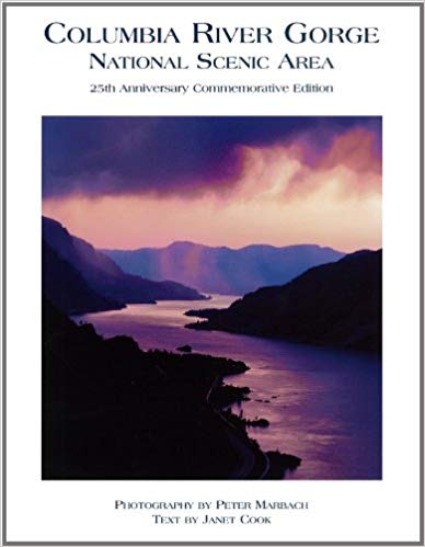
Maps of Washington
I have always enjoyed reading and using maps since I was a child. I used the Bandini Branch of the County of Los Angeles Public library when I was a child. The library was three blocks from my childhood home in Bandini, unincorporated East Los Angeles, Los Angeles County, California. I used many maps in books at this library. I went to St. Alphonsus Elementary School K-8, from 1951-1959, and this school was three blocks from the old East Los Angeles Library near Garfield High School. I was the Librarian III In-Charge of the new East Los Angeles Library on 3rd St. (Fetterly) from 1975-1980. I used many maps from these libraries in my youth, and my brother Paul and I owned many maps.
When I travel in my Ford Explorer, I always carry a variety of paper maps, guides, books, and pamphlets. I have a Sumsung Galaxy 7 cell phone, a Samsung Galaxy Tab A, and a Garmin GPS eTrek 30X for electronic access to information, maps, ebooks, photos, documents, and directional apps. I keep a Discover Pass and other passes, licenses, and official documentation ready on hand in the Explorer as I travel.
I carry various good magnifying glasses, and use one to read maps. A lamp and flashlight for safety, and for map and book reading at night or dim light conditions are essential. A notebook with writing tools is also carried. Here is my 2019 travel and camping Checklist.
I now use the following maps and travel guides for the State of Washington:
Clark County, Washington. GM Johnson City Map Series. Vancouver, B.C., 2015, 2017. ISBN: 978-1-770684300. VSCL. I have one copy for home use, and I keep another copy in the Ford. This is an excellent map for the County in which we now live. An essential tool. A traditional folding map. Good detail on backcountry roads.
Columbia River Gorge National Scenic Area. National Geographic Map, Trails Illustrated, Topographic Map, 2009.
Washington Road & Recreation AtlasWashington: DeLorme Atlas and Gazetter. Detailed topographic maps, back roads, recreation sites, GPS Grids. Yarmouth, Maine, DeLorme Publications, 2016, 12th Edition. Indexes, 104 pages. ISBN: 0-89933329X. VSCL. An oversized map book. I keep this map in my Ford Explorer. An essential tool for travelers. Very convenient to use.
Maps I Use. By Mike Garofalo. 2019-
Mount St. Helens, Mount Adams, Gifford Pinchot National Forest. National Geographic. Trails Illustrated Topographic Map. 2010.
Washington State Map by Rand McNally. Easy to read oversized print. Some city maps. 2013. ISBN: 0528882104.
Washington State Map by G.M. Johnson Publishers. Includes maps of many cities. ISBN: 9781770682900.
Washington State Scenic Byways Road Map
Oregon/Washington Map. American Automobile Association (AAA). Updated on a regular basis.
Tour Book Guide Washington. American Automobile Association (AAA). Updated on a regular basis.
The American Automobile Association (AAA). They offer many detailed maps of areas and cities in the State of Washington. Free to AAA members, or sold to non-AAA members. Very useful travel guides and trip planning services are also available to AAA members. I use dozens of their maps and guides.
I use two electronic navigation devices. First, I use my Samsung Galaxy 7 cell phone. A variety of cell phone applications can help with navigation, orienting, mapping, travel routes, travel guides, information, emergencies, communications, phone, text, email, etc. Second, I use a Garmin eTrek 30X Handheld Navigator GPS device. The Garmin GPS is a full featured GPS device and equipped with applications for navigation, orienting, mapping, routes, directions, travel records, geocaching, specialized maps, games, survival, hiking, etc.
Here are three books I use on the subject of GPS, navigation and maps:
The Complete Idiot's Guide to Geocaching. Editors and staff on
Geocaching.Com. Alpha Press, 3rd Edition, 2012. 368 pages.
Explore the Latest Adventures in the Exciting and Popular GPS Adventure.
ISBN: 978-1615641949. VSCL.
Wilderness Navigation: Finding Your Way Using Map, Compass, Altimeter, and GPS.
By Bob Burns and Mike Burns. Seattle, Washington, Mountaineers Books, 3rd Edition, 2015.
Index, 190 pages. ISBN: 978-01594859458. VSCL.
Using GPS. By Bruce Gibbs. Falcon Guides, 3rd Edition, 2014.
87 pages. Basic Illustrated Series. ISBN: 978-0762750818. VSCL.
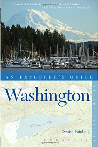
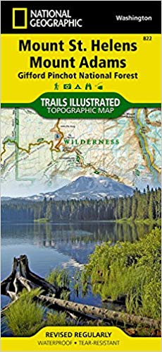
Traveling the Rivers of Washington: Sightseeing, Fishing, Nature Studies
Washington River Maps and Fishing Guide. Edited By Doug Rose. Frank
Amato Publications, 2013. 87 pages. ISBN: 978-1571885135. VSCL.
Excellent resource for river trips and fishing.
Washington's Best Fishing Waters. Wilderness Adventures Press, 2nd
Edition, 2007. 161 pages. ISBN: 978-1932098525. VSCL.
Washington Lake Maps and Fishing Guide. By Bill McMillan. Edited
and illustrated by Esther Appel. Frank Amato Publications, 2012. 48
pages. ISBN: 978-1571884770. VSCL.
Flyfisher's Guide to Washington. By Greg Thomas. The Wilderness
Adventures Flyfisher's Guide Series. Wilderness Adventures Press, 2013.
500 pages. ISBN: 978-185106582. VSCL.
Columbia River (Lower): Bonneville to Pacific Ocean including Portland.
Fish n Map Company. Detailed maps. Waterproof plastic.
Oregon River Maps and Fishing Guide. Edited By Doug Rose. Frank
Amato Publications, 2014. 88 pages. ISBN: 978-1571885142. VSCL.
Many rivers flow north from the Oregon Cascades into the Columbia River:
Willamette, Sandy, Hood, John Day, Deschutes. Excellent resource for river trips and fishing.